Hybrid solar eclipse of 04/25/1846
| Day of week: | Saturday |
| Maximum duration of eclipse: | 00m53s |
| Maximum width of eclipse path: | 31 km |
| Saros cycle: | 126 |
| Coverage: | 100% |
| Magnitude: | 1.0088 |
| Gamma: | 0.2038 |
Wo kann man die Sonnenfinsternis vom 04/25/1846 sehen?
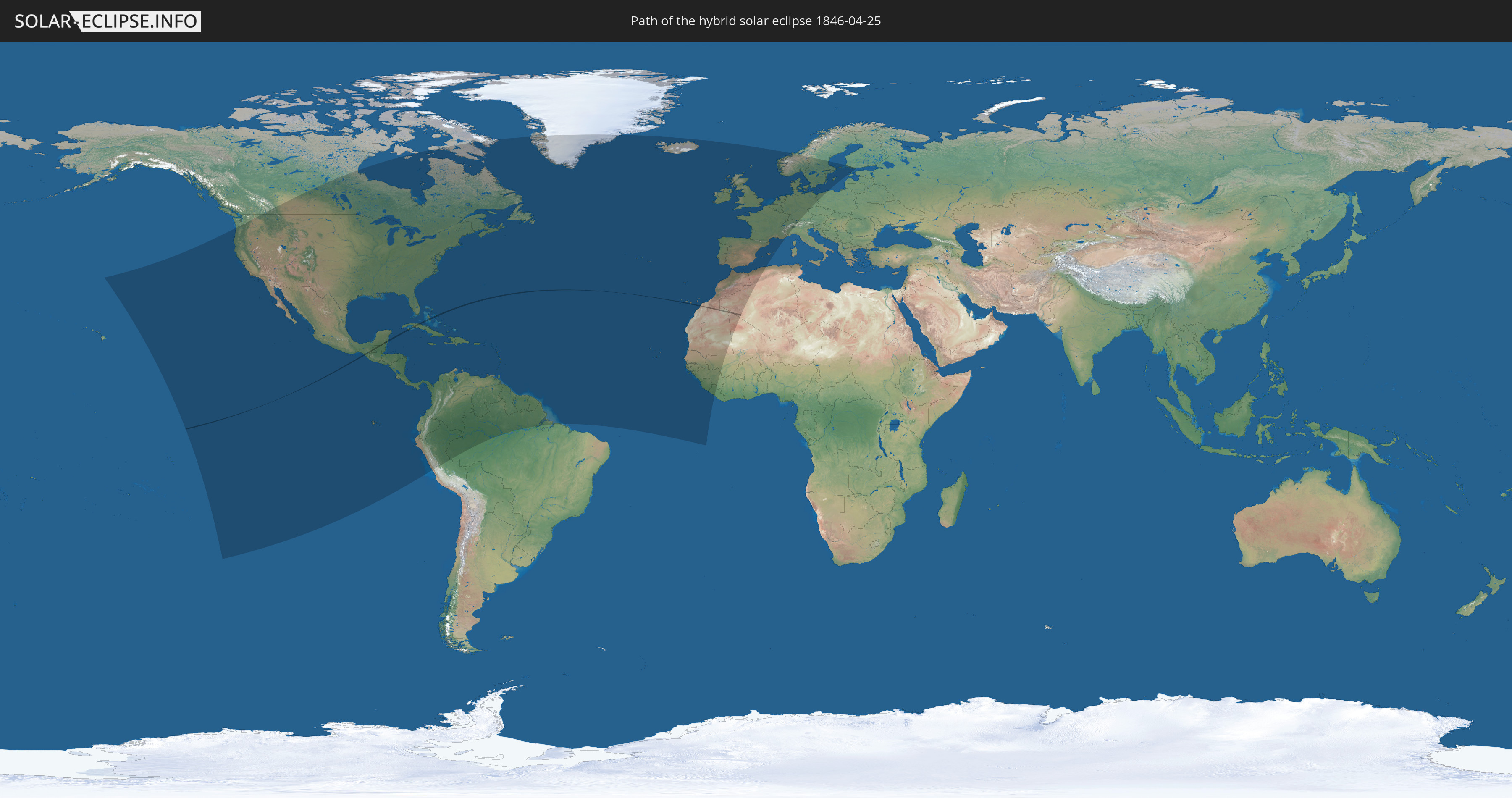
Die Sonnenfinsternis am 04/25/1846 kann man in 88 Ländern als partielle Sonnenfinsternis beobachten.
Der Finsternispfad verläuft durch 8 Länder. Nur in diesen Ländern ist sie als hybrid Sonnenfinsternis zu sehen.
In den folgenden Ländern ist die Sonnenfinsternis hybrid zu sehen
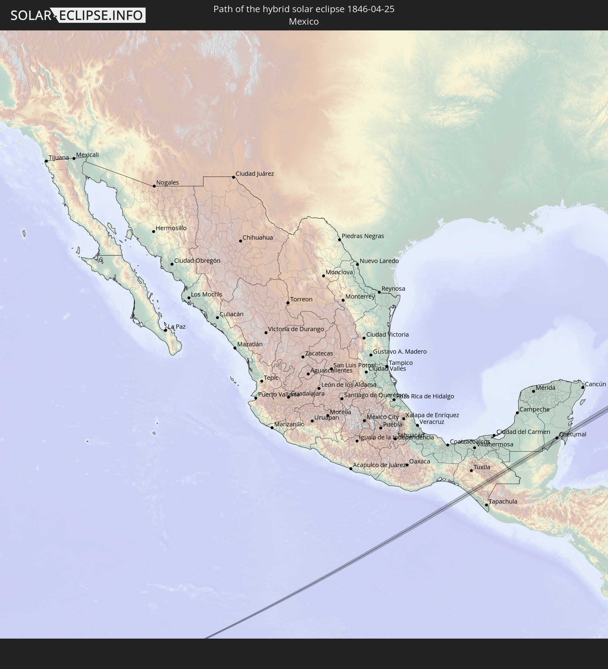 Mexico
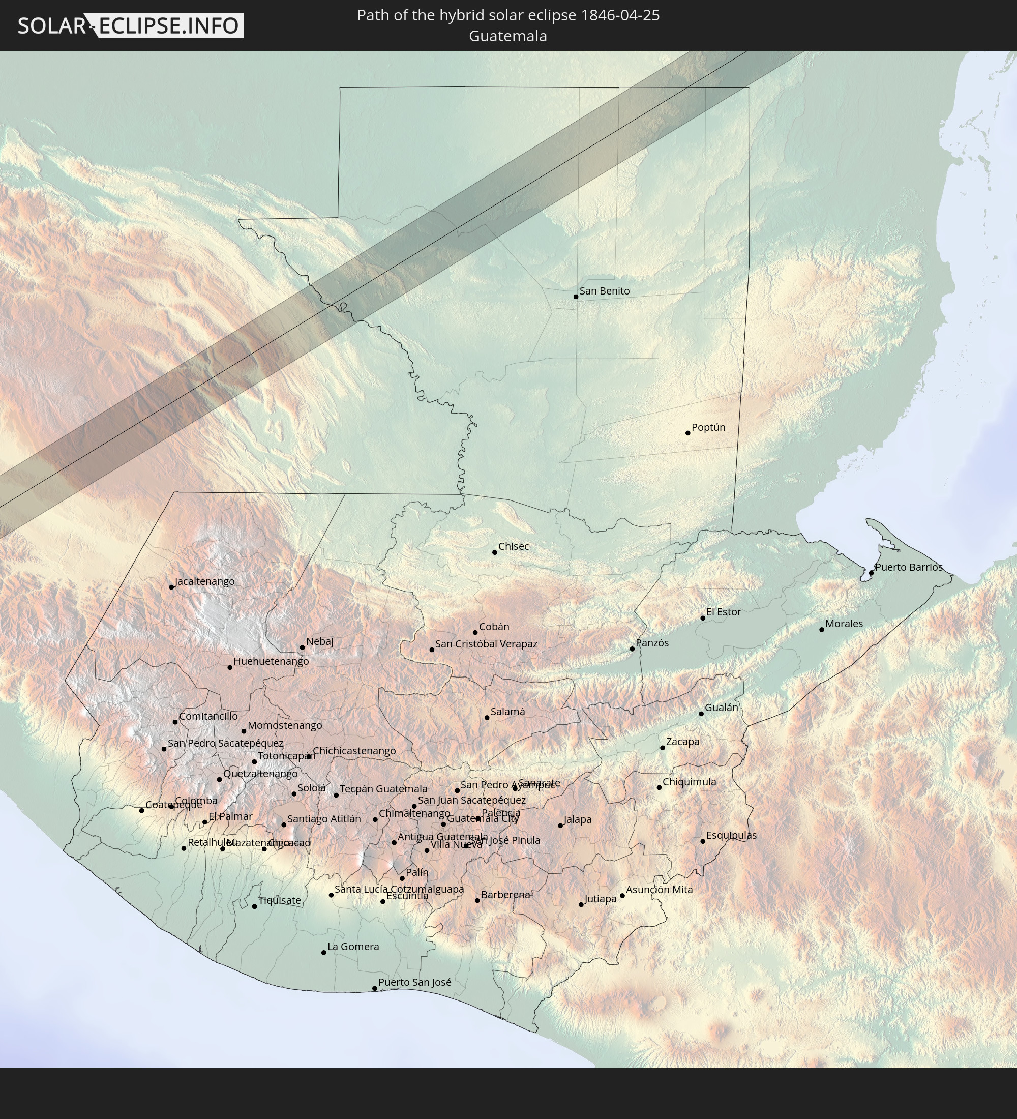 Guatemala
 Belize
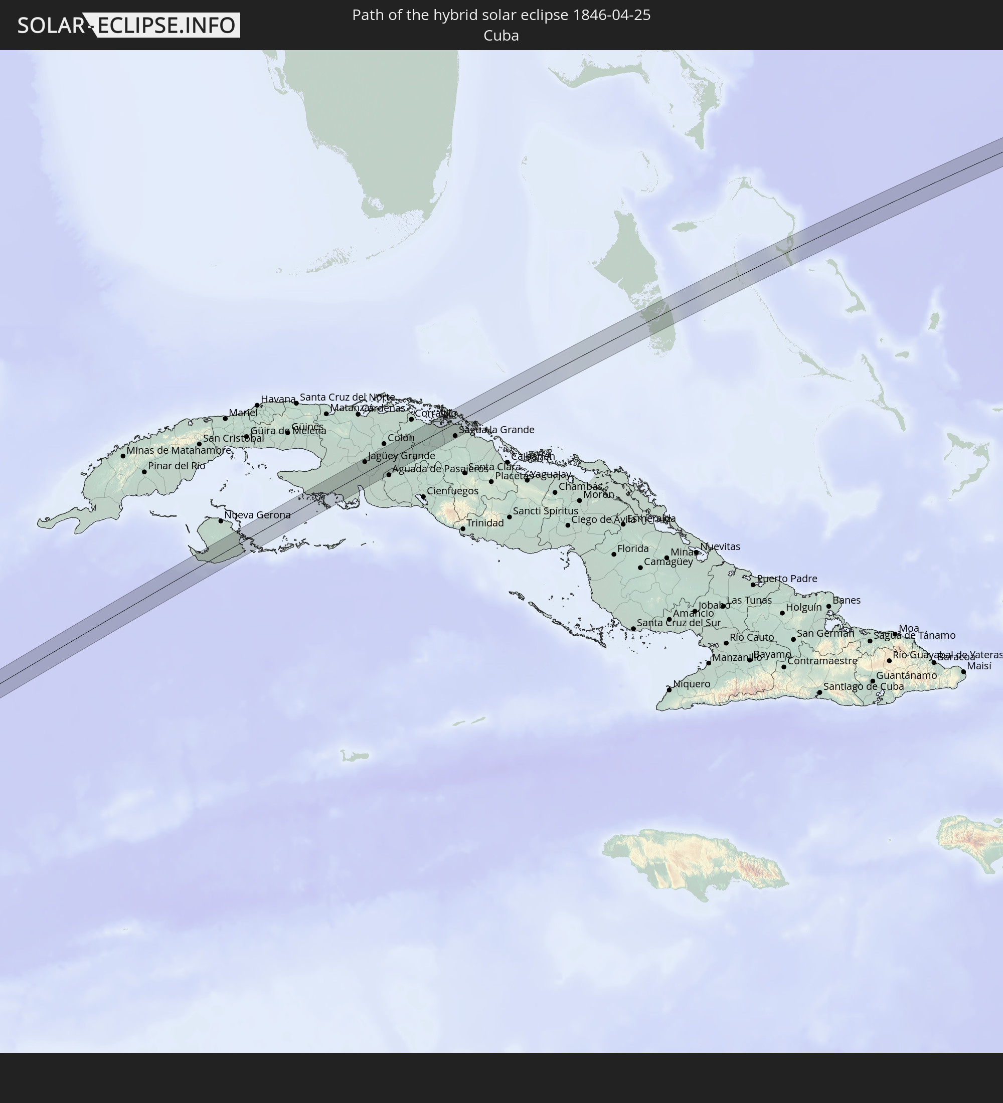 Cuba
Cuba
 The Bahamas
 Spain
Spain
 Mauritania
 Algeria
In den folgenden Ländern ist die Sonnenfinsternis partiell zu sehen
 United States
 United States Minor Outlying Islands
 Canada
 Pitcairn Islands
 Mexico
 Chile
Chile
 Greenland
 Guatemala
 Ecuador
 El Salvador
 Honduras
 Belize
 Nicaragua
 Costa Rica
 Cuba
Cuba
 Panama
 Colombia
 Cayman Islands
 Peru
Peru
 The Bahamas
 Jamaica
 Haiti
Haiti
 Brazil
 Venezuela
 Turks and Caicos Islands
 Dominican Republic
 Aruba
Aruba
 Puerto Rico
 United States Virgin Islands
 Bermuda
 British Virgin Islands
 Anguilla
 Collectivity of Saint Martin
 Saint Barthélemy
 Saint Kitts and Nevis
 Antigua and Barbuda
 Montserrat
 Trinidad and Tobago
 Guadeloupe
 Grenada
 Dominica
 Saint Vincent and the Grenadines
 Guyana
 Martinique
 Saint Lucia
 Barbados
 Suriname
 Saint Pierre and Miquelon
 French Guiana
 Portugal
 Cabo Verde
 Iceland
 Spain
Spain
 Senegal
 Mauritania
 The Gambia
 Guinea-Bissau
 Guinea
 Sierra Leone
 Morocco
 Mali
Mali
 Liberia
 Republic of Ireland
 Algeria
 United Kingdom
 Faroe Islands
 Gibraltar
 France
 Isle of Man
 Guernsey
 Jersey
 Andorra
 Belgium
 Netherlands
 Norway
 Luxembourg
 Germany
 Switzerland
 Italy
Italy
 Denmark
 Liechtenstein
 Austria
 Sweden
 Czechia
 Poland
 Åland Islands
 Finland
 Estonia
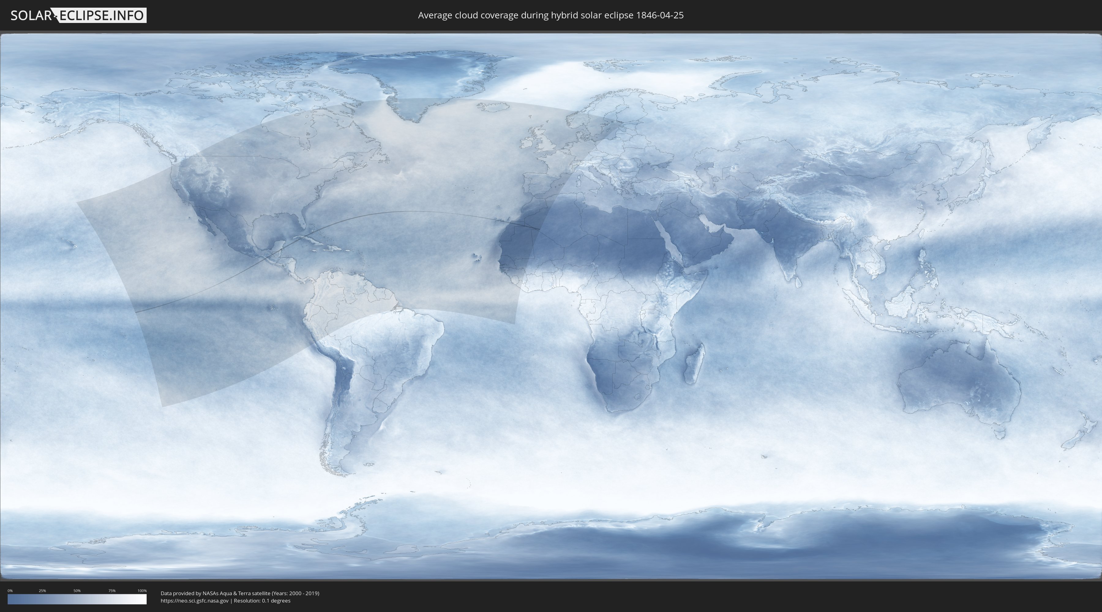
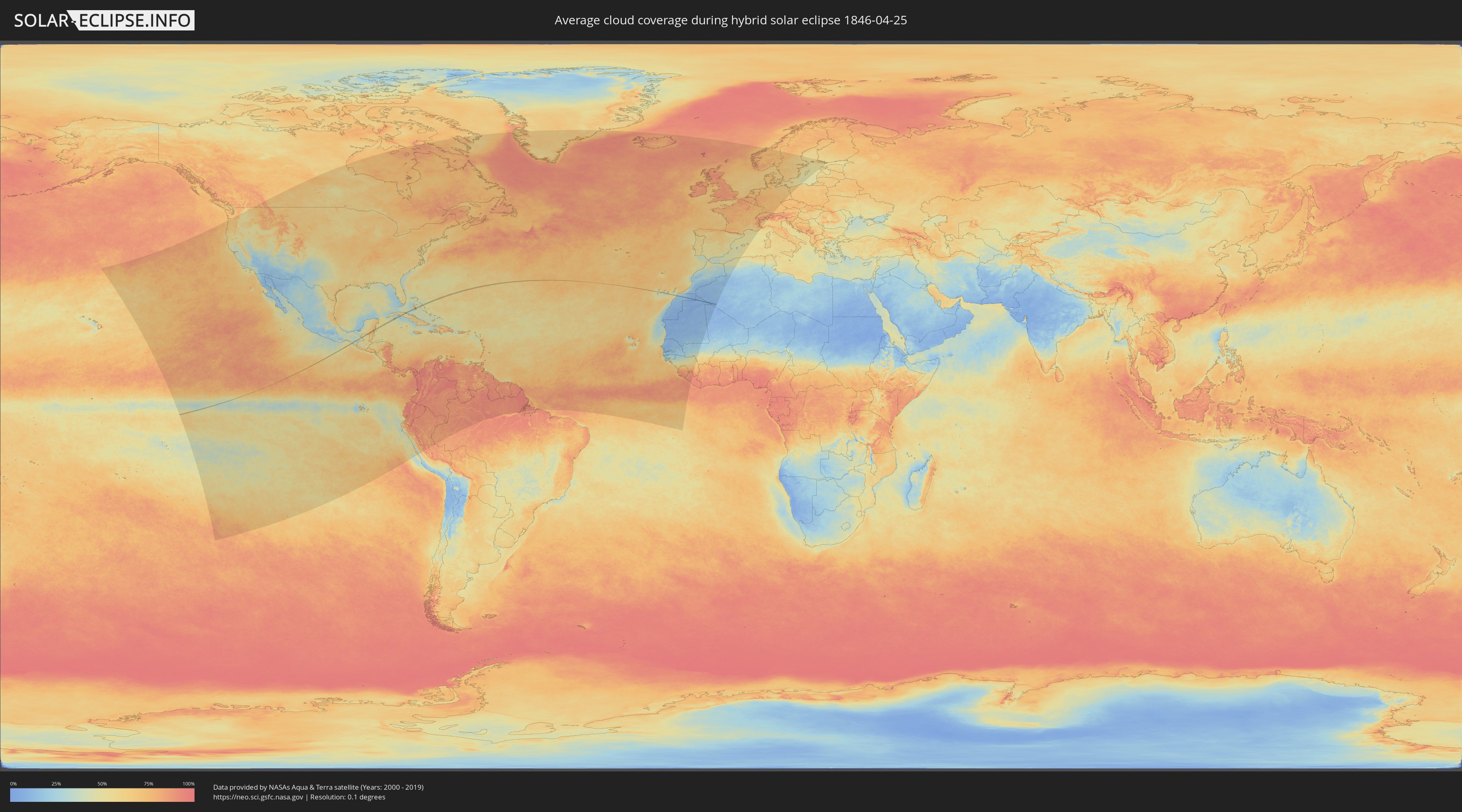
How will be the weather during the hybrid solar eclipse on 04/25/1846?
Where is the best place to see the hybrid solar eclipse of 04/25/1846?
The following maps show the average cloud coverage for the day of the hybrid solar eclipse.
With the help of these maps, it is possible to find the place along the eclipse path, which has the best
chance of a cloudless sky.
Nevertheless, you should consider local circumstances and inform about the weather of your chosen
observation site.
The data is provided by NASAs satellites
AQUA and TERRA.
The cloud maps are averaged over a period of 19 years (2000 - 2019).
Detailed country maps
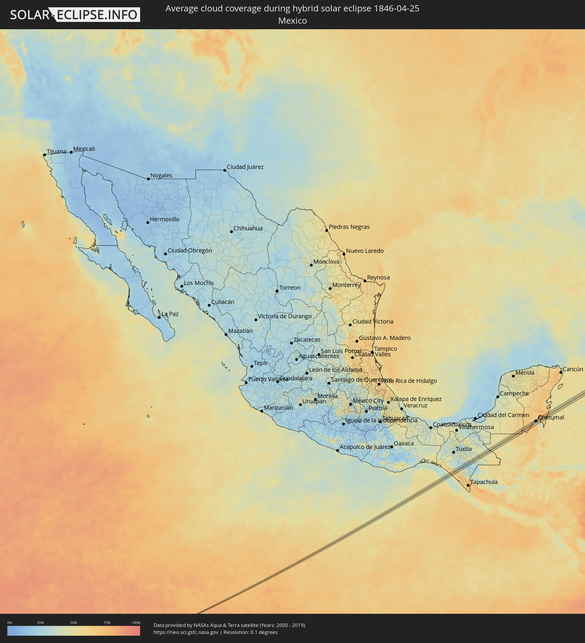 Mexico
 Guatemala
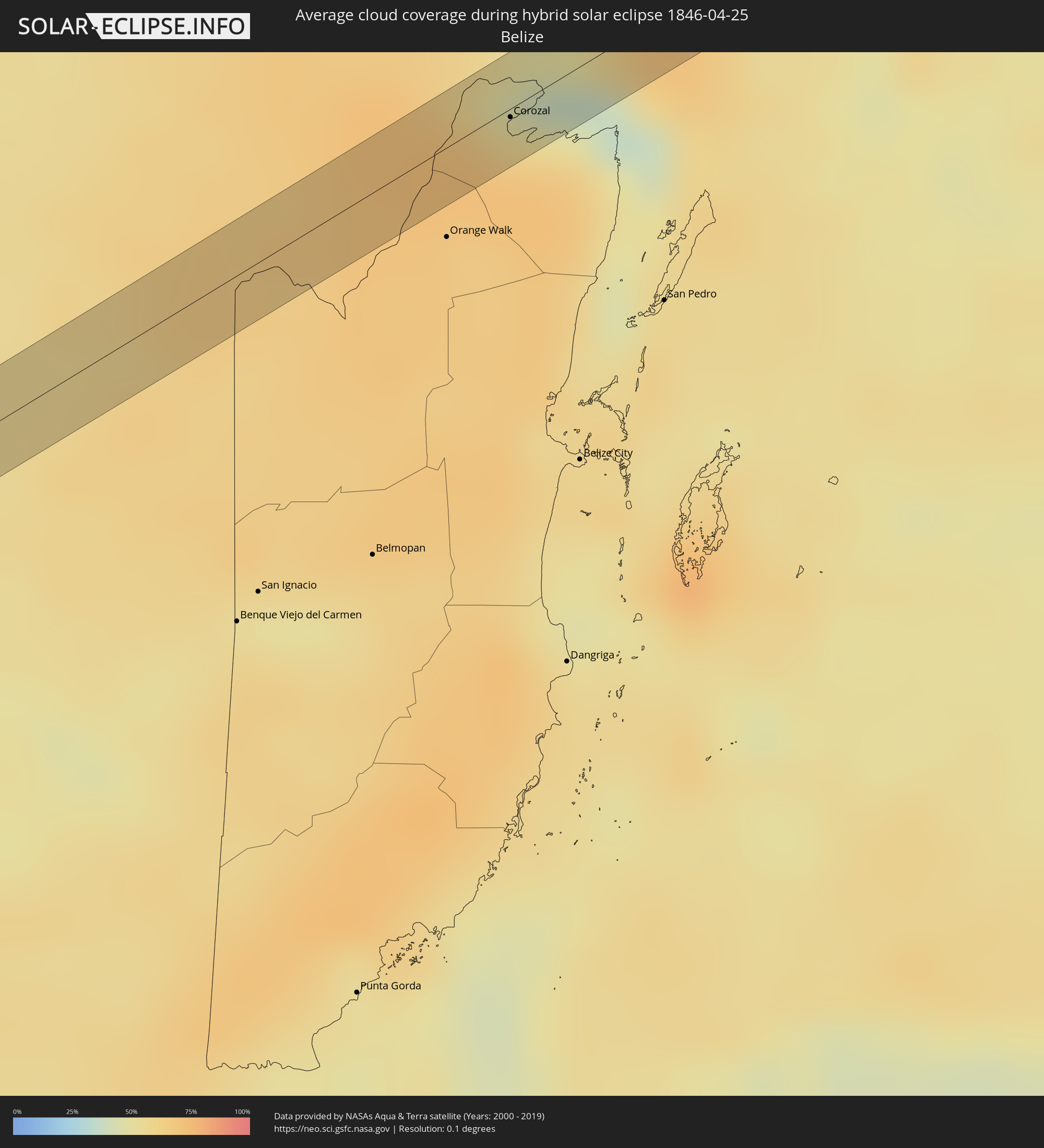 Belize
 Cuba
Cuba
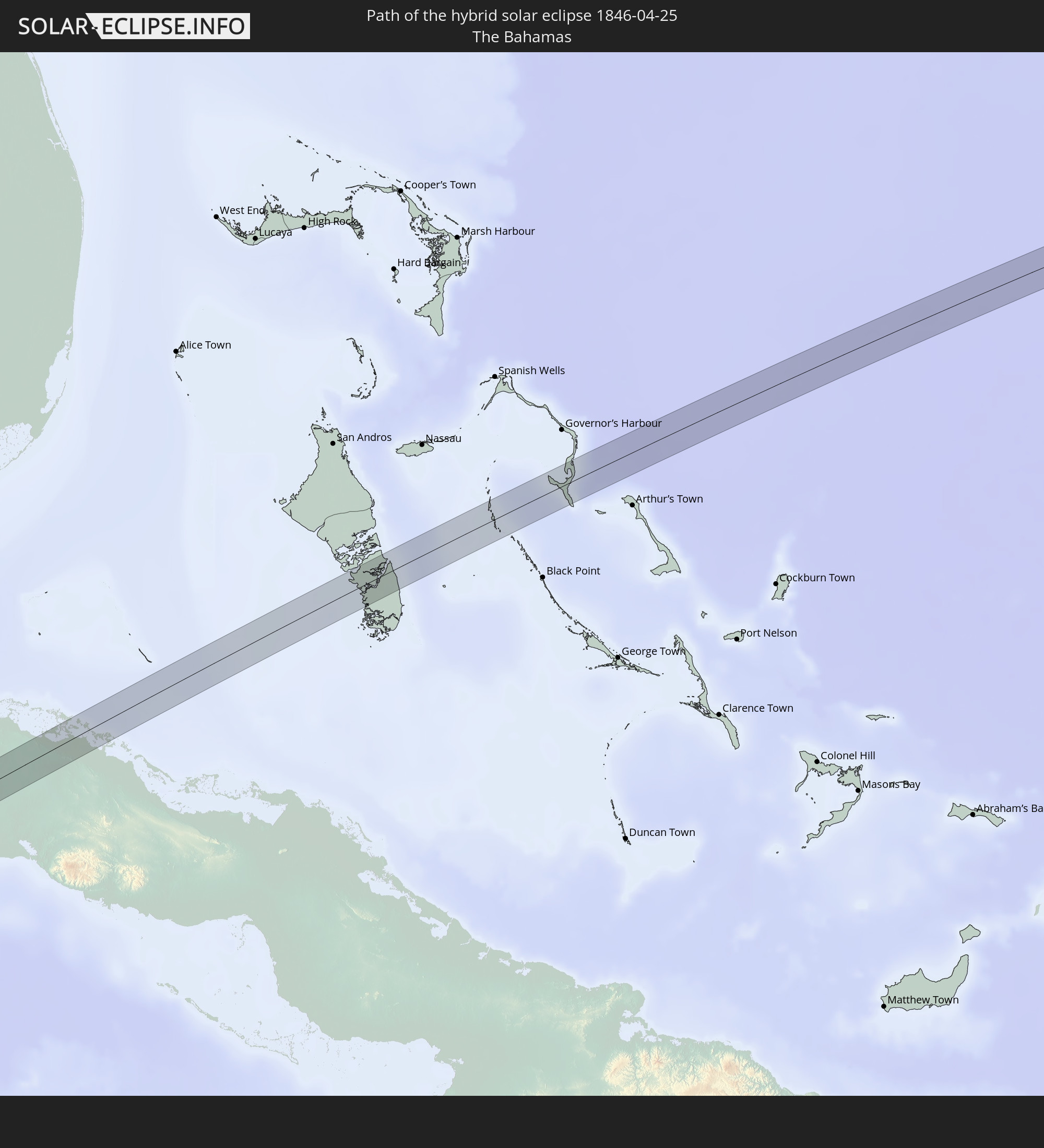
 The Bahamas
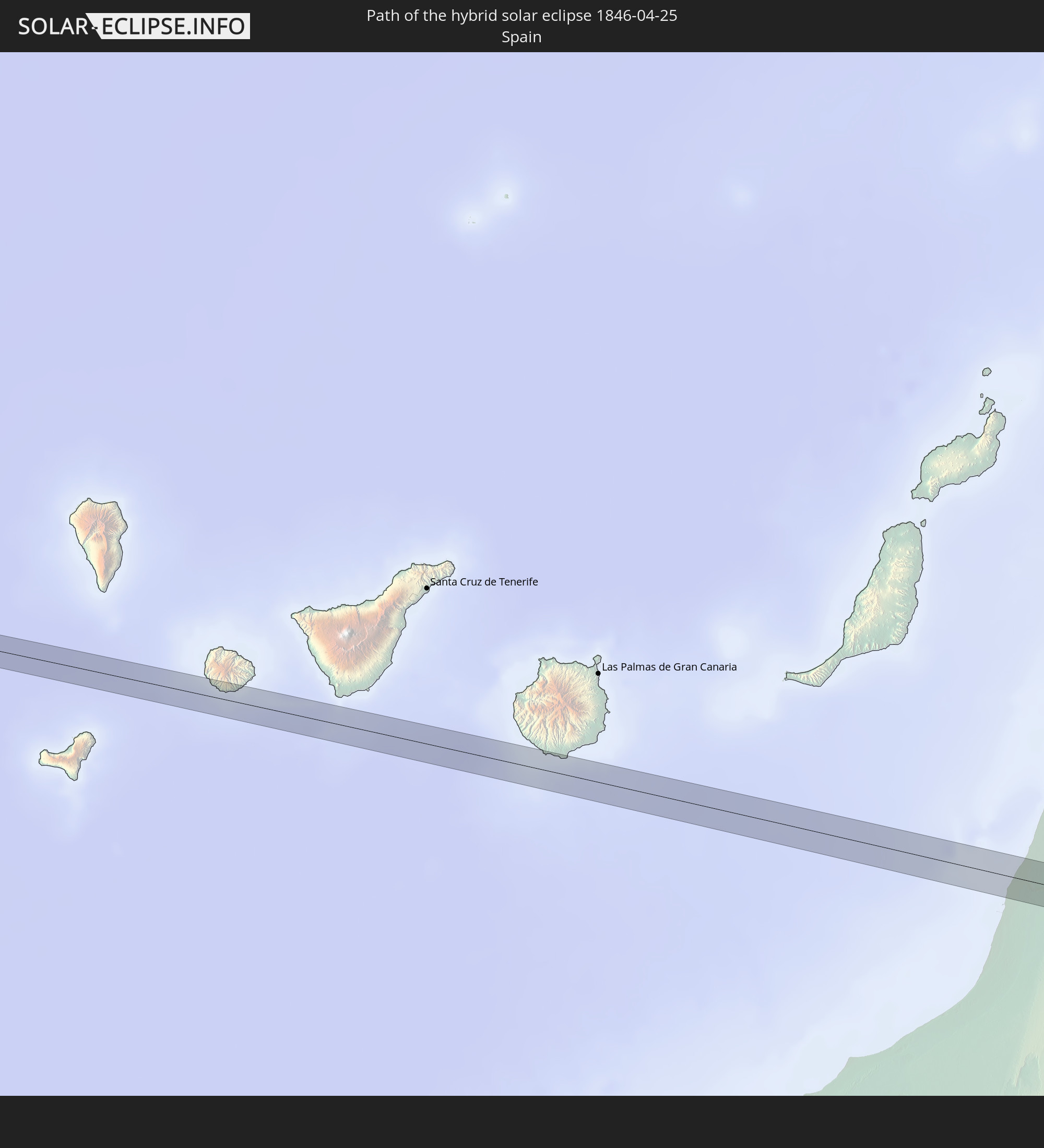
 Spain
Spain
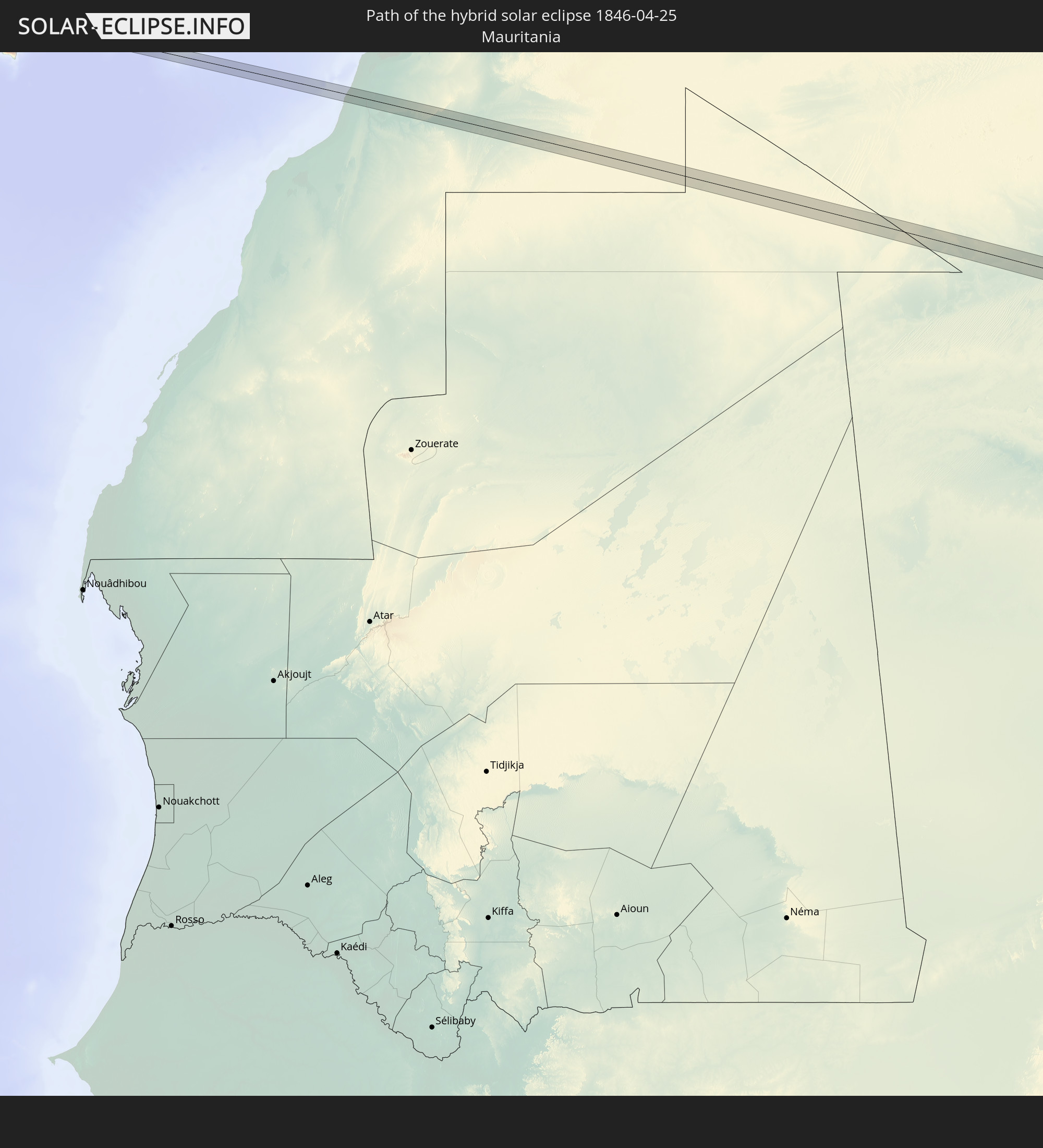
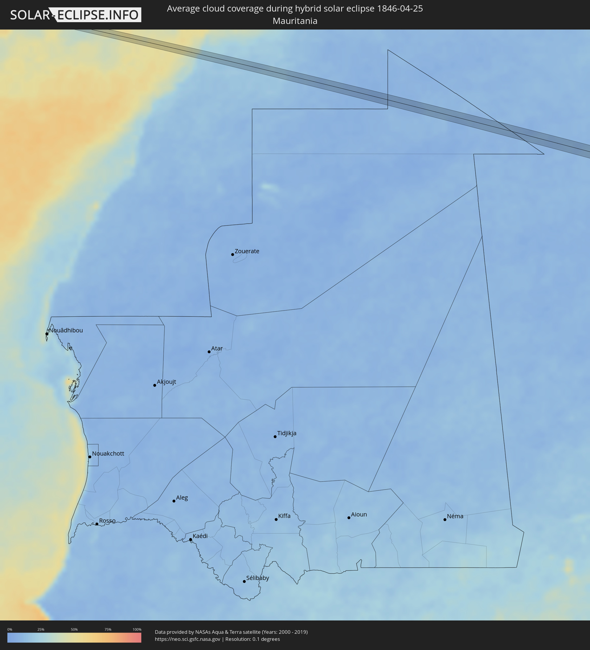 Mauritania
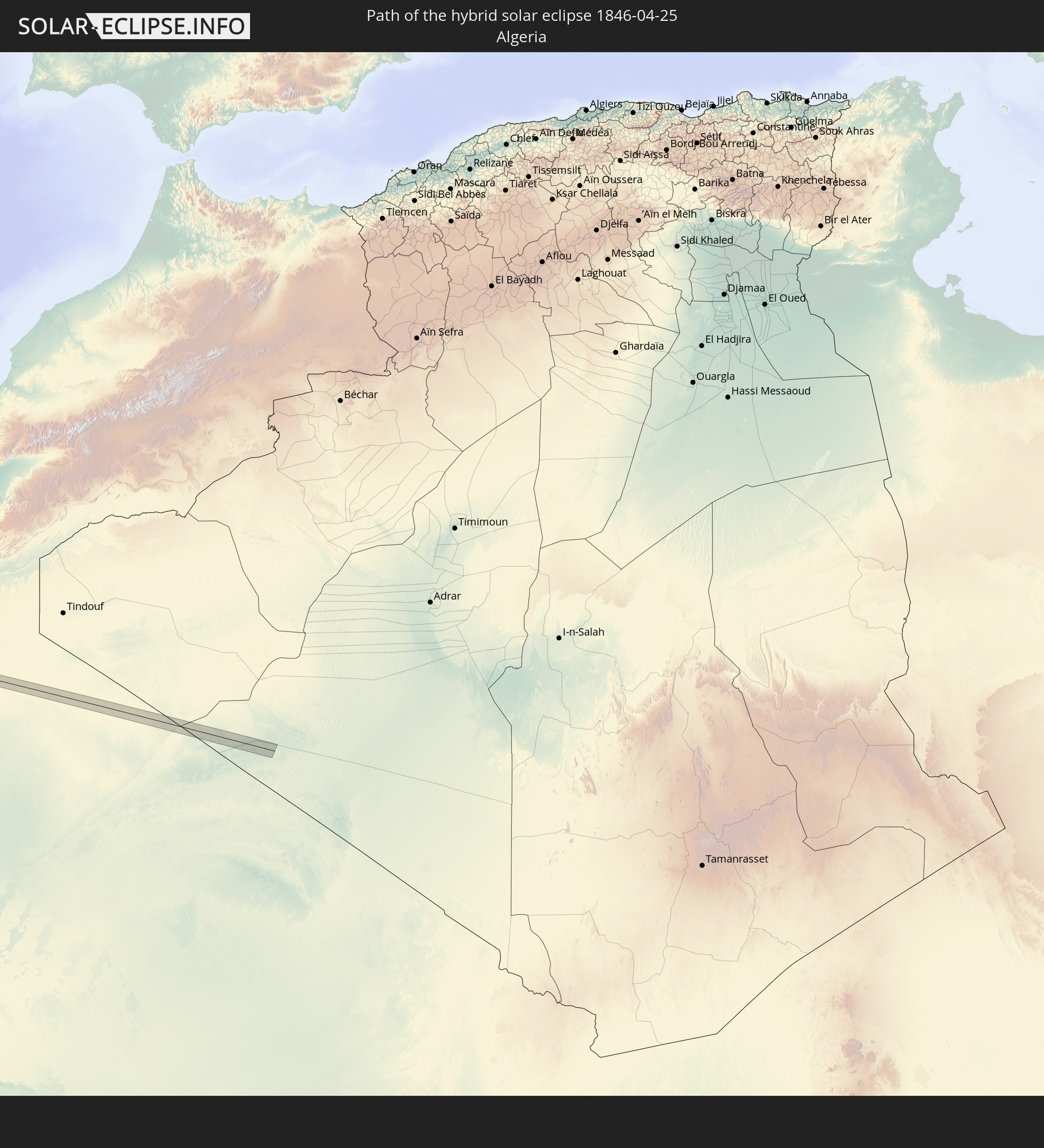
 Algeria
Cities inside the path of the eclipse
The following table shows all locations with a population of more than 5,000 inside the eclipse path. Cities which have more than 100,000 inhabitants are marked bold. A click at the locations opens a detailed map.
| City | Type | Eclipse duration | Local time of max. eclipse | Distance to central line | Ø Cloud coverage |
|
Pijijiapan, Chiapas
|
total | - | 09:18:55 UTC-06:36 | 8 km | 57% |
|
Nueva Palestina, Chiapas
|
total | - | 09:20:00 UTC-06:36 | 6 km | 42% |
|
Angel Albino Corzo, Chiapas
|
total | - | 09:20:10 UTC-06:36 | 1 km | 34% |
|
Tzimol, Chiapas
|
total | - | 09:21:43 UTC-06:36 | 1 km | 32% |
|
Comitán, Chiapas
|
total | - | 09:21:57 UTC-06:36 | 1 km | 33% |
|
Las Margaritas, Chiapas
|
total | - | 09:22:22 UTC-06:36 | 1 km | 34% |
|
Nueva Palestina, Chiapas
|
total | - | 09:24:40 UTC-06:36 | 7 km | 47% |
|
Frontera Corozal, Chiapas
|
total | - | 09:25:25 UTC-06:36 | 13 km | 47% |
|
Corozal, Corozal
|
total | - | 10:17:14 UTC-05:52 | 2 km | 57% |
|
Chetumal, Quintana Roo
|
total | - | 10:23:22 UTC-05:47 | 5 km | 40% |
|
Calderitas, Quintana Roo
|
total | - | 10:23:33 UTC-05:47 | 6 km | 48% |
|
Jagüey Grande, Matanzas
|
total | - | 11:04:39 UTC-05:29 | 11 km | 56% |
|
Calimete, Matanzas
|
total | - | 11:05:13 UTC-05:29 | 1 km | 58% |
|
Los Arabos, Matanzas
|
total | - | 11:06:01 UTC-05:29 | 10 km | 60% |
|
Quemado de Güines, Villa Clara
|
total | - | 11:07:18 UTC-05:29 | 7 km | 56% |
|
Sagua la Grande, Villa Clara
|
total | - | 11:07:47 UTC-05:29 | 14 km | 51% |
 Laâyoune / El Aaiún, Oued Ed-Dahab-Lagouira
|
annular | - | 17:43:24 UTC-00:52 | 4 km | 20% |