Annular solar eclipse of 12/24/1973
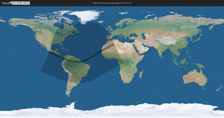
Wo kann man die Sonnenfinsternis vom 12/24/1973 sehen?
Die Sonnenfinsternis am 12/24/1973 kann man in 82 Ländern als partielle Sonnenfinsternis beobachten.
Der Finsternispfad verläuft durch 13 Länder. Nur in diesen Ländern ist sie als annular Sonnenfinsternis zu sehen.
In den folgenden Ländern ist die Sonnenfinsternis annular zu sehen
In den folgenden Ländern ist die Sonnenfinsternis partiell zu sehen
 United States
 United States Minor Outlying Islands
 Canada
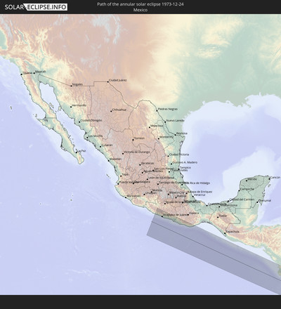
 Mexico
 Chile
Chile
 Greenland
 Guatemala
 Ecuador
 El Salvador
 Honduras
 Belize
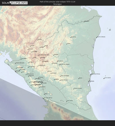
 Nicaragua
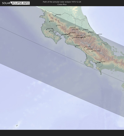
 Costa Rica
 Cuba
Cuba
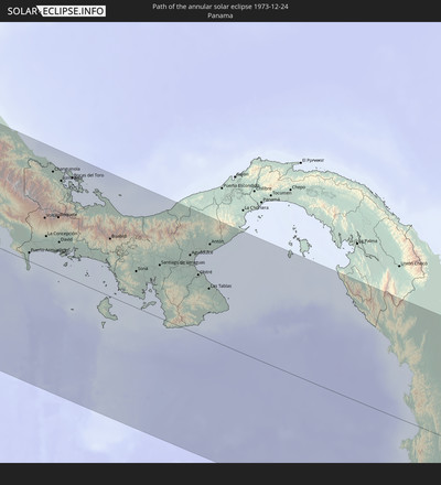
 Panama
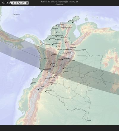
 Colombia
 Cayman Islands
 Peru
Peru
 The Bahamas
 Jamaica
 Haiti
Haiti
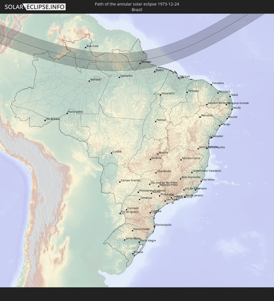
 Brazil
 Argentina
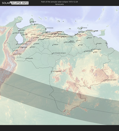
 Venezuela
 Turks and Caicos Islands
 Dominican Republic
 Aruba
Aruba
 Bolivia
 Puerto Rico
 United States Virgin Islands
 Bermuda
 British Virgin Islands
 Anguilla
 Collectivity of Saint Martin
 Saint Barthélemy
 Saint Kitts and Nevis
 Paraguay
 Antigua and Barbuda
 Montserrat
 Trinidad and Tobago
 Guadeloupe
 Grenada
 Dominica
 Saint Vincent and the Grenadines
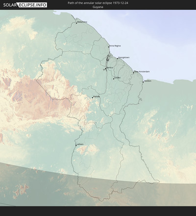
 Guyana
 Martinique
 Saint Lucia
 Barbados
 Uruguay
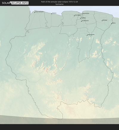
 Suriname
 Saint Pierre and Miquelon
 French Guiana
 Portugal
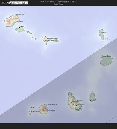
 Cabo Verde
 Spain
Spain
 Senegal
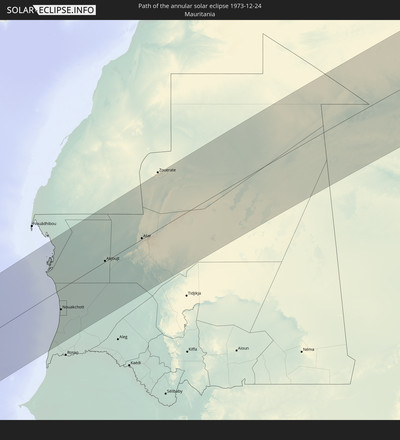
 Mauritania
 The Gambia
 Guinea-Bissau
 Guinea
 Saint Helena, Ascension and Tristan da Cunha
 Sierra Leone
 Morocco
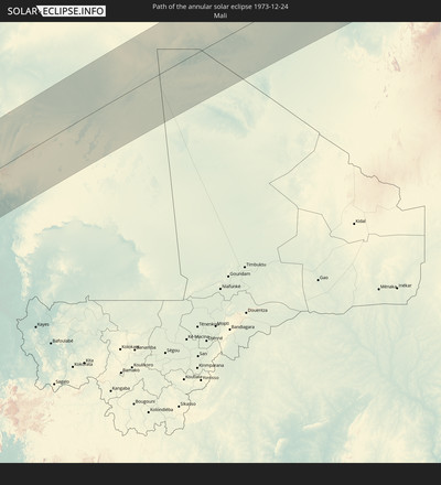
 Mali
Mali
 Liberia
 Republic of Ireland
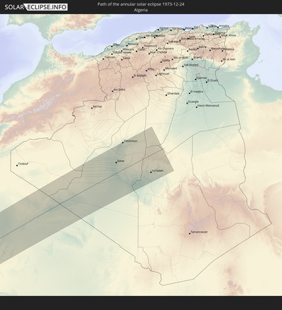
 Algeria
 Ivory Coast
 Burkina Faso
 Gibraltar
 Ghana
Ghana
 Togo
Togo
 Niger
Niger
 Benin
Benin
 Nigeria
 Equatorial Guinea
 São Tomé and Príncipe
 Cameroon
 Gabon
Gabon
 Republic of the Congo
 Democratic Republic of the Congo
 Central African Republic
How will be the weather during the annular solar eclipse on 12/24/1973?
Where is the best place to see the annular solar eclipse of 12/24/1973?
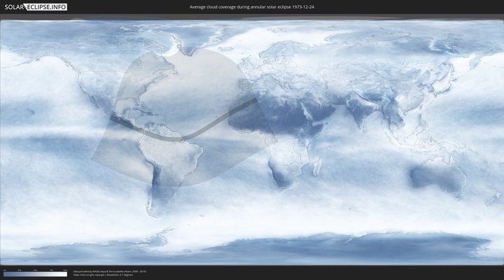
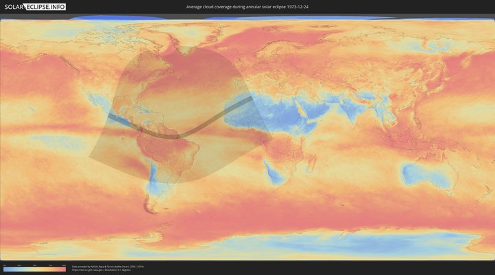
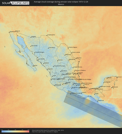
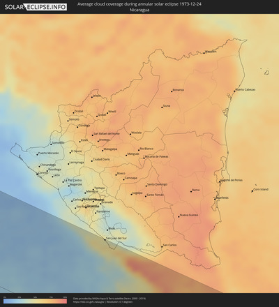
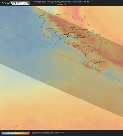
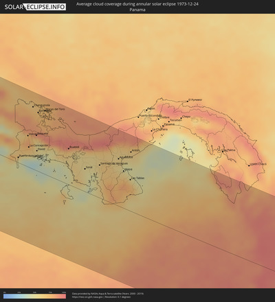
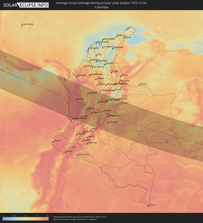
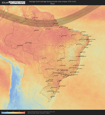
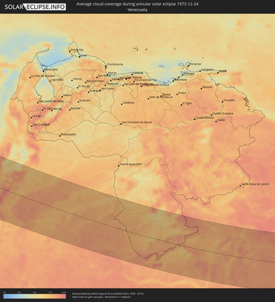
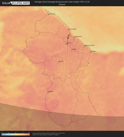
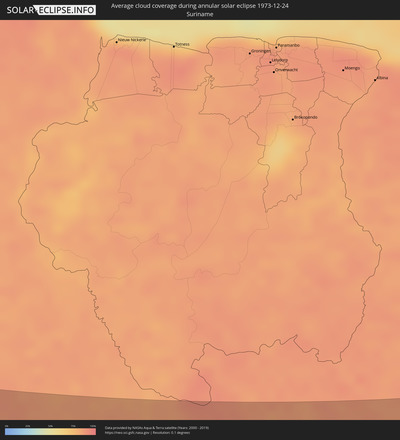
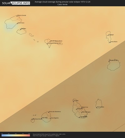
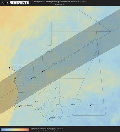
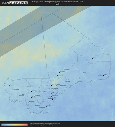
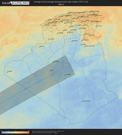
The following maps show the average cloud coverage for the day of the annular solar eclipse.
With the help of these maps, it is possible to find the place along the eclipse path, which has the best
chance of a cloudless sky.
Nevertheless, you should consider local circumstances and inform about the weather of your chosen
observation site.
The data is provided by NASAs satellites
AQUA and TERRA.
The cloud maps are averaged over a period of 19 years (2000 - 2019).
Detailed country maps
Cities inside the path of the eclipse
The following table shows all locations with a population of more than 5,000 inside the eclipse path. Cities which have more than 100,000 inhabitants are marked bold. A click at the locations opens a detailed map.
| City | Type | Eclipse duration | Local time of max. eclipse | Distance to central line | Ø Cloud coverage |
 El Súchil, Guerrero
|
annular | - | 07:14:18 UTC-06:00 | 118 km | 27% |
 Técpan de Galeana, Guerrero
|
annular | - | 07:14:18 UTC-06:00 | 118 km | 27% |
 San Jerónimo de Juárez, Guerrero
|
annular | - | 07:14:18 UTC-06:00 | 117 km | 29% |
 Atoyac de Álvarez, Guerrero
|
annular | - | 07:14:21 UTC-06:00 | 125 km | 30% |
 Coyuca de Benítez, Guerrero
|
annular | - | 07:14:20 UTC-06:00 | 120 km | 26% |
 Acapulco de Juárez, Guerrero
|
annular | - | 07:14:19 UTC-06:00 | 114 km | 28% |
 Kilómetro 30, Guerrero
|
annular | - | 07:14:24 UTC-06:00 | 133 km | 26% |
 Xaltianguis, Guerrero
|
annular | - | 07:14:28 UTC-06:00 | 146 km | 27% |
 Tierra Colorada, Guerrero
|
annular | - | 07:14:33 UTC-06:00 | 161 km | 21% |
 San Marcos, Guerrero
|
annular | - | 07:14:25 UTC-06:00 | 130 km | 22% |
 Cruz Grande, Guerrero
|
annular | - | 07:14:27 UTC-06:00 | 134 km | 22% |
 Ayutla de los Libres, Guerrero
|
annular | - | 07:14:35 UTC-06:00 | 160 km | 27% |
 Copala, Guerrero
|
annular | - | 07:14:26 UTC-06:00 | 129 km | 23% |
 Marquelia, Guerrero
|
annular | - | 07:14:29 UTC-06:00 | 134 km | 21% |
 San Luis Acatlán, Guerrero
|
annular | - | 07:14:37 UTC-06:00 | 160 km | 28% |
 Cuajinicuilapa de Santa Maria, Guerrero
|
annular | - | 07:14:33 UTC-06:00 | 141 km | 22% |
 Ometepec, Guerrero
|
annular | - | 07:14:39 UTC-06:00 | 163 km | 22% |
 Pinotepa, Oaxaca
|
annular | - | 07:14:36 UTC-06:00 | 144 km | 20% |
 Jamiltepec, Oaxaca
|
annular | - | 07:14:40 UTC-06:00 | 148 km | 20% |
 Puerto Escondido, Oaxaca
|
annular | - | 07:14:44 UTC-06:00 | 140 km | 18% |
 Brisas de Zicatela, Oaxaca
|
annular | - | 07:14:44 UTC-06:00 | 138 km | 19% |
 San Pedro Pochutla, Oaxaca
|
annular | - | 07:14:55 UTC-06:00 | 155 km | 18% |
 Crucecita, Oaxaca
|
annular | - | 07:15:04 UTC-06:00 | 172 km | 14% |
 San Juan del Sur, Rivas
|
annular | - | 08:20:30 UTC-05:00 | 180 km | 54% |
 Santa Cruz, Guanacaste
|
annular | - | 07:20:32 UTC-06:00 | 92 km | 40% |
 Nicoya, Guanacaste
|
annular | - | 07:20:39 UTC-06:00 | 87 km | 40% |
 Liberia, Guanacaste
|
annular | - | 07:20:46 UTC-06:00 | 137 km | 42% |
 Cañas, Guanacaste
|
annular | - | 07:21:04 UTC-06:00 | 131 km | 51% |
 Puntarenas, Puntarenas
|
annular | - | 07:21:14 UTC-06:00 | 97 km | 30% |
 Esparza, Puntarenas
|
annular | - | 07:21:26 UTC-06:00 | 107 km | 34% |
 San Rafael, Alajuela
|
annular | - | 07:21:40 UTC-06:00 | 122 km | 56% |
 Quesada, Alajuela
|
annular | - | 07:21:46 UTC-06:00 | 151 km | 78% |
 San Rafael Abajo, San José
|
annular | - | 07:21:48 UTC-06:00 | 107 km | 54% |
 Río Segundo, Alajuela
|
annular | - | 07:21:54 UTC-06:00 | 149 km | 63% |
 Colón, Heredia
|
annular | - | 07:21:52 UTC-06:00 | 117 km | 49% |
 Alajuela, Alajuela
|
annular | - | 07:21:56 UTC-06:00 | 129 km | 45% |
 San Rafael, Heredia
|
annular | - | 07:22:03 UTC-06:00 | 134 km | 54% |
 San José, San José
|
annular | - | 07:22:03 UTC-06:00 | 126 km | 54% |
 Tres Ríos, Cartago
|
annular | - | 07:22:09 UTC-06:00 | 128 km | 53% |
 Paraíso, Cartago
|
annular | - | 07:22:17 UTC-06:00 | 126 km | 69% |
 Guápiles, Limón
|
annular | - | 07:22:27 UTC-06:00 | 169 km | 84% |
 San Isidro, San José
|
annular | - | 07:22:22 UTC-06:00 | 86 km | 69% |
 Turrialba, Cartago
|
annular | - | 07:22:30 UTC-06:00 | 141 km | 74% |
 Daniel Flores, San José
|
annular | - | 07:22:24 UTC-06:00 | 84 km | 73% |
 Siquirres, Limón
|
annular | - | 07:22:45 UTC-06:00 | 169 km | 77% |
 Buenos Aires, Puntarenas
|
annular | - | 07:22:45 UTC-06:00 | 82 km | 54% |
 Limón, Limón
|
annular | - | 07:23:17 UTC-06:00 | 179 km | 67% |
 Puerto Armuelles, Chiriquí
|
annular | - | 08:23:09 UTC-05:00 | 12 km | 59% |
 Volcán, Chiriquí
|
annular | - | 08:23:30 UTC-05:00 | 73 km | 77% |
 La Concepción, Chiriquí
|
annular | - | 08:23:29 UTC-05:00 | 47 km | 67% |
 Guabito, Bocas del Toro
|
annular | - | 08:23:41 UTC-05:00 | 147 km | 73% |
 Changuinola, Bocas del Toro
|
annular | - | 08:23:47 UTC-05:00 | 145 km | 74% |
 Boquete, Chiriquí
|
annular | - | 08:23:45 UTC-05:00 | 82 km | 68% |
 Pedregal, Chiriquí
|
annular | - | 08:23:41 UTC-05:00 | 40 km | 46% |
 David, Chiriquí
|
annular | - | 08:23:42 UTC-05:00 | 47 km | 46% |
 Almirante, Bocas del Toro
|
annular | - | 08:23:54 UTC-05:00 | 137 km | 74% |
 Las Lomas, Chiriquí
|
annular | - | 08:23:46 UTC-05:00 | 49 km | 46% |
 Bocas del Toro, Bocas del Toro
|
annular | - | 08:24:06 UTC-05:00 | 148 km | 75% |
 Buabidi, Ngöbe-Buglé
|
annular | - | 08:24:38 UTC-05:00 | 84 km | 69% |
 Soná, Veraguas
|
annular | - | 08:25:04 UTC-05:00 | 53 km | 53% |
 Santiago de Veraguas, Veraguas
|
annular | - | 08:25:31 UTC-05:00 | 77 km | 60% |
 Pocrí, Coclé
|
annular | - | 08:26:09 UTC-05:00 | 112 km | 59% |
 Aguadulce, Coclé
|
annular | - | 08:26:09 UTC-05:00 | 110 km | 59% |
 Natá, Coclé
|
annular | - | 08:26:12 UTC-05:00 | 121 km | 60% |
 Chitré, Herrera
|
annular | - | 08:26:16 UTC-05:00 | 87 km | 57% |
 Los Santos, Los Santos
|
annular | - | 08:26:17 UTC-05:00 | 84 km | 65% |
 Penonomé, Coclé
|
annular | - | 08:26:27 UTC-05:00 | 147 km | 62% |
 Las Tablas, Los Santos
|
annular | - | 08:26:27 UTC-05:00 | 73 km | 67% |
 Antón, Coclé
|
annular | - | 08:26:34 UTC-05:00 | 139 km | 61% |
 Quibdó, Chocó
|
annular | - | 08:31:53 UTC-05:00 | 14 km | 94% |
 Buga, Valle del Cauca
|
annular | - | 08:32:28 UTC-05:00 | 156 km | 80% |
 Tuluá, Valle del Cauca
|
annular | - | 08:32:39 UTC-05:00 | 133 km | 80% |
 Cartago, Valle del Cauca
|
annular | - | 08:33:09 UTC-05:00 | 53 km | 76% |
 Pereira, Risaralda
|
annular | - | 08:33:33 UTC-05:00 | 37 km | 85% |
 Armenia, Quindío
|
annular | - | 08:33:34 UTC-05:00 | 65 km | 87% |
 Caldas, Antioquia
|
annular | - | 08:33:44 UTC-05:00 | 98 km | 81% |
 Medellín, Antioquia
|
annular | - | 08:33:53 UTC-05:00 | 117 km | 71% |
 Manizales, Caldas
|
annular | - | 08:33:53 UTC-05:00 | 3 km | 83% |
 Rionegro, Antioquia
|
annular | - | 08:34:13 UTC-05:00 | 115 km | 67% |
 Ibagué, Tolima
|
annular | - | 08:34:23 UTC-05:00 | 57 km | 82% |
 Girardot City, Cundinamarca
|
annular | - | 08:35:11 UTC-05:00 | 54 km | 76% |
 La Dorada, Caldas
|
annular | - | 08:35:30 UTC-05:00 | 71 km | 67% |
 Fusagasuga, Cundinamarca
|
annular | - | 08:36:02 UTC-05:00 | 33 km | 84% |
 Facatativá, Cundinamarca
|
annular | - | 08:36:04 UTC-05:00 | 17 km | 89% |
 Soacha, Cundinamarca
|
annular | - | 08:36:19 UTC-05:00 | 2 km | 72% |
 Bogotá, Bogota D.C.
|
annular | - | 08:36:35 UTC-05:00 | 7 km | 76% |
 Chía, Cundinamarca
|
annular | - | 08:36:39 UTC-05:00 | 34 km | 75% |
 Zipaquirá, Cundinamarca
|
annular | - | 08:36:45 UTC-05:00 | 53 km | 75% |
 Villavicencio, Meta
|
annular | - | 08:37:29 UTC-05:00 | 24 km | 81% |
 Tunja, Boyacá
|
annular | - | 08:38:05 UTC-05:00 | 131 km | 70% |
 Duitama, Boyacá
|
annular | - | 08:38:48 UTC-05:00 | 175 km | 49% |
 Sogamoso, Boyacá
|
annular | - | 08:39:00 UTC-05:00 | 167 km | 58% |
 Mazagão, Amapá
|
annular | - | 11:49:16 UTC-03:00 | 74 km | 78% |
 Santana, Amapá
|
annular | - | 14:49:45 UTC+00:00 | 70 km | 73% |
 Macapá, Amapá
|
annular | - | 11:50:18 UTC-03:00 | 61 km | 75% |
 Afuá, Pará
|
annular | - | 11:52:59 UTC-03:00 | 94 km | 81% |
 Tucumã, Pará
|
annular | - | 11:54:21 UTC-03:00 | 103 km | 84% |
 Vila Nova Sintra, Brava
|
annular | - | 14:26:40 UTC-02:00 | 135 km | 61% |
 São Filipe, São Filipe
|
annular | - | 14:27:04 UTC-02:00 | 125 km | 56% |
 Porto dos Mosteiros, Mosteiros
|
annular | - | 14:27:25 UTC-02:00 | 128 km | 58% |
 Cova Figueira, Santa Catarina do Fogo
|
annular | - | 14:27:25 UTC-02:00 | 113 km | 54% |
 Tarrafal, Tarrafal
|
annular | - | 14:28:30 UTC-02:00 | 117 km | 64% |
 Assomada, Santa Catarina
|
annular | - | 14:28:33 UTC-02:00 | 96 km | 55% |
 Picos, São Salvador do Mundo
|
annular | - | 14:28:37 UTC-02:00 | 92 km | 60% |
 Cidade Velha, Ribeira Grande de Santiago
|
annular | - | 14:28:35 UTC-02:00 | 75 km | 59% |
 Calheta, São Miguel
|
annular | - | 14:28:44 UTC-02:00 | 99 km | 66% |
 João Teves, São Lourenço dos Órgãos
|
annular | - | 14:28:41 UTC-02:00 | 87 km | 60% |
 Santa Cruz, Santa Cruz
|
annular | - | 14:28:45 UTC-02:00 | 93 km | 60% |
 São Domingos, São Domingos
|
annular | - | 14:28:43 UTC-02:00 | 82 km | 55% |
 Pedra Badejo, Santa Cruz
|
annular | - | 14:28:49 UTC-02:00 | 91 km | 62% |
 Praia, Praia
|
annular | - | 14:28:45 UTC-02:00 | 71 km | 63% |
 Vila do Maio, Maio
|
annular | - | 14:29:21 UTC-02:00 | 72 km | 64% |
 Vila de Sal Rei, Boa Vista
|
annular | - | 14:30:14 UTC-02:00 | 152 km | 57% |
 Tevragh Zeina, Nouakchott
|
annular | - | 16:40:03 UTC+00:00 | 64 km | 42% |
 Nouakchott, Nouakchott
|
annular | - | 16:40:04 UTC+00:00 | 66 km | 42% |
 Akjoujt, Inchiri
|
annular | - | 16:41:57 UTC+00:00 | 3 km | 26% |
 Atar, Adrar
|
annular | - | 16:43:17 UTC+00:00 | 4 km | 32% |
 Adrar, Adrar
|
annular | - | 16:49:34 UTC+00:00 | 73 km | 36% |
 Reggane, Adrar
|
annular | - | 16:50:09 UTC+00:00 | 63 km | 25% |
 Timimoun, Adrar
|
annular | - | 16:49:08 UTC+00:00 | 185 km | 31% |
 Aoulef, Adrar
|
annular | - | 16:50:20 UTC+00:00 | 80 km | 25% |
 I-n-Salah, Tamanrasset
|
annular | - | 16:50:37 UTC+00:00 | 121 km | 24% |
