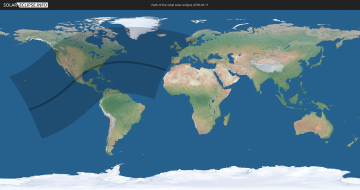
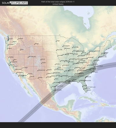
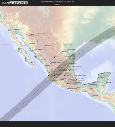
Total solar eclipse of 05/11/2078
| Day of week: | Wednesday |
| Maximum duration of eclipse: | 05m40s |
| Maximum width of eclipse path: | 232 km |
| Saros cycle: | 139 |
| Coverage: | 100% |
| Magnitude: | 1.0701 |
| Gamma: | 0.1838 |
Wo kann man die Sonnenfinsternis vom 05/11/2078 sehen?
Die Sonnenfinsternis am 05/11/2078 kann man in 63 Ländern als partielle Sonnenfinsternis beobachten.
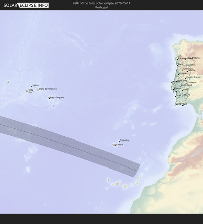
Der Finsternispfad verläuft durch 4 Länder. Nur in diesen Ländern ist sie als total Sonnenfinsternis zu sehen.
In den folgenden Ländern ist die Sonnenfinsternis total zu sehen
In den folgenden Ländern ist die Sonnenfinsternis partiell zu sehen
 United States
 United States Minor Outlying Islands
 Kiribati
 French Polynesia
 Canada
 Pitcairn Islands
 Mexico
 Greenland
 Guatemala
 Ecuador
 El Salvador
 Honduras
 Belize
 Nicaragua
 Costa Rica
 Cuba
Cuba
 Panama
 Colombia
 Cayman Islands
 The Bahamas
 Jamaica
 Haiti
Haiti
 Venezuela
 Turks and Caicos Islands
 Dominican Republic
 Aruba
Aruba
 Puerto Rico
 United States Virgin Islands
 Bermuda
 British Virgin Islands
 Anguilla
 Collectivity of Saint Martin
 Saint Barthélemy
 Saint Kitts and Nevis
 Antigua and Barbuda
 Montserrat
 Trinidad and Tobago
 Guadeloupe
 Grenada
 Dominica
 Saint Vincent and the Grenadines
 Guyana
 Martinique
 Saint Lucia
 Barbados
 Saint Pierre and Miquelon
 Portugal
 Cabo Verde
 Iceland
 Spain
Spain
 Republic of Ireland
 United Kingdom
 Faroe Islands
 France
 Isle of Man
 Guernsey
 Jersey
 Belgium
 Netherlands
 Norway
 Germany
 Denmark
 Sweden
How will be the weather during the total solar eclipse on 05/11/2078?
Where is the best place to see the total solar eclipse of 05/11/2078?
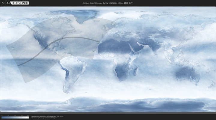
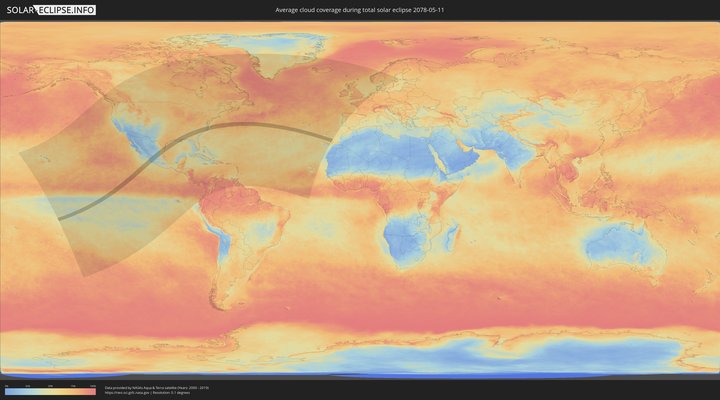
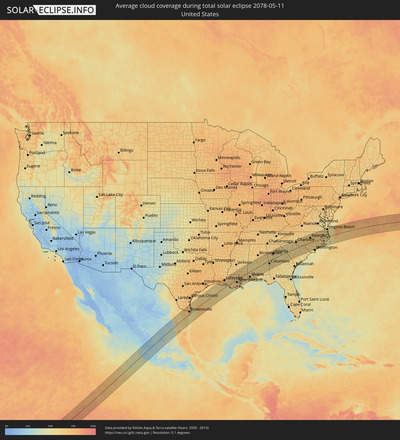
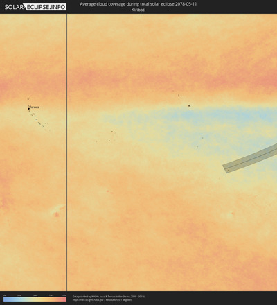
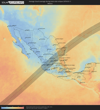
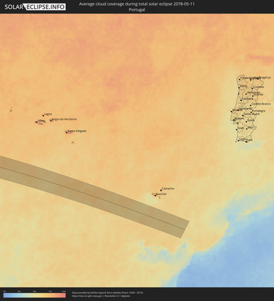
The following maps show the average cloud coverage for the day of the total solar eclipse.
With the help of these maps, it is possible to find the place along the eclipse path, which has the best
chance of a cloudless sky.
Nevertheless, you should consider local circumstances and inform about the weather of your chosen
observation site.
The data is provided by NASAs satellites
AQUA and TERRA.
The cloud maps are averaged over a period of 19 years (2000 - 2019).
Detailed country maps
Cities inside the path of the eclipse
The following table shows all locations with a population of more than 5,000 inside the eclipse path. Cities which have more than 100,000 inhabitants are marked bold. A click at the locations opens a detailed map.
| City | Type | Eclipse duration | Local time of max. eclipse | Distance to central line | Ø Cloud coverage |
 Puerto Vallarta, Jalisco
|
total | - | 11:20:06 UTC-06:00 | 109 km | 32% |
 Cihuatlán, Jalisco
|
total | - | 11:18:38 UTC-06:00 | 51 km | 40% |
 El Salto, Jalisco
|
total | - | 11:20:46 UTC-06:00 | 35 km | 29% |
 Jala, Nayarit
|
total | - | 10:22:17 UTC-07:00 | 94 km | 17% |
 La Resolana, Jalisco
|
total | - | 11:19:32 UTC-06:00 | 30 km | 27% |
 Casimiro Castillo, Jalisco
|
total | - | 11:19:32 UTC-06:00 | 30 km | 27% |
 Ixtlán del Río, Nayarit
|
total | - | 10:22:16 UTC-07:00 | 84 km | 20% |
 Autlán de Navarro, Jalisco
|
total | - | 11:19:57 UTC-06:00 | 21 km | 24% |
 Manzanillo, Colima
|
total | - | 11:18:42 UTC-06:00 | 84 km | 41% |
 Unión de Tula, Jalisco
|
total | - | 11:20:27 UTC-06:00 | 13 km | 21% |
 El Colomo, Colima
|
total | - | 11:18:49 UTC-06:00 | 87 km | 41% |
 El Grullo, Jalisco
|
total | - | 11:20:15 UTC-06:00 | 29 km | 20% |
 Tecolotlán, Jalisco
|
total | - | 11:21:16 UTC-06:00 | 8 km | 24% |
 Ameca, Jalisco
|
total | - | 11:21:54 UTC-06:00 | 20 km | 25% |
 San Gabriel, Jalisco
|
total | - | 11:20:33 UTC-06:00 | 47 km | 21% |
 Ahualulco de Mercado, Jalisco
|
total | - | 11:22:18 UTC-06:00 | 28 km | 28% |
 Tequila, Jalisco
|
total | - | 11:22:52 UTC-06:00 | 33 km | 25% |
 Cocula, Jalisco
|
total | - | 11:21:57 UTC-06:00 | 10 km | 25% |
 Comala, Colima
|
total | - | 11:20:08 UTC-06:00 | 100 km | 21% |
 Amatitán, Jalisco
|
total | - | 11:22:57 UTC-06:00 | 22 km | 23% |
 Colima, Colima
|
total | - | 11:20:03 UTC-06:00 | 109 km | 21% |
 Tala, Jalisco
|
total | - | 11:22:40 UTC-06:00 | 5 km | 22% |
 El Arenal, Jalisco
|
total | - | 11:22:55 UTC-06:00 | 14 km | 23% |
 Cuauhtémoc, Colima
|
total | - | 11:20:24 UTC-06:00 | 111 km | 18% |
 Sayula, Jalisco
|
total | - | 11:21:25 UTC-06:00 | 66 km | 29% |
 Quesería, Colima
|
total | - | 11:20:33 UTC-06:00 | 109 km | 18% |
 Zacoalco de Torres, Jalisco
|
total | - | 11:22:07 UTC-06:00 | 39 km | 32% |
 Santa Cruz de las Flores, Jalisco
|
total | - | 11:22:41 UTC-06:00 | 23 km | 24% |
 Tesistán, Jalisco
|
total | - | 11:23:20 UTC-06:00 | 1 km | 24% |
 Lomas de San Agustín, Jalisco
|
total | - | 11:22:50 UTC-06:00 | 22 km | 24% |
 Ciudad Guzmán, Jalisco
|
total | - | 11:21:20 UTC-06:00 | 90 km | 29% |
 Jocotepec, Jalisco
|
total | - | 11:22:27 UTC-06:00 | 45 km | 28% |
 Guadalajara, Jalisco
|
total | - | 11:23:13 UTC-06:00 | 16 km | 25% |
 Villas de la Hacienda [Fraccionamiento], Jalisco
|
total | - | 11:22:59 UTC-06:00 | 27 km | 24% |
 Hacienda Santa Fe, Jalisco
|
total | - | 11:22:58 UTC-06:00 | 29 km | 24% |
 Tuxpan, Jalisco
|
total | - | 11:21:12 UTC-06:00 | 109 km | 22% |
 Valle Dorado Inn, Jalisco
|
total | - | 11:23:00 UTC-06:00 | 29 km | 24% |
 Tlaltenango de Sánchez Román, Zacatecas
|
total | - | 11:25:25 UTC-06:00 | 70 km | 26% |
 El Quince, Jalisco
|
total | - | 11:23:10 UTC-06:00 | 33 km | 26% |
 Colotlán, Jalisco
|
total | - | 11:26:05 UTC-06:00 | 95 km | 22% |
 Tamazula de Gordiano, Jalisco
|
total | - | 11:21:38 UTC-06:00 | 107 km | 22% |
 La Alameda, Jalisco
|
total | - | 11:23:09 UTC-06:00 | 40 km | 26% |
 San José del Castillo, Jalisco
|
total | - | 11:23:12 UTC-06:00 | 39 km | 26% |
 Tonalá, Jalisco
|
total | - | 11:23:24 UTC-06:00 | 30 km | 25% |
 Galaxia Bonito Jalisco, Jalisco
|
total | - | 11:23:14 UTC-06:00 | 42 km | 26% |
 Chapala, Jalisco
|
total | - | 11:22:53 UTC-06:00 | 60 km | 27% |
 Zapotlanejo, Jalisco
|
total | - | 11:23:41 UTC-06:00 | 42 km | 29% |
 Tizapán el Alto, Jalisco
|
total | - | 11:22:53 UTC-06:00 | 82 km | 26% |
 Jalpa, Zacatecas
|
total | - | 11:25:42 UTC-06:00 | 36 km | 26% |
 Poncitlán, Jalisco
|
total | - | 11:23:29 UTC-06:00 | 72 km | 25% |
 Acatic, Jalisco
|
total | - | 11:24:15 UTC-06:00 | 40 km | 27% |
 Yahualica de González Gallo, Jalisco
|
total | - | 11:25:01 UTC-06:00 | 8 km | 26% |
 Villanueva, Zacatecas
|
total | - | 11:27:11 UTC-06:00 | 89 km | 26% |
 Nochistlán de Mejía, Zacatecas
|
total | - | 11:25:26 UTC-06:00 | 4 km | 30% |
 Tototlán, Jalisco
|
total | - | 11:24:00 UTC-06:00 | 68 km | 27% |
 Ocotlán, Jalisco
|
total | - | 11:23:42 UTC-06:00 | 85 km | 25% |
 Tepatitlán de Morelos, Jalisco
|
total | - | 11:24:34 UTC-06:00 | 47 km | 27% |
 Calvillo, Aguascalientes
|
total | - | 11:26:32 UTC-06:00 | 35 km | 33% |
 Sahuayo de Morelos, Michoacán
|
total | - | 11:23:15 UTC-06:00 | 113 km | 27% |
 Venustiano Carranza, Michoacán
|
total | - | 11:23:28 UTC-06:00 | 113 km | 27% |
 Capilla de Guadalupe, Jalisco
|
total | - | 11:24:53 UTC-06:00 | 58 km | 33% |
 Villa Hidalgo, Jalisco
|
total | - | 11:26:27 UTC-06:00 | 12 km | 30% |
 Zacatecas, Zacatecas
|
total | - | 11:28:27 UTC-06:00 | 102 km | 29% |
 Teocaltiche, Jalisco
|
total | - | 11:26:01 UTC-06:00 | 9 km | 27% |
 La Barca, Jalisco
|
total | - | 11:23:58 UTC-06:00 | 106 km | 26% |
 Atotonilco el Alto, Jalisco
|
total | - | 11:24:31 UTC-06:00 | 87 km | 29% |
 Vista Hermosa de Negrete, Michoacán
|
total | - | 11:24:03 UTC-06:00 | 112 km | 26% |
 Jalostotitlán, Jalisco
|
total | - | 11:25:43 UTC-06:00 | 39 km | 31% |
 San Miguel el Alto, Jalisco
|
total | - | 11:25:34 UTC-06:00 | 54 km | 34% |
 Trancoso, Zacatecas
|
total | - | 11:28:46 UTC-06:00 | 85 km | 30% |
 Arandas, Jalisco
|
total | - | 11:25:05 UTC-06:00 | 85 km | 34% |
 San Juan de los Lagos, Jalisco
|
total | - | 11:26:06 UTC-06:00 | 41 km | 34% |
 Rincón de Romos, Aguascalientes
|
total | - | 11:27:55 UTC-06:00 | 40 km | 29% |
 Jesús Gómez Portugal (Margaritas), Aguascalientes
|
total | - | 11:27:33 UTC-06:00 | 18 km | 26% |
 Aguascalientes, Aguascalientes
|
total | - | 11:27:21 UTC-06:00 | 8 km | 27% |
 Encarnación de Díaz, Jalisco
|
total | - | 11:26:46 UTC-06:00 | 24 km | 29% |
 San Julián, Jalisco
|
total | - | 11:25:56 UTC-06:00 | 71 km | 34% |
 Loreto, Zacatecas
|
total | - | 11:28:34 UTC-06:00 | 20 km | 29% |
 Ciudad Manuel Doblado, Guanajuato
|
total | - | 11:25:48 UTC-06:00 | 111 km | 38% |
 Lagos de Moreno, Jalisco
|
total | - | 11:26:59 UTC-06:00 | 59 km | 31% |
 San Francisco del Rincón, Guanajuato
|
total | - | 11:26:30 UTC-06:00 | 93 km | 32% |
 Salinas de Hidalgo, San Luis Potosí
|
total | - | 11:29:42 UTC-06:00 | 31 km | 25% |
 León de los Aldama, Guanajuato
|
total | - | 11:27:02 UTC-06:00 | 96 km | 29% |
 Ojuelos de Jalisco, Jalisco
|
total | - | 11:28:31 UTC-06:00 | 41 km | 26% |
 San Felipe, Guanajuato
|
total | - | 11:28:29 UTC-06:00 | 99 km | 36% |
 Charcas, San Luis Potosí
|
total | - | 11:31:40 UTC-06:00 | 32 km | 37% |
 San Luis Potosí, San Luis Potosí
|
total | - | 11:30:08 UTC-06:00 | 59 km | 40% |
 Villa de Reyes, San Luis Potosí
|
total | - | 11:29:35 UTC-06:00 | 91 km | 37% |
 Santa María del Río, San Luis Potosí
|
total | - | 11:29:55 UTC-06:00 | 105 km | 33% |
 Matehuala, San Luis Potosí
|
total | - | 11:33:27 UTC-06:00 | 44 km | 33% |
 Cerritos, San Luis Potosí
|
total | - | 11:31:53 UTC-06:00 | 82 km | 34% |
 Tula, Tamaulipas
|
total | - | 11:33:58 UTC-06:00 | 73 km | 38% |
 Linares, Nuevo León
|
total | - | 11:37:34 UTC-06:00 | 75 km | 61% |
 Ciudad Victoria, Tamaulipas
|
total | - | 11:36:21 UTC-06:00 | 47 km | 48% |
 Reynosa, Tamaulipas
|
total | - | 11:42:05 UTC-06:00 | 97 km | 70% |
 McAllen, Texas
|
total | - | 11:42:24 UTC-06:00 | 104 km | 70% |
 Soto la Marina, Tamaulipas
|
total | - | 11:38:10 UTC-06:00 | 106 km | 62% |
 San Fernando, Tamaulipas
|
total | - | 11:40:11 UTC-06:00 | 18 km | 63% |
 Río Bravo, Tamaulipas
|
total | - | 11:42:17 UTC-06:00 | 77 km | 64% |
 Weslaco, Texas
|
total | - | 11:42:46 UTC-06:00 | 85 km | 69% |
 Valle Hermoso, Tamaulipas
|
total | - | 11:42:16 UTC-06:00 | 32 km | 64% |
 Harlingen, Texas
|
total | - | 11:43:23 UTC-06:00 | 69 km | 71% |
 Heroica Matamoros, Tamaulipas
|
total | - | 11:43:12 UTC-06:00 | 30 km | 73% |
 Brownsville, Texas
|
total | - | 11:43:15 UTC-06:00 | 32 km | 73% |
 Lafayette, Louisiana
|
total | - | 12:00:55 UTC-06:00 | 95 km | 72% |
 New Iberia, Louisiana
|
total | - | 12:01:00 UTC-06:00 | 64 km | 69% |
 Baton Rouge, Louisiana
|
total | - | 12:02:58 UTC-06:00 | 69 km | 65% |
 Central, Louisiana
|
total | - | 12:03:22 UTC-06:00 | 73 km | 67% |
 Prairieville, Louisiana
|
total | - | 12:03:08 UTC-06:00 | 46 km | 65% |
 Houma, Louisiana
|
total | - | 12:02:37 UTC-06:00 | 33 km | 67% |
 Laplace, Louisiana
|
total | - | 12:03:47 UTC-06:00 | 2 km | 62% |
 Hammond, Louisiana
|
total | - | 12:04:26 UTC-06:00 | 38 km | 63% |
 Kenner, Louisiana
|
total | - | 12:04:10 UTC-06:00 | 21 km | 63% |
 New Orleans, Louisiana
|
total | - | 12:04:27 UTC-06:00 | 34 km | 66% |
 Slidell, Louisiana
|
total | - | 12:05:30 UTC-06:00 | 19 km | 63% |
 Hattiesburg, Mississippi
|
total | - | 12:07:56 UTC-06:00 | 56 km | 64% |
 Laurel, Mississippi
|
total | - | 12:08:45 UTC-06:00 | 83 km | 62% |
 West Gulfport, Mississippi
|
total | - | 12:07:05 UTC-06:00 | 42 km | 61% |
 Biloxi, Mississippi
|
total | - | 12:07:30 UTC-06:00 | 53 km | 55% |
 Pascagoula, Mississippi
|
total | - | 12:08:08 UTC-06:00 | 72 km | 57% |
 Tillmans Corner, Alabama
|
total | - | 12:09:14 UTC-06:00 | 70 km | 62% |
 Mobile, Alabama
|
total | - | 12:09:38 UTC-06:00 | 66 km | 55% |
 Daphne, Alabama
|
total | - | 12:09:48 UTC-06:00 | 82 km | 54% |
 Cantonment, Florida
|
total | - | 12:10:59 UTC-06:00 | 109 km | 57% |
 Selma, Alabama
|
total | - | 12:13:54 UTC-06:00 | 50 km | 55% |
 Prattville, Alabama
|
total | - | 12:15:06 UTC-06:00 | 30 km | 59% |
 Montgomery, Alabama
|
total | - | 12:15:18 UTC-06:00 | 14 km | 59% |
 Troy, Alabama
|
total | - | 12:15:19 UTC-06:00 | 56 km | 56% |
 Enterprise, Alabama
|
total | - | 12:14:57 UTC-06:00 | 109 km | 58% |
 Auburn, Alabama
|
total | - | 12:17:15 UTC-06:00 | 1 km | 60% |
 Carrollton, Georgia
|
total | - | 13:19:09 UTC-05:00 | 80 km | 60% |
 La Grange, Georgia
|
total | - | 13:18:38 UTC-05:00 | 24 km | 59% |
 Columbus, Georgia
|
total | - | 13:18:05 UTC-05:00 | 35 km | 58% |
 Newnan, Georgia
|
total | - | 13:19:29 UTC-05:00 | 48 km | 60% |
 Douglasville, Georgia
|
total | - | 13:19:59 UTC-05:00 | 83 km | 62% |
 Acworth, Georgia
|
total | - | 13:20:27 UTC-05:00 | 111 km | 62% |
 Peachtree City, Georgia
|
total | - | 13:19:54 UTC-05:00 | 41 km | 60% |
 Mableton, Georgia
|
total | - | 13:20:23 UTC-05:00 | 83 km | 62% |
 Marietta, Georgia
|
total | - | 13:20:35 UTC-05:00 | 94 km | 64% |
 Union City, Georgia
|
total | - | 13:20:13 UTC-05:00 | 58 km | 61% |
 Woodstock, Georgia
|
total | - | 13:20:48 UTC-05:00 | 108 km | 63% |
 Atlanta, Georgia
|
total | - | 13:20:42 UTC-05:00 | 68 km | 63% |
 Sandy Springs, Georgia
|
total | - | 13:20:54 UTC-05:00 | 85 km | 63% |
 Griffin, Georgia
|
total | - | 13:20:25 UTC-05:00 | 12 km | 58% |
 Stockbridge, Georgia
|
total | - | 13:20:47 UTC-05:00 | 41 km | 61% |
 Americus, Georgia
|
total | - | 13:19:12 UTC-05:00 | 106 km | 58% |
 Johns Creek, Georgia
|
total | - | 13:21:22 UTC-05:00 | 88 km | 62% |
 Redan, Georgia
|
total | - | 13:21:12 UTC-05:00 | 57 km | 62% |
 Sugar Hill, Georgia
|
total | - | 13:21:46 UTC-05:00 | 89 km | 63% |
 Lawrenceville, Georgia
|
total | - | 13:21:42 UTC-05:00 | 72 km | 63% |
 Gainesville, Georgia
|
total | - | 13:22:22 UTC-05:00 | 100 km | 56% |
 Macon, Georgia
|
total | - | 13:21:16 UTC-05:00 | 54 km | 55% |
 Warner Robins, Georgia
|
total | - | 13:21:02 UTC-05:00 | 77 km | 58% |
 Athens, Georgia
|
total | - | 13:22:55 UTC-05:00 | 48 km | 59% |
 Milledgeville, Georgia
|
total | - | 13:22:20 UTC-05:00 | 46 km | 54% |
 Dublin, Georgia
|
total | - | 13:22:26 UTC-05:00 | 114 km | 52% |
 Anderson, South Carolina
|
total | - | 13:24:53 UTC-05:00 | 74 km | 55% |
 Easley, South Carolina
|
total | - | 13:25:17 UTC-05:00 | 106 km | 54% |
 Greenville, South Carolina
|
total | - | 13:25:42 UTC-05:00 | 100 km | 59% |
 Simpsonville, South Carolina
|
total | - | 13:25:52 UTC-05:00 | 83 km | 57% |
 Greer, South Carolina
|
total | - | 13:26:06 UTC-05:00 | 103 km | 59% |
 Greenwood, South Carolina
|
total | - | 13:25:34 UTC-05:00 | 25 km | 57% |
 Evans, Georgia
|
total | - | 13:25:00 UTC-05:00 | 44 km | 66% |
 Augusta, Georgia
|
total | - | 13:25:15 UTC-05:00 | 56 km | 63% |
 Spartanburg, South Carolina
|
total | - | 13:26:41 UTC-05:00 | 93 km | 56% |
 Aiken, South Carolina
|
total | - | 13:25:51 UTC-05:00 | 57 km | 63% |
 Shelby, North Carolina
|
total | - | 13:27:45 UTC-05:00 | 113 km | 59% |
 Lexington, South Carolina
|
total | - | 13:27:12 UTC-05:00 | 32 km | 64% |
 Gastonia, North Carolina
|
total | - | 13:28:24 UTC-05:00 | 98 km | 61% |
 Columbia, South Carolina
|
total | - | 13:27:38 UTC-05:00 | 37 km | 62% |
 Rock Hill, South Carolina
|
total | - | 13:28:26 UTC-05:00 | 58 km | 60% |
 Charlotte, North Carolina
|
total | - | 13:29:03 UTC-05:00 | 82 km | 64% |
 Huntersville, North Carolina
|
total | - | 13:29:12 UTC-05:00 | 101 km | 64% |
 Indian Trail, North Carolina
|
total | - | 13:29:15 UTC-05:00 | 61 km | 65% |
 Concord, North Carolina
|
total | - | 13:29:42 UTC-05:00 | 92 km | 67% |
 Sumter, South Carolina
|
total | - | 13:28:57 UTC-05:00 | 70 km | 60% |
 Asheboro, North Carolina
|
total | - | 13:31:24 UTC-05:00 | 97 km | 65% |
 Florence, South Carolina
|
total | - | 13:30:19 UTC-05:00 | 62 km | 59% |
 Sanford, North Carolina
|
total | - | 13:32:27 UTC-05:00 | 52 km | 67% |
 Chapel Hill, North Carolina
|
total | - | 13:32:59 UTC-05:00 | 94 km | 62% |
 Lumberton, North Carolina
|
total | - | 13:32:08 UTC-05:00 | 43 km | 61% |
 Fort Bragg, North Carolina
|
total | - | 13:32:32 UTC-05:00 | 11 km | 67% |
 Durham, North Carolina
|
total | - | 13:33:21 UTC-05:00 | 97 km | 67% |
 Fayetteville, North Carolina
|
total | - | 13:32:43 UTC-05:00 | 2 km | 66% |
 Apex, North Carolina
|
total | - | 13:33:15 UTC-05:00 | 68 km | 61% |
 Fuquay-Varina, North Carolina
|
total | - | 13:33:15 UTC-05:00 | 51 km | 65% |
 Raleigh, North Carolina
|
total | - | 13:33:41 UTC-05:00 | 66 km | 66% |
 Wake Forest, North Carolina
|
total | - | 13:34:04 UTC-05:00 | 83 km | 65% |
 Goldsboro, North Carolina
|
total | - | 13:34:39 UTC-05:00 | 5 km | 63% |
 Wilson, North Carolina
|
total | - | 13:35:02 UTC-05:00 | 38 km | 68% |
 Rocky Mount, North Carolina
|
total | - | 13:35:24 UTC-05:00 | 57 km | 65% |
 Kinston, North Carolina
|
total | - | 13:35:22 UTC-05:00 | 20 km | 65% |
 Jacksonville, North Carolina
|
total | - | 13:35:19 UTC-05:00 | 78 km | 62% |
 Greenville, North Carolina
|
total | - | 13:36:00 UTC-05:00 | 10 km | 64% |
 New Bern, North Carolina
|
total | - | 13:36:18 UTC-05:00 | 52 km | 58% |
 Havelock, North Carolina
|
total | - | 13:36:26 UTC-05:00 | 81 km | 59% |
 Suffolk, Virginia
|
total | - | 13:38:07 UTC-05:00 | 106 km | 58% |
 Norfolk, Virginia
|
total | - | 13:38:44 UTC-05:00 | 110 km | 57% |
 Elizabeth City, North Carolina
|
total | - | 13:38:30 UTC-05:00 | 51 km | 60% |
 Virginia Beach, Virginia
|
total | - | 13:39:18 UTC-05:00 | 103 km | 56% |
