Annular solar eclipse of 12/29/2103
| Day of week: | Saturday |
| Maximum duration of eclipse: | 00m43s |
| Maximum width of eclipse path: | 23 km |
| Saros cycle: | 143 |
| Coverage: | 99.4% |
| Magnitude: | 0.9936 |
| Gamma: | 0.2747 |
Wo kann man die Sonnenfinsternis vom 12/29/2103 sehen?
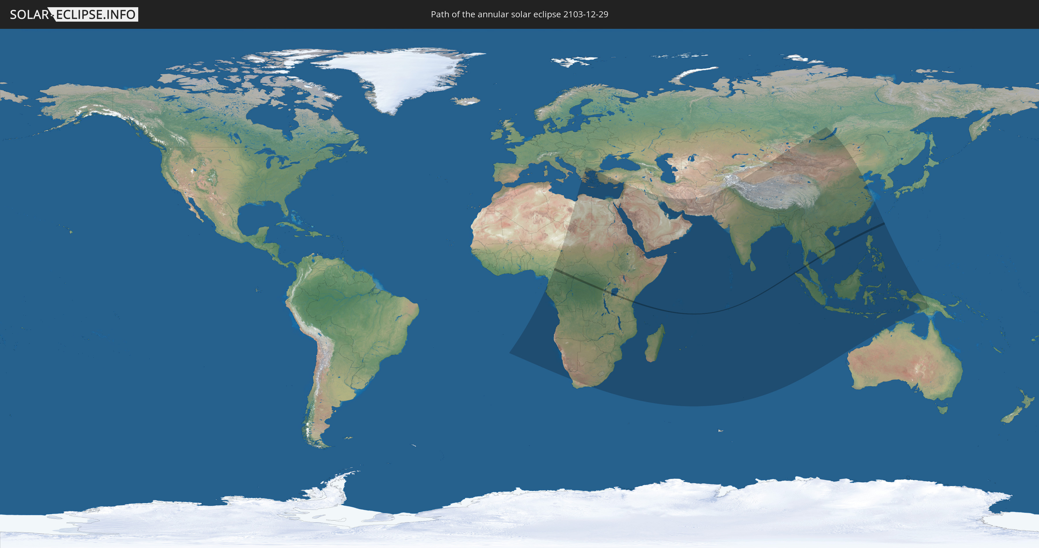
Die Sonnenfinsternis am 12/29/2103 kann man in 88 Ländern als partielle Sonnenfinsternis beobachten.
Der Finsternispfad verläuft durch 13 Länder. Nur in diesen Ländern ist sie als annular Sonnenfinsternis zu sehen.
In den folgenden Ländern ist die Sonnenfinsternis annular zu sehen
 Cameroon
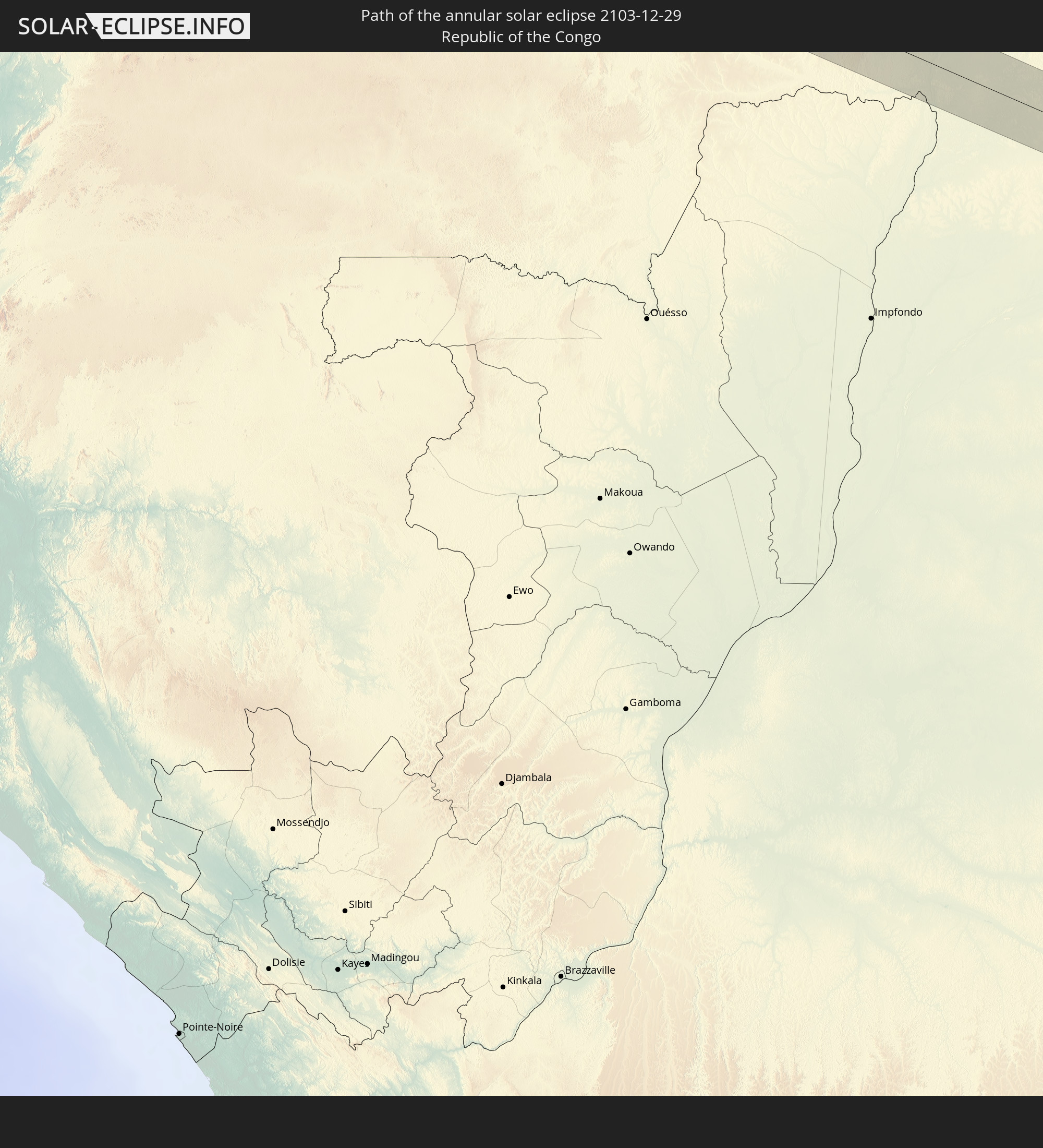 Republic of the Congo
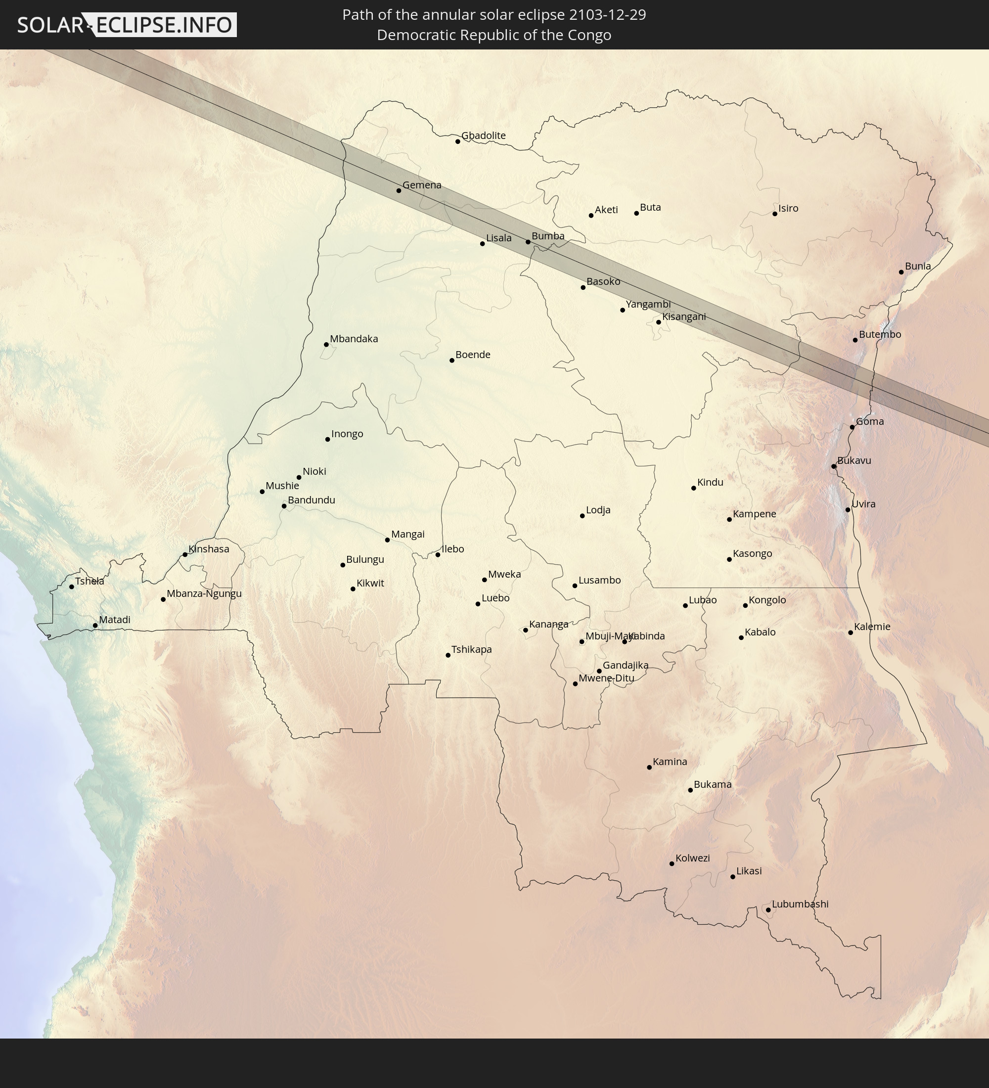 Democratic Republic of the Congo
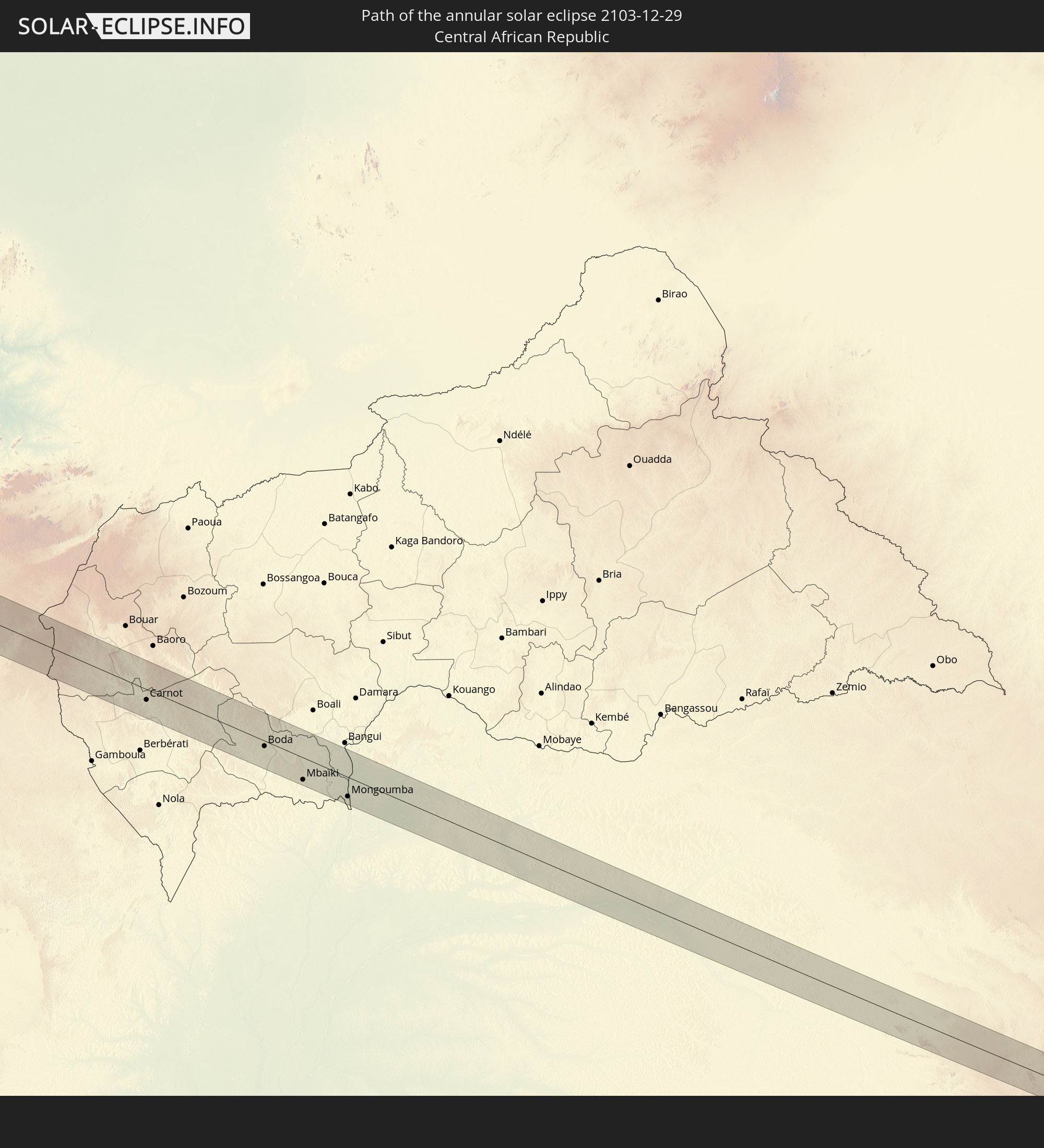 Central African Republic
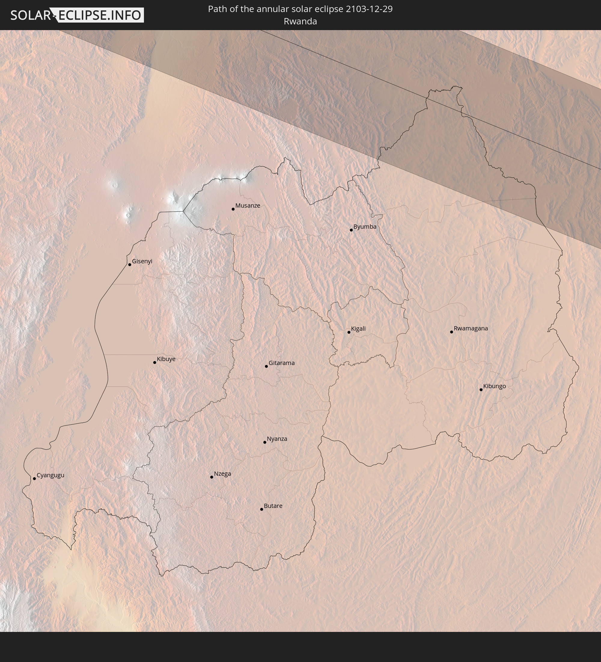 Rwanda
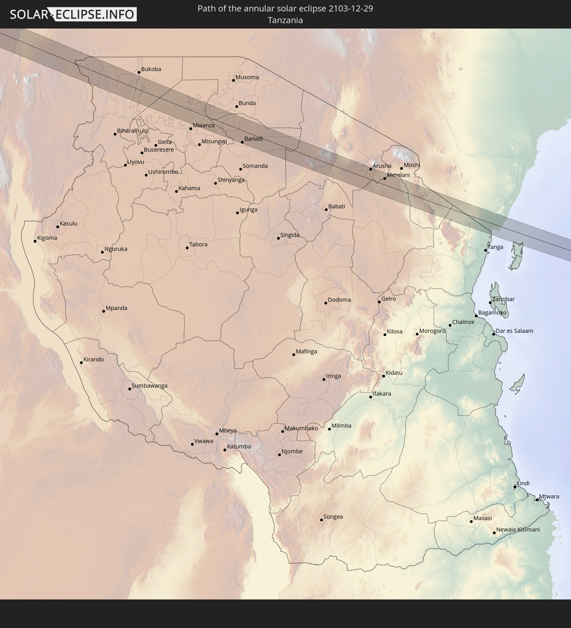 Tanzania
 Uganda
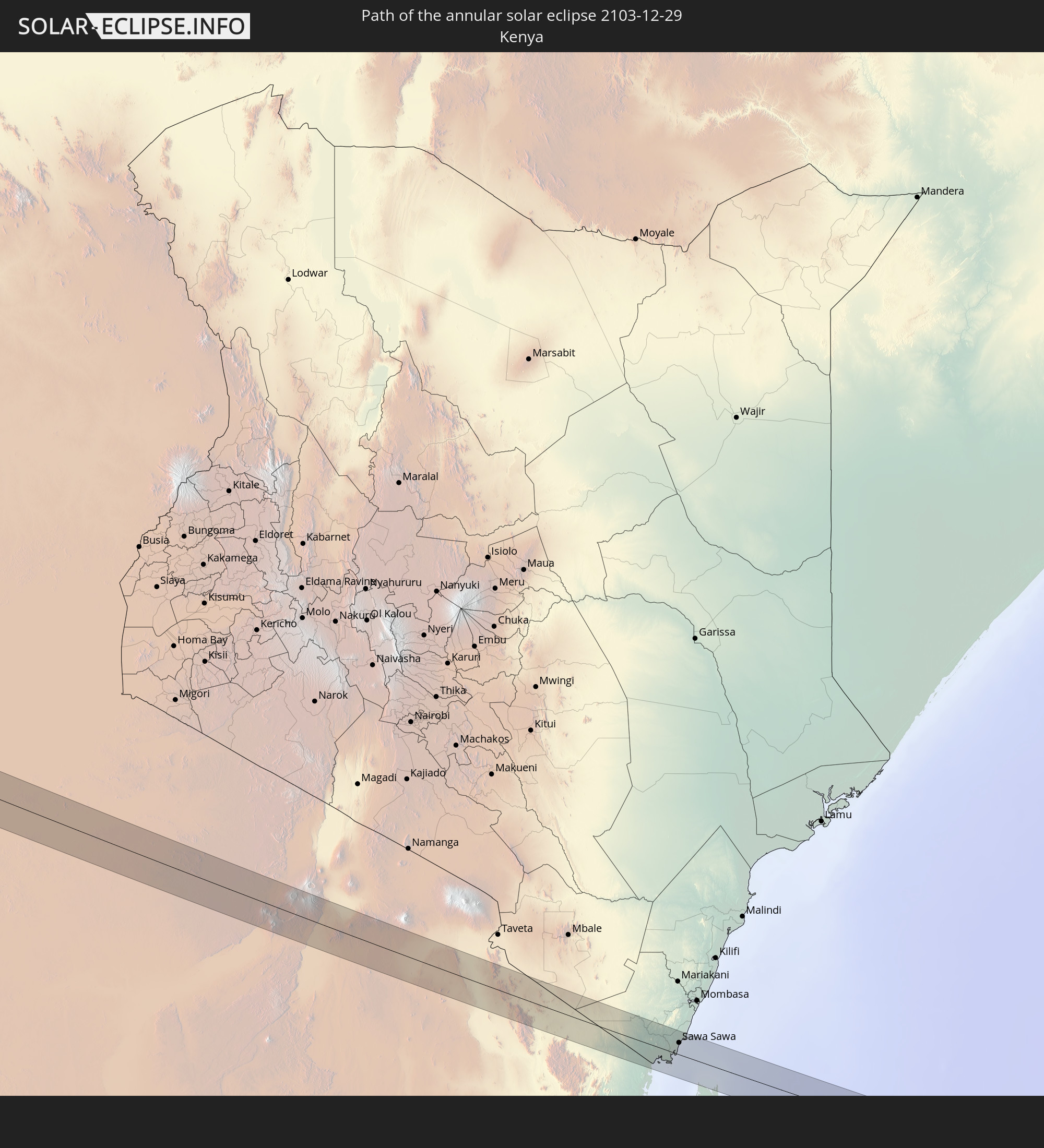 Kenya
Kenya
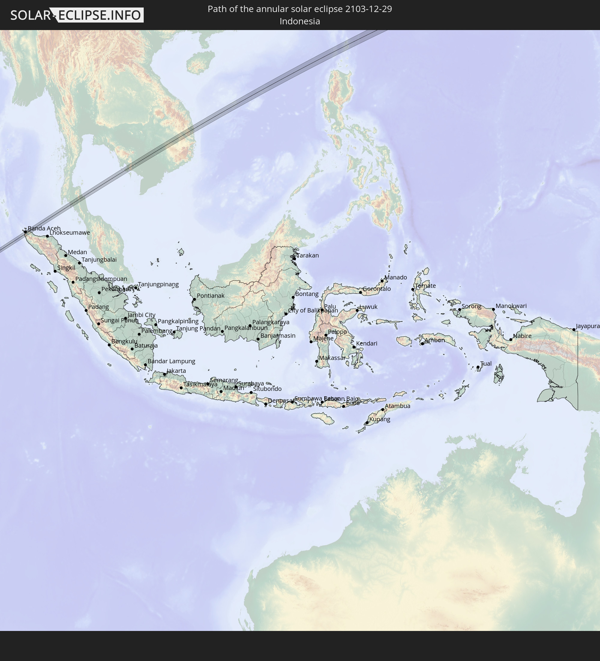 Indonesia
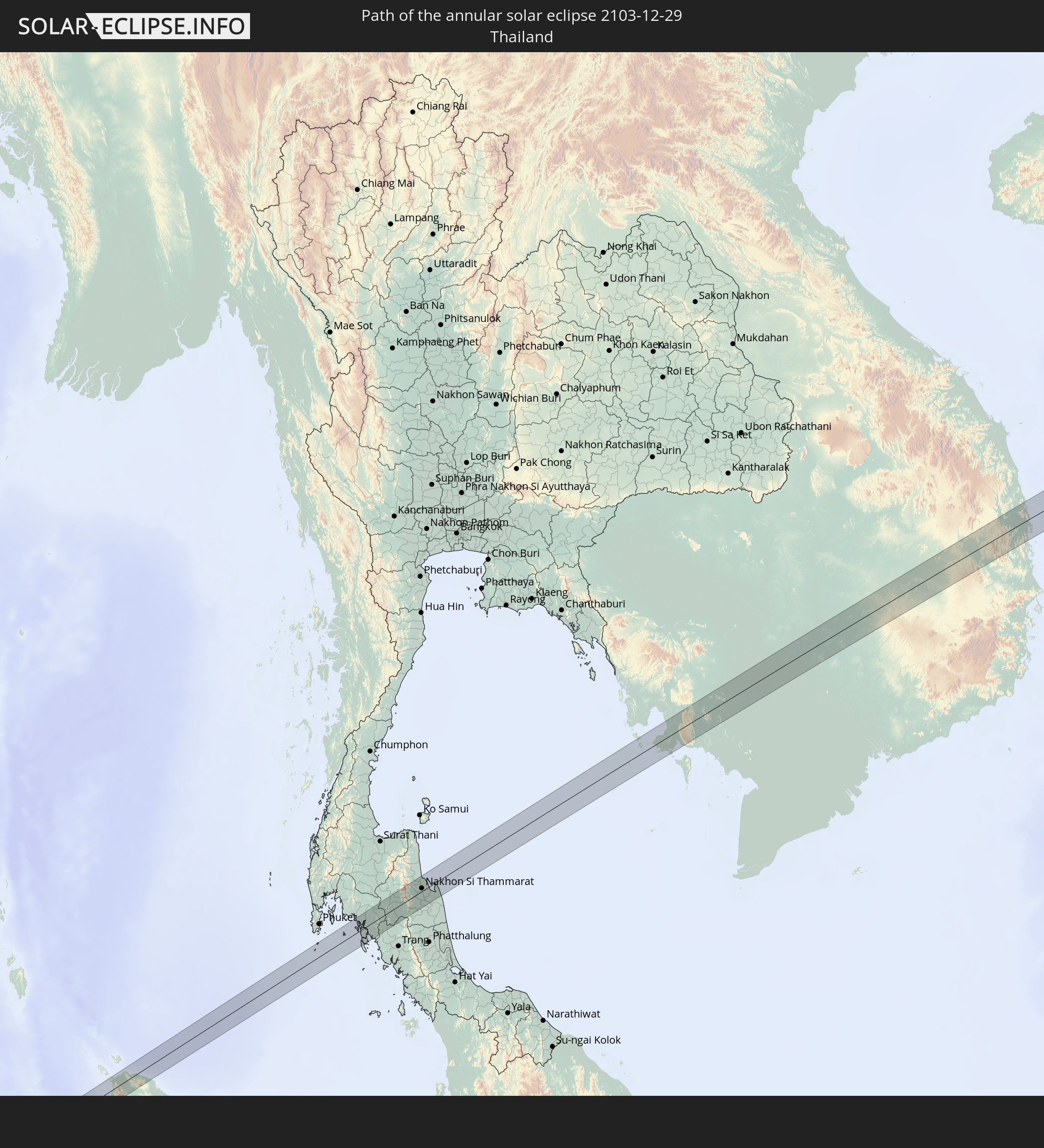 Thailand
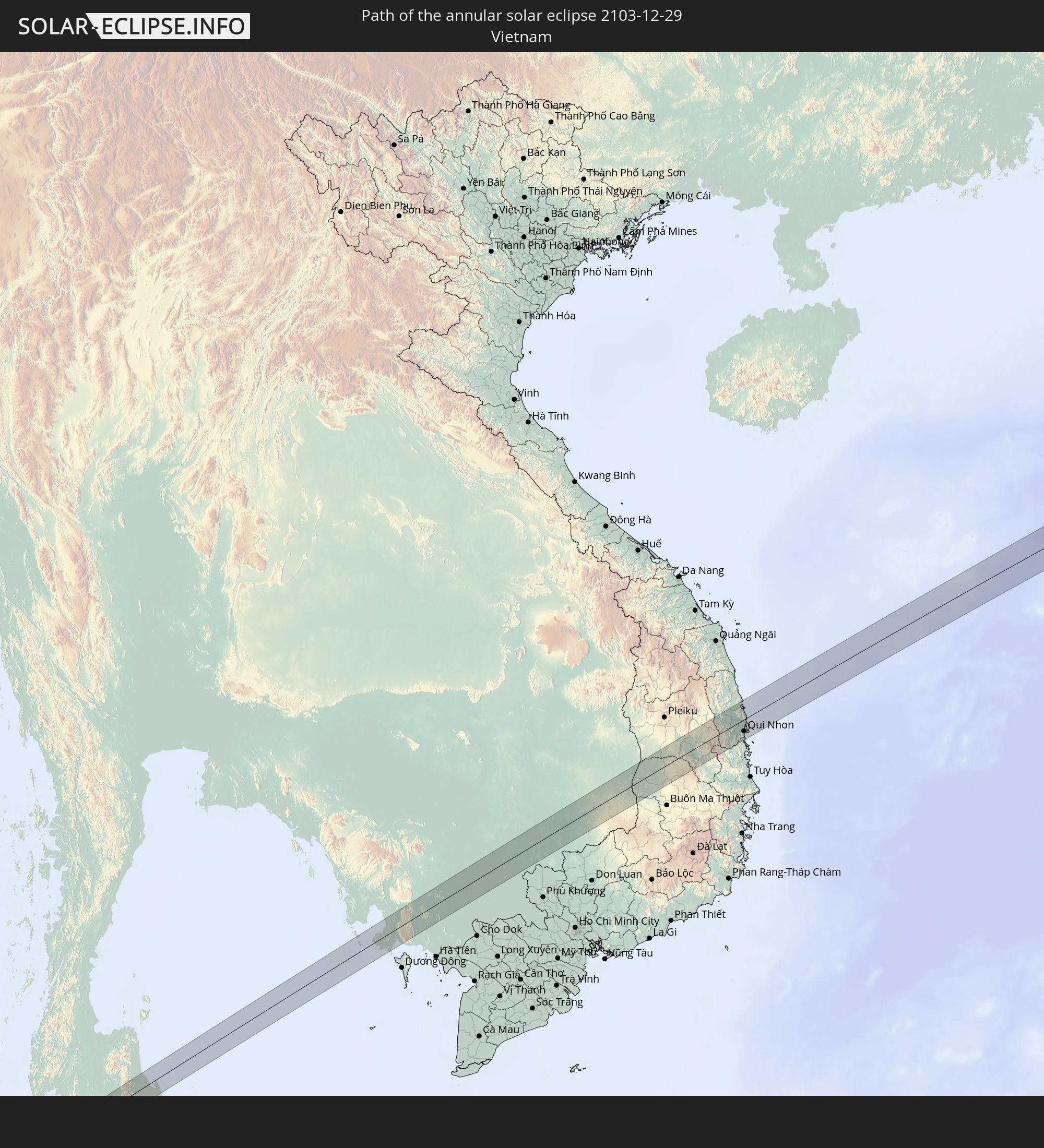 Vietnam
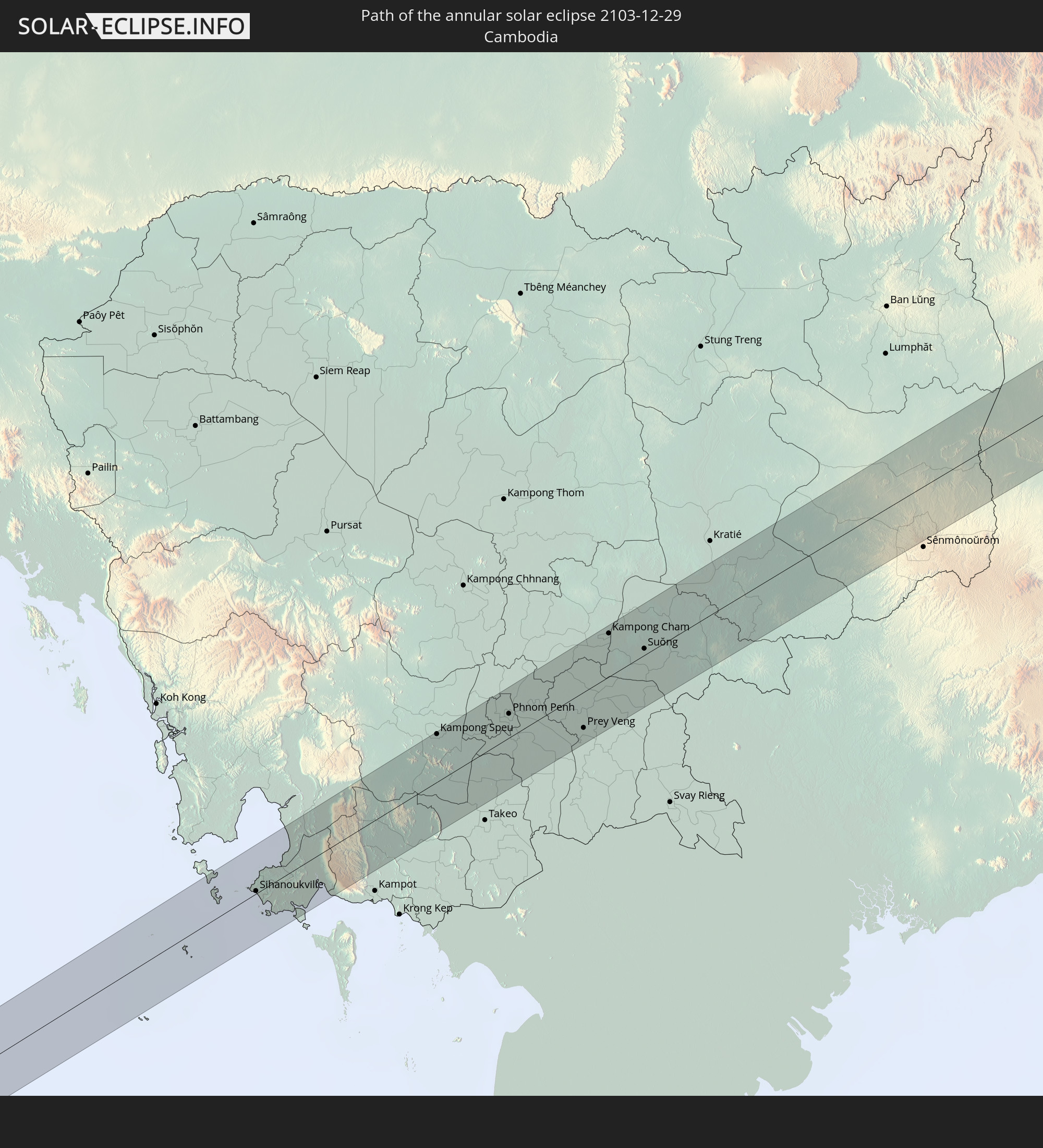 Cambodia
 Philippines
In den folgenden Ländern ist die Sonnenfinsternis partiell zu sehen
 Russia
 Nigeria
 Equatorial Guinea
 Cameroon
 Gabon
Gabon
 Libya
Libya
 Republic of the Congo
 Angola
 Namibia
 Democratic Republic of the Congo
 Chad
Chad
 Central African Republic
 South Africa
 Greece
 Botswana
 Republic of Macedonia
 Sudan
Sudan
 Zambia
 Bulgaria
 Egypt
Egypt
 Zimbabwe
 Turkey
 Lesotho
 Rwanda
 Burundi
 Tanzania
 Uganda
 Mozambique
 Swaziland
 Cyprus
 Malawi
 Ethiopia
 Kenya
Kenya
 State of Palestine
 Israel
 Saudi Arabia
 Jordan
 Lebanon
 Syria
Syria
 Eritrea
 Iraq
Iraq
 French Southern and Antarctic Lands
 Somalia
 Djibouti
 Yemen
Yemen
 Madagascar
 Comoros
 Iran
Iran
 Mayotte
 Seychelles
 Kuwait
 Bahrain
 Qatar
Qatar
 United Arab Emirates
 Oman
Oman
 Réunion
 Mauritius
 Afghanistan
 Pakistan
 India
India
 British Indian Ocean Territory
 Maldives
 China
China
 Sri Lanka
 Nepal
Nepal
 Mongolia
 Bangladesh
 Bhutan
 Myanmar
 Indonesia
 Cocos Islands
 Thailand
 Malaysia
 Laos
Laos
 Vietnam
 Cambodia
 Singapore
 Christmas Island
 Australia
 Macau
Macau
 Hong Kong
 Brunei
 Taiwan
 Philippines
 Japan
Japan
 East Timor
 Palau
Palau
 Papua New Guinea
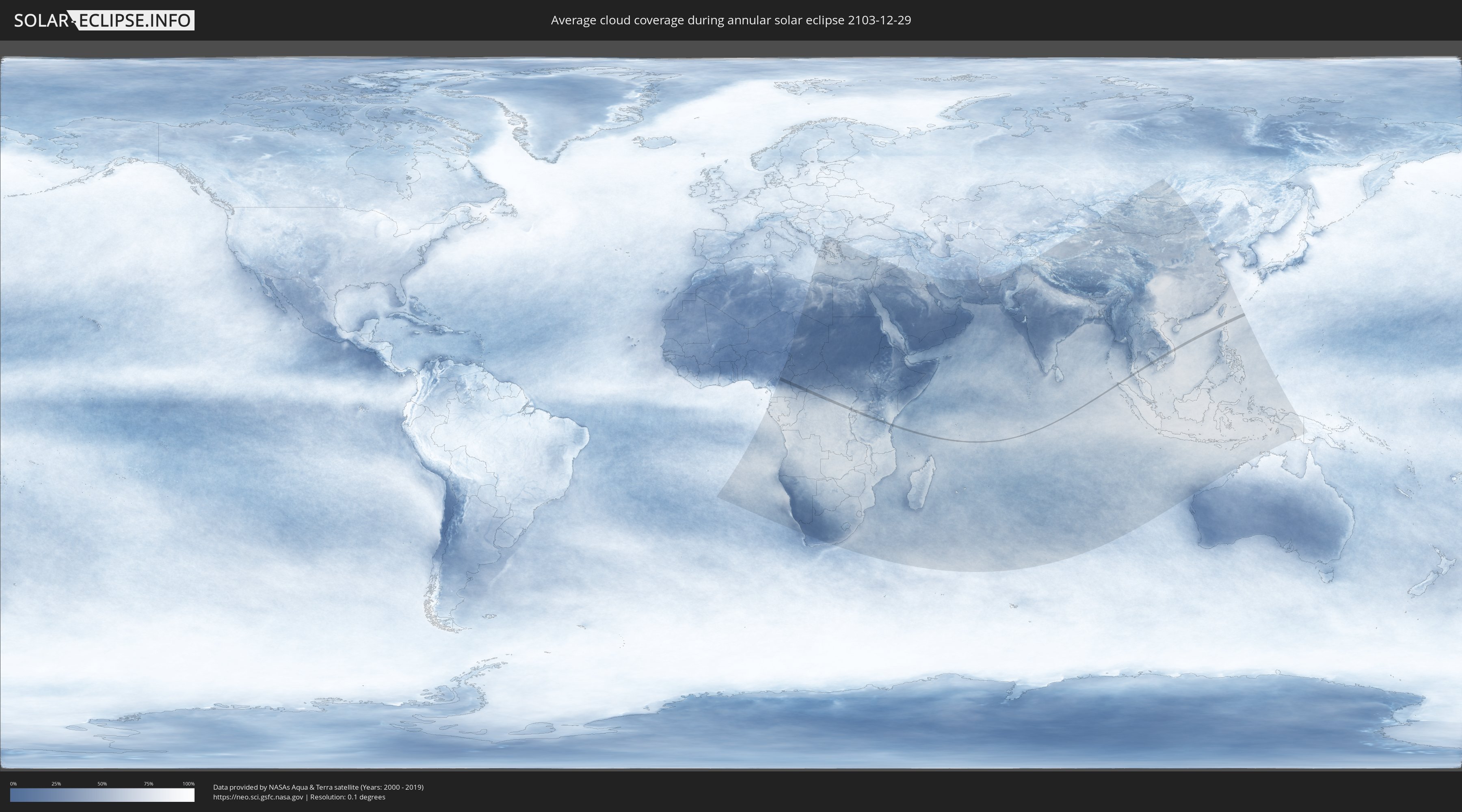
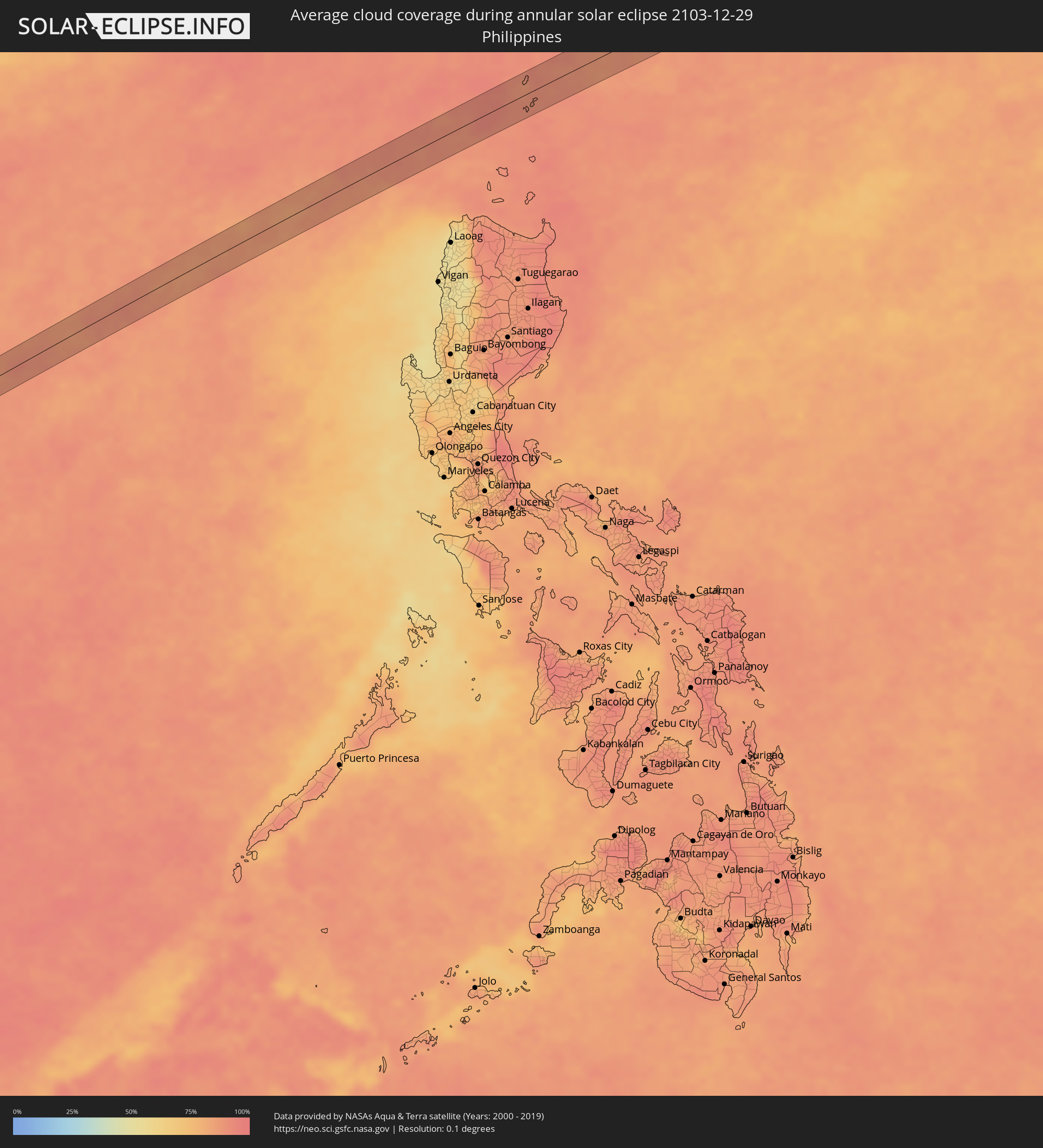
How will be the weather during the annular solar eclipse on 12/29/2103?
Where is the best place to see the annular solar eclipse of 12/29/2103?
The following maps show the average cloud coverage for the day of the annular solar eclipse.
With the help of these maps, it is possible to find the place along the eclipse path, which has the best
chance of a cloudless sky.
Nevertheless, you should consider local circumstances and inform about the weather of your chosen
observation site.
The data is provided by NASAs satellites
AQUA and TERRA.
The cloud maps are averaged over a period of 19 years (2000 - 2019).

Detailed country maps
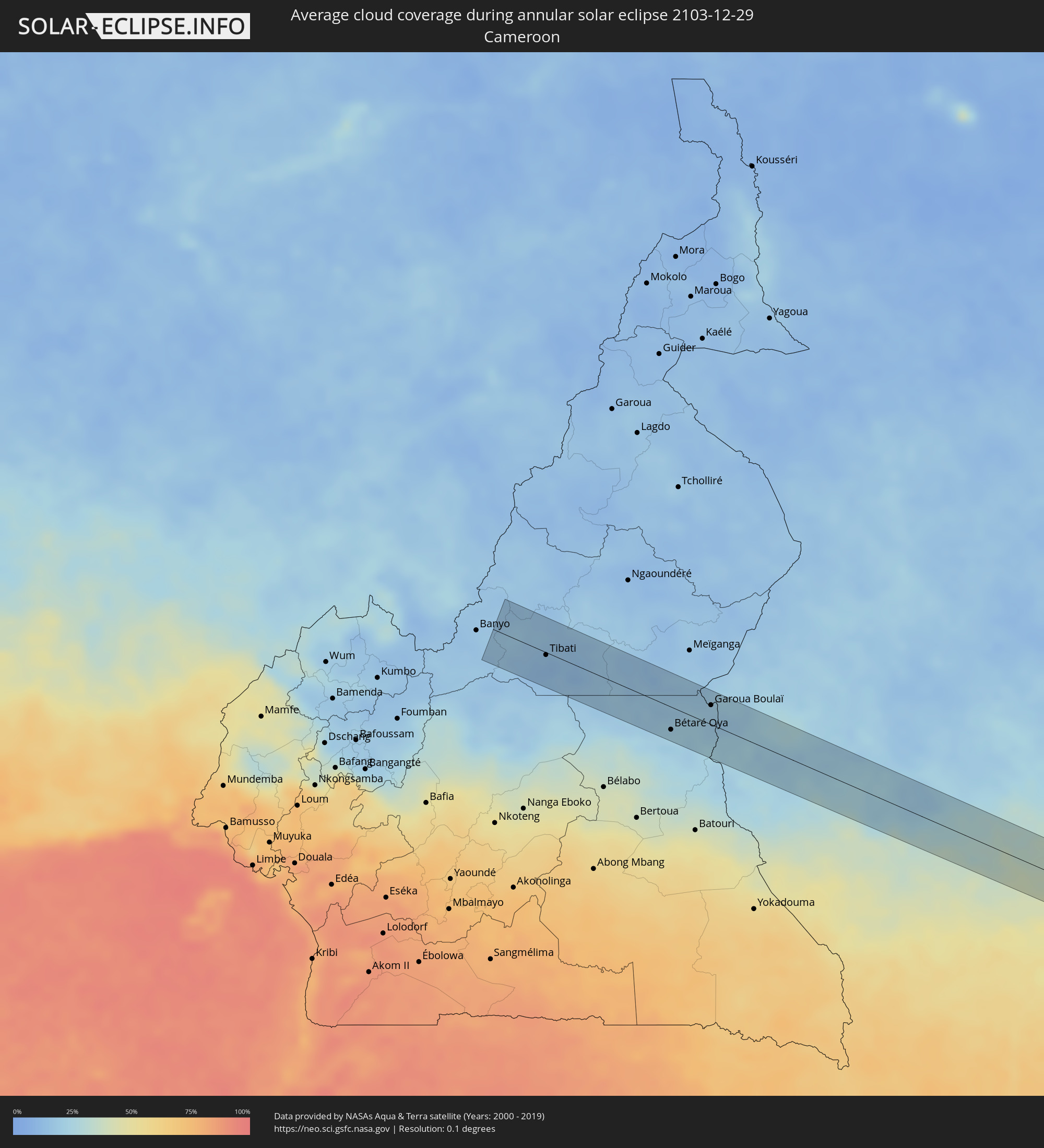 Cameroon
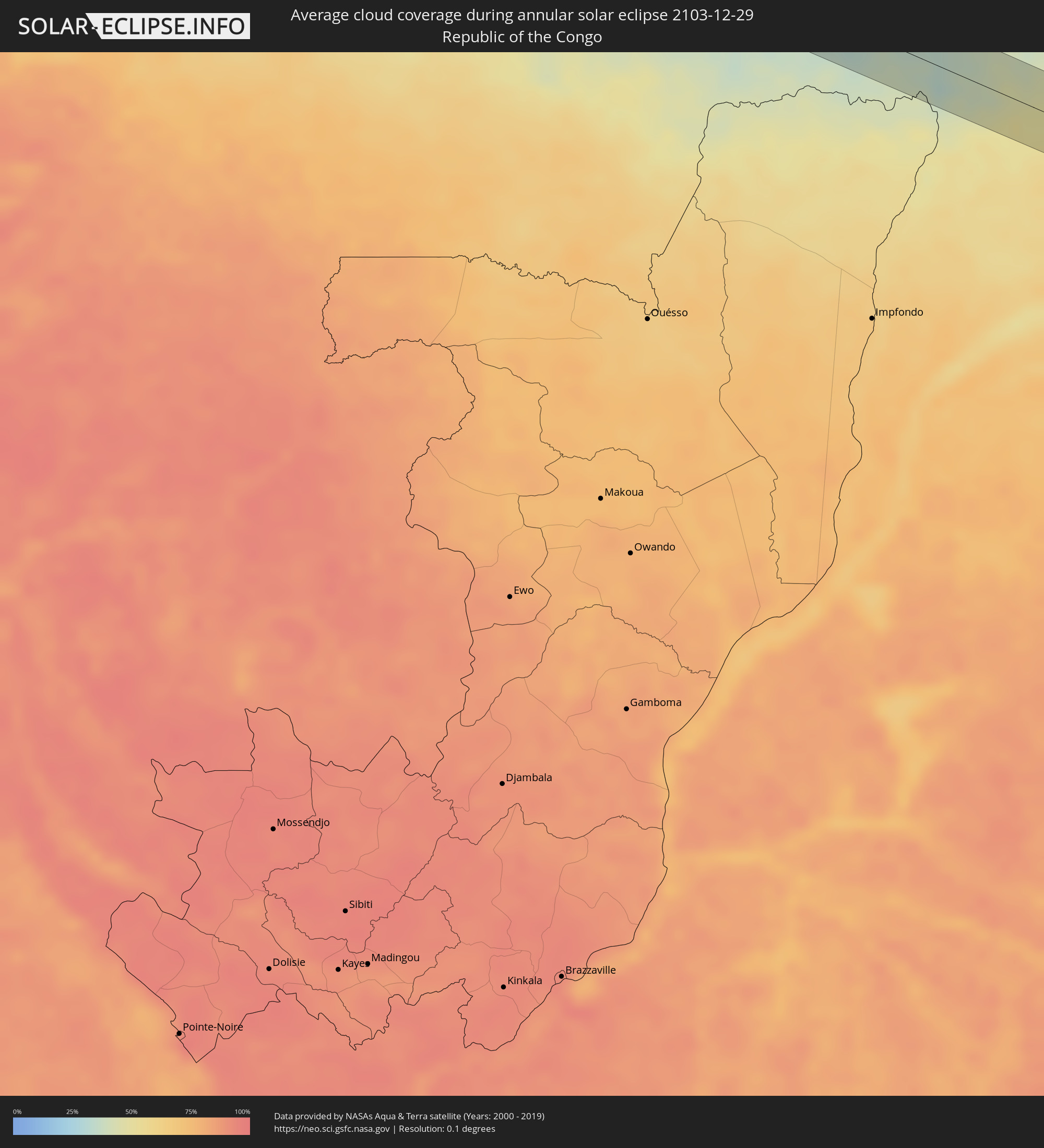 Republic of the Congo
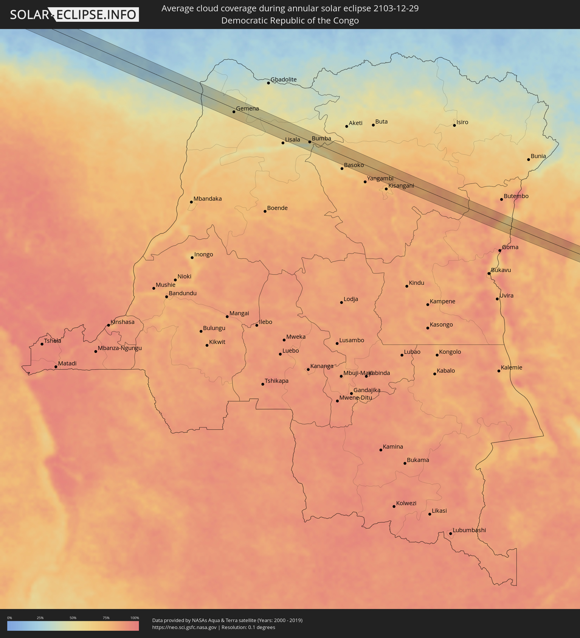 Democratic Republic of the Congo
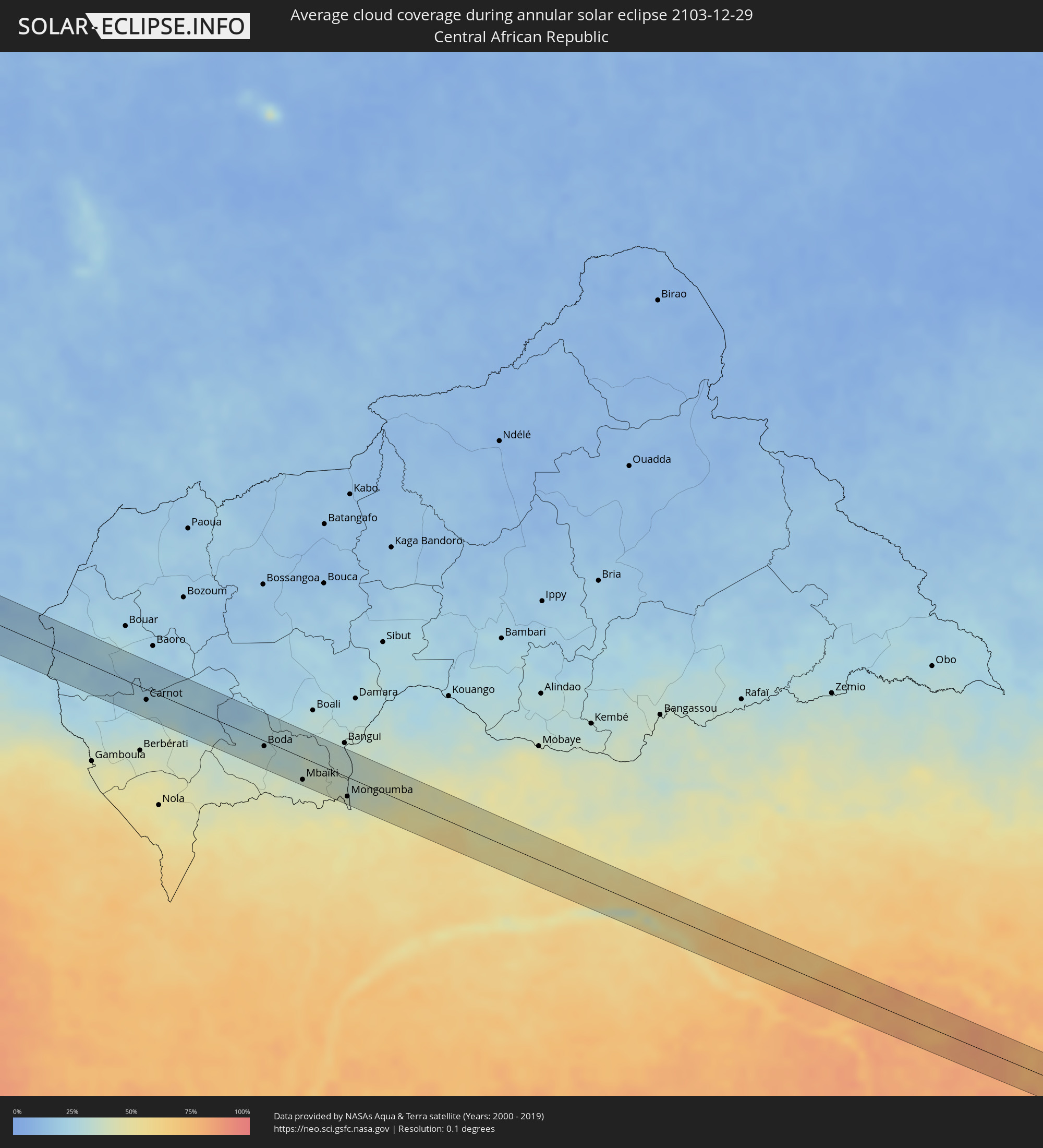 Central African Republic
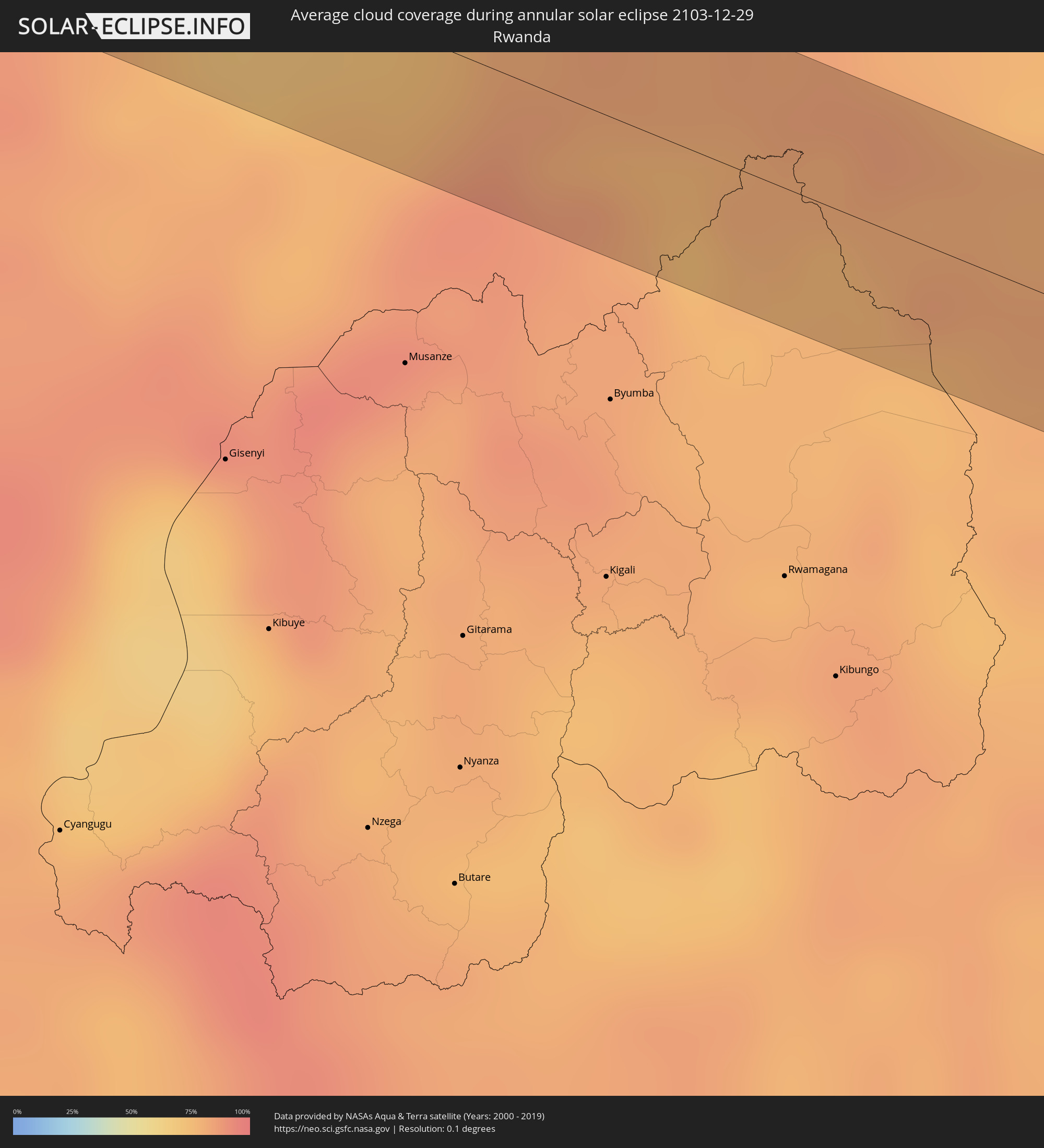 Rwanda
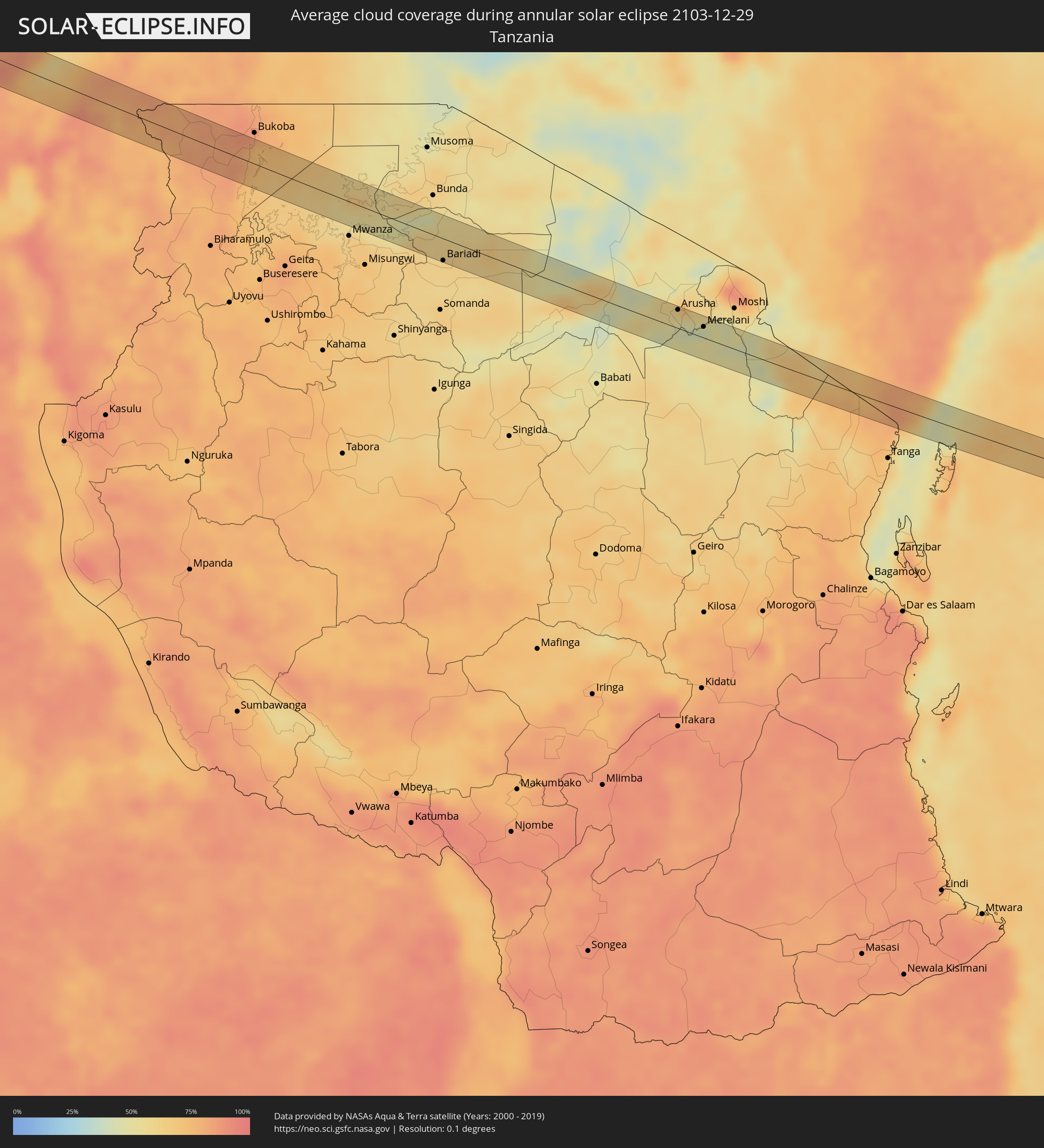 Tanzania
 Uganda
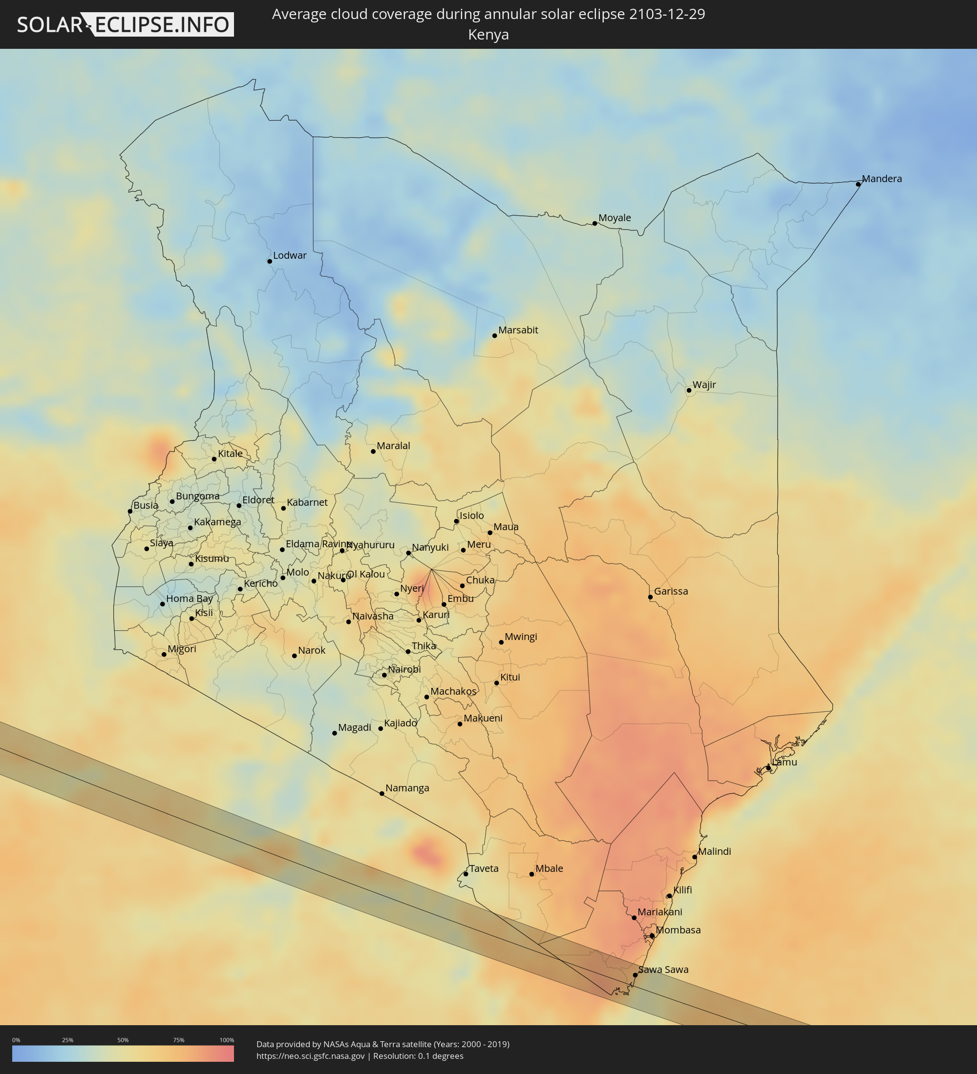 Kenya
Kenya
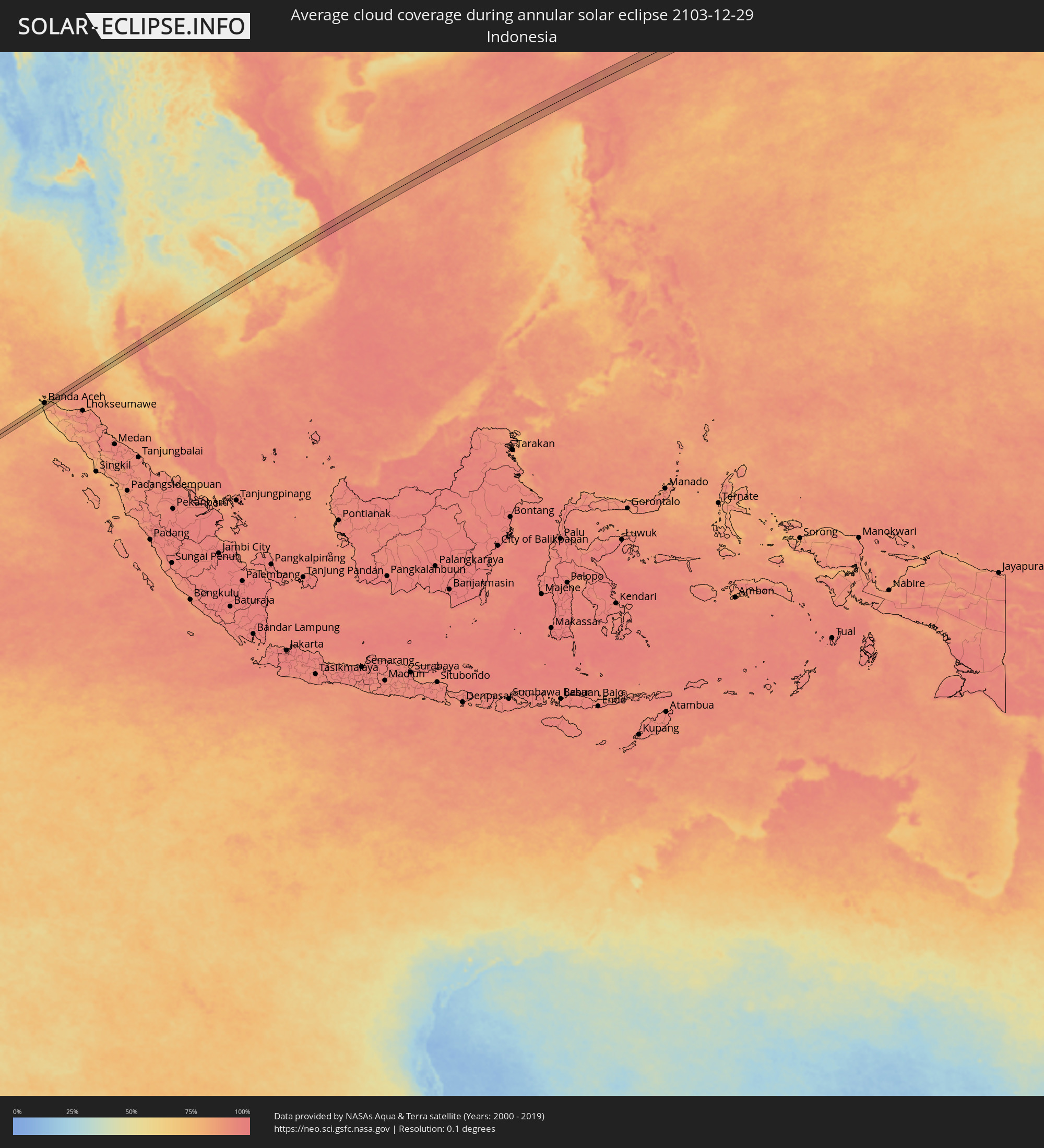 Indonesia
 Thailand
 Vietnam
 Cambodia
 Philippines
Cities inside the path of the eclipse
The following table shows all locations with a population of more than 5,000 inside the eclipse path. Cities which have more than 100,000 inhabitants are marked bold. A click at the locations opens a detailed map.
| City | Type | Eclipse duration | Local time of max. eclipse | Distance to central line | Ø Cloud coverage |
|
Tibati, Adamaoua
|
annular | - | 06:25:02 UTC+01:00 | 3 km | 13% |
|
Bétaré Oya, East
|
annular | - | 06:25:05 UTC+01:00 | 27 km | 23% |
|
Garoua Boulaï, East
|
annular | - | 06:25:12 UTC+01:00 | 23 km | 20% |
|
Carnot, Mambéré-Kadéï
|
annular | - | 06:25:20 UTC+01:00 | 14 km | 27% |
|
Boda, Lobaye
|
annular | - | 06:25:40 UTC+01:00 | 7 km | 32% |
|
Mbaïki, Lobaye
|
annular | - | 06:25:46 UTC+01:00 | 30 km | 38% |
|
Bimbo, Ombella-M'Poko
|
annular | - | 06:25:56 UTC+01:00 | 28 km | 34% |
|
Mongoumba, Lobaye
|
annular | - | 06:25:57 UTC+01:00 | 27 km | 38% |
|
Libenge, Équateur
|
annular | - | 06:25:58 UTC+01:00 | 24 km | 36% |
|
Gemena, Équateur
|
annular | - | 06:26:20 UTC+01:00 | 14 km | 55% |
|
Bumba, Équateur
|
annular | - | 06:27:28 UTC+01:00 | 4 km | 47% |
|
Ntungamo, Western Region
|
annular | - | 08:32:28 UTC+03:00 | 8 km | 83% |
|
Kanungu, Western Region
|
annular | - | 08:32:36 UTC+03:00 | 9 km | 89% |
|
Rukungiri, Western Region
|
annular | - | 08:32:44 UTC+03:00 | 9 km | 83% |
|
Ntungamo, Western Region
|
annular | - | 08:33:01 UTC+03:00 | 19 km | 79% |
|
Nyachera, Western Region
|
annular | - | 08:33:10 UTC+03:00 | 23 km | 81% |
|
Nyakahanga, Kagera
|
annular | - | 08:33:55 UTC+03:00 | 19 km | 82% |
|
Kyaka, Kagera
|
annular | - | 08:34:09 UTC+03:00 | 29 km | 85% |
|
Katoro, Kagera
|
annular | - | 08:34:14 UTC+03:00 | 17 km | 83% |
|
Nshamba, Kagera
|
annular | - | 08:34:20 UTC+03:00 | 22 km | 78% |
|
Kamachumu, Kagera
|
annular | - | 08:34:23 UTC+03:00 | 1 km | 84% |
|
Muleba, Kagera
|
annular | - | 08:34:27 UTC+03:00 | 22 km | 72% |
|
Katerero, Kagera
|
annular | - | 08:34:28 UTC+03:00 | 27 km | 79% |
|
Muriti, Mara
|
annular | - | 08:35:46 UTC+03:00 | 15 km | 66% |
|
Kibara, Mara
|
annular | - | 08:36:22 UTC+03:00 | 20 km | 46% |
|
Bariadi, Simiyu
|
annular | - | 08:37:04 UTC+03:00 | 26 km | 61% |
|
Nyakabindi, Simiyu
|
annular | - | 08:37:02 UTC+03:00 | 9 km | 61% |
|
Matonga, Simiyu
|
annular | - | 08:37:07 UTC+03:00 | 21 km | 56% |
|
Kiratu, Arusha
|
annular | - | 08:39:10 UTC+03:00 | 14 km | 44% |
|
Mto wa Mbu, Arusha
|
annular | - | 08:39:24 UTC+03:00 | 9 km | 45% |
|
Arusha, Arusha
|
annular | - | 08:40:28 UTC+03:00 | 22 km | 48% |
|
Mbuguni, Arusha
|
annular | - | 08:40:52 UTC+03:00 | 11 km | 51% |
|
Merelani, Arusha
|
annular | - | 08:40:54 UTC+03:00 | 13 km | 51% |
|
Lembeni, Kilimanjaro
|
annular | - | 08:41:49 UTC+03:00 | 14 km | 48% |
|
Same, Kilimanjaro
|
annular | - | 08:42:01 UTC+03:00 | 11 km | 45% |
|
Sawa Sawa, Kwale
|
annular | - | 08:44:40 UTC+03:00 | 12 km | 52% |
|
Gazi, Kwale
|
annular | - | 08:44:41 UTC+03:00 | 18 km | 65% |
|
Banda Aceh, Aceh
|
annular | - | 15:27:35 UTC+07:00 | 10 km | 77% |
|
Saladan, Krabi
|
annular | - | 15:34:27 UTC+07:00 | 18 km | 77% |
|
Thung Song, Nakhon Si Thammarat
|
annular | - | 15:35:38 UTC+07:00 | 4 km | 90% |
|
Ron Phibun, Nakhon Si Thammarat
|
annular | - | 15:35:52 UTC+07:00 | 13 km | 91% |
|
Nakhon Si Thammarat, Nakhon Si Thammarat
|
annular | - | 15:36:10 UTC+07:00 | 4 km | 91% |
|
Pak Phanang, Nakhon Si Thammarat
|
annular | - | 15:36:24 UTC+07:00 | 17 km | 84% |
|
Sihanoukville, Preah Sihanouk
|
annular | - | 15:41:25 UTC+07:00 | 1 km | 63% |
|
Kampong Speu, Kampong Speu
|
annular | - | 15:42:48 UTC+07:00 | 24 km | 73% |
|
Phnom Penh, Phnom Penh
|
annular | - | 15:43:13 UTC+07:00 | 12 km | 70% |
|
Ta Khmau, Kandal
|
annular | - | 15:43:13 UTC+07:00 | 3 km | 60% |
|
Prey Veng, Prey Veng
|
annular | - | 15:43:34 UTC+07:00 | 18 km | 75% |
|
Kampong Cham, Kampong Cham
|
annular | - | 15:43:55 UTC+07:00 | 22 km | 63% |
|
Suŏng, Tboung Khmum
|
annular | - | 15:44:03 UTC+07:00 | 3 km | 73% |
|
Qui Nhon, Bình Định
|
annular | - | 15:47:36 UTC+07:00 | 17 km | 95% |
|
Basco, Cagayan Valley
|
annular | - | 16:54:03 UTC+08:00 | 14 km | 89% |