Annular solar eclipse of 12/24/2345
| Day of week: | Monday |
| Maximum duration of eclipse: | 09m21s |
| Maximum width of eclipse path: | 284 km |
| Saros cycle: | 147 |
| Coverage: | 92.5% |
| Magnitude: | 0.9252 |
| Gamma: | -0.1081 |
Wo kann man die Sonnenfinsternis vom 12/24/2345 sehen?
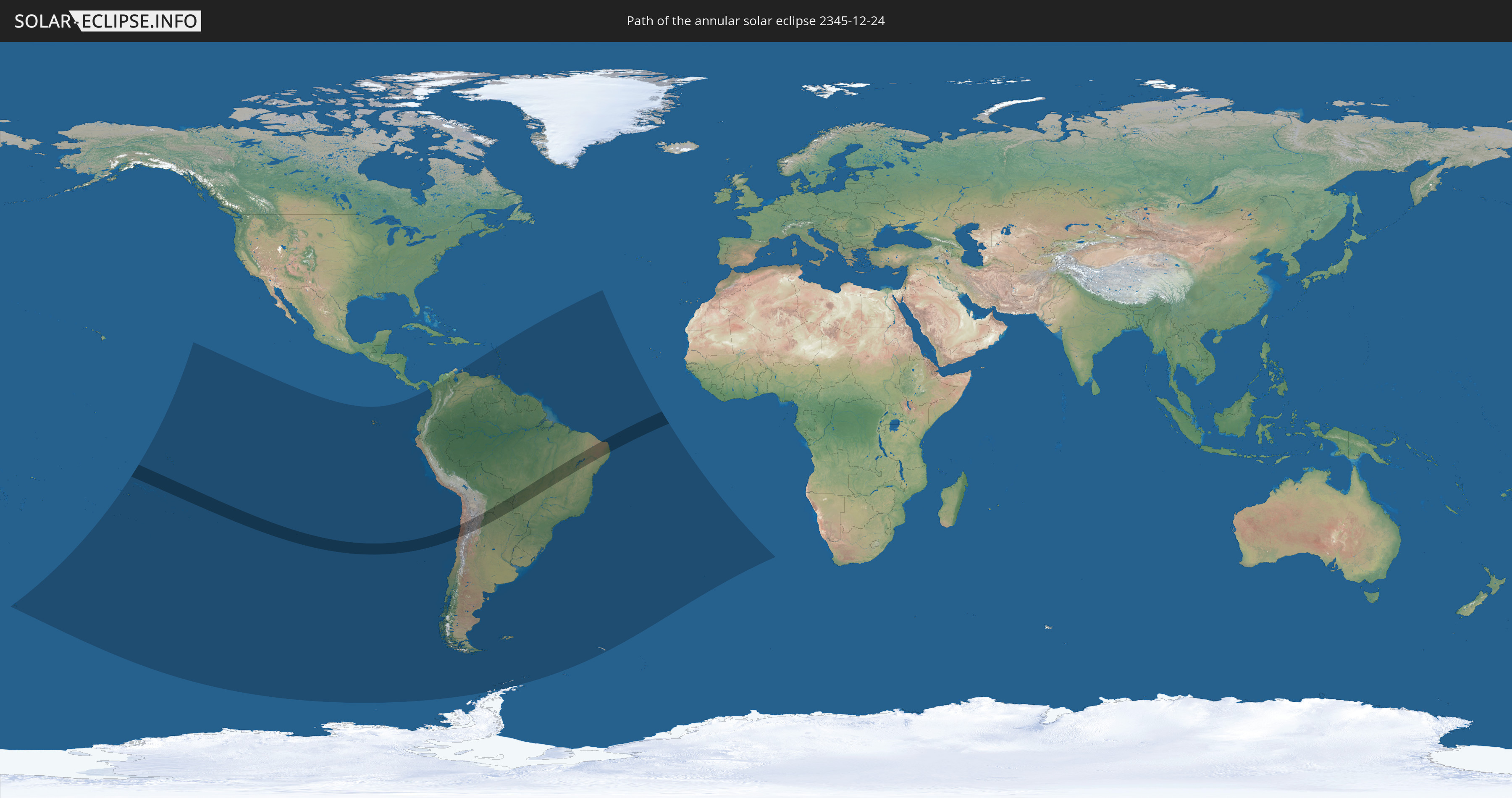
Die Sonnenfinsternis am 12/24/2345 kann man in 32 Ländern als partielle Sonnenfinsternis beobachten.
Der Finsternispfad verläuft durch 6 Länder. Nur in diesen Ländern ist sie als annular Sonnenfinsternis zu sehen.
In den folgenden Ländern ist die Sonnenfinsternis annular zu sehen
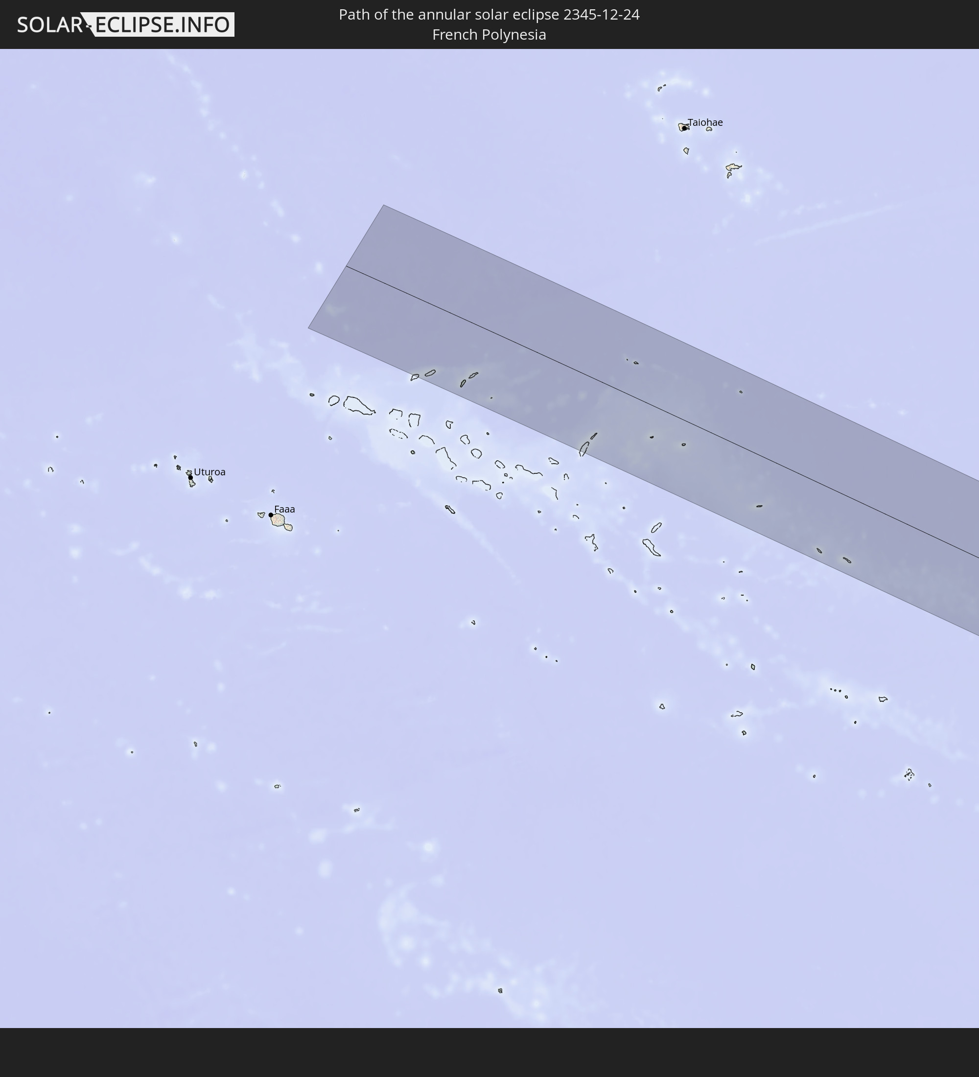 French Polynesia
 Chile
Chile
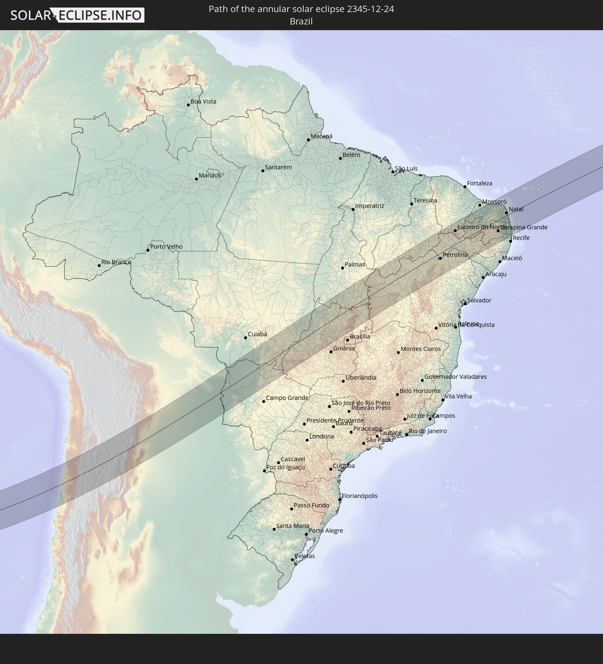 Brazil
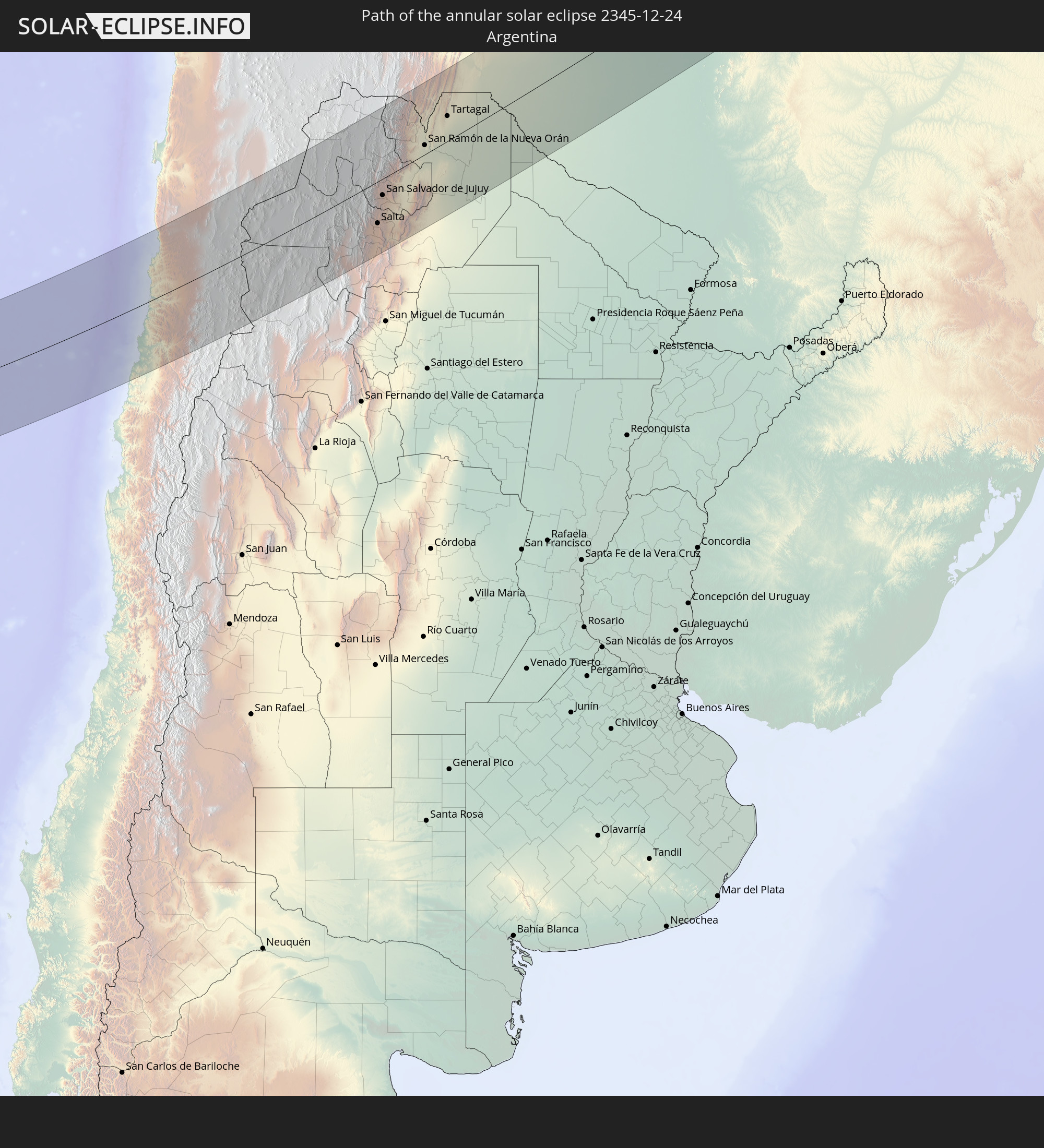 Argentina
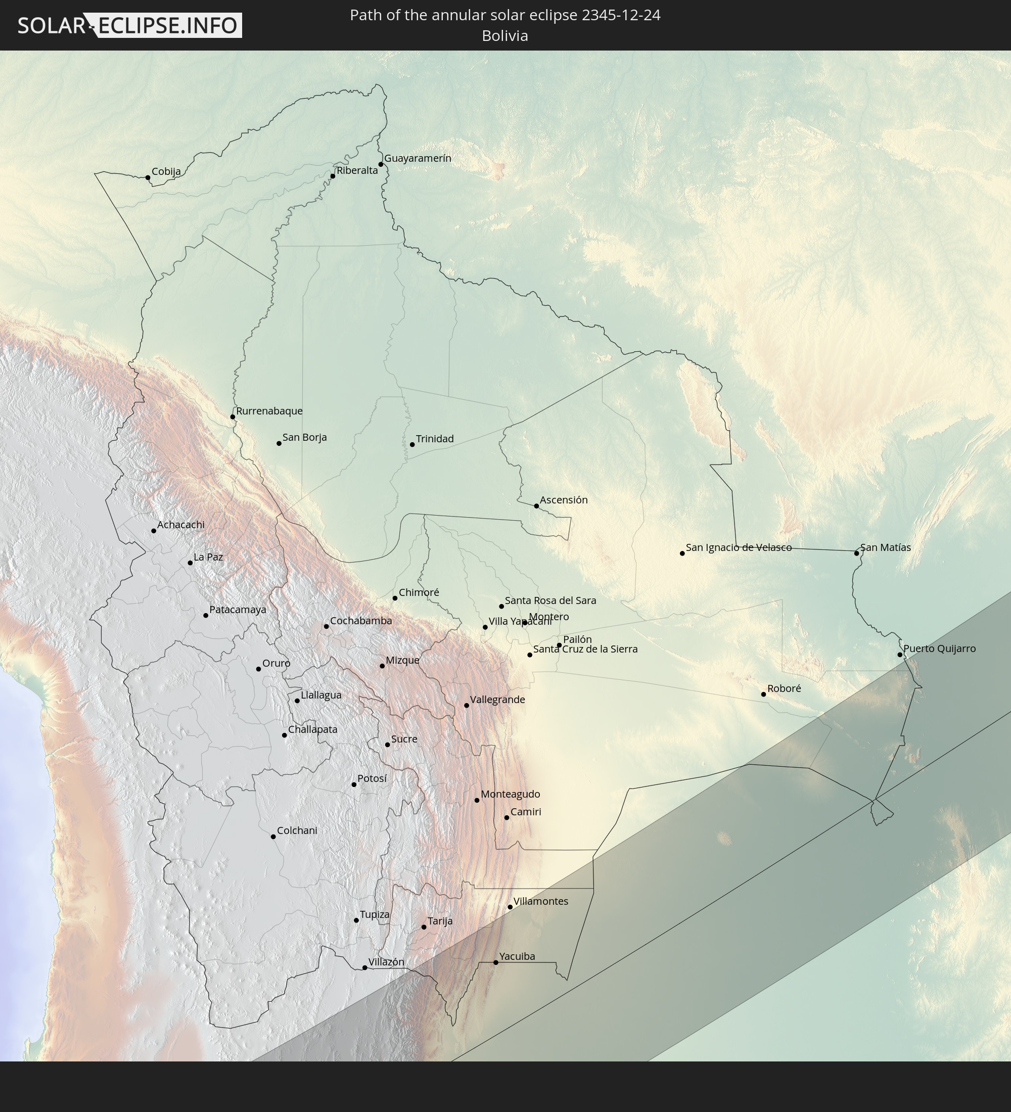 Bolivia
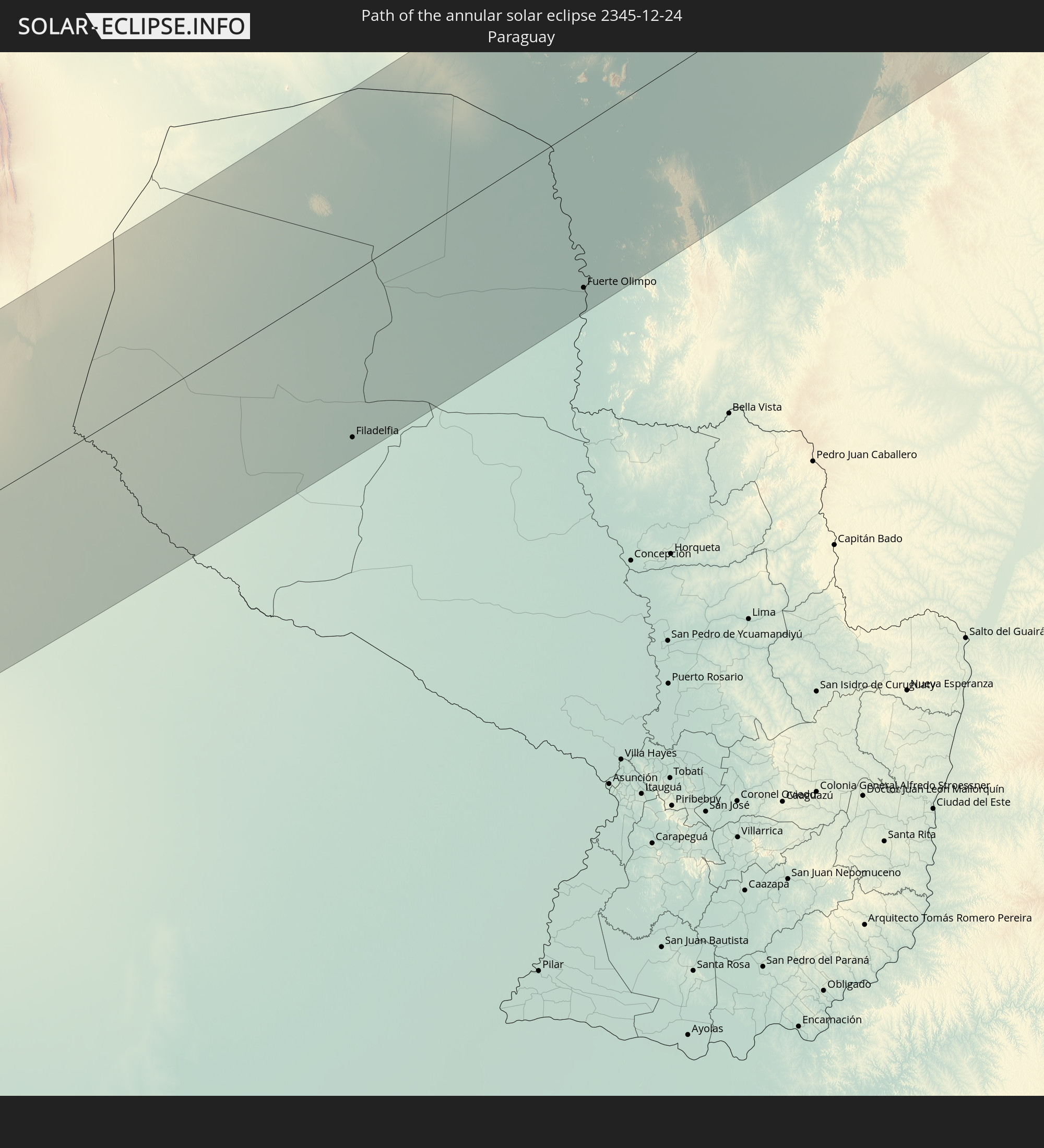 Paraguay
In den folgenden Ländern ist die Sonnenfinsternis partiell zu sehen
 Antarctica
 New Zealand
 Kiribati
 French Polynesia
 Pitcairn Islands
 Chile
Chile
 Ecuador
 Panama
 Colombia
 Peru
Peru
 Brazil
 Argentina
 Venezuela
 Bolivia
 Paraguay
 Antigua and Barbuda
 Montserrat
 Trinidad and Tobago
 Guadeloupe
 Grenada
 Dominica
 Saint Vincent and the Grenadines
 Falkland Islands
 Guyana
 Martinique
 Saint Lucia
 Barbados
 Uruguay
 Suriname
 French Guiana
 South Georgia and the South Sandwich Islands
 Saint Helena, Ascension and Tristan da Cunha
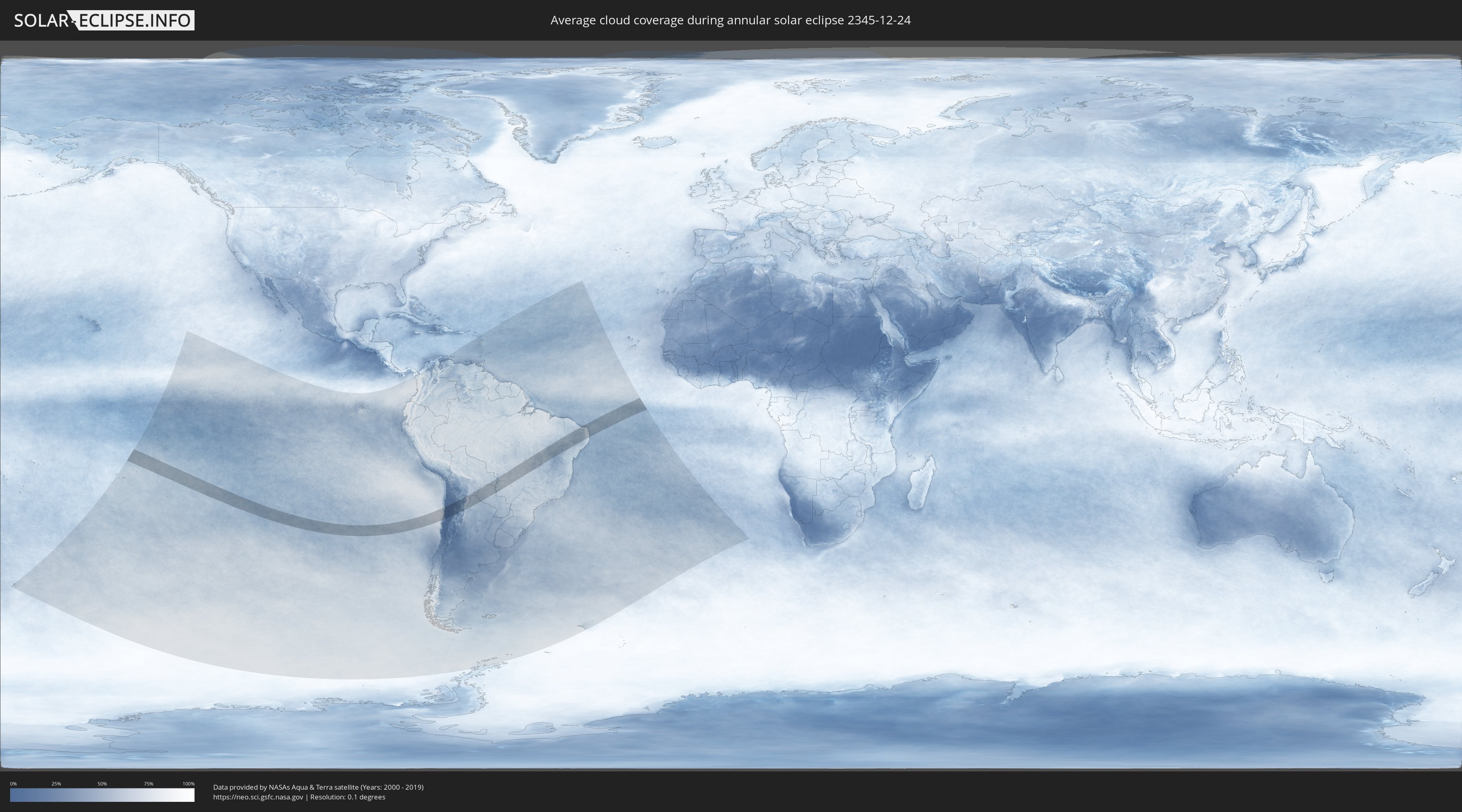
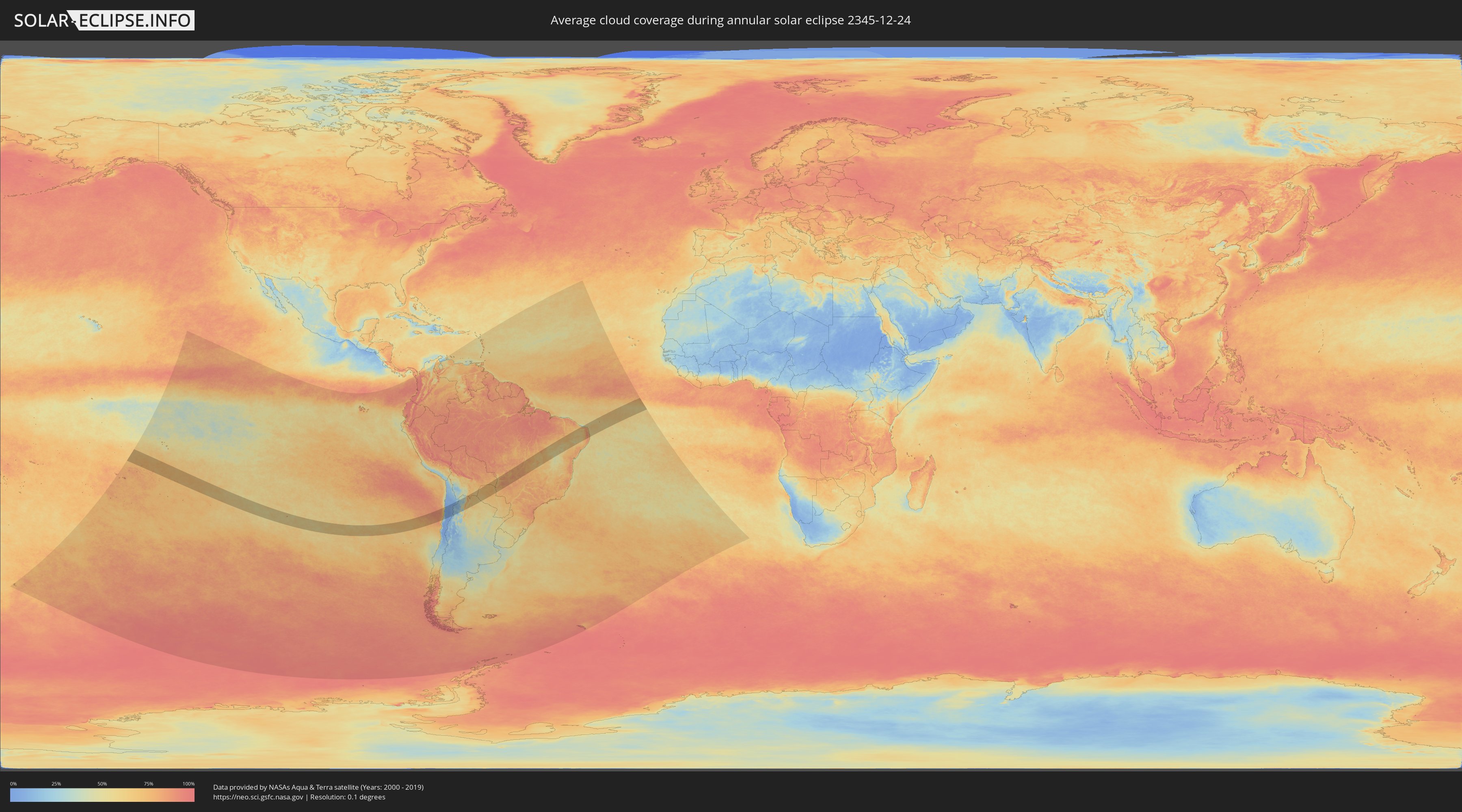
How will be the weather during the annular solar eclipse on 12/24/2345?
Where is the best place to see the annular solar eclipse of 12/24/2345?
The following maps show the average cloud coverage for the day of the annular solar eclipse.
With the help of these maps, it is possible to find the place along the eclipse path, which has the best
chance of a cloudless sky.
Nevertheless, you should consider local circumstances and inform about the weather of your chosen
observation site.
The data is provided by NASAs satellites
AQUA and TERRA.
The cloud maps are averaged over a period of 19 years (2000 - 2019).
Detailed country maps
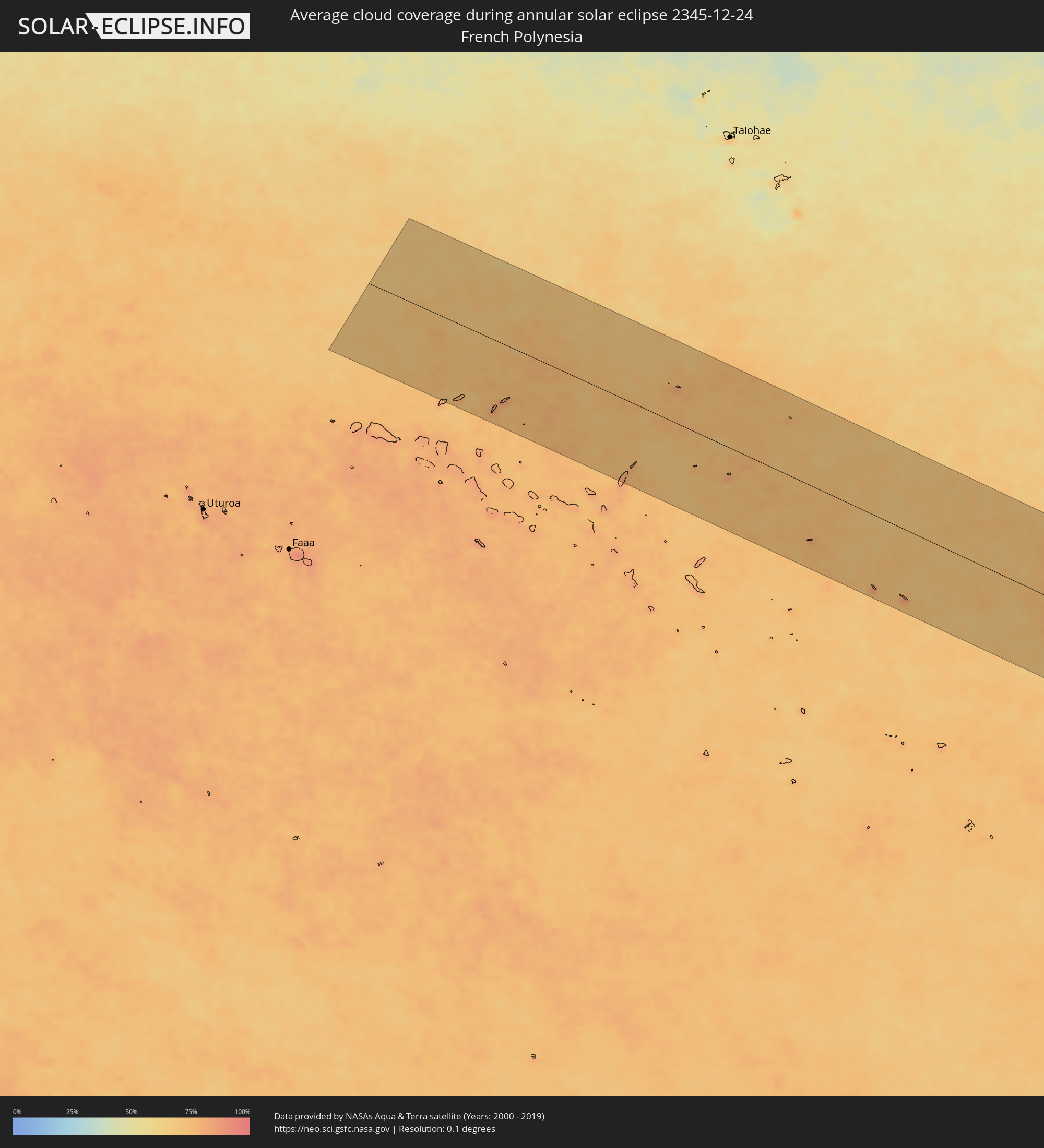 French Polynesia
 Chile
Chile
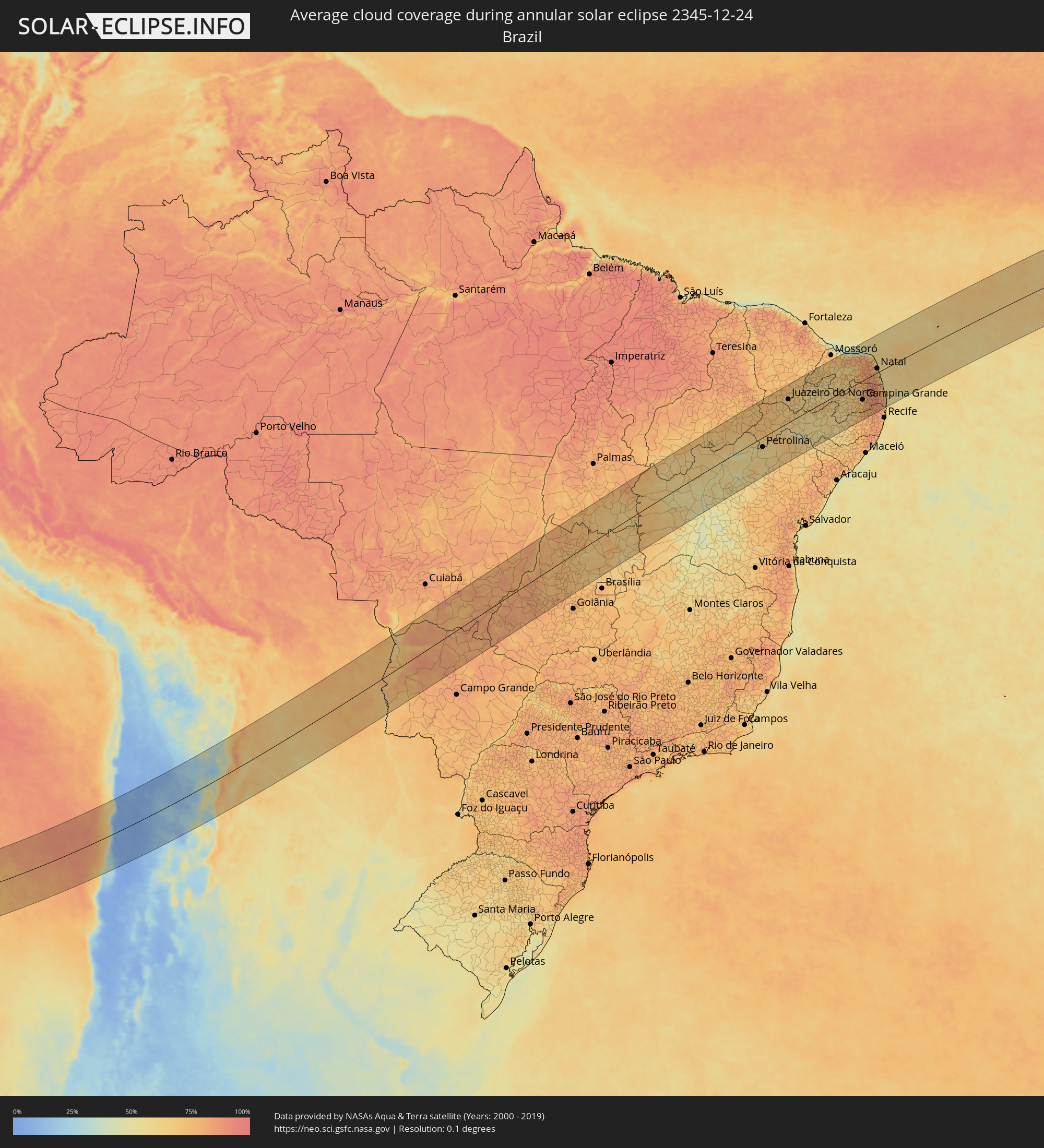 Brazil
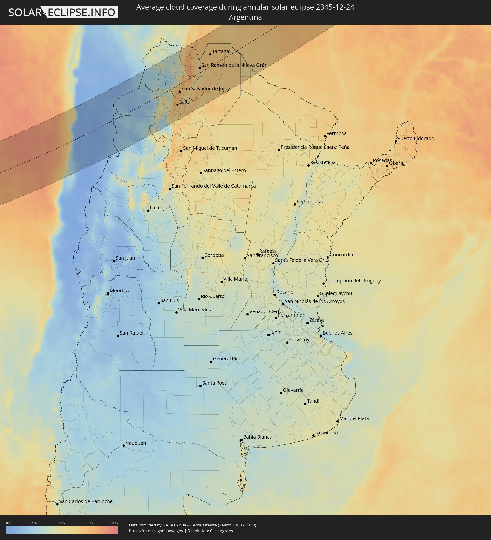 Argentina
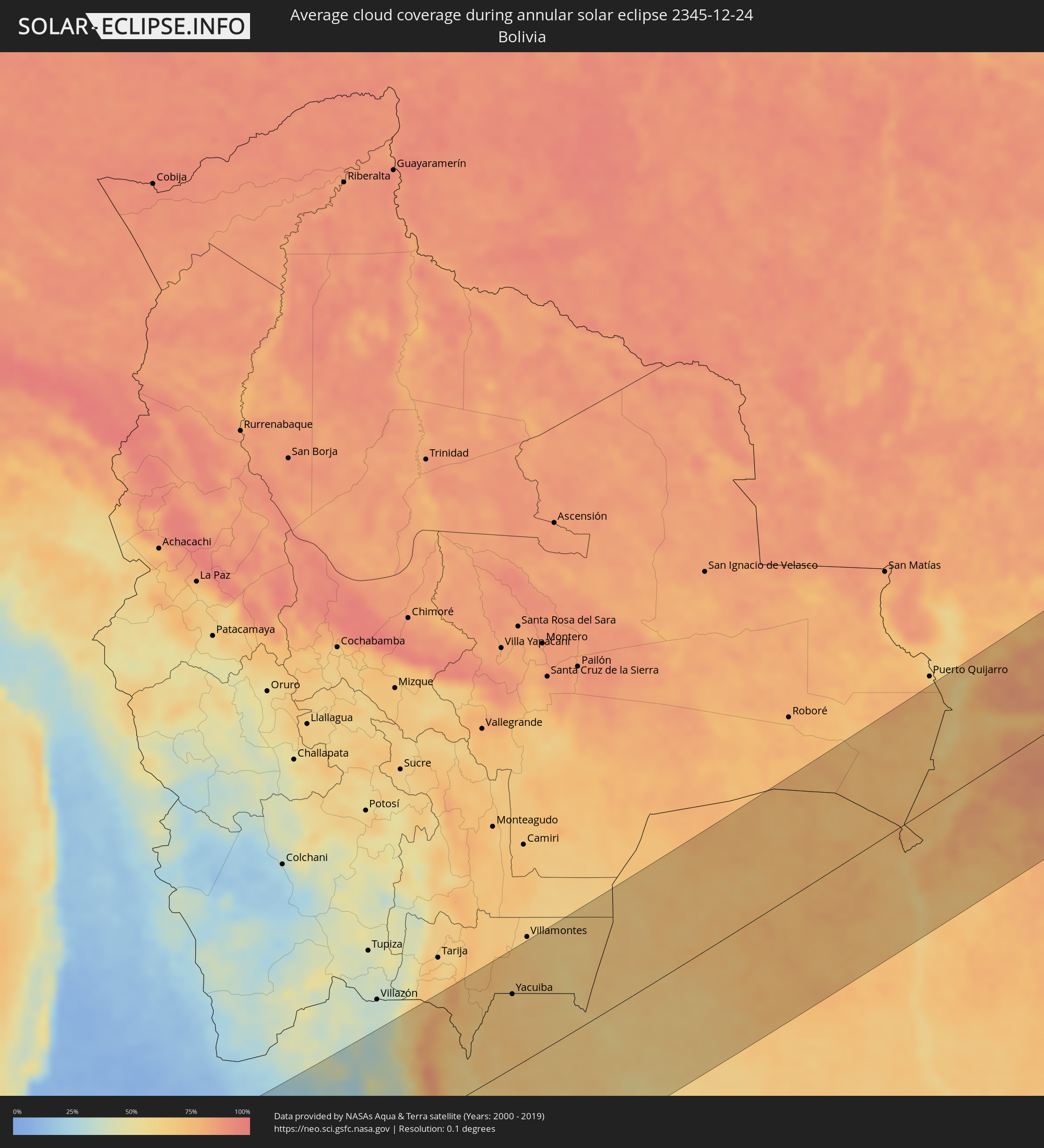 Bolivia
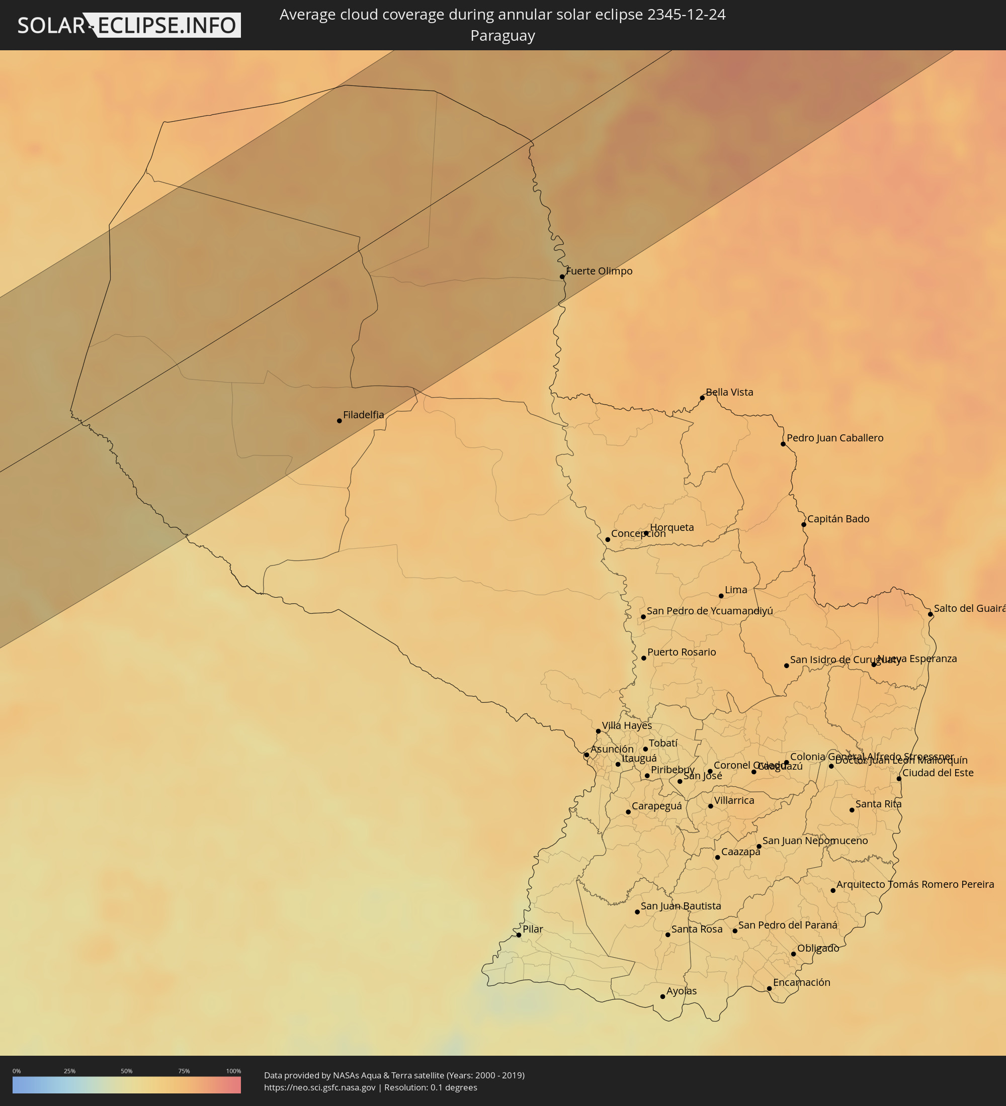 Paraguay
Cities inside the path of the eclipse
The following table shows all locations with a population of more than 5,000 inside the eclipse path. Cities which have more than 100,000 inhabitants are marked bold. A click at the locations opens a detailed map.
| City | Type | Eclipse duration | Local time of max. eclipse | Distance to central line | Ø Cloud coverage |
|
Taltal, Antofagasta
|
annular | - | 15:03:51 UTC-03:00 | 92 km | 34% |
|
Copiapó, Atacama
|
annular | - | 15:01:09 UTC-03:00 | 111 km | 6% |
|
Diego de Almagro, Atacama
|
annular | - | 15:03:28 UTC-03:00 | 23 km | 5% |
|
Abra Pampa, Jujuy Province
|
annular | - | 15:20:24 UTC-03:00 | 129 km | 32% |
|
Chicoana, Salta Province
|
annular | - | 15:16:40 UTC-03:00 | 109 km | 58% |
|
El Carril, Salta Province
|
annular | - | 15:16:48 UTC-03:00 | 109 km | 58% |
|
Salta, Salta Province
|
annular | - | 15:17:29 UTC-03:00 | 85 km | 66% |
|
Tilcara, Jujuy Province
|
annular | - | 15:19:42 UTC-03:00 | 29 km | 42% |
|
Humahuaca, Jujuy Province
|
annular | - | 15:20:21 UTC-03:00 | 65 km | 36% |
|
San Salvador de Jujuy, Jujuy Province
|
annular | - | 15:18:46 UTC-03:00 | 33 km | 70% |
|
Palpalá, Jujuy Province
|
annular | - | 15:18:51 UTC-03:00 | 44 km | 63% |
|
San Pedro, Jujuy Province
|
annular | - | 15:19:40 UTC-03:00 | 59 km | 56% |
|
Ingenio La Esperanza, Jujuy Province
|
annular | - | 15:19:44 UTC-03:00 | 60 km | 58% |
|
Fraile Pintado, Jujuy Province
|
annular | - | 15:20:19 UTC-03:00 | 34 km | 59% |
|
Libertador General San Martín, Jujuy Province
|
annular | - | 15:20:35 UTC-03:00 | 22 km | 63% |
|
Calilegua, Jujuy Province
|
annular | - | 15:20:41 UTC-03:00 | 20 km | 63% |
|
Caimancito, Jujuy Province
|
annular | - | 15:21:07 UTC-03:00 | 25 km | 55% |
|
Yuto, Jujuy Province
|
annular | - | 15:21:34 UTC-03:00 | 22 km | 54% |
|
San Ramón de la Nueva Orán, Salta Province
|
annular | - | 15:22:46 UTC-03:00 | 19 km | 60% |
|
Palma Sola, Jujuy Province
|
annular | - | 15:21:23 UTC-03:00 | 62 km | 70% |
|
Las Lajitas, Salta Province
|
annular | - | 15:20:14 UTC-03:00 | 134 km | 57% |
|
Embarcación, Salta Province
|
annular | - | 15:23:08 UTC-03:00 | 0 km | 61% |
|
Apolinario Saravia, Salta Province
|
annular | - | 15:21:14 UTC-03:00 | 123 km | 62% |
|
General Enrique Mosconi, Salta Province
|
annular | - | 15:24:50 UTC-03:00 | 44 km | 69% |
|
Tartagal, Salta Province
|
annular | - | 15:24:59 UTC-03:00 | 51 km | 71% |
|
Yacuiba, Tarija
|
annular | - | 14:26:08 UTC-04:00 | 92 km | 67% |
|
Filadelfia, Boquerón
|
annular | - | 15:32:49 UTC-03:00 | 135 km | 74% |
|
Colonia Menno, Boquerón
|
annular | - | 15:33:10 UTC-03:00 | 149 km | 69% |
|
Fuerte Olimpo, Alto Paraguay
|
annular | - | 15:38:52 UTC-03:00 | 133 km | 62% |
|
Corumbá, Mato Grosso do Sul
|
annular | - | 14:42:41 UTC-04:00 | 44 km | 73% |
|
Coxim, Mato Grosso do Sul
|
annular | - | 14:47:57 UTC-04:00 | 75 km | 81% |
|
Rondonópolis, Mato Grosso
|
annular | - | 14:51:25 UTC-04:00 | 107 km | 77% |
|
Mineiros, Goiás
|
annular | - | 15:52:26 UTC-03:00 | 117 km | 78% |
|
Barra do Garças, Mato Grosso
|
annular | - | 14:55:26 UTC-04:00 | 23 km | 76% |
|
Jaraguá, Goiás
|
annular | - | 15:58:57 UTC-03:00 | 136 km | 73% |
|
Porangatu, Goiás
|
annular | - | 16:02:29 UTC-03:00 | 70 km | 76% |
|
Uruaçu, Goiás
|
annular | - | 16:00:57 UTC-03:00 | 32 km | 68% |
|
Goianésia, Goiás
|
annular | - | 15:59:49 UTC-03:00 | 108 km | 66% |
|
Barreiras, Bahia
|
annular | - | 16:07:52 UTC-03:00 | 50 km | 63% |
|
Xique Xique, Bahia
|
annular | - | 16:11:06 UTC-03:00 | 53 km | 52% |
|
Irecê, Bahia
|
annular | - | 16:11:03 UTC-03:00 | 148 km | 56% |
|
Petrolina, Pernambuco
|
annular | - | 16:14:02 UTC-03:00 | 42 km | 60% |
|
Araripina, Pernambuco
|
annular | - | 16:16:02 UTC-03:00 | 133 km | 75% |
|
Senhor do Bonfim, Bahia
|
annular | - | 16:12:58 UTC-03:00 | 162 km | 67% |
|
Juazeiro do Norte, Ceará
|
annular | - | 16:16:56 UTC-03:00 | 102 km | 65% |
|
Salgueiro, Pernambuco
|
annular | - | 16:16:07 UTC-03:00 | 9 km | 68% |
|
Cajazeiras, Paraíba
|
annular | - | 16:17:35 UTC-03:00 | 92 km | 61% |
|
Serra Talhada, Pernambuco
|
annular | - | 16:16:33 UTC-03:00 | 29 km | 59% |
|
Sousa, Paraíba
|
annular | - | 16:17:50 UTC-03:00 | 87 km | 58% |
|
Paulo Afonso, Bahia
|
annular | - | 16:15:04 UTC-03:00 | 170 km | 60% |
|
Patos, Paraíba
|
annular | - | 16:17:54 UTC-03:00 | 10 km | 58% |
|
Caicó, Rio Grande do Norte
|
annular | - | 16:18:31 UTC-03:00 | 55 km | 59% |
|
Arcoverde, Pernambuco
|
annular | - | 16:16:34 UTC-03:00 | 138 km | 54% |
|
Açu, Rio Grande do Norte
|
annular | - | 16:19:25 UTC-03:00 | 131 km | 65% |
|
Pesqueira, Pernambuco
|
annular | - | 16:16:45 UTC-03:00 | 151 km | 62% |
|
Currais Novos, Rio Grande do Norte
|
annular | - | 16:18:54 UTC-03:00 | 43 km | 67% |
|
Belo Jardim, Pernambuco
|
annular | - | 16:16:52 UTC-03:00 | 164 km | 67% |
|
Santa Cruz do Capibaribe, Pernambuco
|
annular | - | 16:17:19 UTC-03:00 | 139 km | 69% |
|
Campina Grande, Paraíba
|
annular | - | 16:18:09 UTC-03:00 | 85 km | 76% |
|
Surubim, Pernambuco
|
annular | - | 16:17:35 UTC-03:00 | 151 km | 81% |
|
Guarabira, Paraíba
|
annular | - | 16:18:37 UTC-03:00 | 70 km | 86% |
|
Limoeiro, Pernambuco
|
annular | - | 16:17:38 UTC-03:00 | 171 km | 86% |
|
Ceará Mirim, Rio Grande do Norte
|
annular | - | 16:19:47 UTC-03:00 | 46 km | 79% |
|
Macaíba, Rio Grande do Norte
|
annular | - | 16:19:36 UTC-03:00 | 21 km | 79% |
|
Timbaúba, Pernambuco
|
annular | - | 16:18:02 UTC-03:00 | 142 km | 86% |
|
Natal, Rio Grande do Norte
|
annular | - | 16:19:41 UTC-03:00 | 19 km | 65% |
|
Goiana, Pernambuco
|
annular | - | 16:18:04 UTC-03:00 | 164 km | 78% |
|
João Pessoa, Paraíba
|
annular | - | 16:18:32 UTC-03:00 | 128 km | 76% |
|
Cabedelo, Paraíba
|
annular | - | 16:18:40 UTC-03:00 | 117 km | 57% |