Total solar eclipse of 08/22/2389
| Day of week: | Tuesday |
| Maximum duration of eclipse: | 04m45s |
| Maximum width of eclipse path: | 166 km |
| Saros cycle: | 151 |
| Coverage: | 100% |
| Magnitude: | 1.05 |
| Gamma: | 0.0133 |
Wo kann man die Sonnenfinsternis vom 08/22/2389 sehen?
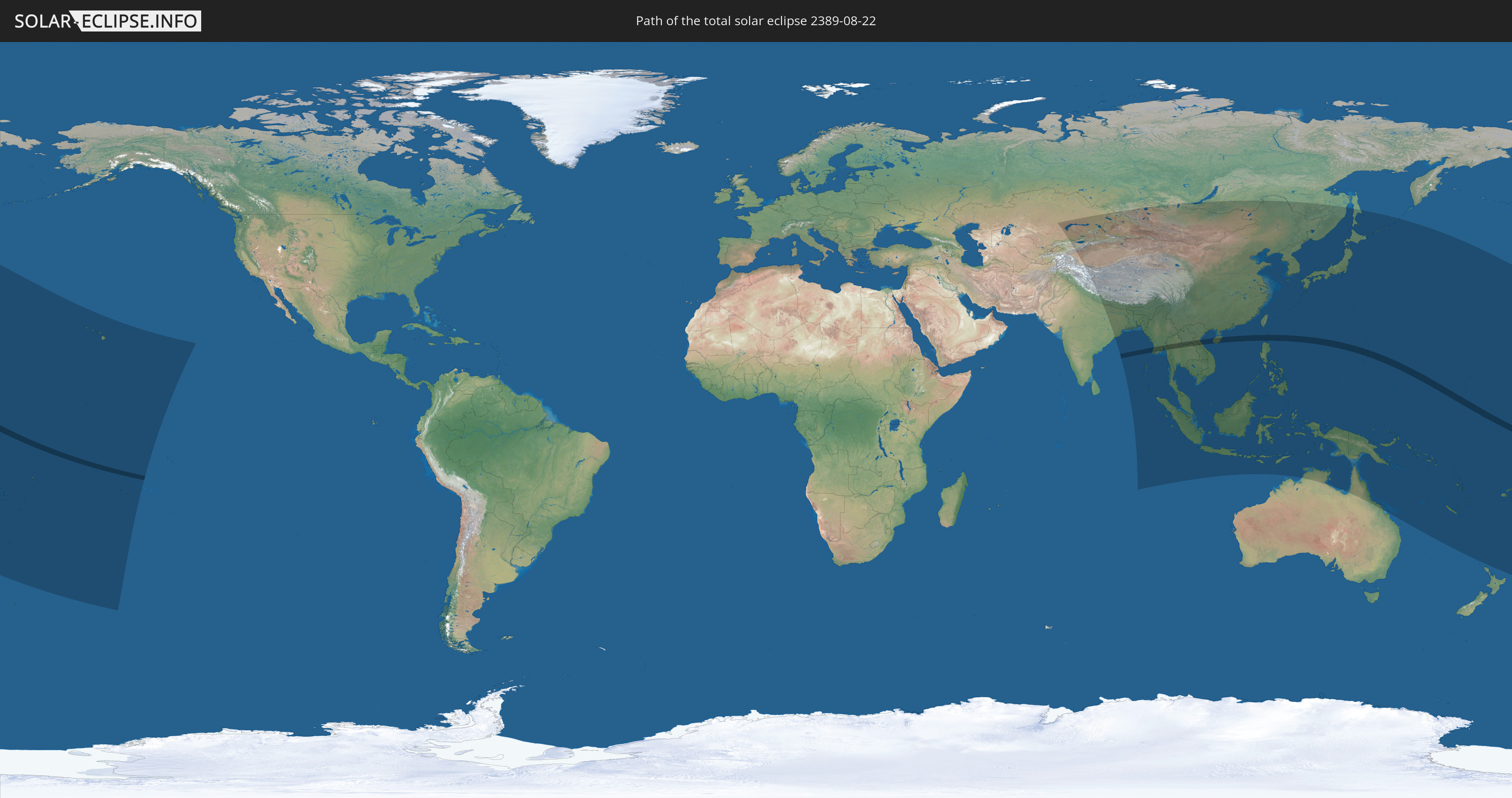
Die Sonnenfinsternis am 08/22/2389 kann man in 54 Ländern als partielle Sonnenfinsternis beobachten.
Der Finsternispfad verläuft durch 10 Länder. Nur in diesen Ländern ist sie als total Sonnenfinsternis zu sehen.
In den folgenden Ländern ist die Sonnenfinsternis total zu sehen
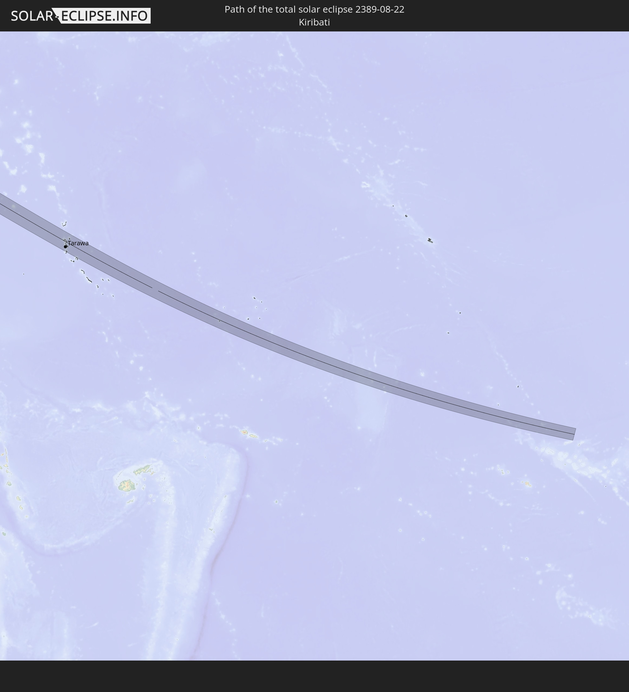 Kiribati
 Cook Islands
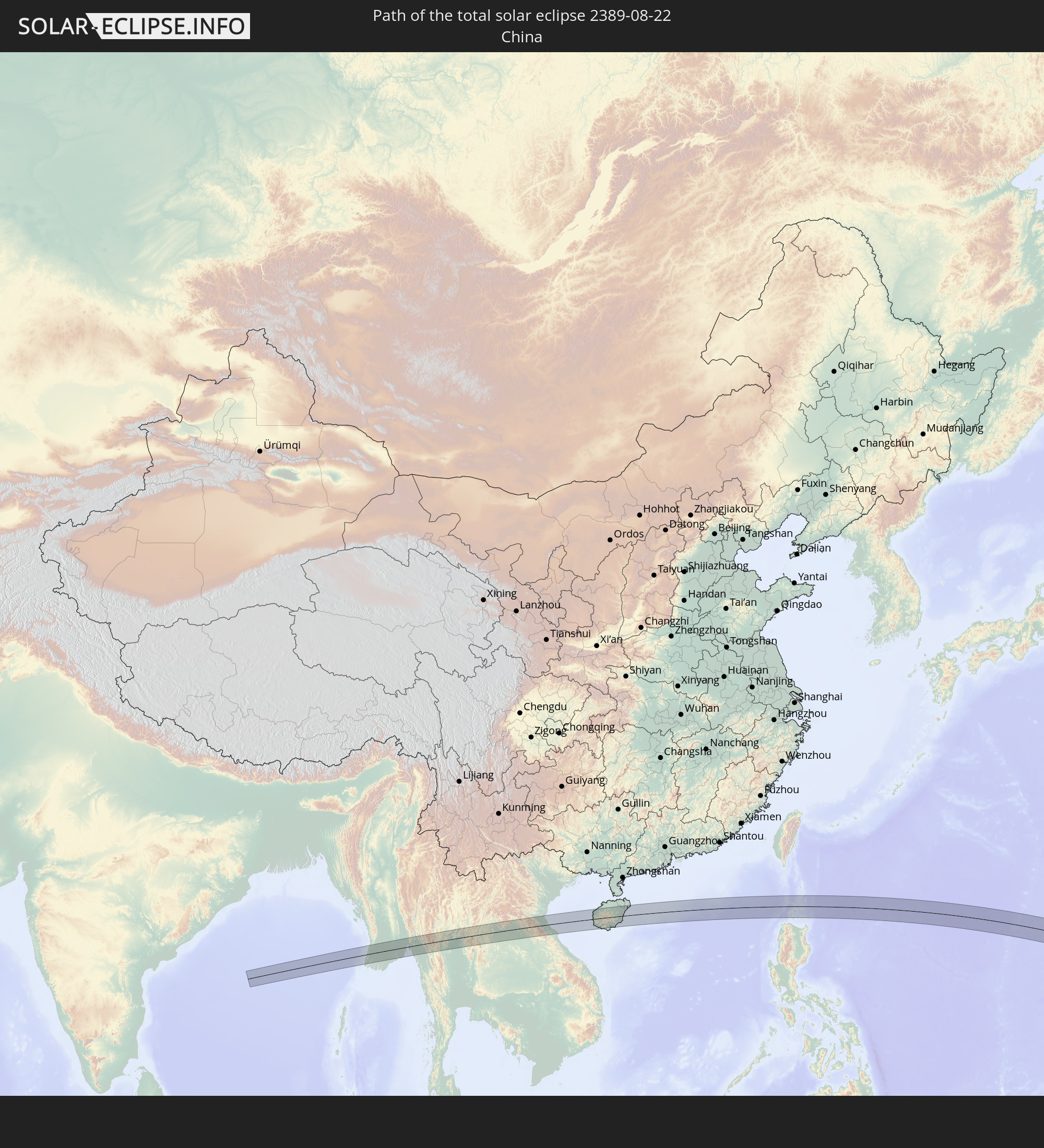 China
China
 Myanmar
 Thailand
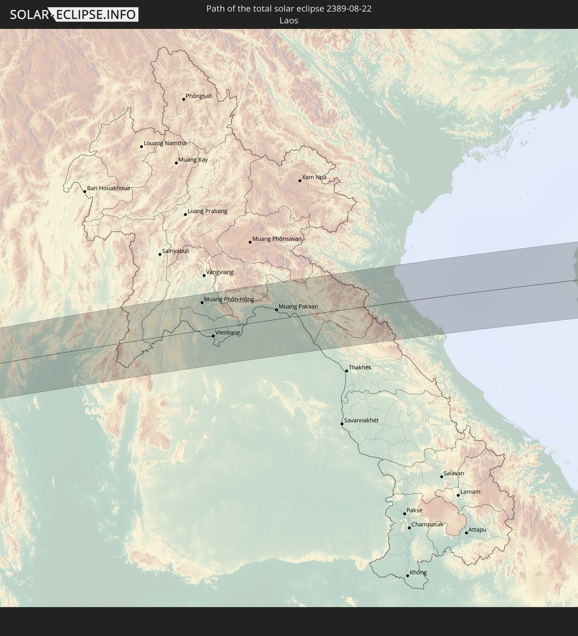 Laos
Laos
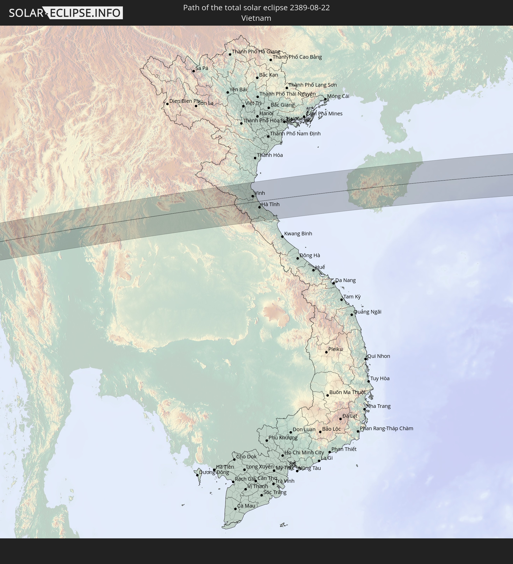 Vietnam
 Philippines
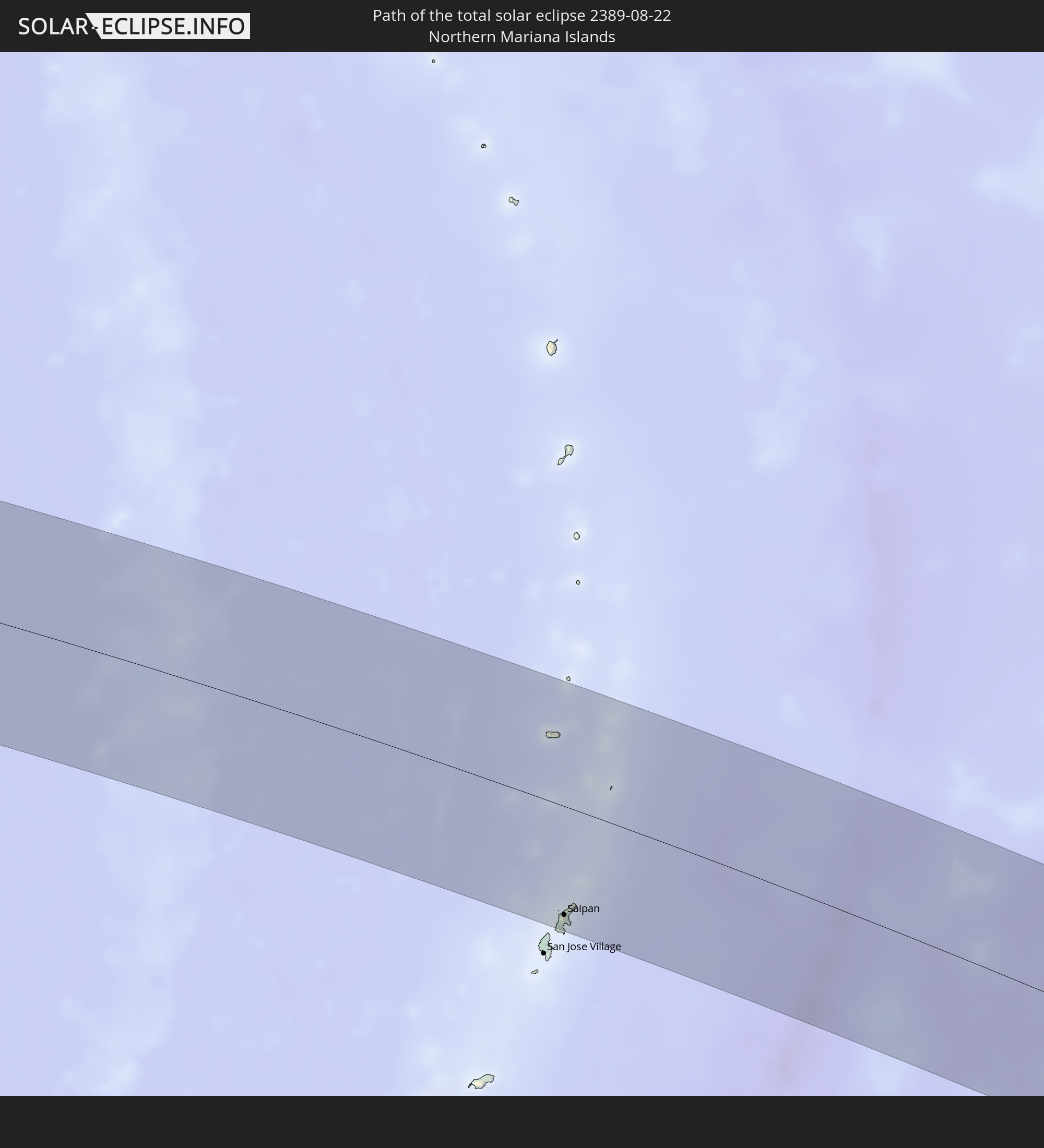 Northern Mariana Islands
 Marshall Islands
In den folgenden Ländern ist die Sonnenfinsternis partiell zu sehen
 Fiji
Fiji
 Russia
 United States
 New Zealand
 United States Minor Outlying Islands
 Wallis and Futuna
 Tonga
Tonga
 Kiribati
 Samoa
Samoa
 Tokelau
 American Samoa
 Niue
Niue
 Cook Islands
 French Polynesia
 Kazakhstan
 India
India
 Kyrgyzstan
 China
China
 Nepal
Nepal
 Mongolia
 Bangladesh
 Bhutan
 Myanmar
 Indonesia
 Cocos Islands
 Thailand
 Malaysia
 Laos
Laos
 Vietnam
 Cambodia
 Singapore
 Christmas Island
 Australia
 Macau
Macau
 Hong Kong
 Brunei
 Taiwan
 Philippines
 Japan
Japan
 East Timor
 North Korea
 South Korea
 Palau
Palau
 Federated States of Micronesia
 Papua New Guinea
 Guam
Guam
 Northern Mariana Islands
 Solomon Islands
 New Caledonia
 Marshall Islands
 Vanuatu
 Nauru
Nauru
 Norfolk Island
 Tuvalu
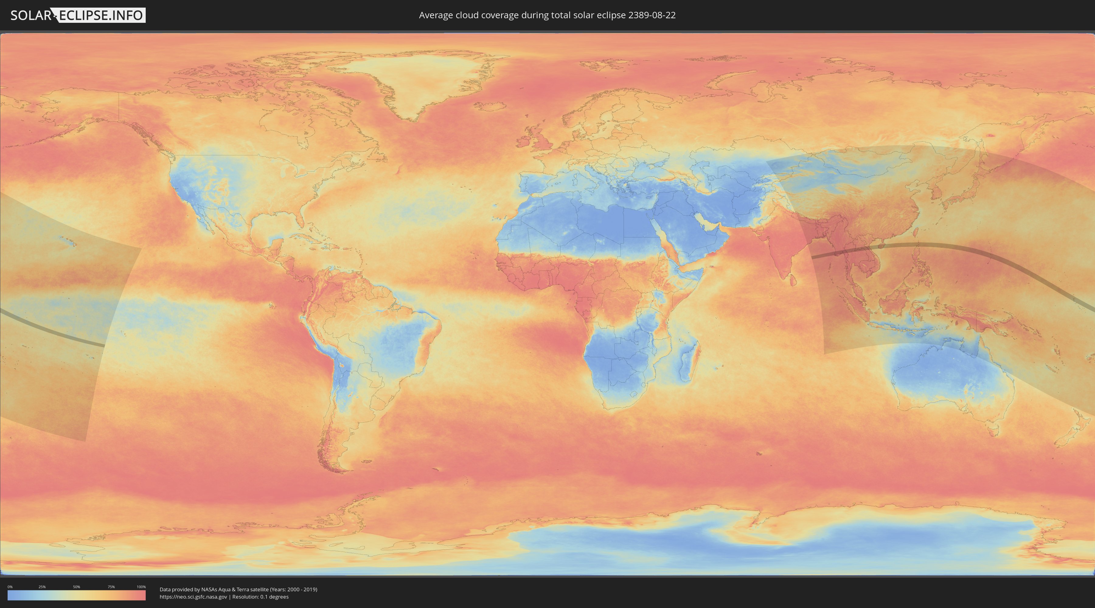
How will be the weather during the total solar eclipse on 08/22/2389?
Where is the best place to see the total solar eclipse of 08/22/2389?
The following maps show the average cloud coverage for the day of the total solar eclipse.
With the help of these maps, it is possible to find the place along the eclipse path, which has the best
chance of a cloudless sky.
Nevertheless, you should consider local circumstances and inform about the weather of your chosen
observation site.
The data is provided by NASAs satellites
AQUA and TERRA.
The cloud maps are averaged over a period of 19 years (2000 - 2019).

Detailed country maps
 Kiribati
 Cook Islands
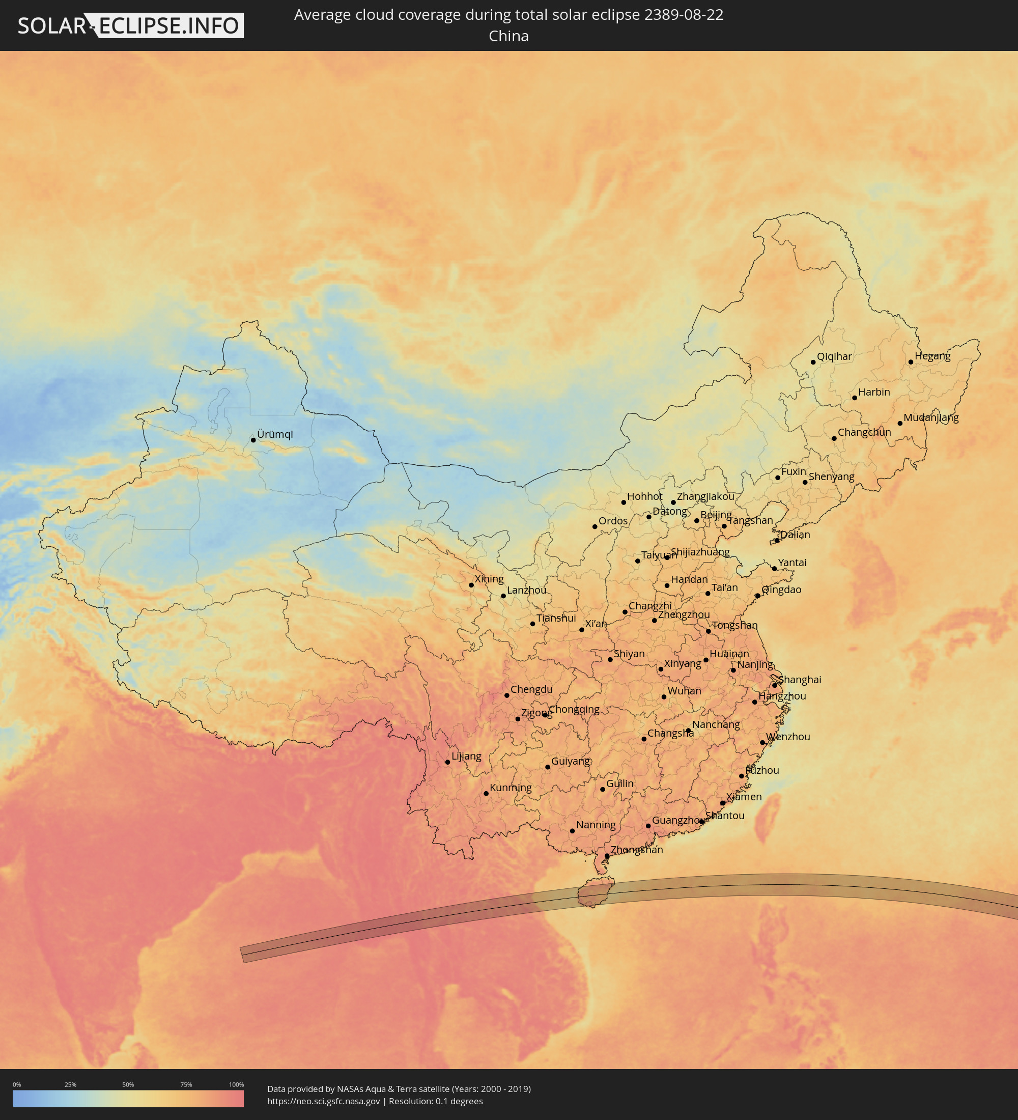 China
China
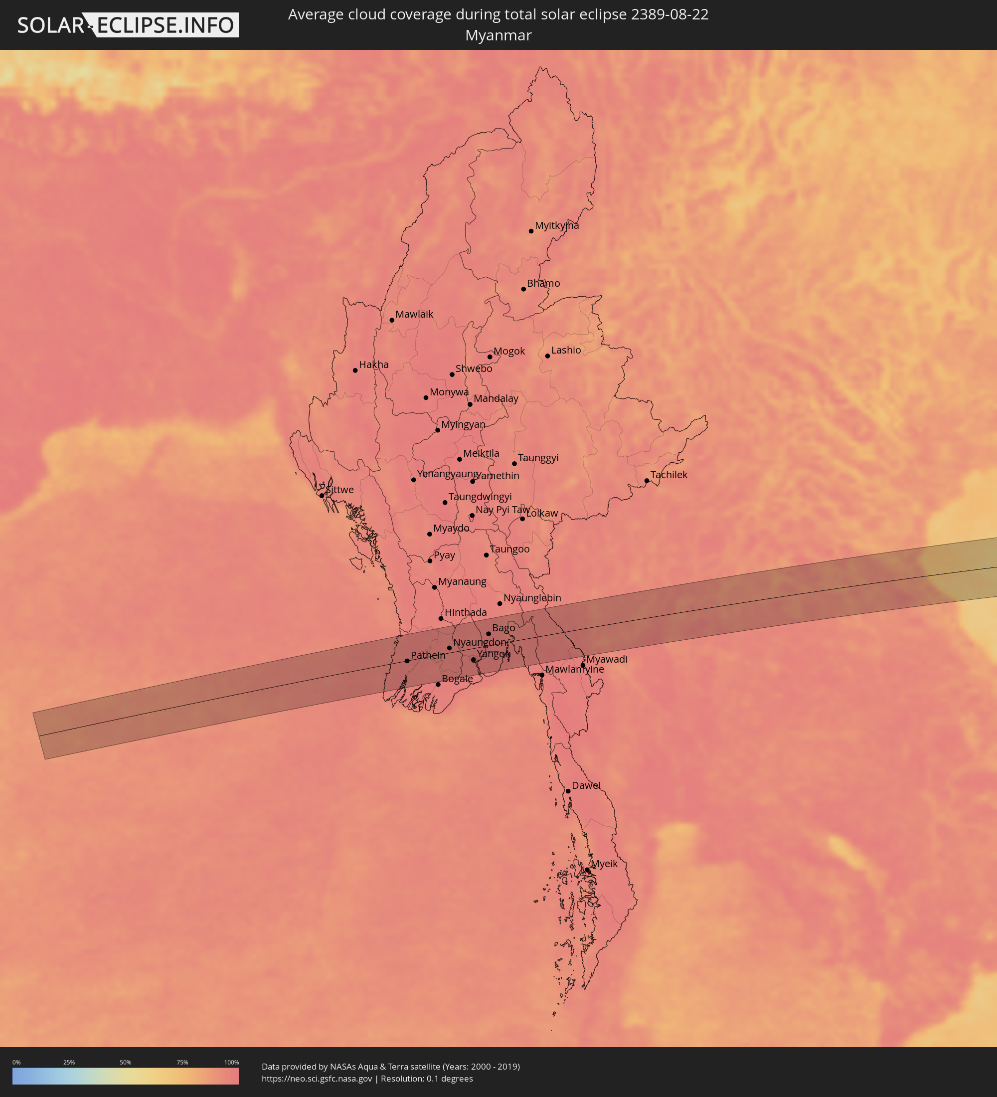 Myanmar
 Thailand
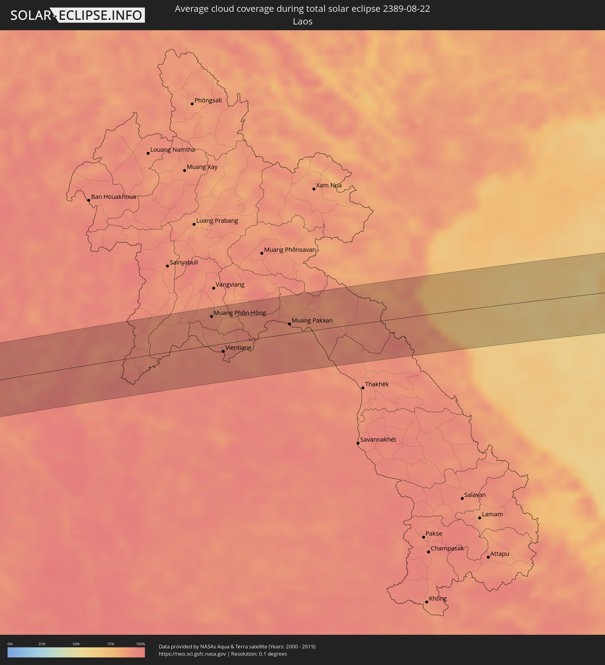 Laos
Laos
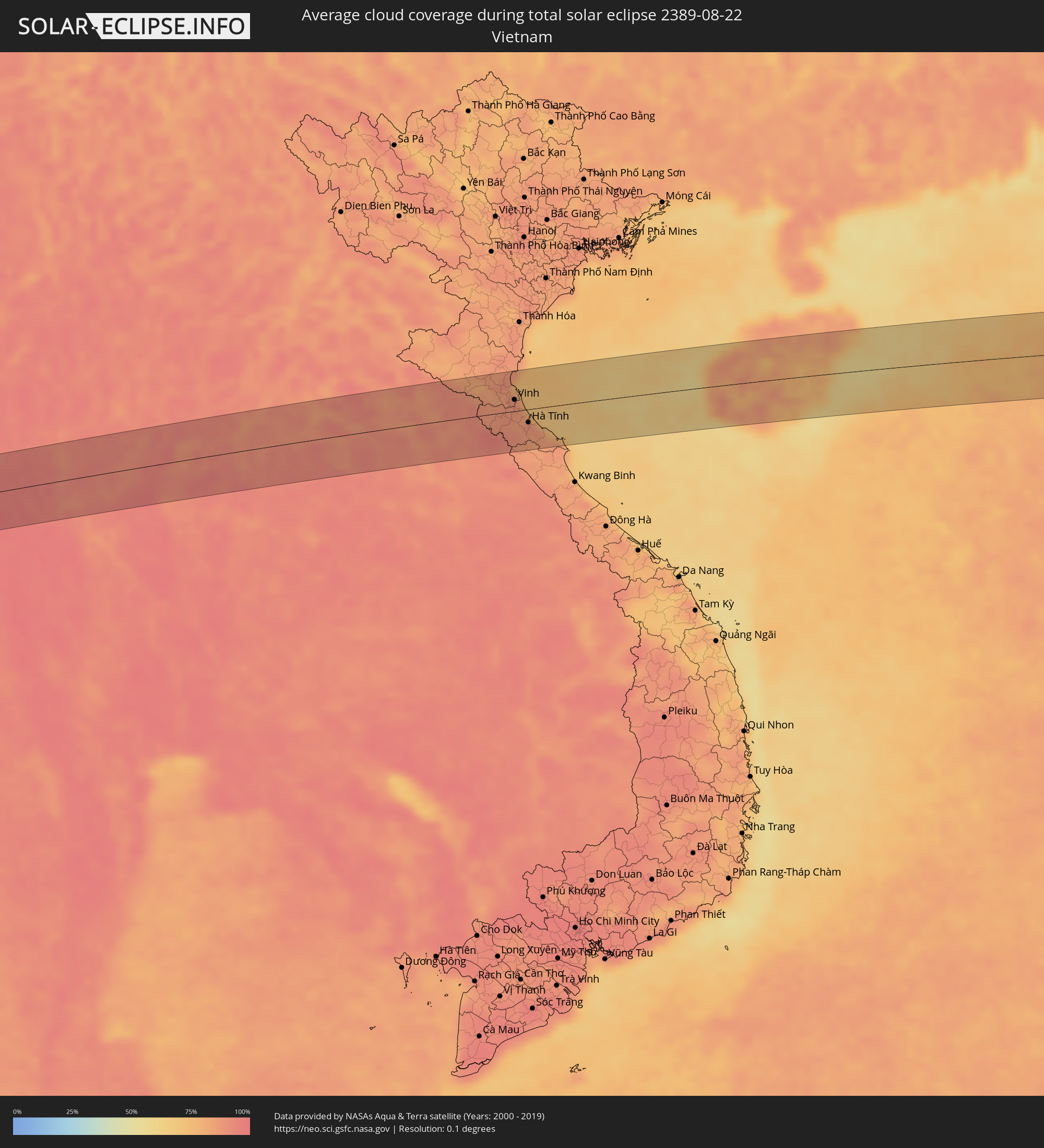 Vietnam
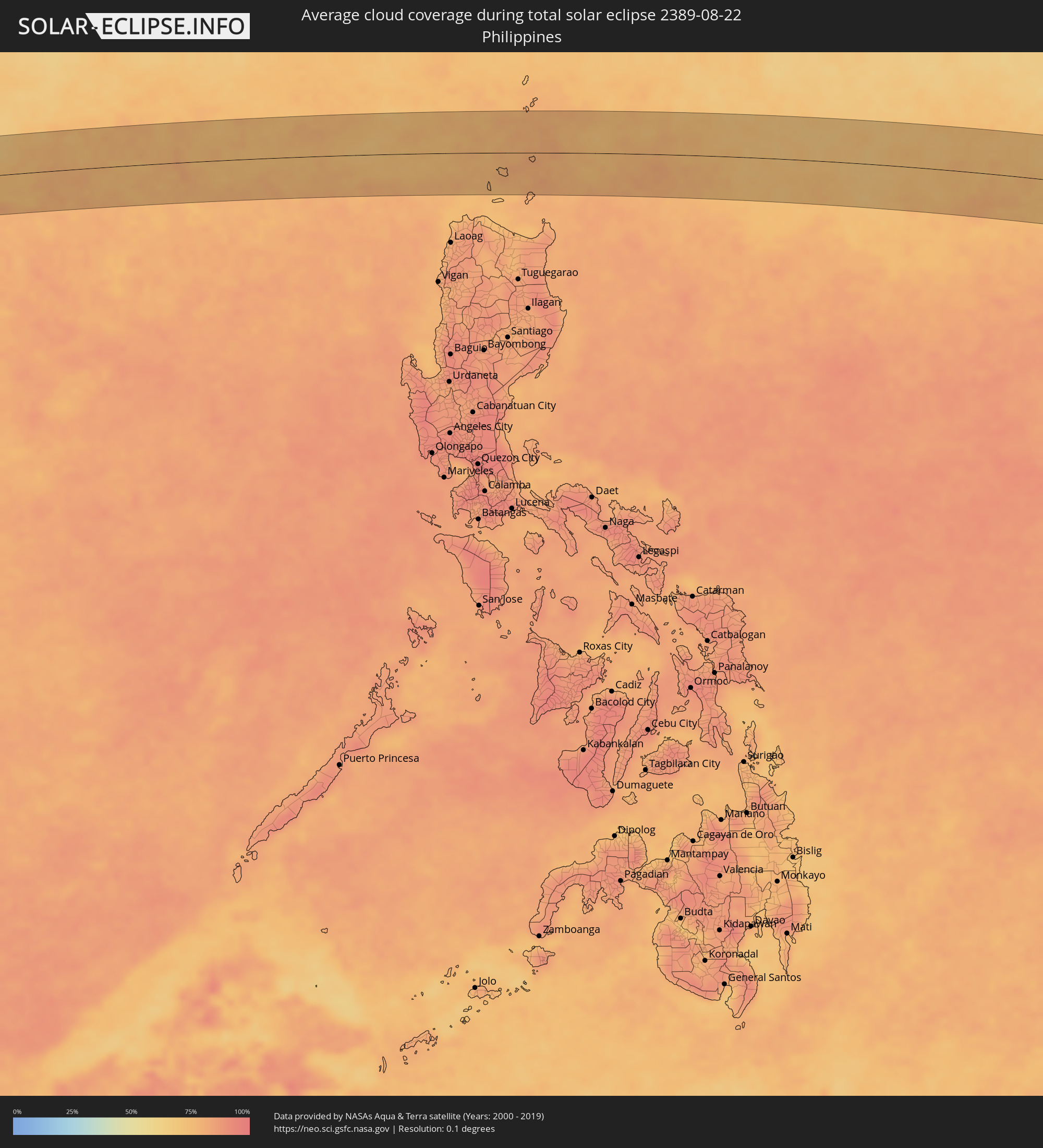 Philippines
 Northern Mariana Islands
 Marshall Islands
Cities inside the path of the eclipse
The following table shows all locations with a population of more than 5,000 inside the eclipse path. Cities which have more than 100,000 inhabitants are marked bold. A click at the locations opens a detailed map.
| City | Type | Eclipse duration | Local time of max. eclipse | Distance to central line | Ø Cloud coverage |
|
Pathein, Ayeyarwady
|
total | - | 06:34:29 UTC+06:30 | 2 km | 96% |
|
Wakema, Ayeyarwady
|
total | - | 06:34:32 UTC+06:30 | 30 km | 96% |
|
Mawlamyinegyunn, Ayeyarwady
|
total | - | 06:34:31 UTC+06:30 | 56 km | 97% |
|
Nyaungdon, Ayeyarwady
|
total | - | 06:34:45 UTC+06:30 | 9 km | 96% |
|
Maubin, Ayeyarwady
|
total | - | 06:34:41 UTC+06:30 | 25 km | 97% |
|
Kyaiklat, Ayeyarwady
|
total | - | 06:34:39 UTC+06:30 | 58 km | 97% |
|
Twante, Yangon
|
total | - | 06:34:45 UTC+06:30 | 33 km | 97% |
|
Kanbe, Yangon
|
total | - | 06:34:46 UTC+06:30 | 35 km | 97% |
|
Yangon, Yangon
|
total | - | 06:34:50 UTC+06:30 | 27 km | 97% |
|
Syriam, Yangon
|
total | - | 06:34:51 UTC+06:30 | 33 km | 97% |
|
Thanatpin, Bago
|
total | - | 06:34:59 UTC+06:30 | 15 km | 97% |
|
Bago, Bago
|
total | - | 06:35:03 UTC+06:30 | 25 km | 98% |
|
Thongwa, Yangon
|
total | - | 06:34:56 UTC+06:30 | 39 km | 97% |
|
Kayan, Yangon
|
total | - | 06:34:59 UTC+06:30 | 23 km | 97% |
|
Thanatpin, Bago
|
total | - | 06:35:04 UTC+06:30 | 18 km | 97% |
|
Kyaikto, Mon
|
total | - | 06:35:12 UTC+06:30 | 12 km | 96% |
|
Thaton, Mon
|
total | - | 06:35:14 UTC+06:30 | 38 km | 96% |
|
Hpa-an, Kayin
|
total | - | 06:35:19 UTC+06:30 | 46 km | 97% |
|
Mae Ramat, Tak
|
total | - | 07:05:39 UTC+07:00 | 52 km | 97% |
|
Ban Tak, Tak
|
total | - | 07:05:52 UTC+07:00 | 55 km | 90% |
|
Thoen, Lampang
|
total | - | 07:06:03 UTC+07:00 | 5 km | 93% |
|
Si Satchanalai, Sukhothai
|
total | - | 07:06:15 UTC+07:00 | 15 km | 95% |
|
Long, Phrae
|
total | - | 07:06:25 UTC+07:00 | 45 km | 93% |
|
Sawankhalok, Sukhothai
|
total | - | 07:06:14 UTC+07:00 | 39 km | 96% |
|
Den Chai, Phrae
|
total | - | 07:06:30 UTC+07:00 | 31 km | 93% |
|
Uttaradit, Uttaradit
|
total | - | 07:06:25 UTC+07:00 | 9 km | 96% |
|
Phrae, Phrae
|
total | - | 07:06:34 UTC+07:00 | 47 km | 94% |
|
Loei, Loei
|
total | - | 07:07:09 UTC+07:00 | 52 km | 94% |
|
Nam Som, Changwat Udon Thani
|
total | - | 07:07:27 UTC+07:00 | 28 km | 93% |
|
Muang Phôn-Hông, Vientiane Province
|
total | - | 07:07:45 UTC+07:00 | 48 km | 92% |
|
Tha Bo, Nong Khai
|
total | - | 07:07:41 UTC+07:00 | 26 km | 92% |
|
Si Chiang Mai, Nong Khai
|
total | - | 07:07:42 UTC+07:00 | 14 km | 94% |
|
Vientiane, Vientiane
|
total | - | 07:07:43 UTC+07:00 | 13 km | 94% |
|
Nong Khai, Nong Khai
|
total | - | 07:07:46 UTC+07:00 | 25 km | 93% |
|
Phon Charoen, Nong Khai
|
total | - | 07:08:03 UTC+07:00 | 15 km | 92% |
|
Ban Dung, Changwat Udon Thani
|
total | - | 07:08:01 UTC+07:00 | 53 km | 94% |
|
Bueng Kan, Changwat Bueng Kan
|
total | - | 07:08:24 UTC+07:00 | 14 km | 86% |
|
Muang Pakxan, Bolikhamsai Province
|
total | - | 07:08:24 UTC+07:00 | 16 km | 86% |
|
Seka, Changwat Bueng Kan
|
total | - | 07:08:28 UTC+07:00 | 39 km | 89% |
|
Yên Vinh, Nghệ An
|
total | - | 07:09:44 UTC+07:00 | 18 km | 88% |
|
Vinh, Nghệ An
|
total | - | 07:09:45 UTC+07:00 | 18 km | 88% |
|
Hà Tĩnh, Hà Tĩnh
|
total | - | 07:09:49 UTC+07:00 | 21 km | 87% |
|
Wanning, Hainan
|
total | - | 08:13:27 UTC+08:00 | 26 km | 73% |
|
Saipan, Saipan
|
total | - | 11:22:47 UTC+10:00 | 72 km | 88% |
|
Ebon, Ebon Atoll
|
total | - | 14:38:22 UTC+12:00 | 33 km | 79% |
|
Betio Village, Gilbert Islands
|
total | - | 14:51:15 UTC+12:00 | 43 km | 61% |
|
Tarawa, Gilbert Islands
|
total | - | 14:51:23 UTC+12:00 | 43 km | 53% |
|
Bikenibeu Village, Gilbert Islands
|
total | - | 14:51:37 UTC+12:00 | 31 km | 64% |