Total solar eclipse of 10/16/2870
| Day of week: | Thursday |
| Maximum duration of eclipse: | 05m07s |
| Maximum width of eclipse path: | 184 km |
| Saros cycle: | 167 |
| Coverage: | 100% |
| Magnitude: | 1.0557 |
| Gamma: | -0.0147 |
Wo kann man die Sonnenfinsternis vom 10/16/2870 sehen?
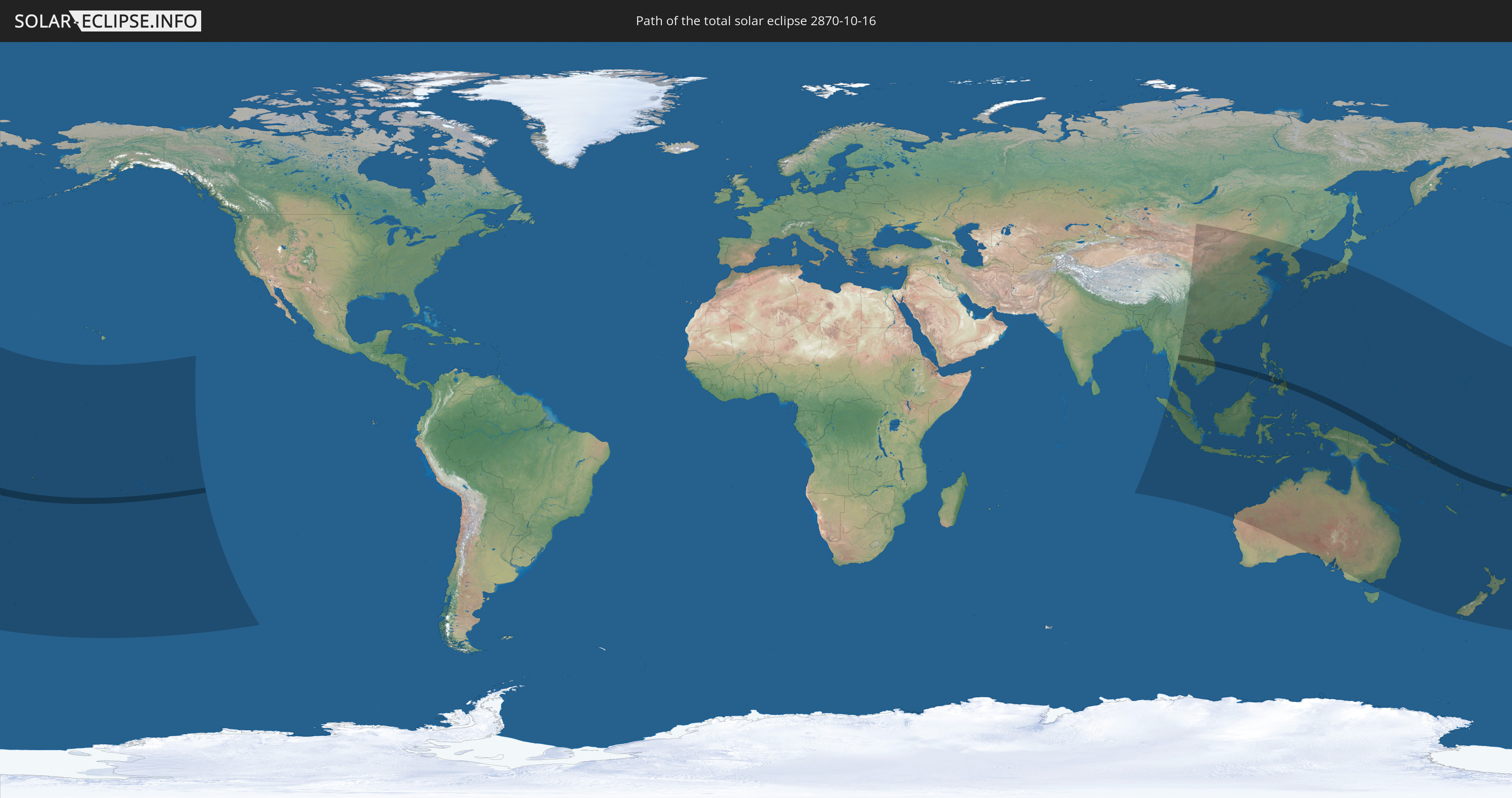
Die Sonnenfinsternis am 10/16/2870 kann man in 46 Ländern als partielle Sonnenfinsternis beobachten.
Der Finsternispfad verläuft durch 15 Länder. Nur in diesen Ländern ist sie als total Sonnenfinsternis zu sehen.
In den folgenden Ländern ist die Sonnenfinsternis total zu sehen
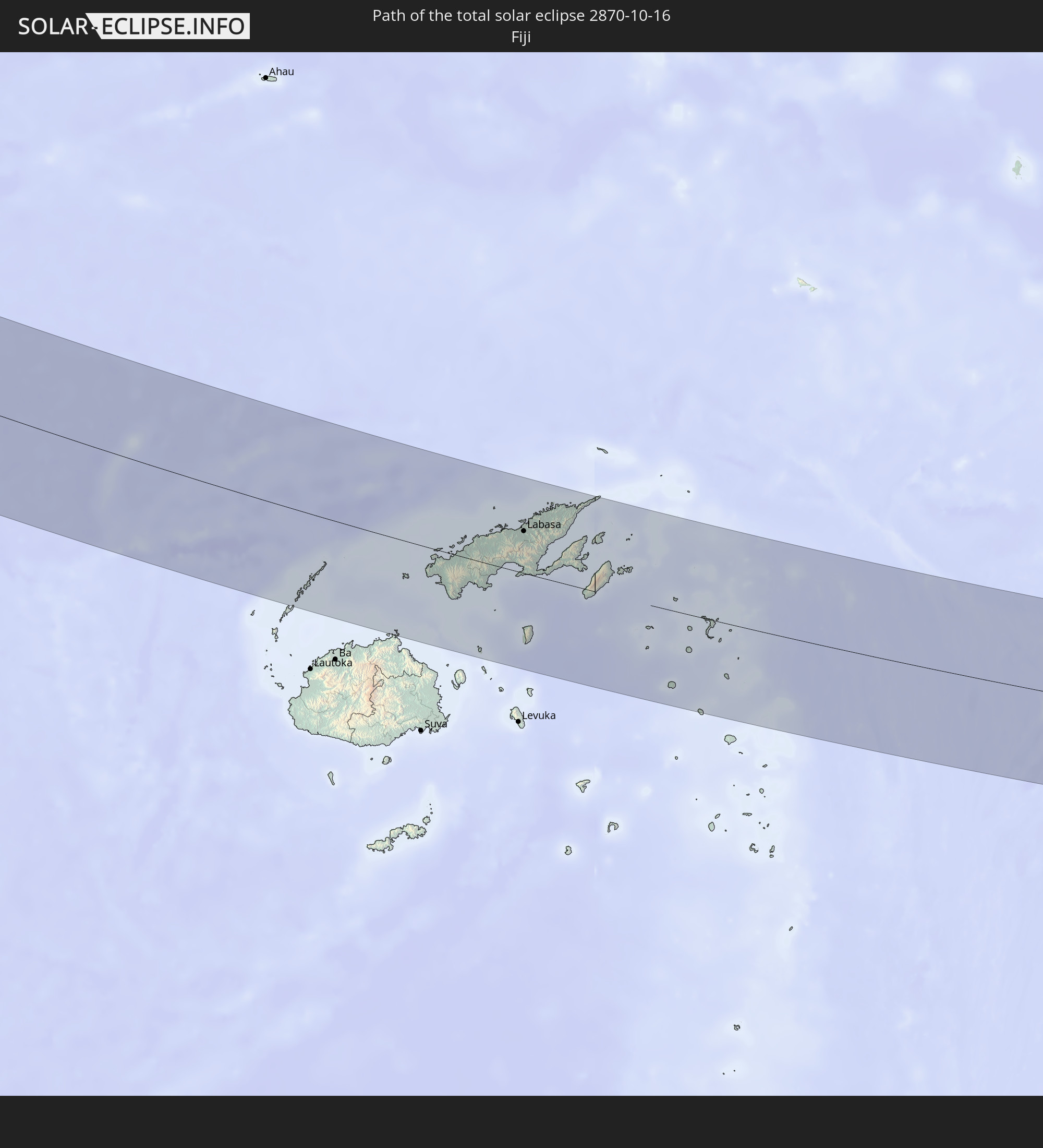 Fiji
Fiji
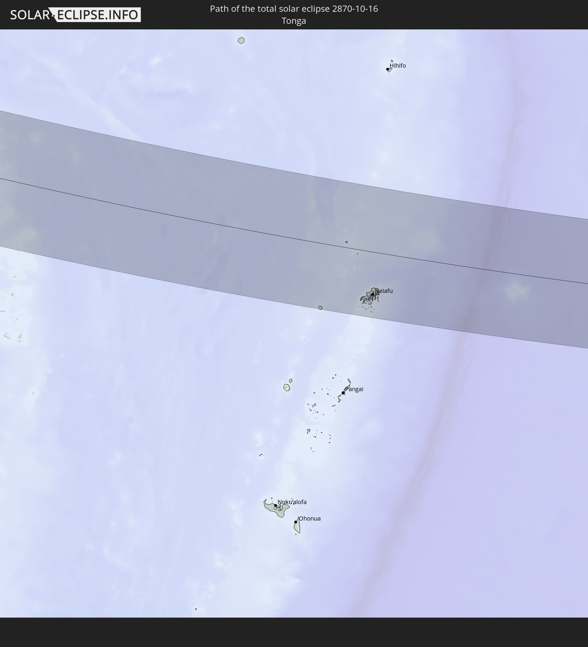 Tonga
Tonga
 Kiribati
 Niue
Niue
 Cook Islands
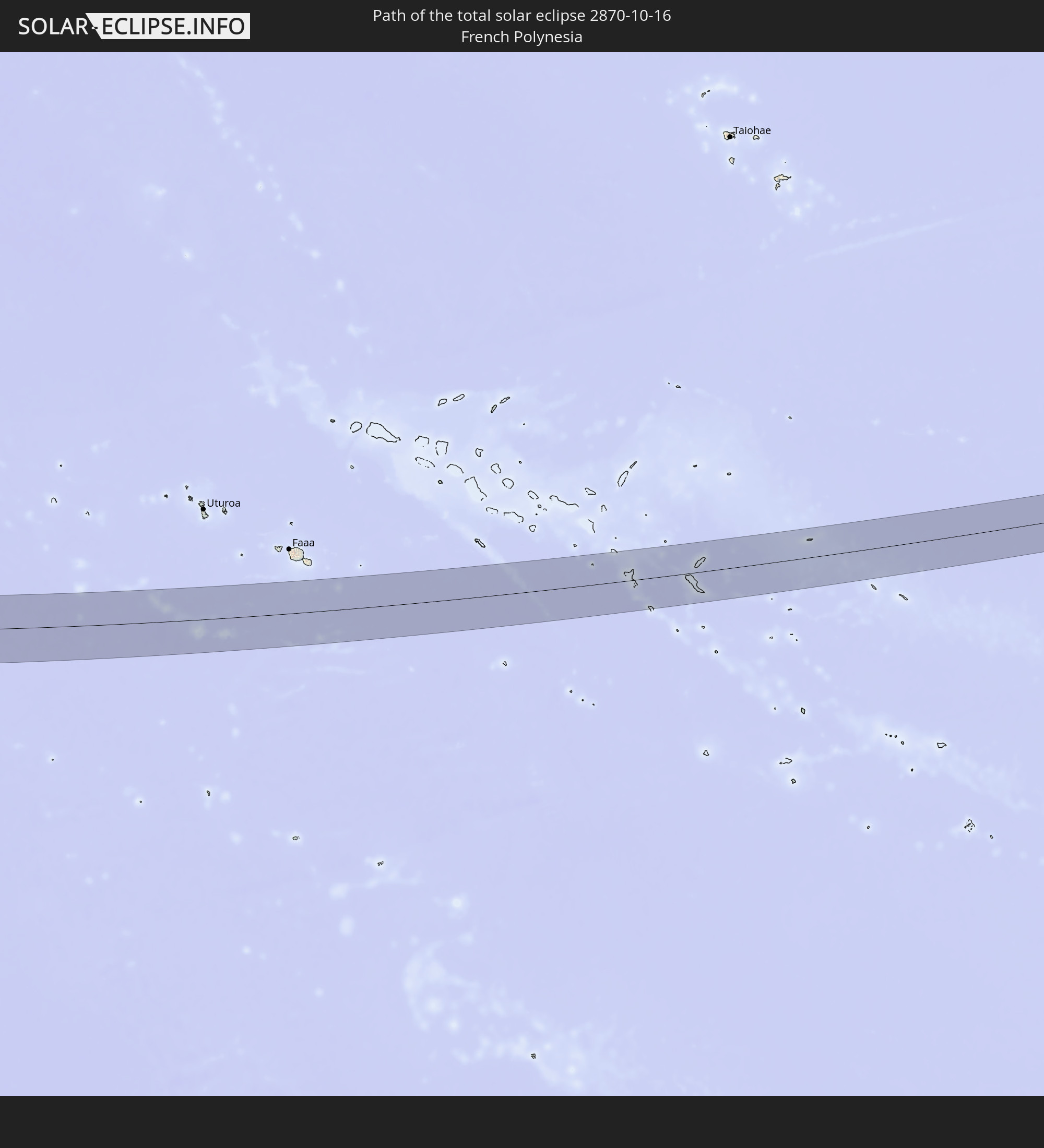 French Polynesia
 Thailand
 Laos
Laos
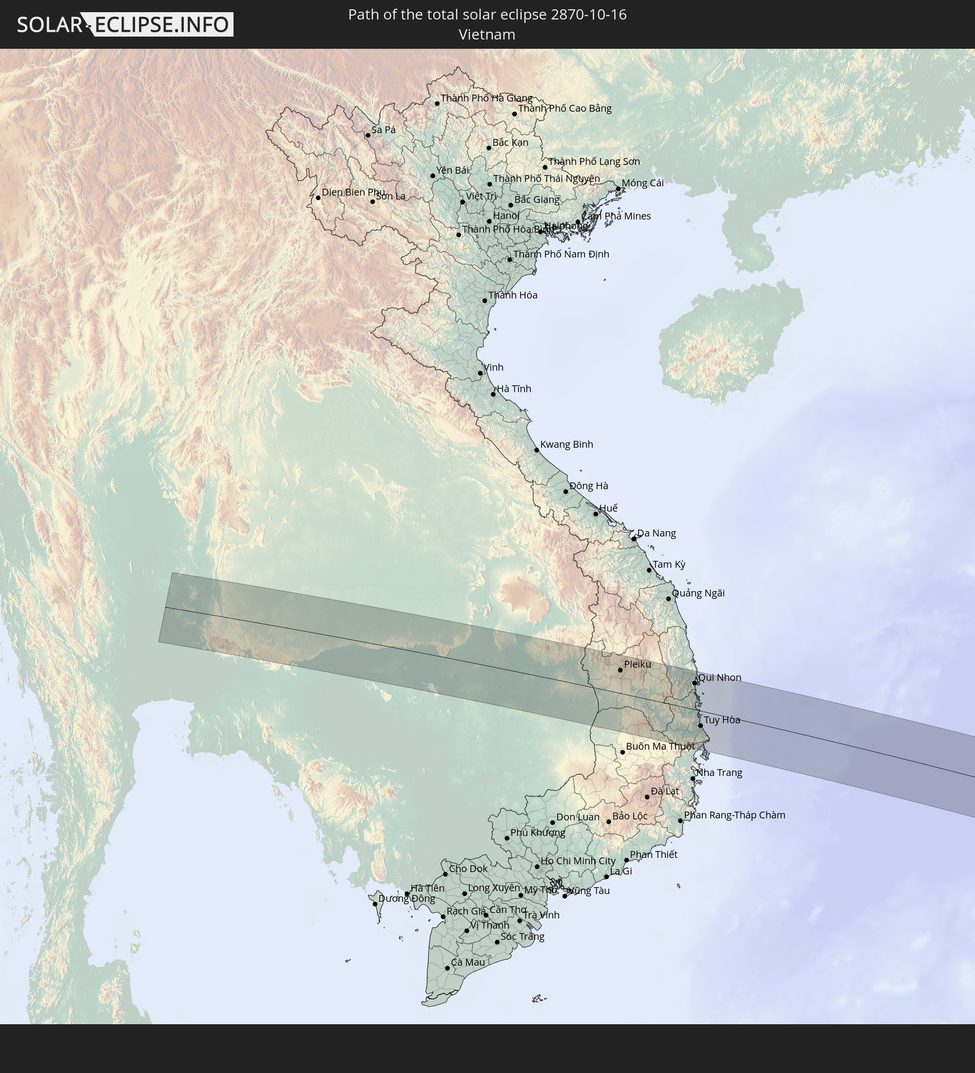 Vietnam
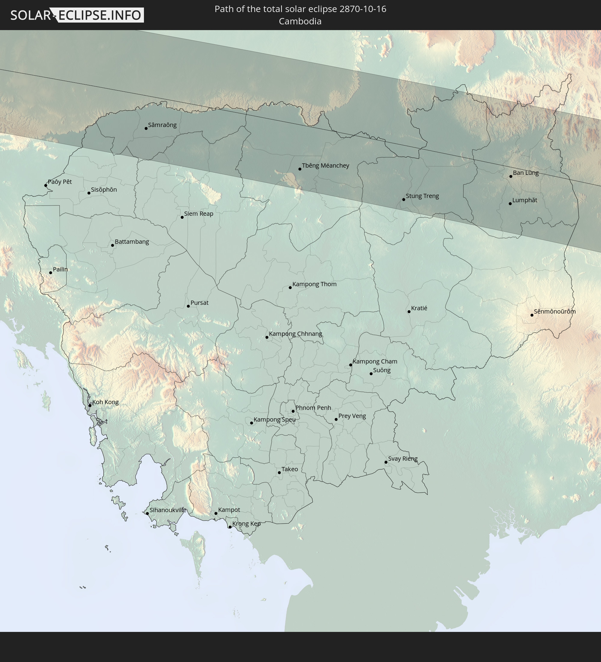 Cambodia
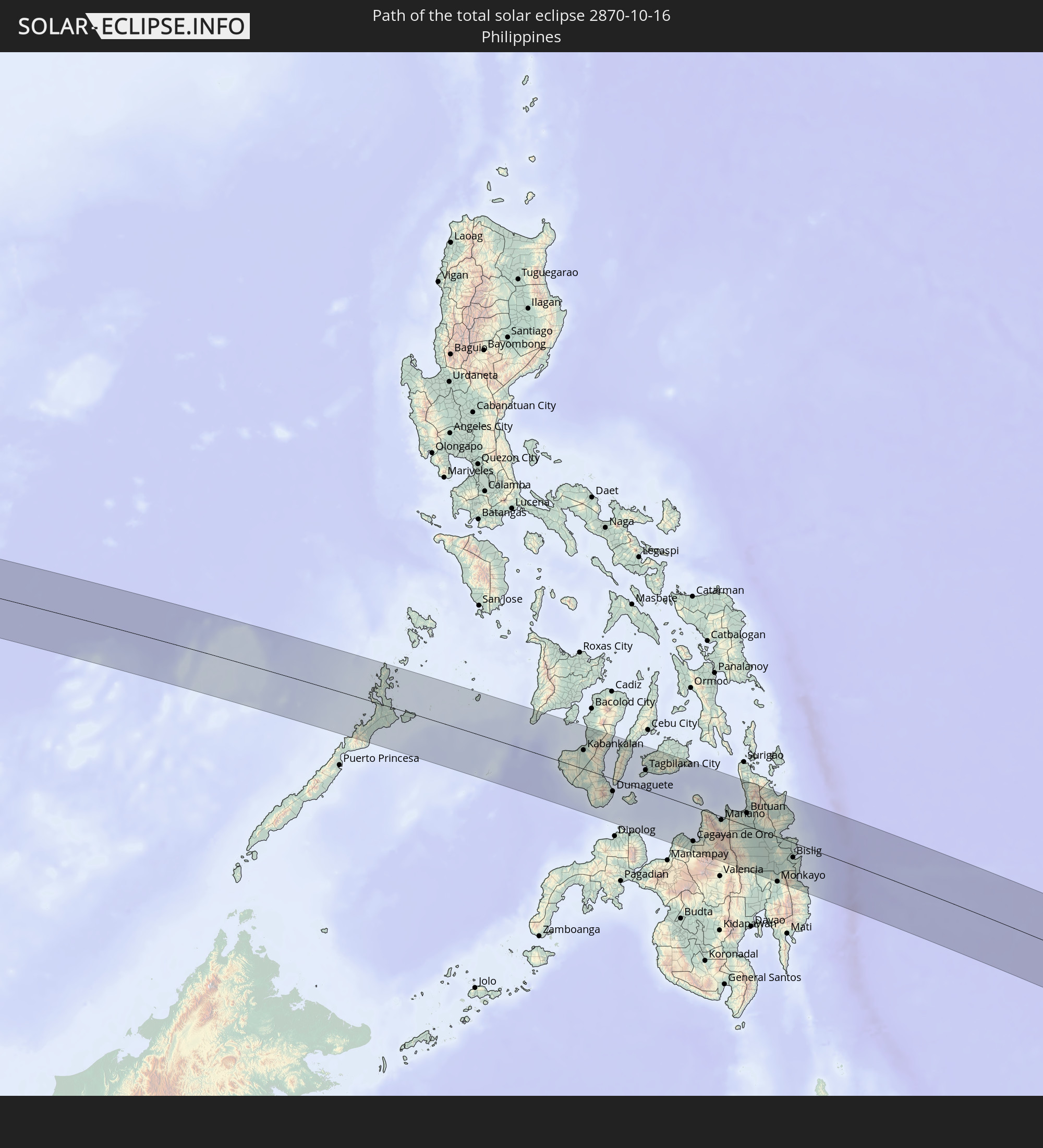 Philippines
 Palau
Palau
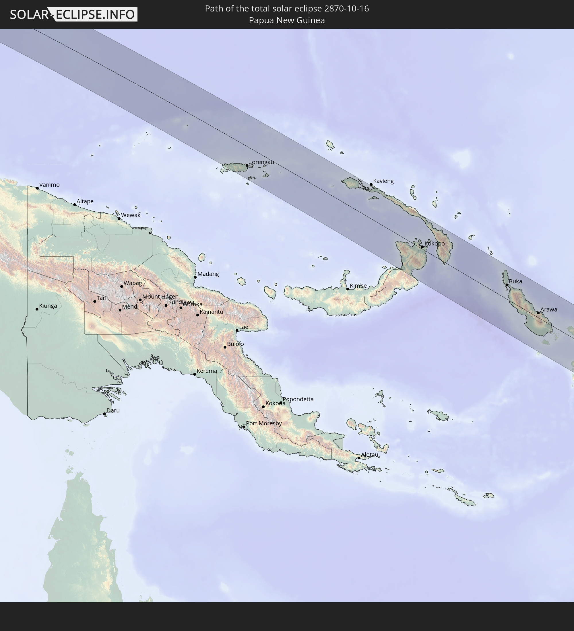 Papua New Guinea
 Solomon Islands
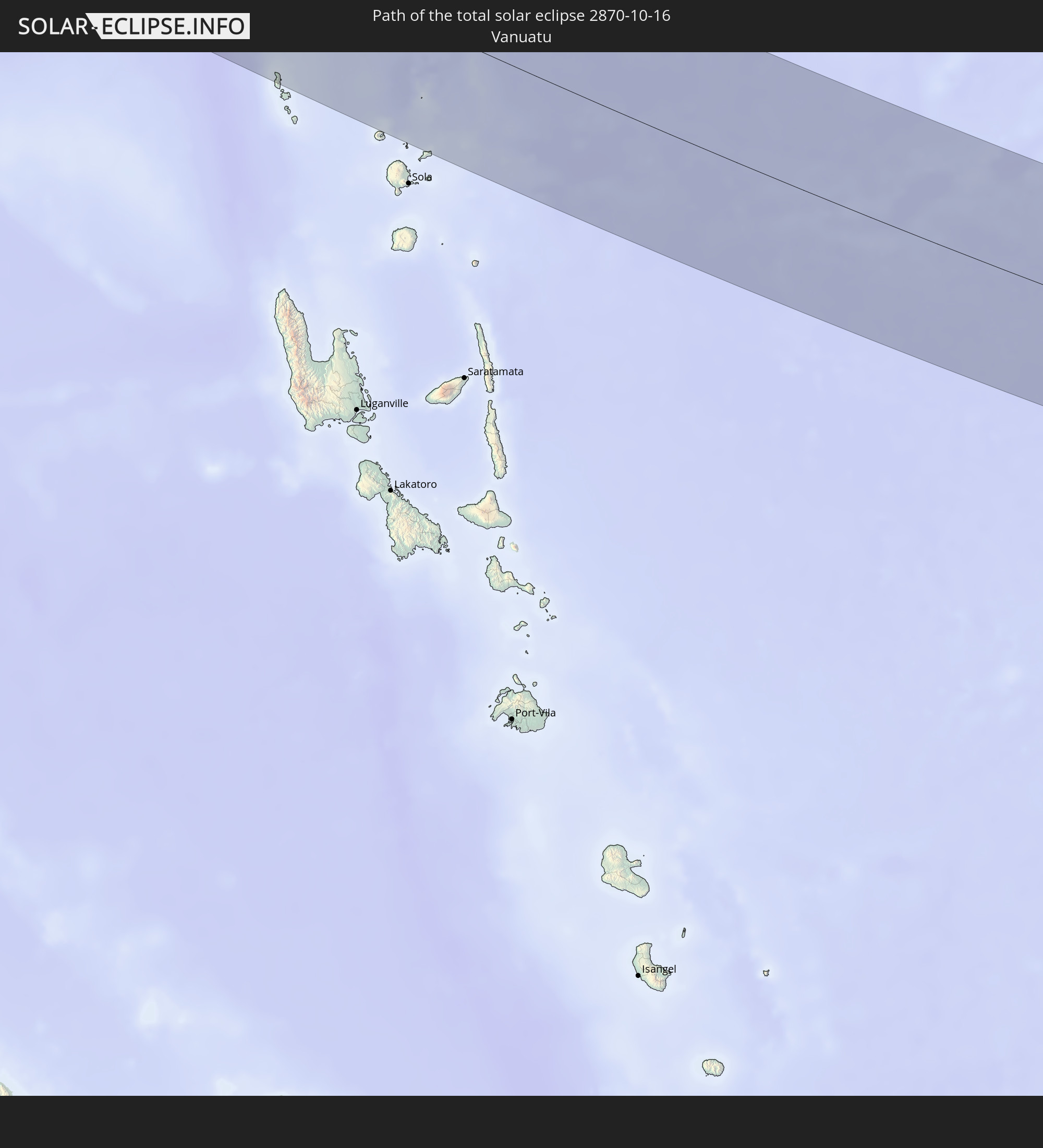 Vanuatu
In den folgenden Ländern ist die Sonnenfinsternis partiell zu sehen
 Fiji
Fiji
 New Zealand
 United States Minor Outlying Islands
 Wallis and Futuna
 Tonga
Tonga
 Kiribati
 Samoa
Samoa
 Tokelau
 American Samoa
 Niue
Niue
 Cook Islands
 French Polynesia
 Pitcairn Islands
 China
China
 Mongolia
 Indonesia
 Cocos Islands
 Thailand
 Malaysia
 Laos
Laos
 Vietnam
 Cambodia
 Singapore
 Christmas Island
 Australia
 Macau
Macau
 Hong Kong
 Brunei
 Taiwan
 Philippines
 Japan
Japan
 East Timor
 North Korea
 South Korea
 Palau
Palau
 Federated States of Micronesia
 Papua New Guinea
 Guam
Guam
 Northern Mariana Islands
 Solomon Islands
 New Caledonia
 Marshall Islands
 Vanuatu
 Nauru
Nauru
 Norfolk Island
 Tuvalu
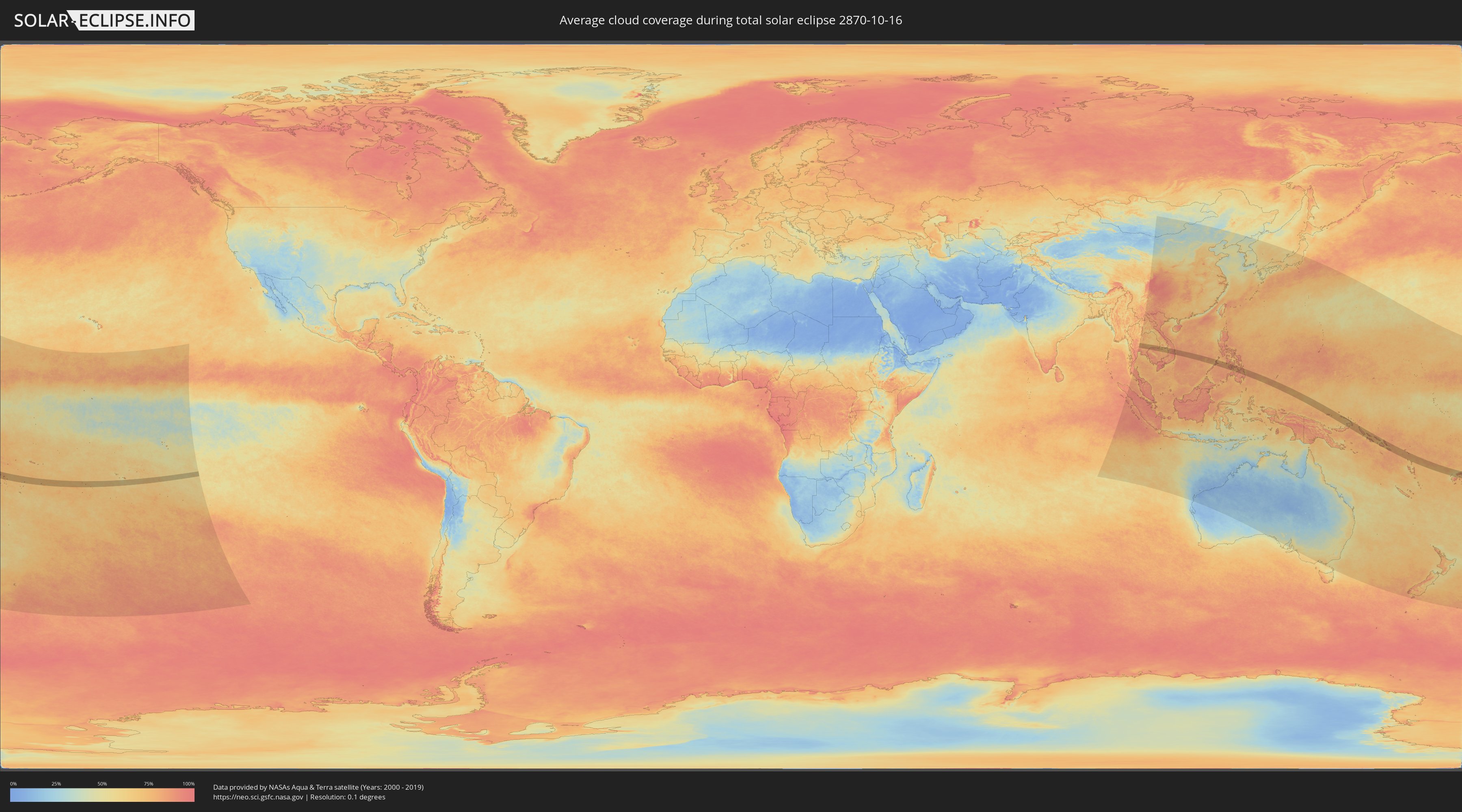
How will be the weather during the total solar eclipse on 10/16/2870?
Where is the best place to see the total solar eclipse of 10/16/2870?
The following maps show the average cloud coverage for the day of the total solar eclipse.
With the help of these maps, it is possible to find the place along the eclipse path, which has the best
chance of a cloudless sky.
Nevertheless, you should consider local circumstances and inform about the weather of your chosen
observation site.
The data is provided by NASAs satellites
AQUA and TERRA.
The cloud maps are averaged over a period of 19 years (2000 - 2019).

Detailed country maps
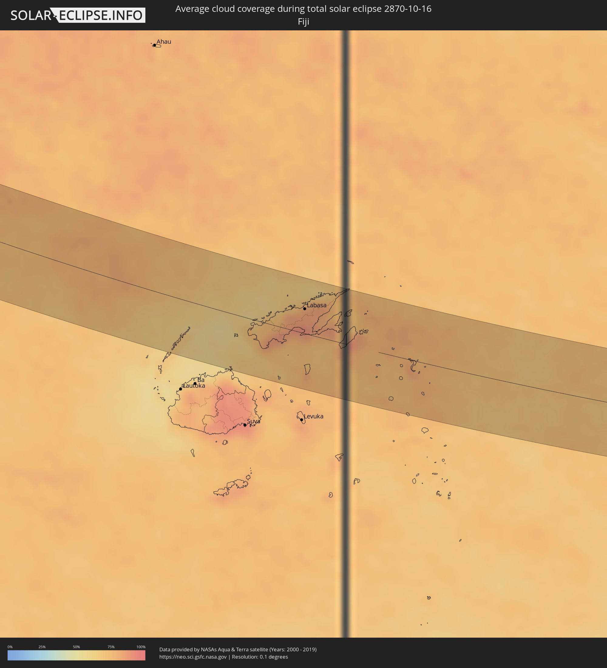 Fiji
Fiji
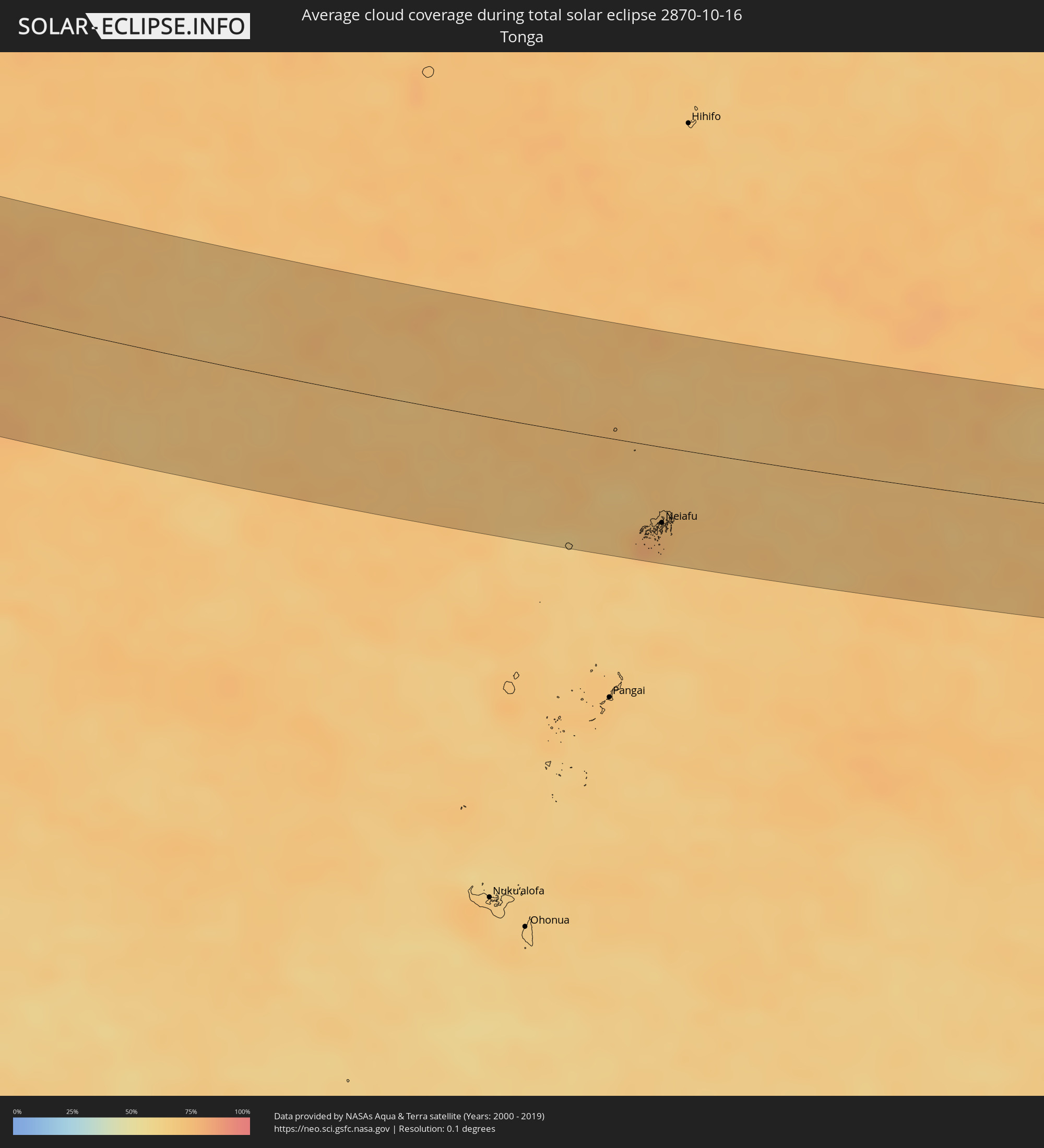 Tonga
Tonga
 Kiribati
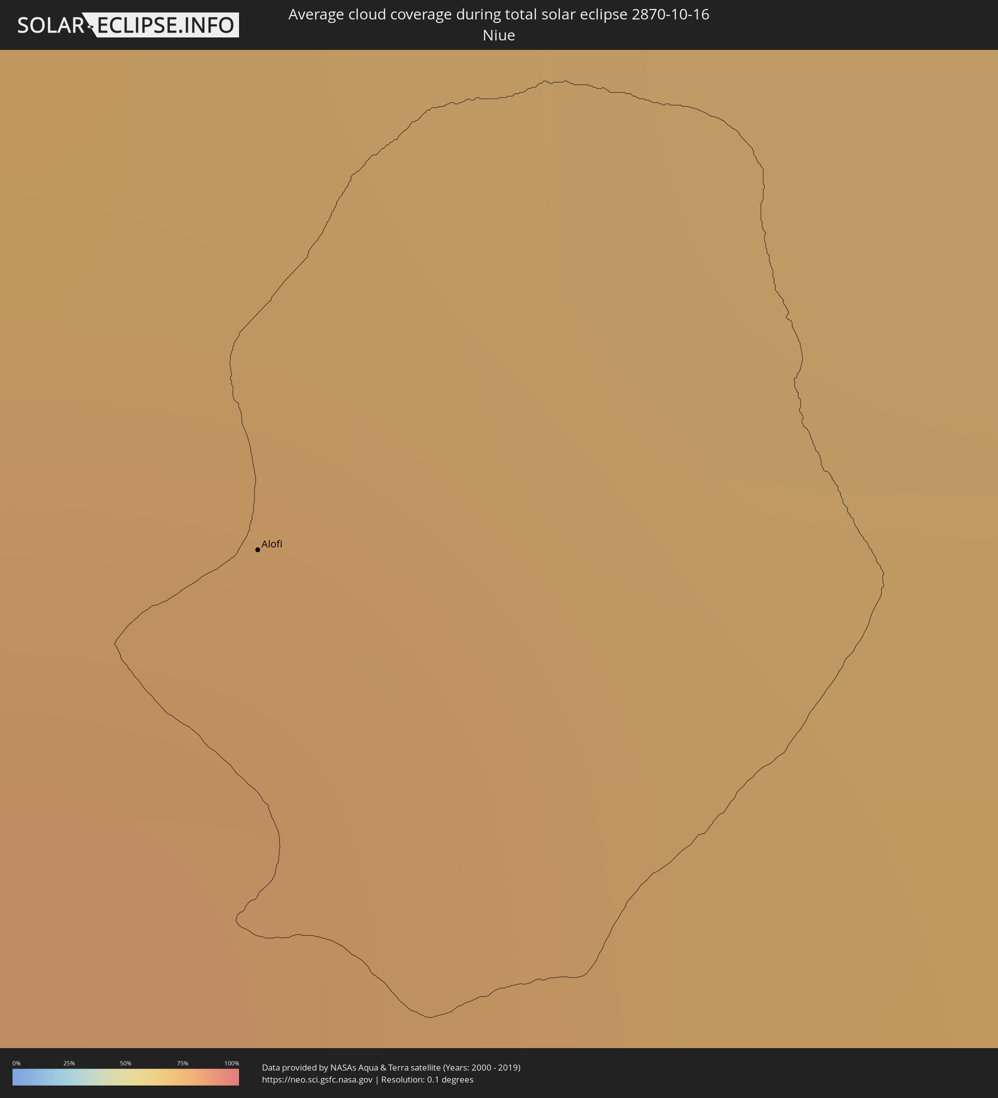 Niue
Niue
 Cook Islands
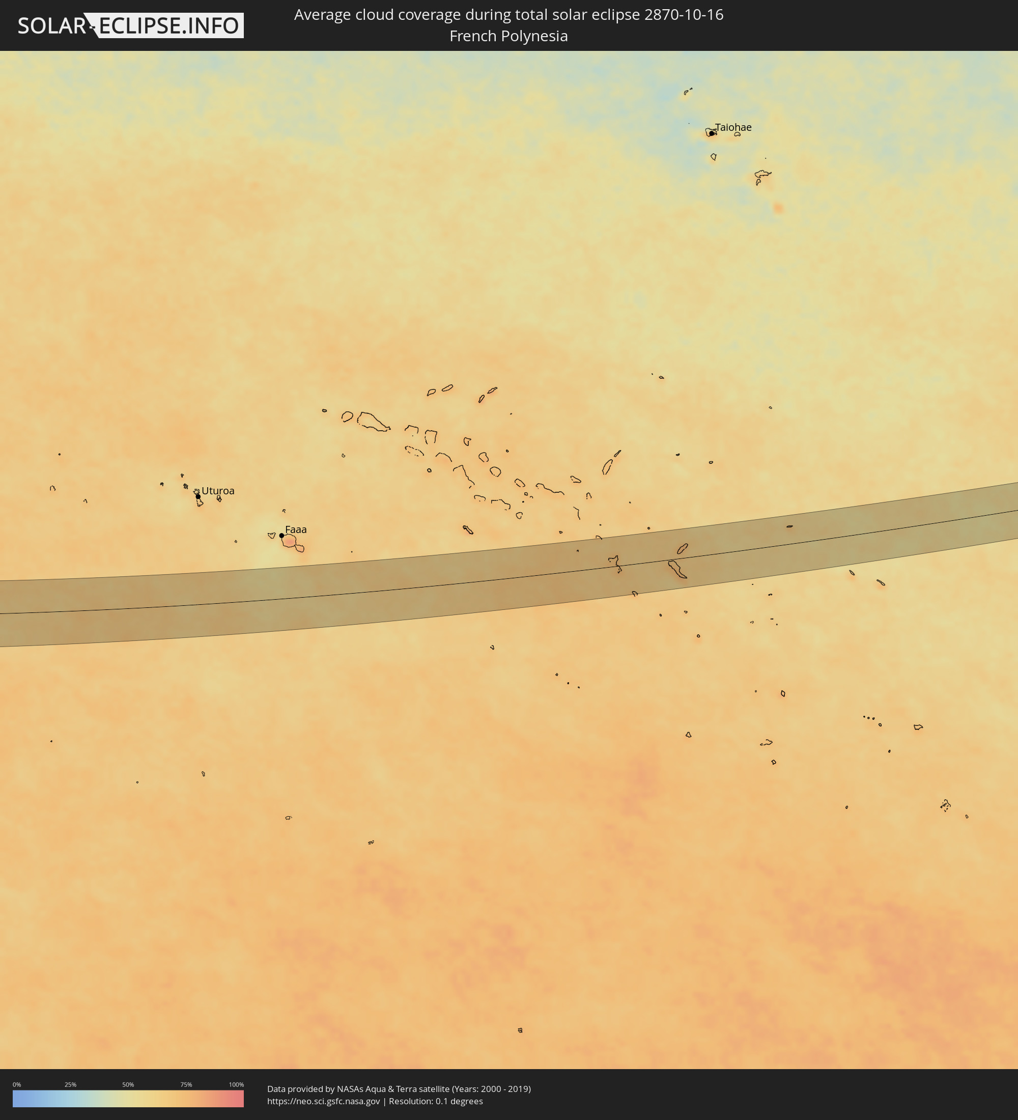 French Polynesia
 Thailand
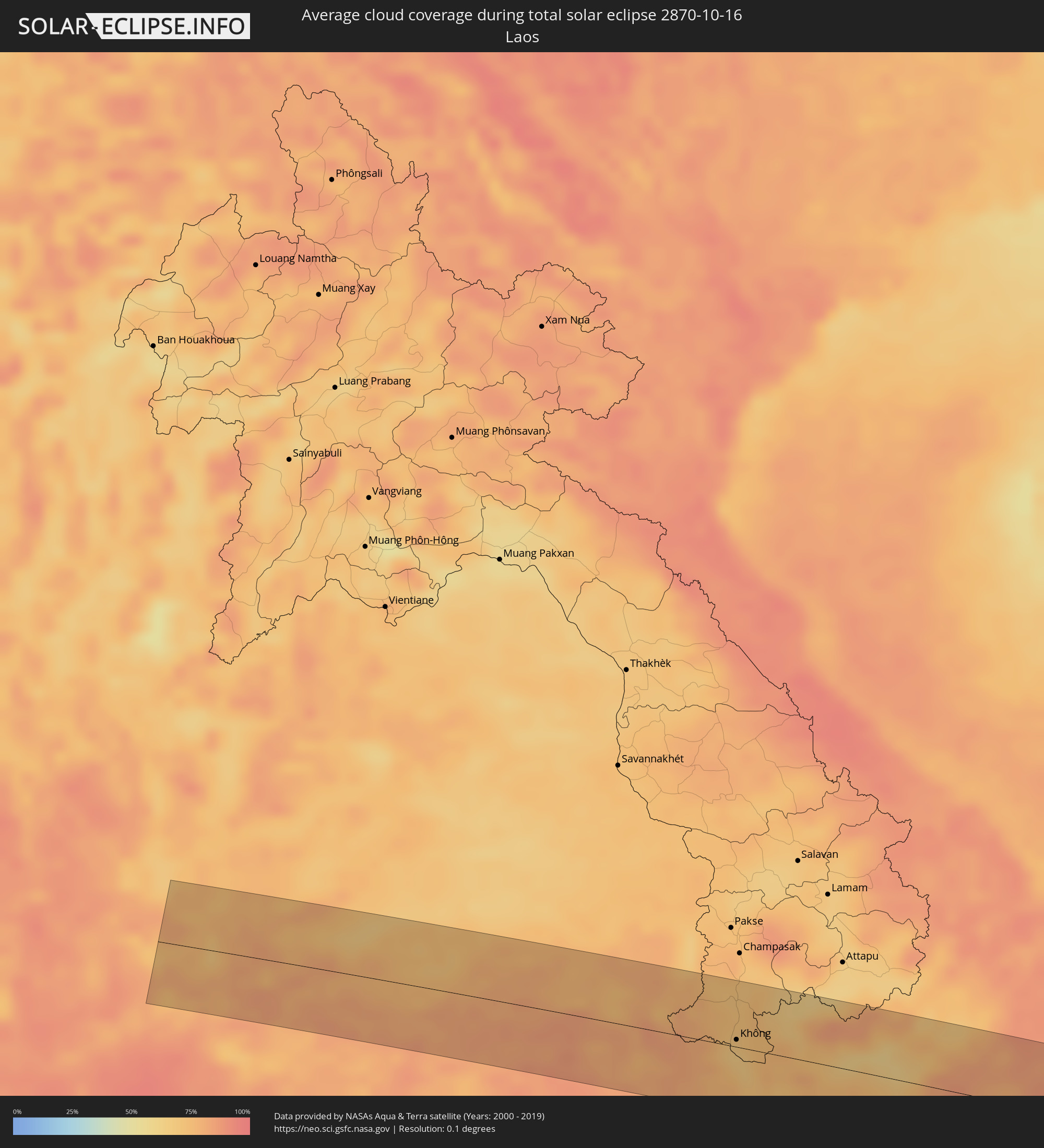 Laos
Laos
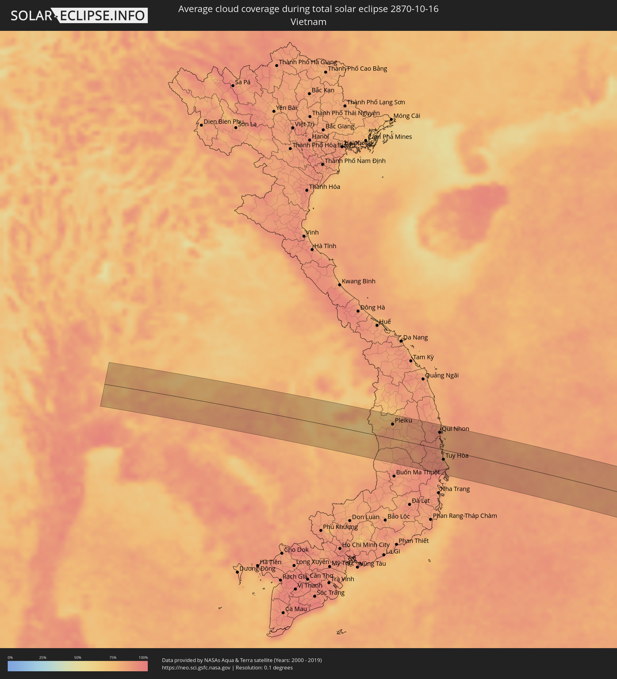 Vietnam
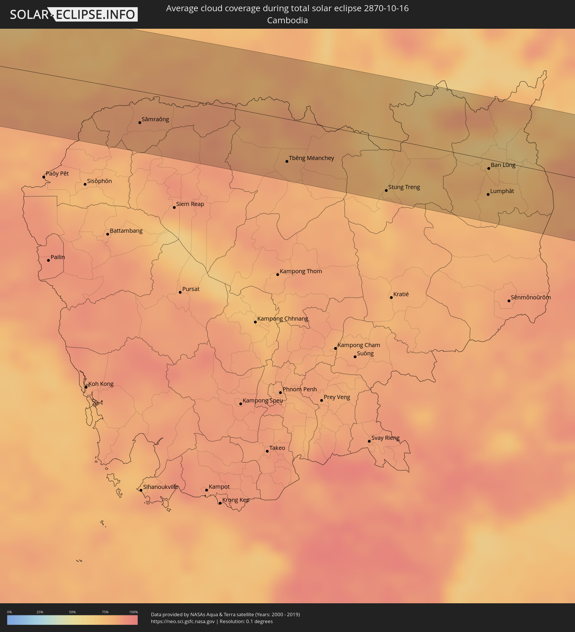 Cambodia
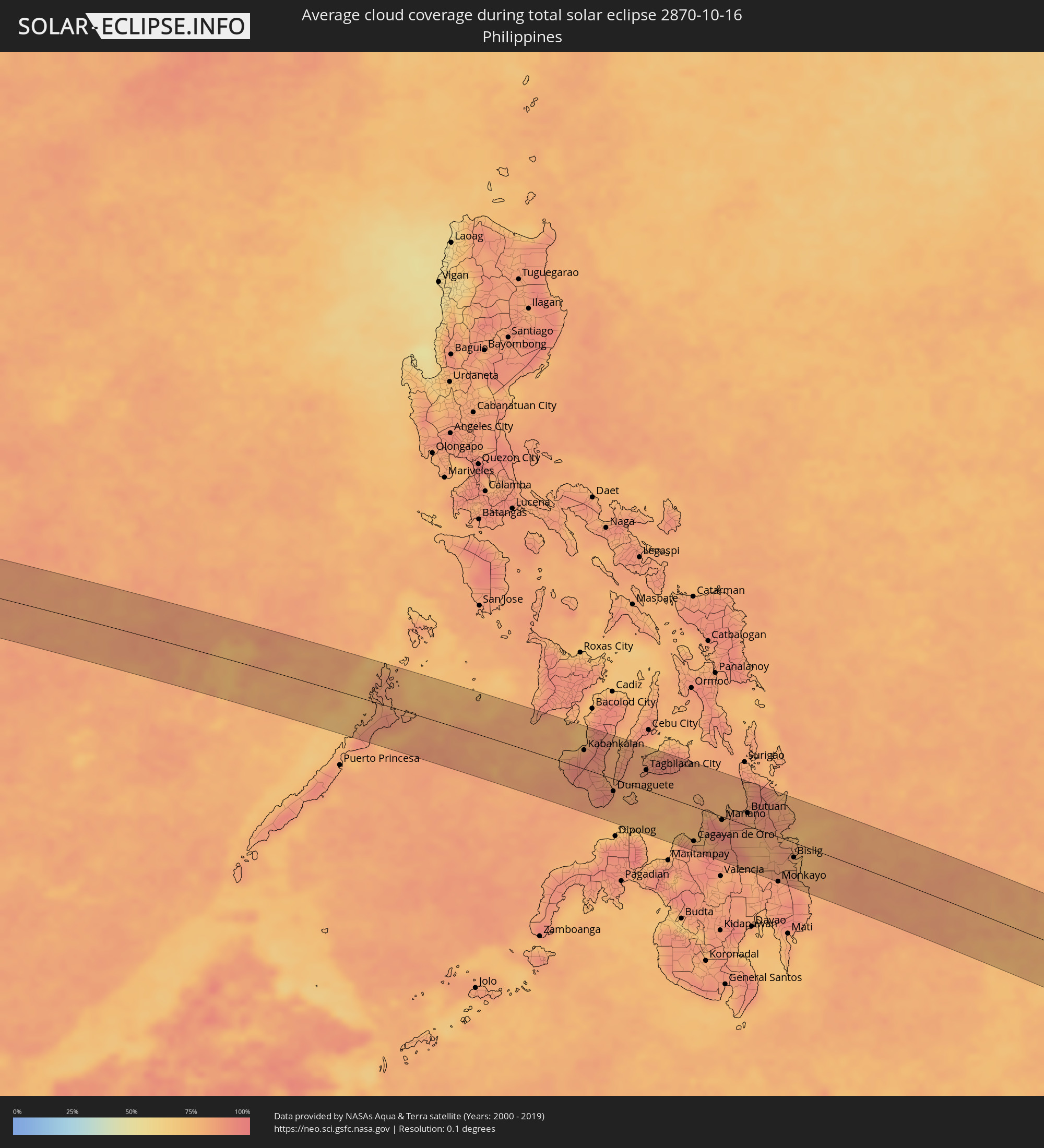 Philippines
 Palau
Palau
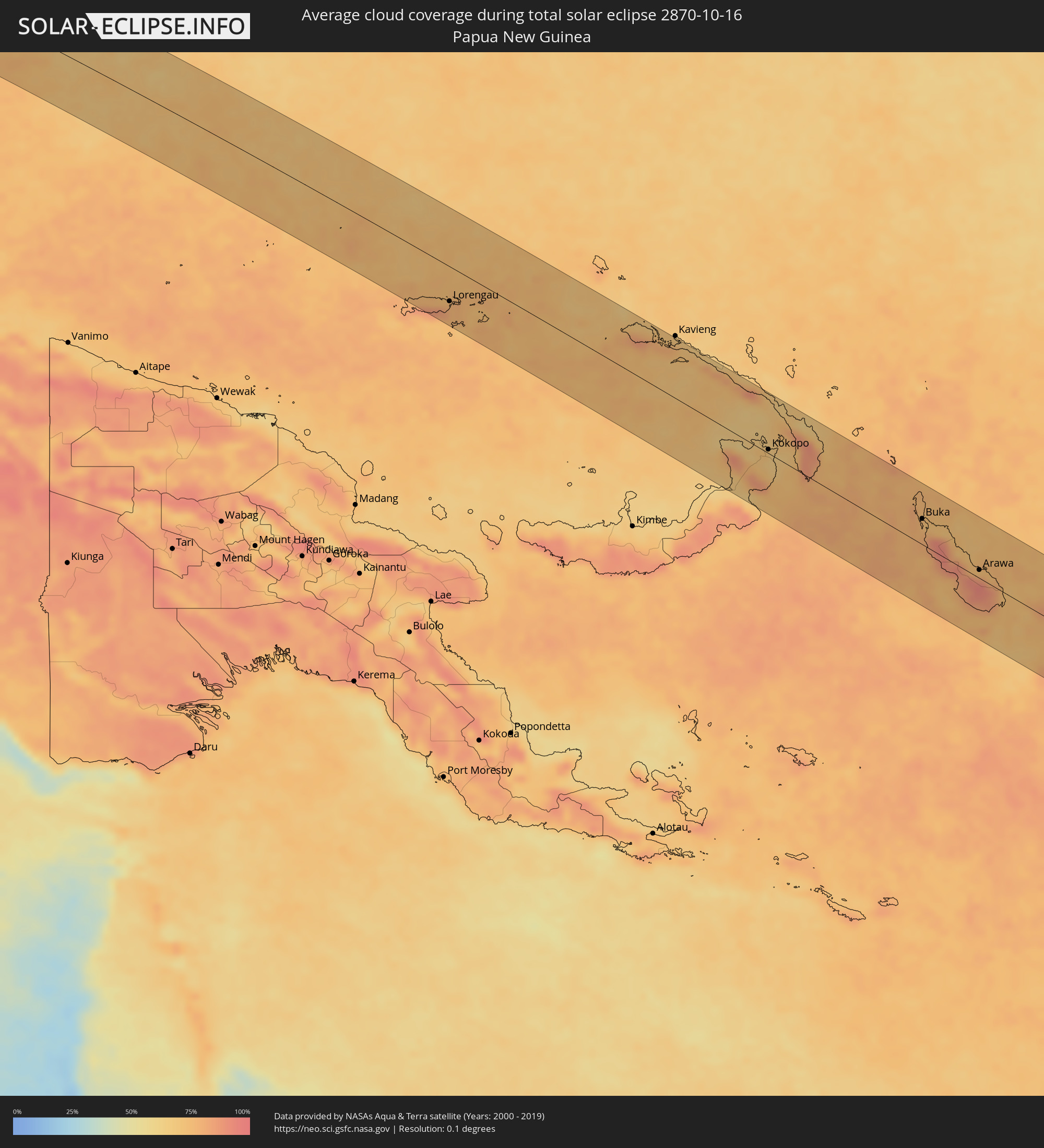 Papua New Guinea
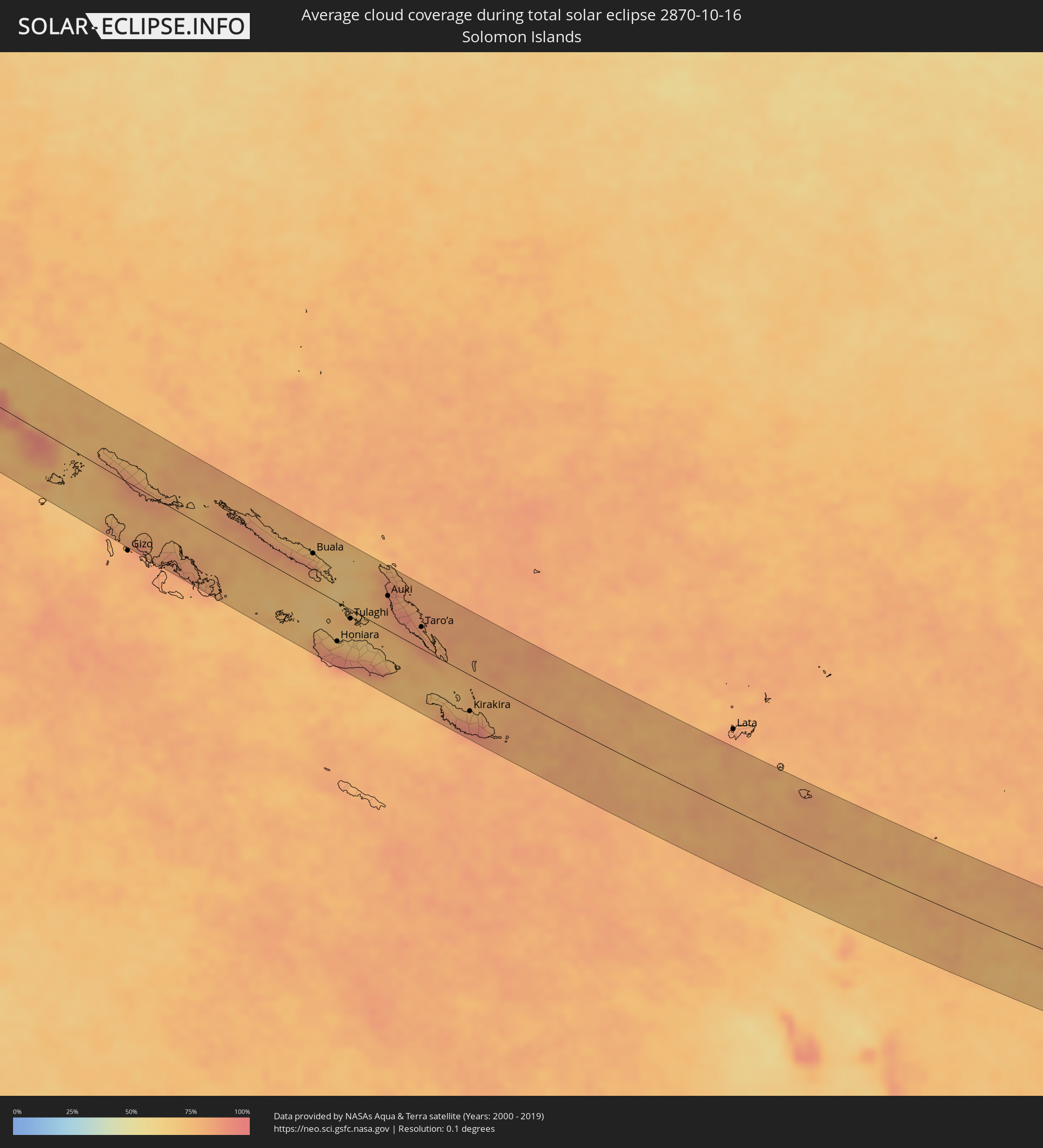 Solomon Islands
 Vanuatu
Cities inside the path of the eclipse
The following table shows all locations with a population of more than 5,000 inside the eclipse path. Cities which have more than 100,000 inhabitants are marked bold. A click at the locations opens a detailed map.
| City | Type | Eclipse duration | Local time of max. eclipse | Distance to central line | Ø Cloud coverage |
|
Neiafu, Vava‘u
|
total | - | 15:04:55 UTC+13:00 | 56 km | 77% |
|
Alofi
|
total | - | 15:12:15 UTC-11:00 | 42 km | 75% |
|
Nakhon Luang, Phra Nakhon Si Ayutthaya
|
total | - | 06:13:38 UTC+07:00 | 61 km | 79% |
|
Lop Buri, Lop Buri
|
total | - | 06:13:34 UTC+07:00 | 28 km | 80% |
|
Tha Ruea, Phra Nakhon Si Ayutthaya
|
total | - | 06:13:37 UTC+07:00 | 43 km | 76% |
|
Ban Mo, Sara Buri
|
total | - | 06:13:36 UTC+07:00 | 38 km | 76% |
|
Phra Phutthabat, Sara Buri
|
total | - | 06:13:35 UTC+07:00 | 25 km | 81% |
|
Saraburi, Sara Buri
|
total | - | 06:13:37 UTC+07:00 | 44 km | 81% |
|
Chai Badan, Lop Buri
|
total | - | 06:13:30 UTC+07:00 | 33 km | 77% |
|
Pak Chong, Nakhon Ratchasima
|
total | - | 06:13:35 UTC+07:00 | 15 km | 83% |
|
Amphoe Sikhiu, Nakhon Ratchasima
|
total | - | 06:13:33 UTC+07:00 | 11 km | 79% |
|
Dan Khun Thot, Nakhon Ratchasima
|
total | - | 06:13:30 UTC+07:00 | 46 km | 75% |
|
Nakhon Ratchasima, Nakhon Ratchasima
|
total | - | 06:13:33 UTC+07:00 | 26 km | 80% |
|
Chok Chai, Nakhon Ratchasima
|
total | - | 06:13:35 UTC+07:00 | 1 km | 80% |
|
Khon Buri, Nakhon Ratchasima
|
total | - | 06:13:37 UTC+07:00 | 20 km | 81% |
|
Non Sung, Nakhon Ratchasima
|
total | - | 06:13:31 UTC+07:00 | 52 km | 67% |
|
Ban Huai Thalaeng, Nakhon Ratchasima
|
total | - | 06:13:34 UTC+07:00 | 38 km | 74% |
|
Nang Rong, Buriram
|
total | - | 06:13:37 UTC+07:00 | 2 km | 76% |
|
Buriram, Buriram
|
total | - | 06:13:35 UTC+07:00 | 47 km | 74% |
|
Prakhon Chai, Buriram
|
total | - | 06:13:39 UTC+07:00 | 5 km | 80% |
|
Surin, Surin
|
total | - | 06:13:37 UTC+07:00 | 43 km | 79% |
|
Sâmraông, Ŏtâr Méanchey
|
total | - | 06:13:45 UTC+07:00 | 33 km | 83% |
|
Kantharalak, Sisaket
|
total | - | 06:13:45 UTC+07:00 | 39 km | 75% |
|
Tbêng Méanchey, Preah Vihear
|
total | - | 06:13:57 UTC+07:00 | 45 km | 80% |
|
Không, Champasak
|
total | - | 06:13:59 UTC+07:00 | 7 km | 66% |
|
Stung Treng, Stung Treng
|
total | - | 06:14:08 UTC+07:00 | 55 km | 79% |
|
Lumphăt, Ratanakiri
|
total | - | 06:14:18 UTC+07:00 | 37 km | 71% |
|
Ban Lŭng, Ratanakiri
|
total | - | 06:14:15 UTC+07:00 | 10 km | 77% |
|
Pleiku, Gia Lai
|
total | - | 06:14:23 UTC+07:00 | 39 km | 83% |
|
Sông Cầu, Phú Yên
|
total | - | 06:14:47 UTC+07:00 | 10 km | 86% |
|
Qui Nhon, Bình Định
|
total | - | 06:14:42 UTC+07:00 | 45 km | 89% |
|
Tuy Hòa, Phú Yên
|
total | - | 06:14:54 UTC+07:00 | 26 km | 89% |
|
Sipalay, Western Visayas
|
total | - | 07:22:40 UTC+08:00 | 6 km | 82% |
|
Bayawan, Central Visayas
|
total | - | 07:23:12 UTC+08:00 | 33 km | 83% |
|
Kabankalan, Western Visayas
|
total | - | 07:22:52 UTC+08:00 | 33 km | 89% |
|
Hinigaran, Western Visayas
|
total | - | 07:22:44 UTC+08:00 | 64 km | 84% |
|
Bais, Central Visayas
|
total | - | 07:23:19 UTC+08:00 | 2 km | 85% |
|
Dumaguete, Central Visayas
|
total | - | 07:23:37 UTC+08:00 | 22 km | 82% |
|
Carcar, Central Visayas
|
total | - | 07:23:27 UTC+08:00 | 74 km | 85% |
|
Tagbilaran City, Central Visayas
|
total | - | 07:23:52 UTC+08:00 | 35 km | 87% |
|
Jagna, Central Visayas
|
total | - | 07:24:18 UTC+08:00 | 53 km | 85% |
|
Cagayan de Oro, Northern Mindanao
|
total | - | 07:25:14 UTC+08:00 | 60 km | 86% |
|
Manolo Fortich, Northern Mindanao
|
total | - | 07:25:30 UTC+08:00 | 64 km | 87% |
|
Mariano, Northern Mindanao
|
total | - | 07:25:26 UTC+08:00 | 6 km | 88% |
|
Malaybalay, Northern Mindanao
|
total | - | 07:25:52 UTC+08:00 | 76 km | 87% |
|
Cabadbaran, Caraga
|
total | - | 07:25:37 UTC+08:00 | 40 km | 83% |
|
Butuan, Caraga
|
total | - | 07:25:44 UTC+08:00 | 22 km | 85% |
|
Bayugan, Caraga
|
total | - | 07:26:04 UTC+08:00 | 10 km | 88% |
|
Bah-Bah, Caraga
|
total | - | 07:26:18 UTC+08:00 | 0 km | 82% |
|
Monkayo, Davao
|
total | - | 07:26:56 UTC+08:00 | 77 km | 85% |
|
Tandag, Caraga
|
total | - | 07:26:15 UTC+08:00 | 60 km | 80% |
|
Bislig, Caraga
|
total | - | 07:26:55 UTC+08:00 | 26 km | 78% |
|
Lorengau, Manus
|
total | - | 10:09:34 UTC+10:00 | 53 km | 77% |
|
Rabaul, East New Britain
|
total | - | 10:23:45 UTC+10:00 | 15 km | 71% |
|
Kokopo, East New Britain
|
total | - | 10:24:13 UTC+10:00 | 6 km | 65% |
|
Buka, Bougainville
|
total | - | 11:31:44 UTC+11:00 | 38 km | 71% |
|
Arawa, Bougainville
|
total | - | 11:35:12 UTC+11:00 | 12 km | 81% |
|
Buala, Isabel
|
total | - | 11:48:35 UTC+11:00 | 50 km | 77% |
|
Honiara, Guadalcanal
|
total | - | 11:51:27 UTC+11:00 | 56 km | 75% |
|
Tulaghi, Central Province
|
total | - | 11:51:29 UTC+11:00 | 13 km | 74% |
|
Auki, Malaita
|
total | - | 11:52:29 UTC+11:00 | 49 km | 83% |
|
Taro’a, Choiseul
|
total | - | 11:54:29 UTC+11:00 | 31 km | 84% |
|
Kirakira, Makira
|
total | - | 11:58:13 UTC+11:00 | 52 km | 83% |
|
Labasa, Northern
|
total | - | 13:49:54 UTC+12:00 | 39 km | 84% |