Total solar eclipse of 03/13/2909
| Day of week: | Wednesday |
| Maximum duration of eclipse: | 03m56s |
| Maximum width of eclipse path: | 219 km |
| Saros cycle: | 154 |
| Coverage: | 100% |
| Magnitude: | 1.0495 |
| Gamma: | 0.6663 |
Wo kann man die Sonnenfinsternis vom 03/13/2909 sehen?

Die Sonnenfinsternis am 03/13/2909 kann man in 60 Ländern als partielle Sonnenfinsternis beobachten.
Der Finsternispfad verläuft durch 11 Länder. Nur in diesen Ländern ist sie als total Sonnenfinsternis zu sehen.
In den folgenden Ländern ist die Sonnenfinsternis total zu sehen
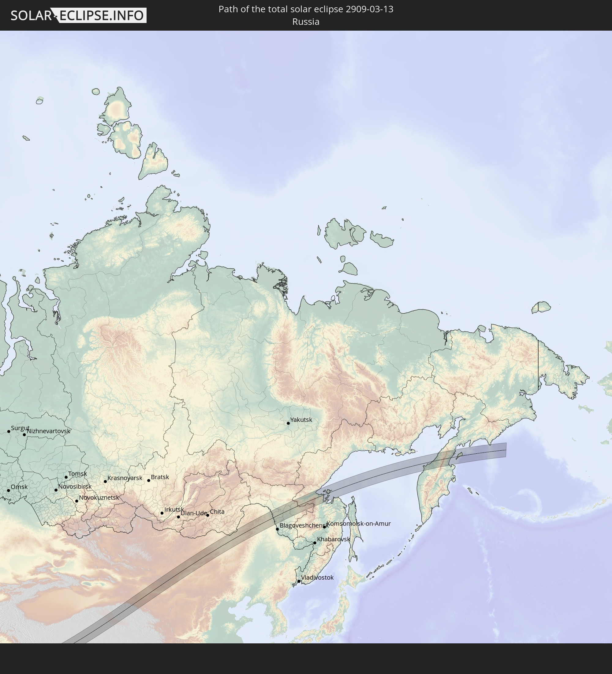 Russia
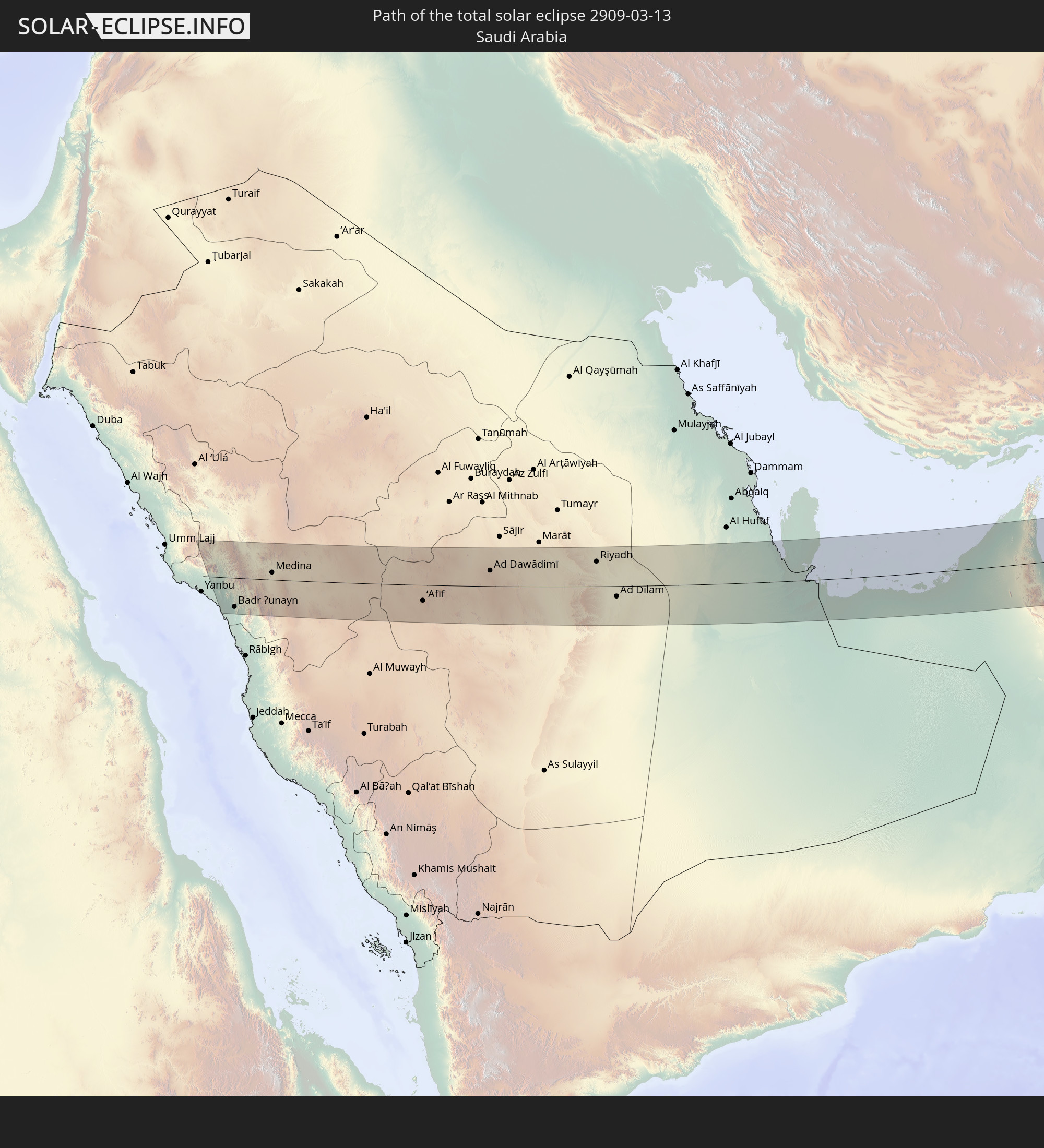 Saudi Arabia
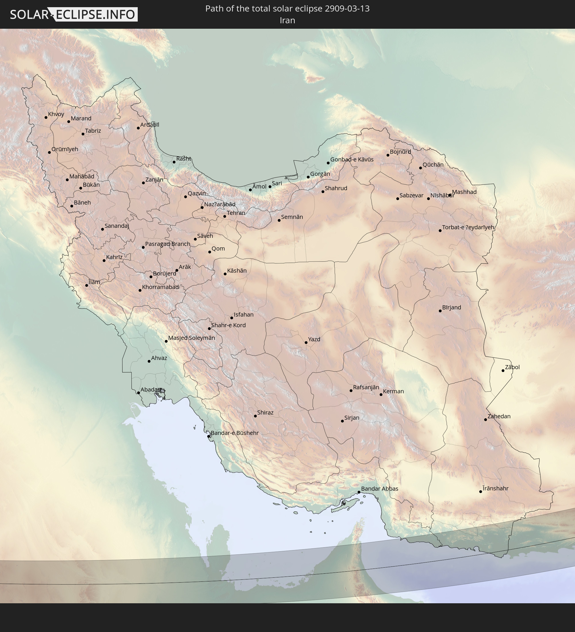 Iran
Iran
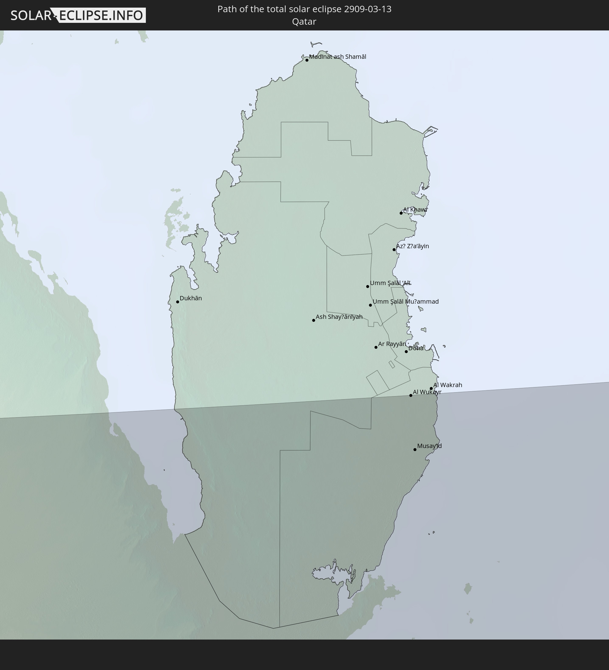 Qatar
Qatar
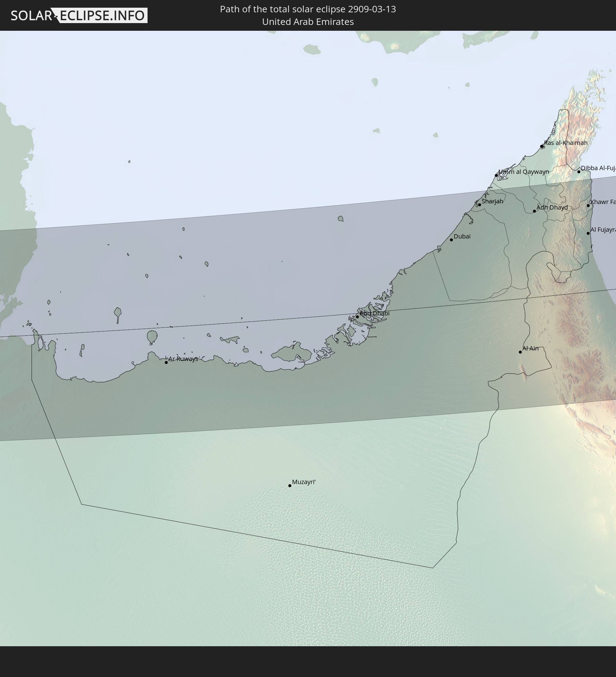 United Arab Emirates
 Oman
Oman
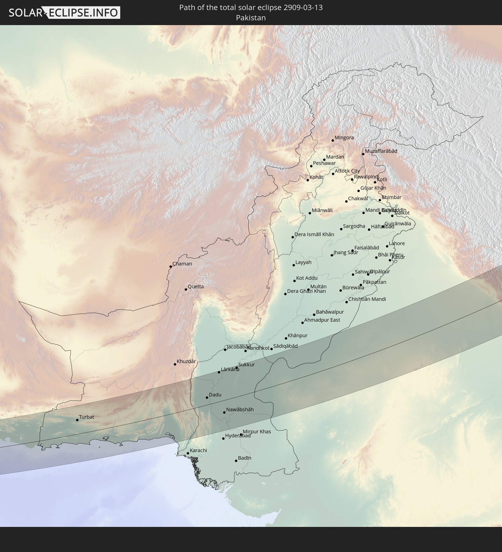 Pakistan
 India
India
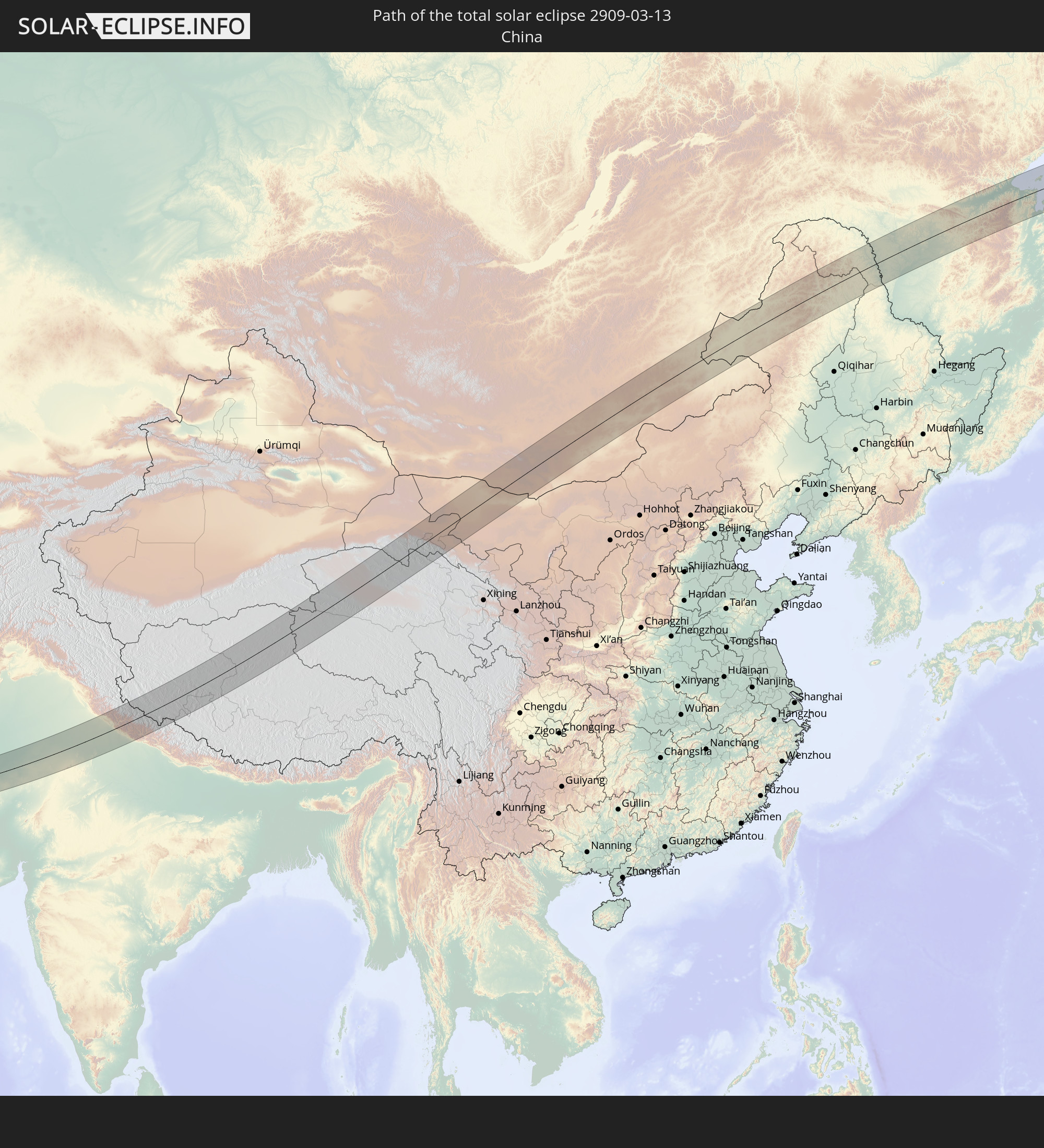 China
China
 Nepal
Nepal
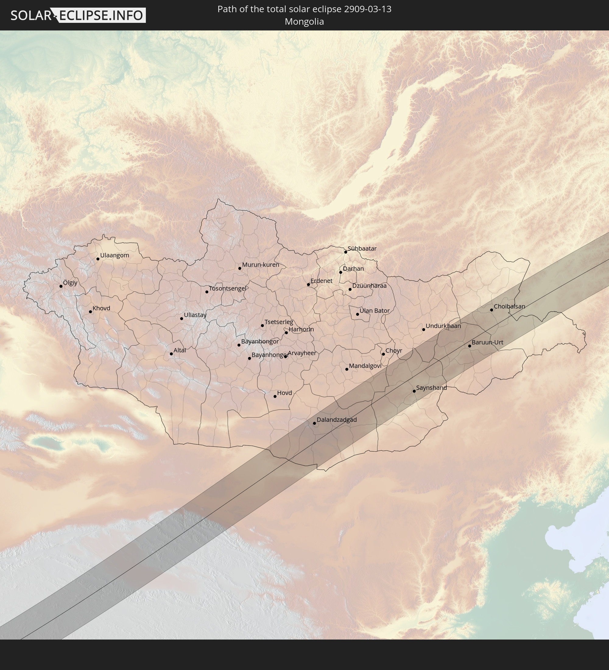 Mongolia
In den folgenden Ländern ist die Sonnenfinsternis partiell zu sehen
 Russia
 United States
 Svalbard and Jan Mayen
 Norway
 Finland
 Ukraine
 Belarus
 Turkey
 Ethiopia
 Kenya
Kenya
 Israel
 Saudi Arabia
 Jordan
 Lebanon
 Syria
Syria
 Eritrea
 Iraq
Iraq
 Georgia
 Somalia
 Djibouti
 Yemen
Yemen
 Armenia
 Iran
Iran
 Azerbaijan
 Seychelles
 Kazakhstan
 Kuwait
 Bahrain
 Qatar
Qatar
 United Arab Emirates
 Oman
Oman
 Turkmenistan
 Uzbekistan
 Afghanistan
 Pakistan
 Tajikistan
 India
India
 Kyrgyzstan
 British Indian Ocean Territory
 Maldives
 China
China
 Sri Lanka
 Nepal
Nepal
 Mongolia
 Bangladesh
 Bhutan
 Myanmar
 Indonesia
 Thailand
 Malaysia
 Laos
Laos
 Vietnam
 Cambodia
 Macau
Macau
 Hong Kong
 Taiwan
 Philippines
 Japan
Japan
 North Korea
 South Korea
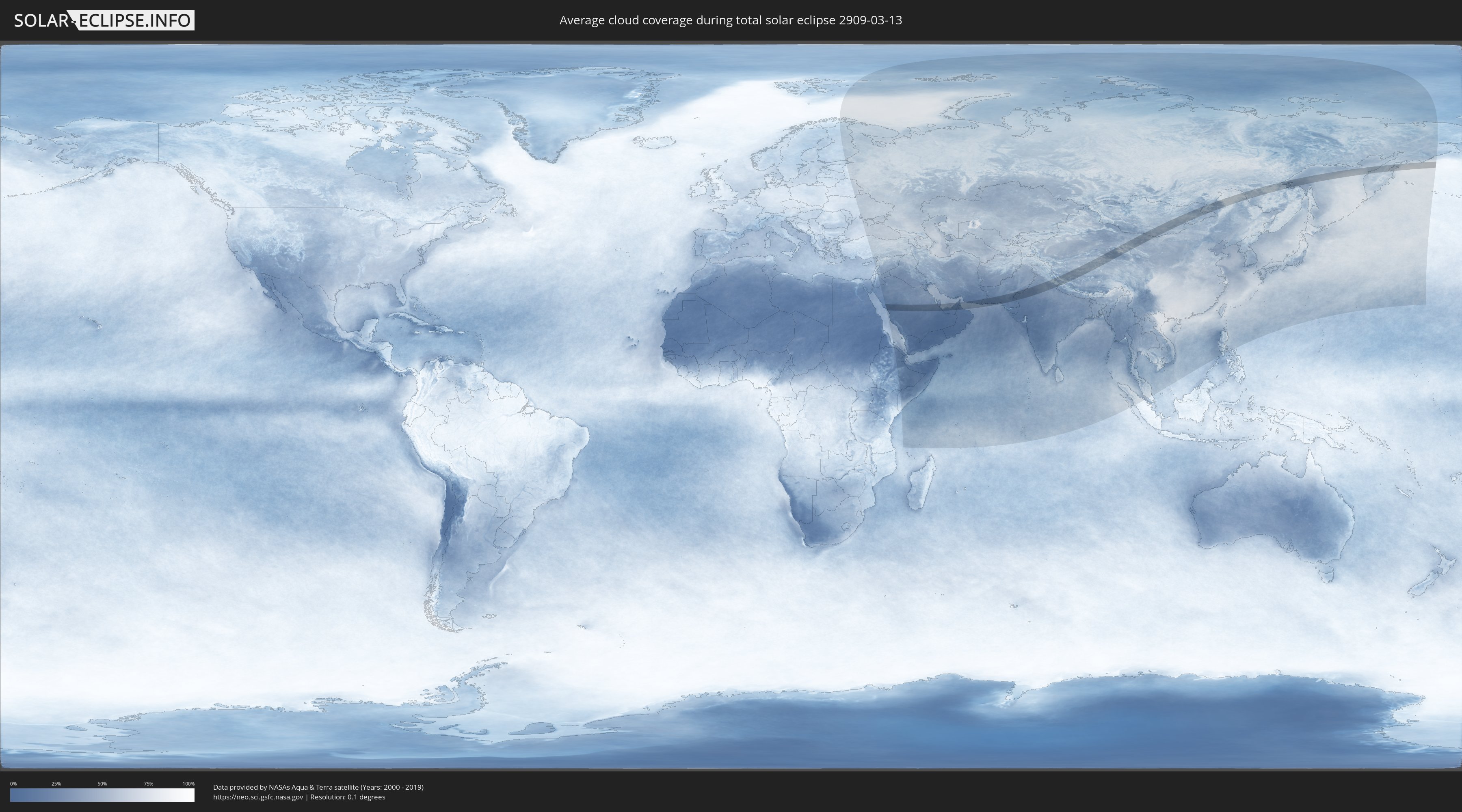
How will be the weather during the total solar eclipse on 03/13/2909?
Where is the best place to see the total solar eclipse of 03/13/2909?
The following maps show the average cloud coverage for the day of the total solar eclipse.
With the help of these maps, it is possible to find the place along the eclipse path, which has the best
chance of a cloudless sky.
Nevertheless, you should consider local circumstances and inform about the weather of your chosen
observation site.
The data is provided by NASAs satellites
AQUA and TERRA.
The cloud maps are averaged over a period of 19 years (2000 - 2019).

Detailed country maps
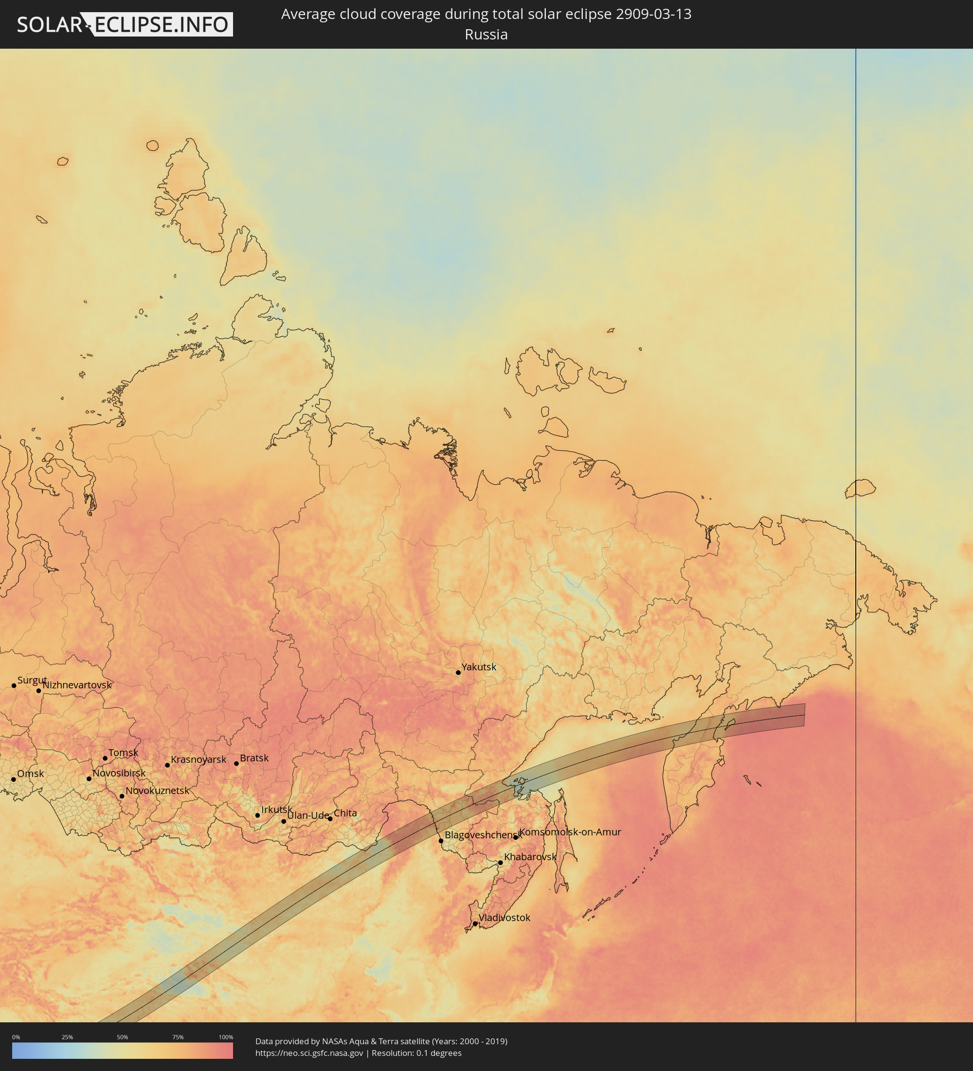 Russia
 Saudi Arabia
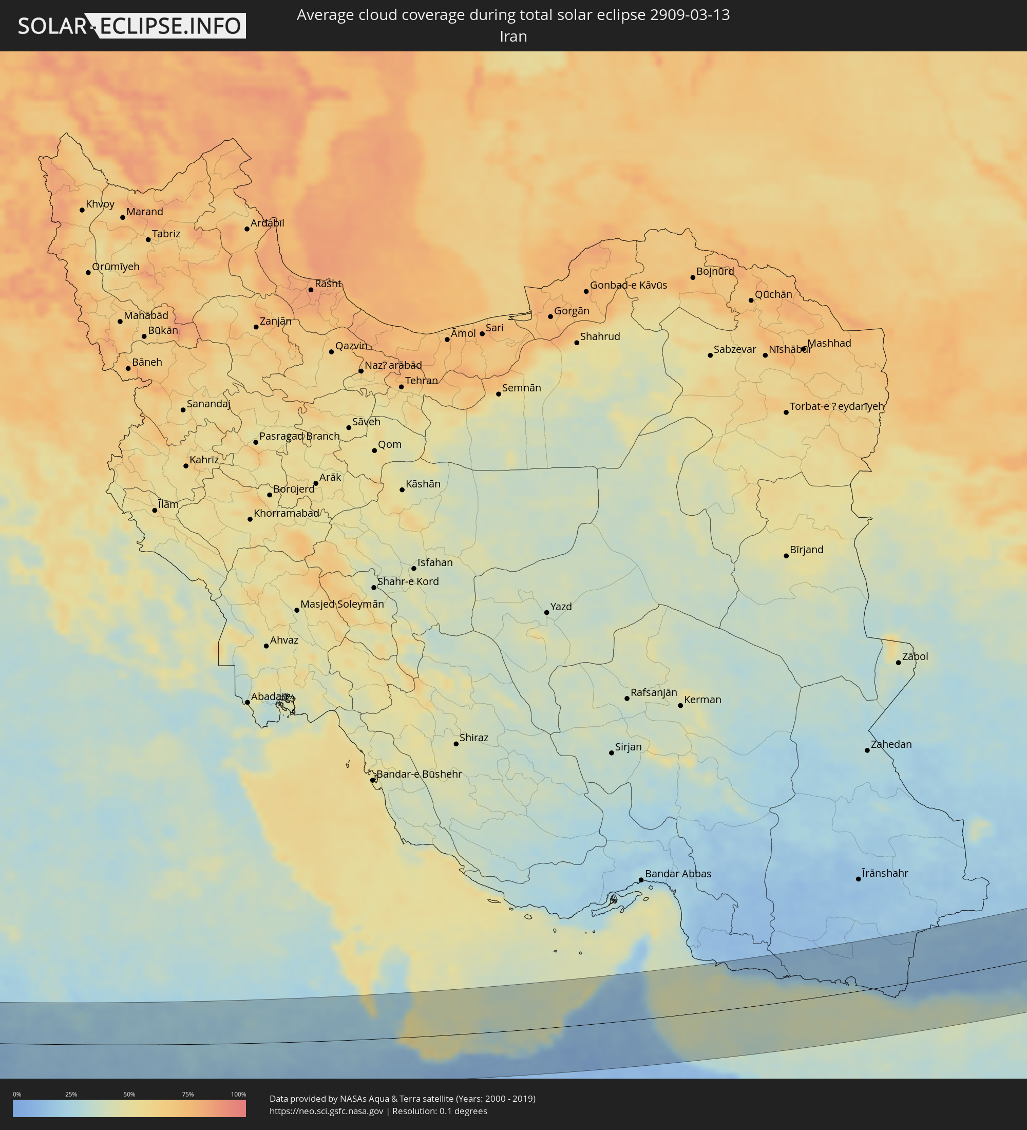 Iran
Iran
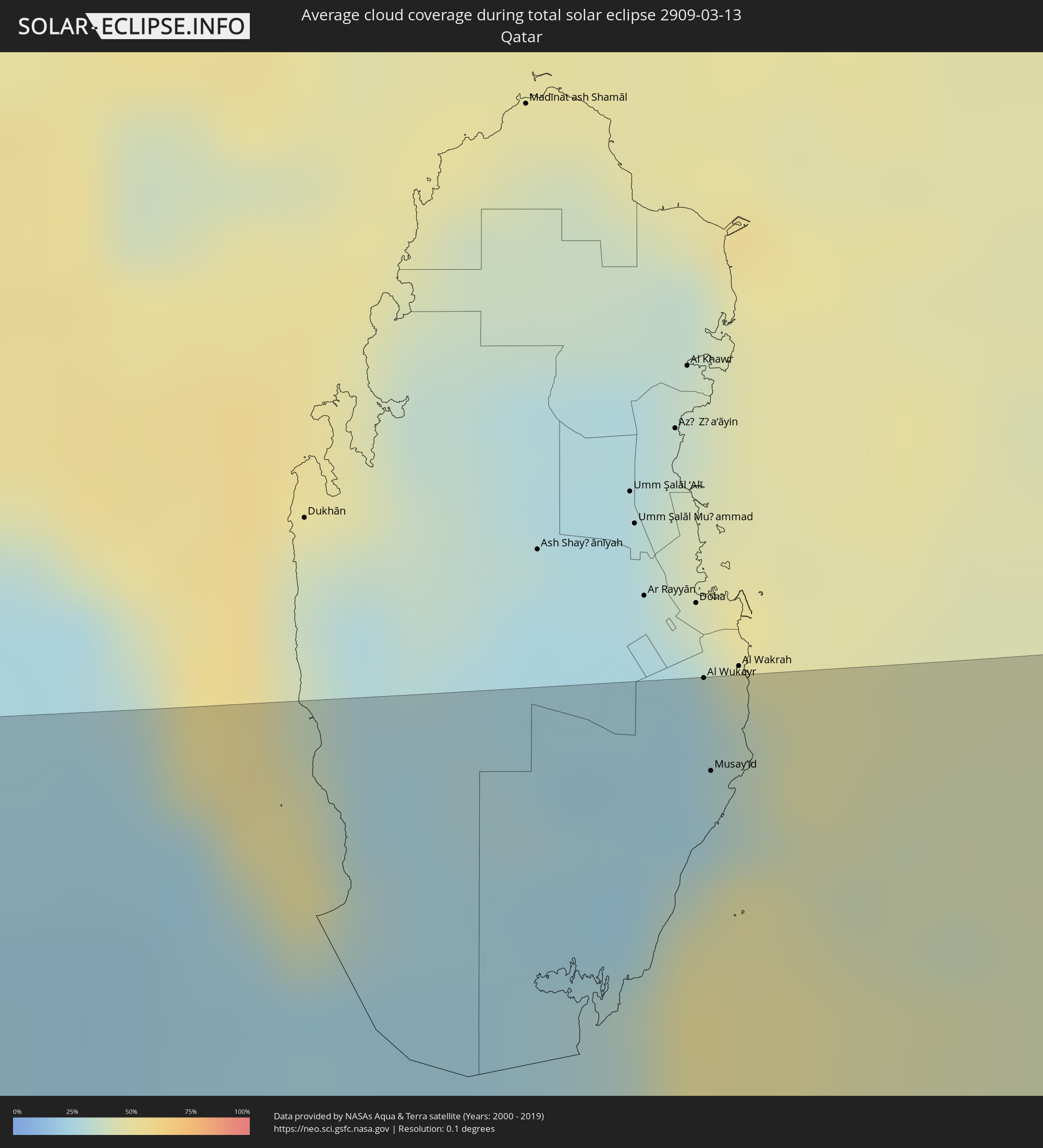 Qatar
Qatar
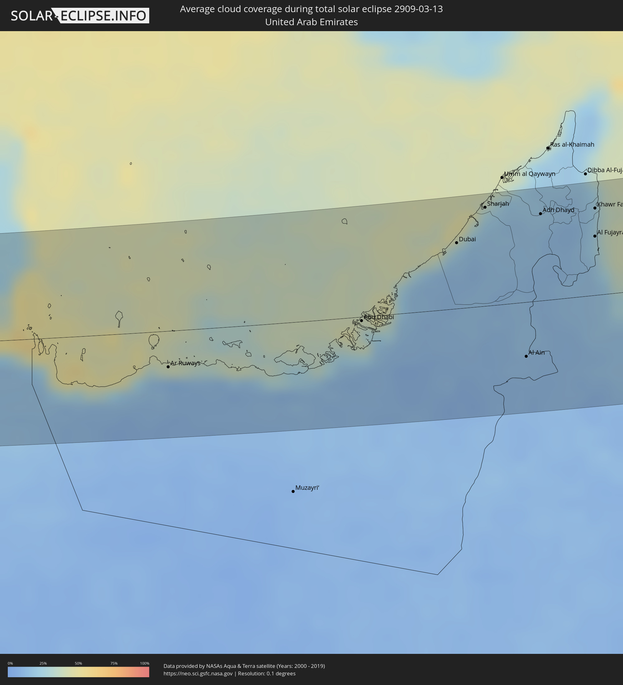 United Arab Emirates
 Oman
Oman
 Pakistan
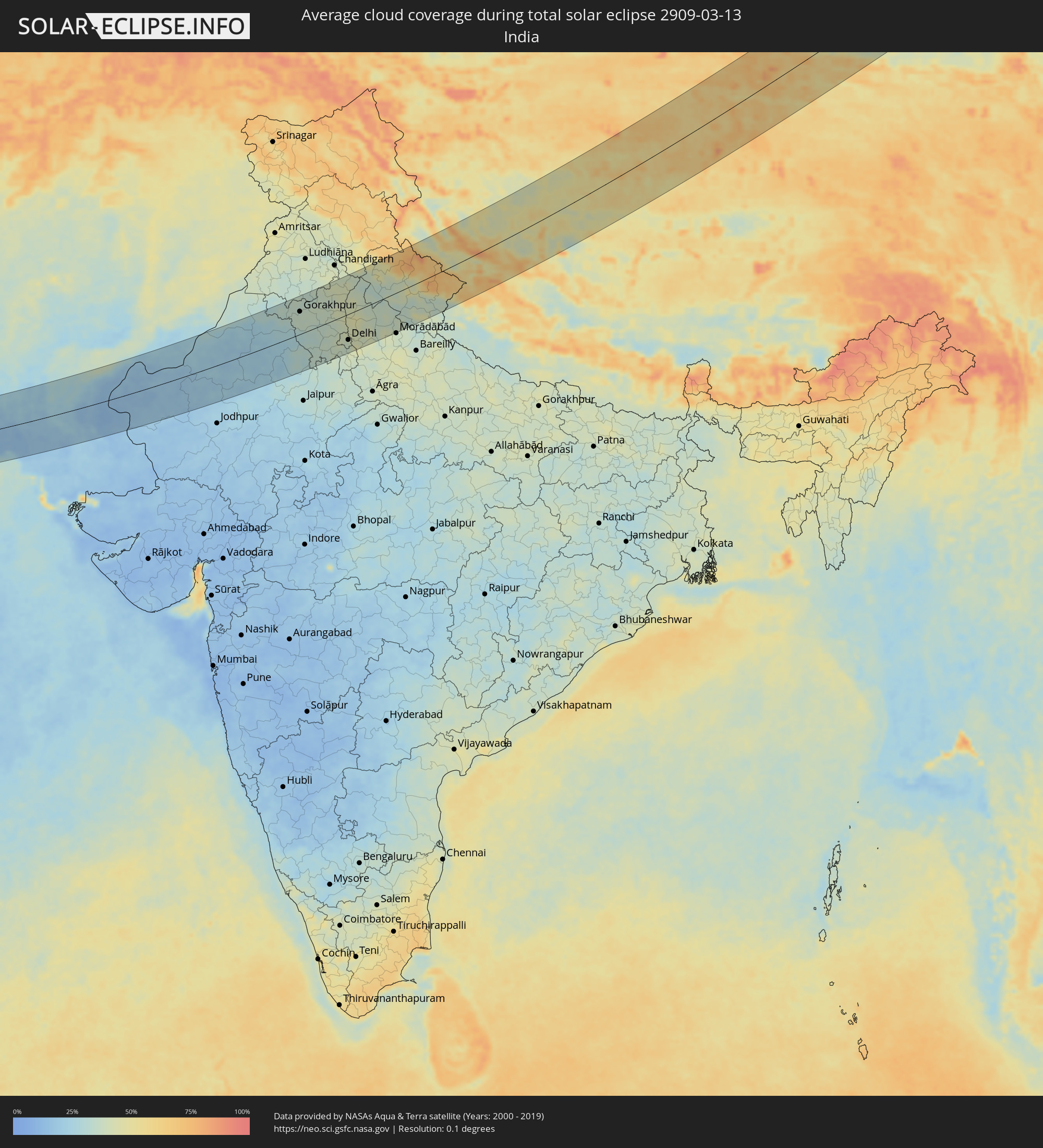 India
India
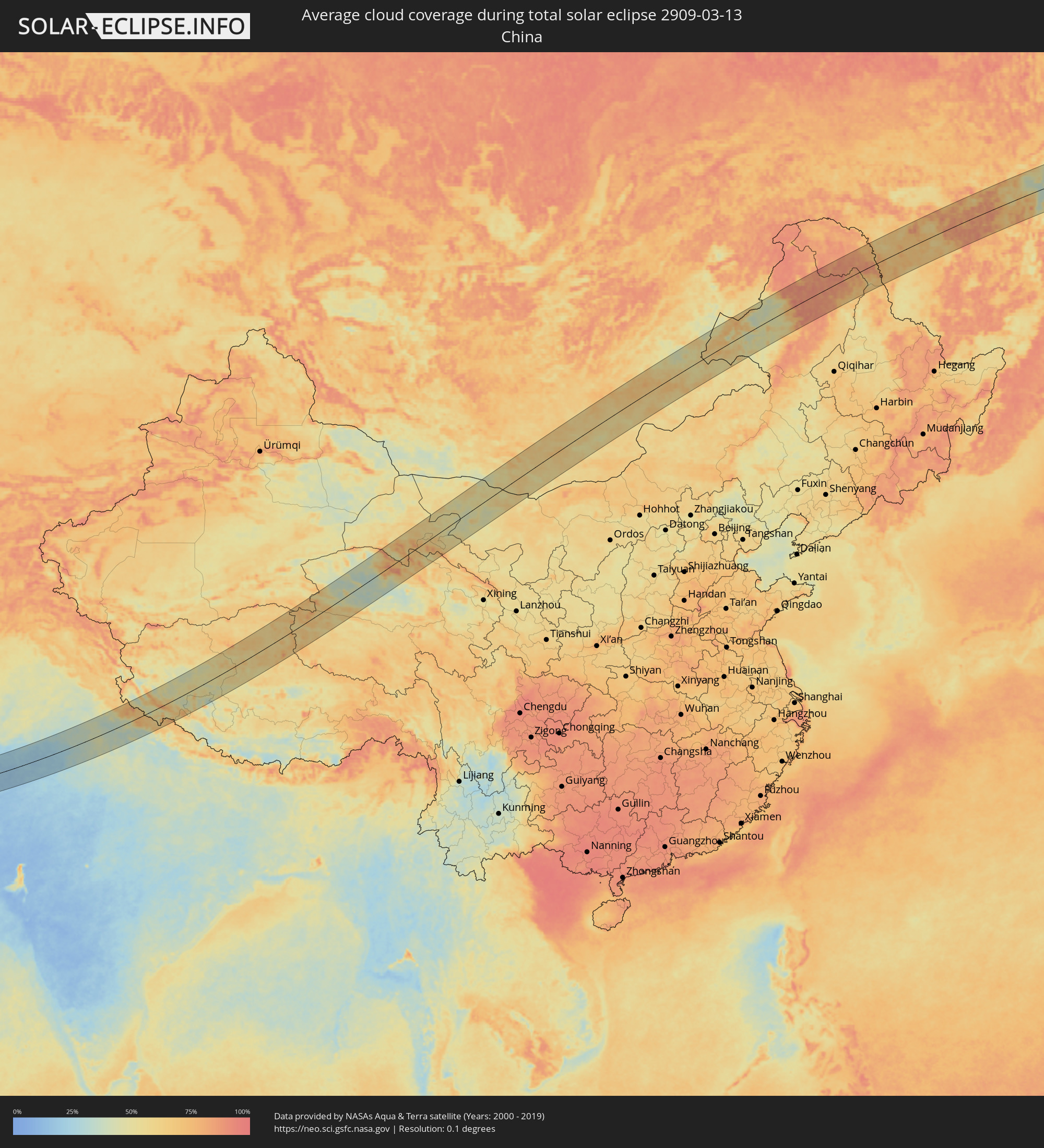 China
China
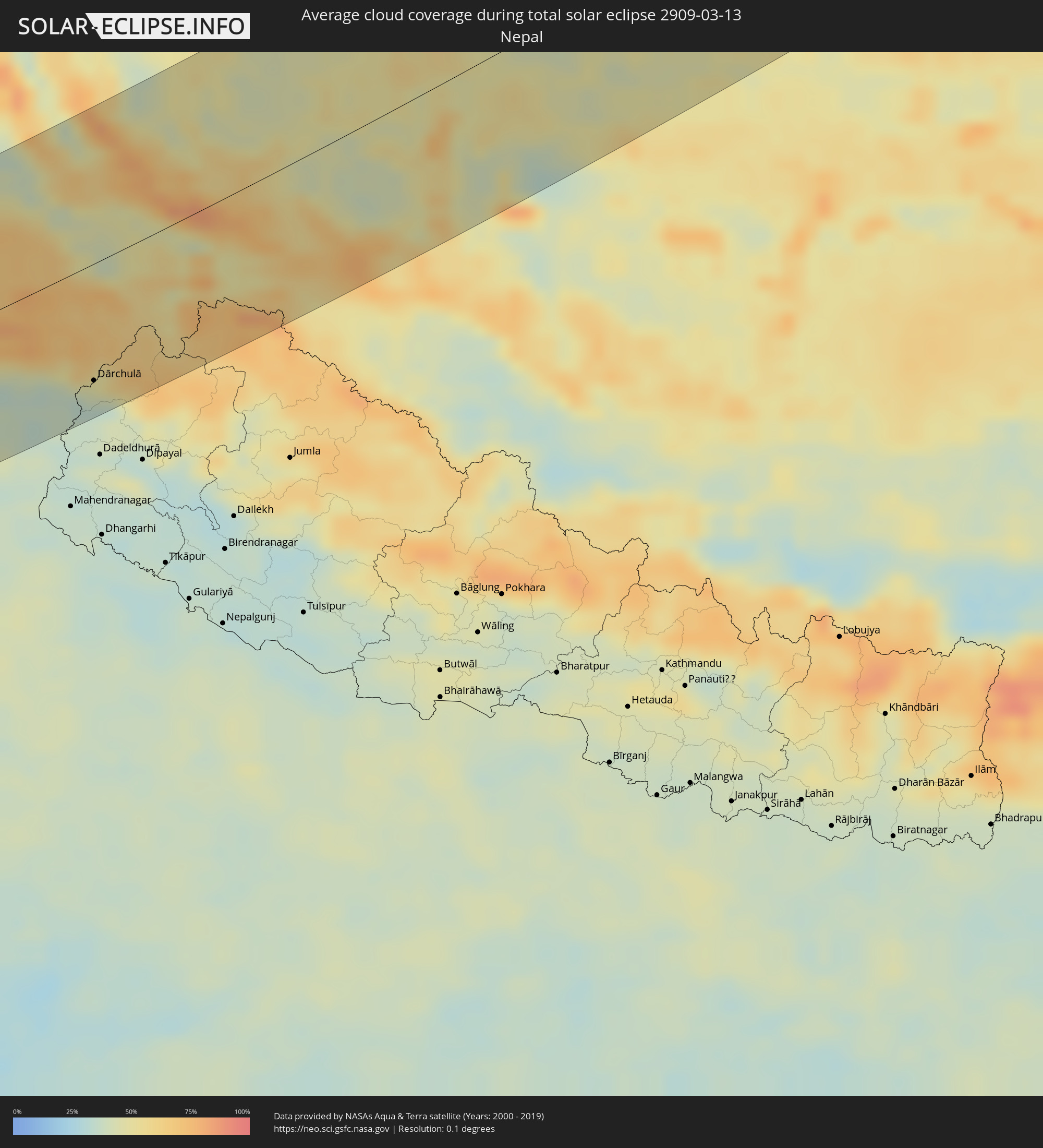 Nepal
Nepal
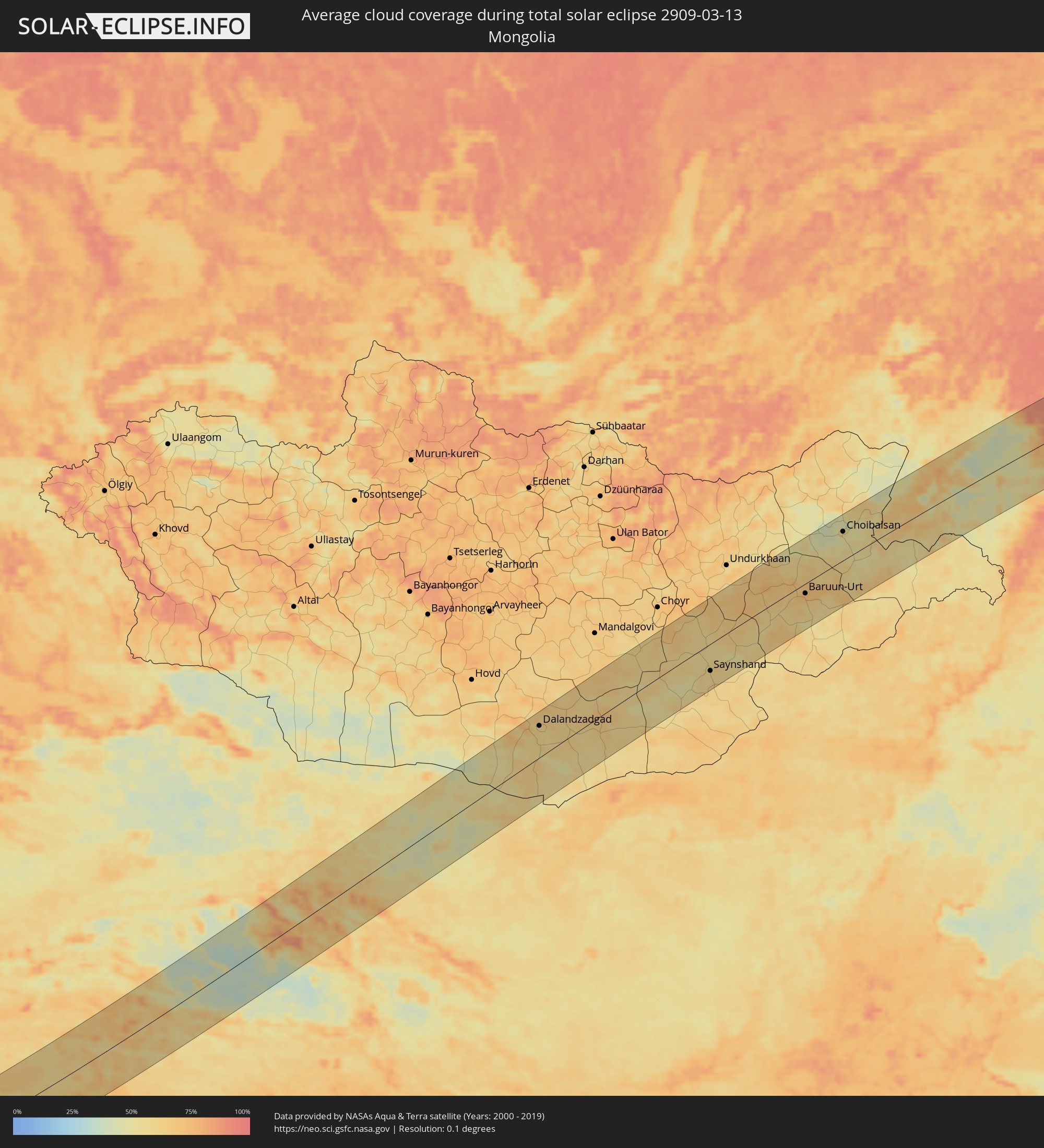 Mongolia
Cities inside the path of the eclipse
The following table shows all locations with a population of more than 5,000 inside the eclipse path. Cities which have more than 100,000 inhabitants are marked bold. A click at the locations opens a detailed map.
| City | Type | Eclipse duration | Local time of max. eclipse | Distance to central line | Ø Cloud coverage |
|
Badr Ḩunayn, Al Madīnah al Munawwarah
|
total | - | 06:40:52 UTC+03:00 | 65 km | 10% |
|
Sulţānah, Al Madīnah al Munawwarah
|
total | - | 06:41:47 UTC+03:00 | 18 km | 12% |
|
Medina, Al Madīnah al Munawwarah
|
total | - | 06:41:46 UTC+03:00 | 16 km | 12% |
|
‘Afīf, Ar Riyāḑ
|
total | - | 06:41:35 UTC+03:00 | 35 km | 13% |
|
Ad Dawādimī, Ar Riyāḑ
|
total | - | 06:42:41 UTC+03:00 | 34 km | 19% |
|
Riyadh, Ar Riyāḑ
|
total | - | 06:43:36 UTC+03:00 | 55 km | 25% |
|
Ad Dilam, Ar Riyāḑ
|
total | - | 06:42:51 UTC+03:00 | 23 km | 25% |
|
Al Wukayr, Al Wakrah
|
total | - | 06:46:14 UTC+03:00 | 92 km | 25% |
|
Musay‘īd, Al Wakrah
|
total | - | 06:46:02 UTC+03:00 | 74 km | 35% |
|
Ar Ruways, Abu Dhabi
|
total | - | 07:45:28 UTC+04:00 | 31 km | 14% |
|
Abu Dhabi, Abu Dhabi
|
total | - | 07:46:53 UTC+04:00 | 3 km | 30% |
|
Dubai, Dubai
|
total | - | 07:48:13 UTC+04:00 | 56 km | 20% |
|
Sharjah, Ash Shāriqah
|
total | - | 07:48:45 UTC+04:00 | 84 km | 20% |
|
Ajman, Ajman
|
total | - | 07:48:52 UTC+04:00 | 92 km | 28% |
|
Al Ain, Abu Dhabi
|
total | - | 07:47:24 UTC+04:00 | 47 km | 12% |
|
Al Buraymī, Al Buraimi
|
total | - | 07:47:30 UTC+04:00 | 40 km | 12% |
|
Adh Dhayd, Ash Shāriqah
|
total | - | 07:49:00 UTC+04:00 | 74 km | 15% |
|
Al Fujayrah, Al Fujayrah
|
total | - | 07:49:04 UTC+04:00 | 50 km | 21% |
|
Khawr Fakkān, Ash Shāriqah
|
total | - | 07:49:22 UTC+04:00 | 74 km | 20% |
|
Shināş, Al Batinah North Governorate
|
total | - | 07:48:38 UTC+04:00 | 7 km | 26% |
|
Al Liwā’, Al Batinah North Governorate
|
total | - | 07:48:25 UTC+04:00 | 17 km | 20% |
|
Sohar, Al Batinah North Governorate
|
total | - | 07:48:15 UTC+04:00 | 39 km | 21% |
|
Şaḩam, Al Batinah North Governorate
|
total | - | 07:48:08 UTC+04:00 | 60 km | 26% |
|
Al Khābūrah, Al Batinah North Governorate
|
total | - | 07:48:02 UTC+04:00 | 83 km | 20% |
|
Chabahar, Sistan and Baluchestan
|
total | - | 07:22:40 UTC+03:30 | 13 km | 38% |
|
Gwadar, Balochistān
|
total | - | 08:53:56 UTC+05:00 | 34 km | 35% |
|
Turbat, Balochistān
|
total | - | 08:55:55 UTC+05:00 | 49 km | 14% |
|
Pasni, Balochistān
|
total | - | 08:55:14 UTC+05:00 | 39 km | 21% |
|
Dadu, Sindh
|
total | - | 09:02:06 UTC+05:00 | 24 km | 24% |
|
Sehwān, Sindh
|
total | - | 09:01:43 UTC+05:00 | 11 km | 24% |
|
Moro, Sindh
|
total | - | 09:02:15 UTC+05:00 | 11 km | 24% |
|
New Bādāh, Sindh
|
total | - | 09:03:20 UTC+05:00 | 83 km | 27% |
|
Lārkāna, Sindh
|
total | - | 09:03:53 UTC+05:00 | 101 km | 29% |
|
Sakrand, Sindh
|
total | - | 09:01:46 UTC+05:00 | 52 km | 20% |
|
Nawābshāh, Sindh
|
total | - | 09:02:06 UTC+05:00 | 44 km | 23% |
|
Hāla, Sindh
|
total | - | 09:01:27 UTC+05:00 | 91 km | 19% |
|
Sethārja Old, Sindh
|
total | - | 09:03:39 UTC+05:00 | 58 km | 25% |
|
Gambat, Sindh
|
total | - | 09:03:56 UTC+05:00 | 71 km | 27% |
|
Pīr jo Goth, Sindh
|
total | - | 09:04:25 UTC+05:00 | 95 km | 29% |
|
Shāhdādpur, Sindh
|
total | - | 09:01:52 UTC+05:00 | 84 km | 21% |
|
Tando Ādam, Sindh
|
total | - | 09:01:40 UTC+05:00 | 103 km | 21% |
|
Khairpur, Sindh
|
total | - | 09:04:30 UTC+05:00 | 84 km | 28% |
|
Sukkur, Sindh
|
total | - | 09:04:54 UTC+05:00 | 100 km | 32% |
|
Sānghar, Sindh
|
total | - | 09:02:27 UTC+05:00 | 80 km | 18% |
|
Bīkaner, Rajasthan
|
total | - | 09:41:15 UTC+05:30 | 1 km | 20% |
|
Sīkar, Rajasthan
|
total | - | 09:43:15 UTC+05:30 | 105 km | 27% |
|
Gorakhpur, Haryana
|
total | - | 09:46:57 UTC+05:30 | 66 km | 36% |
|
Hisar, Haryana
|
total | - | 09:46:34 UTC+05:30 | 33 km | 36% |
|
Rohtak, Haryana
|
total | - | 09:47:28 UTC+05:30 | 25 km | 37% |
|
Pānīpat, Haryana
|
total | - | 09:48:50 UTC+05:30 | 11 km | 40% |
|
Karnāl, Haryana
|
total | - | 09:49:21 UTC+05:30 | 42 km | 40% |
|
Sonīpat, Haryana
|
total | - | 09:48:18 UTC+05:30 | 31 km | 38% |
|
Gurgaon, Haryana
|
total | - | 09:47:28 UTC+05:30 | 86 km | 38% |
|
Delhi, NCT
|
total | - | 09:48:05 UTC+05:30 | 74 km | 37% |
|
Yamunānagar, Haryana
|
total | - | 09:50:30 UTC+05:30 | 75 km | 39% |
|
Farīdābād, Haryana
|
total | - | 09:47:50 UTC+05:30 | 102 km | 40% |
|
Ghāziābād, Uttar Pradesh
|
total | - | 09:48:26 UTC+05:30 | 81 km | 41% |
|
Greater Noida, Uttar Pradesh
|
total | - | 09:48:19 UTC+05:30 | 102 km | 44% |
|
Sahāranpur, Uttar Pradesh
|
total | - | 09:50:39 UTC+05:30 | 48 km | 38% |
|
Muzaffarnagar, Uttar Pradesh
|
total | - | 09:50:07 UTC+05:30 | 9 km | 41% |
|
Meerut, Uttar Pradesh
|
total | - | 09:49:21 UTC+05:30 | 59 km | 40% |
|
Hāpur, Uttar Pradesh
|
total | - | 09:49:04 UTC+05:30 | 87 km | 40% |
|
Dehra Dūn, Uttarakhand
|
total | - | 09:52:00 UTC+05:30 | 65 km | 36% |
|
Dārchulā, Western Region
|
total | - | 09:55:19 UTC+05:30 | 85 km | 40% |
|
Burang, Tibet Autonomous Region
|
total | - | 12:27:07 UTC+08:00 | 67 km | 52% |
|
Laojunmiao, Gansu
|
total | - | 13:10:12 UTC+08:00 | 46 km | 58% |
|
Jiayuguan, Gansu
|
total | - | 13:11:11 UTC+08:00 | 17 km | 61% |
|
Jiuquan, Gansu
|
total | - | 13:11:33 UTC+08:00 | 1 km | 63% |
|
Dalandzadgad, Ömnögovĭ
|
total | - | 13:25:07 UTC+08:00 | 71 km | 57% |
|
Saynshand, East Gobi Aymag
|
total | - | 13:35:07 UTC+08:00 | 59 km | 59% |
|
Baruun-Urt, Sühbaatar
|
total | - | 13:40:30 UTC+08:00 | 21 km | 70% |
|
Choibalsan, East Aimak
|
total | - | 13:42:33 UTC+08:00 | 61 km | 57% |
|
Manzhouli, Inner Mongolia
|
total | - | 13:46:33 UTC+08:00 | 97 km | 67% |
|
Jalai Nur, Inner Mongolia
|
total | - | 13:46:54 UTC+08:00 | 73 km | 77% |
|
Hailar, Inner Mongolia
|
total | - | 13:49:30 UTC+08:00 | 24 km | 63% |
|
Yakeshi, Inner Mongolia
|
total | - | 13:50:48 UTC+08:00 | 52 km | 61% |
|
Genhe, Inner Mongolia
|
total | - | 13:51:31 UTC+08:00 | 67 km | 86% |
|
Oroqen Zizhiqi, Inner Mongolia
|
total | - | 13:54:09 UTC+08:00 | 28 km | 79% |
|
Jagdaqi, Inner Mongolia
|
total | - | 13:54:40 UTC+08:00 | 56 km | 77% |
|
Shimanovsk, Amur
|
total | - | 14:58:01 UTC+09:00 | 10 km | 71% |
|
Svobodnyy, Amur
|
total | - | 14:58:46 UTC+09:00 | 87 km | 69% |