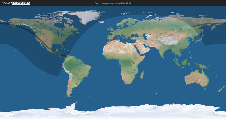
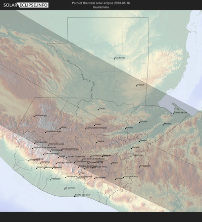
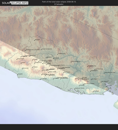
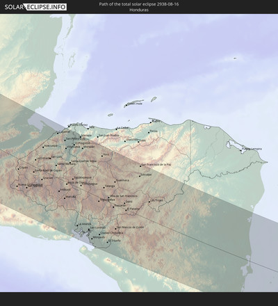
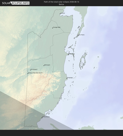
Total solar eclipse of 08/16/2938
| Day of week: | Saturday |
| Maximum duration of eclipse: | 04m42s |
| Maximum width of eclipse path: | 261 km |
| Saros cycle: | 160 |
| Coverage: | 100% |
| Magnitude: | 1.066 |
| Gamma: | 0.5697 |
Wo kann man die Sonnenfinsternis vom 08/16/2938 sehen?
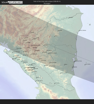
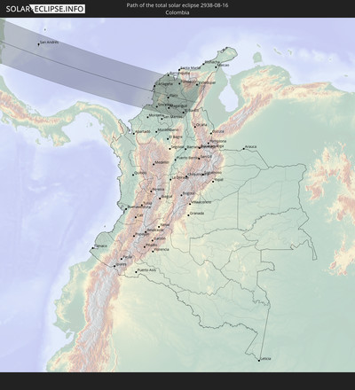
Die Sonnenfinsternis am 08/16/2938 kann man in 30 Ländern als partielle Sonnenfinsternis beobachten.
Der Finsternispfad verläuft durch 10 Länder. Nur in diesen Ländern ist sie als total Sonnenfinsternis zu sehen.
In den folgenden Ländern ist die Sonnenfinsternis total zu sehen
In den folgenden Ländern ist die Sonnenfinsternis partiell zu sehen
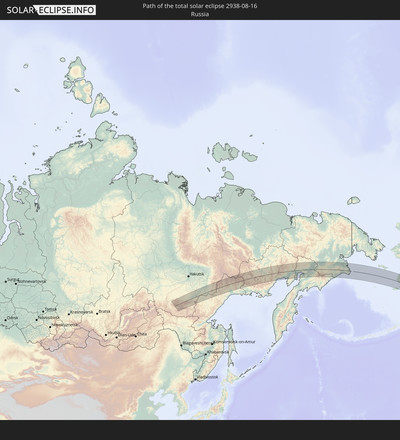
 Russia
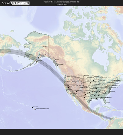
 United States
 United States Minor Outlying Islands
 Canada
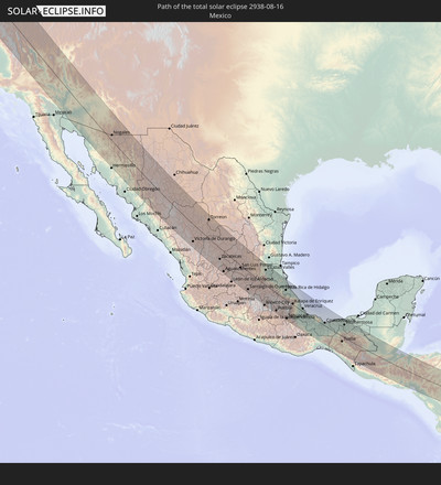
 Mexico
 Greenland
 Guatemala
 Ecuador
 El Salvador
 Honduras
 Belize
 Nicaragua
 Costa Rica
 Cuba
Cuba
 Panama
 Colombia
 Cayman Islands
 Peru
Peru
 The Bahamas
 Jamaica
 Haiti
Haiti
 Venezuela
 Turks and Caicos Islands
 Dominican Republic
 Bermuda
 Saint Pierre and Miquelon
 Iceland
 Svalbard and Jan Mayen
 China
China
 Japan
Japan
How will be the weather during the total solar eclipse on 08/16/2938?
Where is the best place to see the total solar eclipse of 08/16/2938?
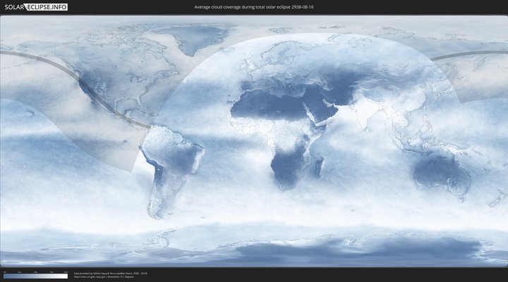
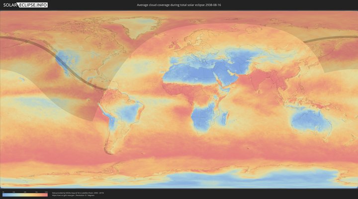
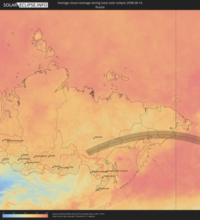
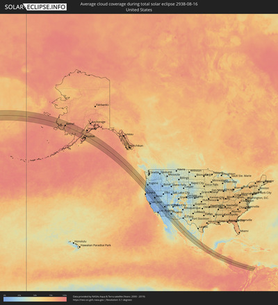
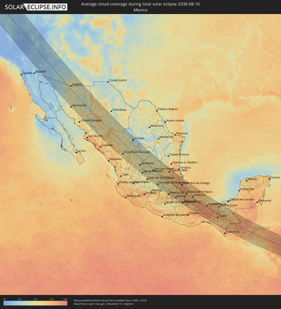
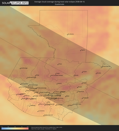
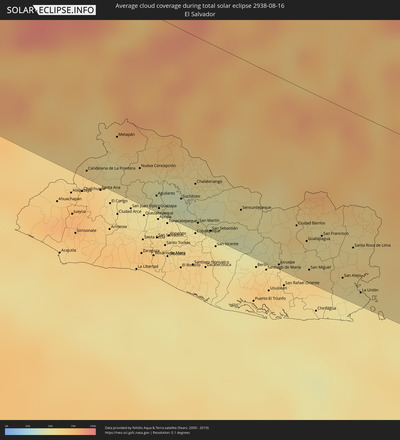
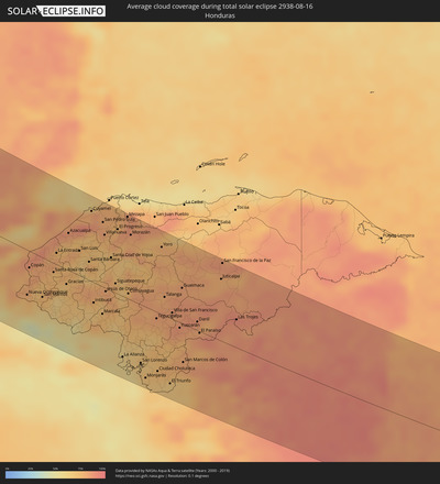
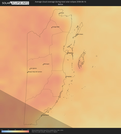
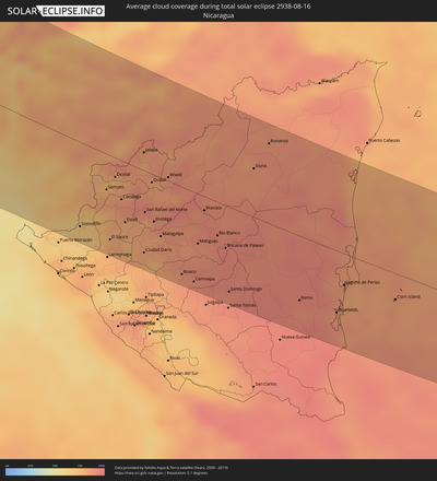
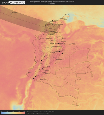
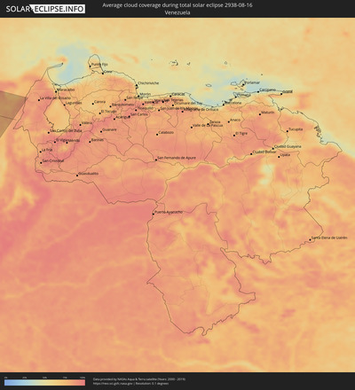
The following maps show the average cloud coverage for the day of the total solar eclipse.
With the help of these maps, it is possible to find the place along the eclipse path, which has the best
chance of a cloudless sky.
Nevertheless, you should consider local circumstances and inform about the weather of your chosen
observation site.
The data is provided by NASAs satellites
AQUA and TERRA.
The cloud maps are averaged over a period of 19 years (2000 - 2019).
Detailed country maps
Cities inside the path of the eclipse
The following table shows all locations with a population of more than 5,000 inside the eclipse path. Cities which have more than 100,000 inhabitants are marked bold. A click at the locations opens a detailed map.
| City | Type | Eclipse duration | Local time of max. eclipse | Distance to central line | Ø Cloud coverage |
 Eugene, Oregon
|
total | - | 13:44:40 UTC-08:00 | 109 km | 23% |
 Medford, Oregon
|
total | - | 13:47:54 UTC-08:00 | 1 km | 9% |
 Redding, California
|
total | - | 13:51:35 UTC-08:00 | 95 km | 4% |
 Chico, California
|
total | - | 13:53:49 UTC-08:00 | 121 km | 5% |
 Reno, Nevada
|
total | - | 13:56:37 UTC-08:00 | 2 km | 14% |
 Carson City, Nevada
|
total | - | 13:57:21 UTC-08:00 | 25 km | 15% |
 Pahrump, Nevada
|
total | - | 14:07:14 UTC-08:00 | 23 km | 9% |
 Enterprise, Nevada
|
total | - | 14:08:24 UTC-08:00 | 62 km | 19% |
 Las Vegas, Nevada
|
total | - | 14:08:13 UTC-08:00 | 80 km | 17% |
 Henderson, Nevada
|
total | - | 14:08:39 UTC-08:00 | 81 km | 21% |
 Yuma, Arizona
|
total | - | 14:15:25 UTC-08:00 | 131 km | 27% |
 Bullhead City, Arizona
|
total | - | 15:10:48 UTC-07:00 | 47 km | 14% |
 Lake Havasu City, Arizona
|
total | - | 15:12:20 UTC-07:00 | 17 km | 13% |
 Buckeye, Arizona
|
total | - | 15:16:16 UTC-07:00 | 60 km | 32% |
 Avondale, Arizona
|
total | - | 15:16:23 UTC-07:00 | 81 km | 28% |
 Peoria, Arizona
|
total | - | 15:16:13 UTC-07:00 | 100 km | 24% |
 Phoenix, Arizona
|
total | - | 15:16:38 UTC-07:00 | 102 km | 24% |
 Maricopa, Arizona
|
total | - | 15:17:24 UTC-07:00 | 76 km | 39% |
 Mesa, Arizona
|
total | - | 15:16:56 UTC-07:00 | 116 km | 27% |
 Casa Grande, Arizona
|
total | - | 15:18:02 UTC-07:00 | 83 km | 30% |
 Apache Junction, Arizona
|
total | - | 15:17:12 UTC-07:00 | 137 km | 22% |
 San Tan Valley, Arizona
|
total | - | 15:17:39 UTC-07:00 | 122 km | 33% |
 Oro Valley, Arizona
|
total | - | 15:19:44 UTC-07:00 | 104 km | 30% |
 Nogales, Sonora
|
total | - | 15:21:51 UTC-07:00 | 27 km | 47% |
 Tucson, Arizona
|
total | - | 15:20:06 UTC-07:00 | 95 km | 30% |
 Sierra Vista, Arizona
|
total | - | 15:21:58 UTC-07:00 | 90 km | 48% |
 Victoria de Durango, Durango
|
total | - | 16:40:44 UTC-06:00 | 100 km | 42% |
 Torreon, Coahuila
|
total | - | 16:38:51 UTC-06:00 | 109 km | 33% |
 Aguascalientes, Aguascalientes
|
total | - | 16:46:06 UTC-06:00 | 122 km | 48% |
 San Luis Potosí, San Luis Potosí
|
total | - | 16:46:25 UTC-06:00 | 14 km | 53% |
 Santiago de Querétaro, Querétaro
|
total | - | 16:49:24 UTC-06:00 | 112 km | 43% |
 Nicolás Romero, México
|
total | - | 16:51:34 UTC-06:00 | 129 km | 55% |
 Tlalnepantla, México
|
total | - | 16:51:46 UTC-06:00 | 131 km | 58% |
 Ecatepec, México
|
total | - | 16:51:43 UTC-06:00 | 116 km | 55% |
 Ciudad Nezahualcoyotl, México
|
total | - | 16:52:06 UTC-06:00 | 132 km | 57% |
 Ixtapaluca, México
|
total | - | 16:52:18 UTC-06:00 | 132 km | 65% |
 Pachuca de Soto, Hidalgo
|
total | - | 16:51:03 UTC-06:00 | 50 km | 51% |
 Puebla, Puebla
|
total | - | 16:53:04 UTC-06:00 | 116 km | 58% |
 Poza Rica de Hidalgo, Veracruz
|
total | - | 16:50:59 UTC-06:00 | 65 km | 85% |
 Tuxpan de Rodríguez Cano, Veracruz
|
total | - | 16:50:19 UTC-06:00 | 107 km | 68% |
 Tehuacán, Puebla
|
total | - | 16:54:22 UTC-06:00 | 120 km | 63% |
 Orizaba, Veracruz
|
total | - | 16:53:52 UTC-06:00 | 66 km | 75% |
 Córdoba, Veracruz
|
total | - | 16:53:54 UTC-06:00 | 53 km | 75% |
 Xalapa de Enríquez, Veracruz
|
total | - | 16:52:52 UTC-06:00 | 7 km | 75% |
 Veracruz, Veracruz
|
total | - | 16:53:45 UTC-06:00 | 20 km | 74% |
 Minatitlan, Veracruz
|
total | - | 16:56:13 UTC-06:00 | 2 km | 79% |
 Coatzacoalcos, Veracruz
|
total | - | 16:56:03 UTC-06:00 | 21 km | 78% |
 Tuxtla, Chiapas
|
total | - | 16:58:35 UTC-06:00 | 37 km | 79% |
 Villahermosa, Tabasco
|
total | - | 16:56:47 UTC-06:00 | 90 km | 63% |
 San Cristóbal de las Casas, Chiapas
|
total | - | 16:58:46 UTC-06:00 | 15 km | 78% |
 Jacaltenango, Huehuetenango
|
total | - | 17:00:34 UTC-06:00 | 70 km | 82% |
 Comitancillo, San Marcos
|
total | - | 17:01:25 UTC-06:00 | 127 km | 72% |
 Huehuetenango, Huehuetenango
|
total | - | 17:01:08 UTC-06:00 | 91 km | 58% |
 Momostenango, Totonicapán
|
total | - | 17:01:32 UTC-06:00 | 115 km | 72% |
 Totonicapán, Totonicapán
|
total | - | 17:01:44 UTC-06:00 | 125 km | 72% |
 Nebaj, Quiché
|
total | - | 17:01:05 UTC-06:00 | 66 km | 76% |
 Chichicastenango, Quiché
|
total | - | 17:01:46 UTC-06:00 | 111 km | 76% |
 Tecpán Guatemala, Chimaltenango
|
total | - | 17:02:02 UTC-06:00 | 121 km | 73% |
 Chimaltenango, Chimaltenango
|
total | - | 17:02:13 UTC-06:00 | 123 km | 74% |
 San Juan Sacatepéquez, Guatemala
|
total | - | 17:02:10 UTC-06:00 | 109 km | 76% |
 San Cristóbal Verapaz, Alta Verapaz
|
total | - | 17:01:14 UTC-06:00 | 38 km | 83% |
 Petapa, Guatemala
|
total | - | 17:02:30 UTC-06:00 | 125 km | 75% |
 Guatemala City, Guatemala
|
total | - | 17:02:18 UTC-06:00 | 110 km | 73% |
 San Pedro Ayampuc, Guatemala
|
total | - | 17:02:07 UTC-06:00 | 92 km | 74% |
 San José Pinula, Guatemala
|
total | - | 17:02:28 UTC-06:00 | 114 km | 73% |
 Cobán, Alta Verapaz
|
total | - | 17:01:10 UTC-06:00 | 21 km | 89% |
 Salamá, Baja Verapaz
|
total | - | 17:01:42 UTC-06:00 | 55 km | 80% |
 Jalapa, Jalapa
|
total | - | 17:02:25 UTC-06:00 | 85 km | 72% |
 Jutiapa, Jutiapa
|
total | - | 17:02:55 UTC-06:00 | 114 km | 61% |
 Panzós, Alta Verapaz
|
total | - | 17:01:25 UTC-06:00 | 7 km | 71% |
 Candelaria de La Frontera, Santa Ana
|
total | - | 17:03:12 UTC-06:00 | 120 km | 67% |
 Chiquimula, Chiquimula
|
total | - | 17:02:17 UTC-06:00 | 47 km | 78% |
 Zacapa, Zacapa
|
total | - | 17:02:02 UTC-06:00 | 29 km | 74% |
 Metapán, Santa Ana
|
total | - | 17:02:56 UTC-06:00 | 89 km | 53% |
 Gualán, Zacapa
|
total | - | 17:01:52 UTC-06:00 | 6 km | 69% |
 Esquipulas, Chiquimula
|
total | - | 17:02:38 UTC-06:00 | 61 km | 80% |
 Nueva Concepción, Chalatenango
|
total | - | 17:03:14 UTC-06:00 | 102 km | 53% |
 Aguilares, San Salvador
|
total | - | 17:03:30 UTC-06:00 | 114 km | 51% |
 Guazapa, San Salvador
|
total | - | 17:03:37 UTC-06:00 | 121 km | 54% |
 Suchitoto, Cuscatlán
|
total | - | 17:03:33 UTC-06:00 | 108 km | 50% |
 Chalatenango, Chalatenango
|
total | - | 17:03:26 UTC-06:00 | 94 km | 46% |
 San Martín, Cuscatlán
|
total | - | 17:03:47 UTC-06:00 | 118 km | 56% |
 San Sebastián, San Vicente
|
total | - | 17:03:52 UTC-06:00 | 120 km | 57% |
 Punta Gorda, Toledo
|
total | - | 17:00:35 UTC-06:00 | 118 km | 62% |
 Apastepeque, San Vicente
|
total | - | 17:03:58 UTC-06:00 | 124 km | 57% |
 Santa Rosa de Copán, Copán
|
total | - | 17:02:27 UTC-06:00 | 14 km | 76% |
 La Entrada, Copán
|
total | - | 17:02:04 UTC-06:00 | 17 km | 80% |
 Sensuntepeque, Cabañas
|
total | - | 17:03:43 UTC-06:00 | 97 km | 51% |
 Puerto Barrios, Izabal
|
total | - | 17:01:09 UTC-06:00 | 91 km | 80% |
 Jucuapa, Usulután
|
total | - | 17:04:13 UTC-06:00 | 120 km | 65% |
 Nueva Guadalupe, San Miguel
|
total | - | 17:04:12 UTC-06:00 | 117 km | 65% |
 Chinameca, San Miguel
|
total | - | 17:04:15 UTC-06:00 | 121 km | 65% |
 Ciudad Barrios, San Miguel
|
total | - | 17:03:54 UTC-06:00 | 90 km | 63% |
 Santa Bárbara, Santa Bárbara
|
total | - | 17:02:20 UTC-06:00 | 27 km | 73% |
 Guatajiagua, Morazán
|
total | - | 17:04:03 UTC-06:00 | 97 km | 55% |
 San Miguel, San Miguel
|
total | - | 17:04:17 UTC-06:00 | 115 km | 64% |
 Intibucá, Intibucá
|
total | - | 17:03:10 UTC-06:00 | 30 km | 66% |
 Cofradía, Cortés
|
total | - | 17:01:41 UTC-06:00 | 80 km | 70% |
 San Francisco, Morazán
|
total | - | 17:04:01 UTC-06:00 | 89 km | 56% |
 Marcala, La Paz
|
total | - | 17:03:25 UTC-06:00 | 41 km | 74% |
 San Pedro Sula, Cortés
|
total | - | 17:01:34 UTC-06:00 | 96 km | 83% |
 Villanueva, Cortés
|
total | - | 17:01:49 UTC-06:00 | 78 km | 73% |
 San Alejo, La Unión
|
total | - | 17:04:23 UTC-06:00 | 110 km | 53% |
 Santa Cruz de Yojoa, Cortés
|
total | - | 17:02:18 UTC-06:00 | 49 km | 72% |
 Santa Rosa de Lima, La Unión
|
total | - | 17:04:08 UTC-06:00 | 87 km | 59% |
 La Unión, La Unión
|
total | - | 17:04:32 UTC-06:00 | 114 km | 54% |
 Siguatepeque, Comayagua
|
total | - | 17:02:50 UTC-06:00 | 14 km | 76% |
 El Progreso, Yoro
|
total | - | 17:01:44 UTC-06:00 | 96 km | 80% |
 La Paz, La Paz
|
total | - | 17:03:14 UTC-06:00 | 7 km | 71% |
 Comayagua, Comayagua
|
total | - | 17:03:04 UTC-06:00 | 8 km | 77% |
 Morazán, Yoro
|
total | - | 17:01:53 UTC-06:00 | 97 km | 79% |
 San Lorenzo, Valle
|
total | - | 17:04:28 UTC-06:00 | 87 km | 68% |
 Santa Rita, Yoro
|
total | - | 17:02:08 UTC-06:00 | 96 km | 71% |
 Tegucigalpa, Francisco Morazán
|
total | - | 17:03:37 UTC-06:00 | 10 km | 79% |
 Ciudad Choluteca, Choluteca
|
total | - | 17:04:39 UTC-06:00 | 88 km | 71% |
 Yoro, Yoro
|
total | - | 17:02:12 UTC-06:00 | 100 km | 78% |
 Talanga, Francisco Morazán
|
total | - | 17:03:12 UTC-06:00 | 28 km | 81% |
 Somotillo, Chinandega
|
total | - | 17:05:01 UTC-06:00 | 102 km | 65% |
 Guaimaca, Francisco Morazán
|
total | - | 17:03:03 UTC-06:00 | 53 km | 84% |
 San Marcos de Colón, Choluteca
|
total | - | 17:04:31 UTC-06:00 | 58 km | 78% |
 Danlí, El Paraíso
|
total | - | 17:03:45 UTC-06:00 | 13 km | 81% |
 Somoto, Madriz
|
total | - | 17:04:29 UTC-06:00 | 43 km | 81% |
 El Paraíso, El Paraíso
|
total | - | 17:03:58 UTC-06:00 | 2 km | 83% |
 El Sauce, León
|
total | - | 17:05:16 UTC-06:00 | 102 km | 81% |
 Ocotal, Nueva Segovia
|
total | - | 17:04:17 UTC-06:00 | 23 km | 79% |
 Condega, Estelí
|
total | - | 17:04:39 UTC-06:00 | 47 km | 87% |
 Estelí, Estelí
|
total | - | 17:05:01 UTC-06:00 | 73 km | 80% |
 Juticalpa, Olancho
|
total | - | 17:02:56 UTC-06:00 | 93 km | 78% |
 Ciudad Darío, Matagalpa
|
total | - | 17:05:30 UTC-06:00 | 100 km | 80% |
 Jalapa, Nueva Segovia
|
total | - | 17:03:56 UTC-06:00 | 22 km | 82% |
 Quilalí, Nueva Segovia
|
total | - | 17:04:25 UTC-06:00 | 10 km | 84% |
 Jinotega, Jinotega
|
total | - | 17:05:02 UTC-06:00 | 57 km | 86% |
 Matagalpa, Matagalpa
|
total | - | 17:05:16 UTC-06:00 | 71 km | 87% |
 Wiwilí, Nueva Segovia
|
total | - | 17:04:21 UTC-06:00 | 5 km | 88% |
 San Lorenzo, Boaco
|
total | - | 17:05:59 UTC-06:00 | 117 km | 86% |
 Boaco, Boaco
|
total | - | 17:05:52 UTC-06:00 | 107 km | 85% |
 Camoapa, Boaco
|
total | - | 17:05:59 UTC-06:00 | 110 km | 88% |
 Matiguás, Matagalpa
|
total | - | 17:05:24 UTC-06:00 | 61 km | 87% |
 Waslala, Atlántico Norte (RAAN)
|
total | - | 17:04:54 UTC-06:00 | 17 km | 91% |
 Río Blanco, Matagalpa
|
total | - | 17:05:18 UTC-06:00 | 41 km | 91% |
 Bocana de Paiwas, Atlántico Sur
|
total | - | 17:05:29 UTC-06:00 | 52 km | 92% |
 Siuna, Atlántico Norte (RAAN)
|
total | - | 17:04:17 UTC-06:00 | 60 km | 87% |
 Bonanza, Atlántico Norte (RAAN)
|
total | - | 17:03:55 UTC-06:00 | 98 km | 90% |
 Rama, Atlántico Sur
|
total | - | 17:06:19 UTC-06:00 | 80 km | 89% |
 Bluefields, Atlántico Sur
|
total | - | 17:06:30 UTC-06:00 | 77 km | 88% |
 Laguna de Perlas, Atlántico Sur
|
total | - | 17:06:06 UTC-06:00 | 39 km | 83% |
 Corn Island, Atlántico Sur
|
total | - | 17:06:19 UTC-06:00 | 32 km | 83% |
 San Andrés, Archipiélago de San Andrés, Providencia y Santa Catalina
|
total | - | 18:05:47 UTC-05:00 | 62 km | 81% |
 Lorica, Córdoba
|
total | - | 18:08:56 UTC-05:00 | 101 km | 88% |
 Tolú, Sucre
|
total | - | 18:08:35 UTC-05:00 | 64 km | 81% |
 San Onofre, Sucre
|
total | - | 18:08:21 UTC-05:00 | 39 km | 86% |
 Cartagena, Bolívar
|
total | - | 18:07:37 UTC-05:00 | 32 km | 84% |
 Sincelejo, Sucre
|
total | - | 18:08:47 UTC-05:00 | 82 km | 90% |
 Arjona, Bolívar
|
total | - | 18:07:45 UTC-05:00 | 22 km | 79% |
 María la Baja, Bolívar
|
total | - | 18:08:02 UTC-05:00 | 6 km | 76% |
 Sincé, Sucre
|
total | - | 18:08:48 UTC-05:00 | 82 km | 89% |
 El Carmen de Bolívar, Bolívar
|
total | - | 18:08:17 UTC-05:00 | 30 km | 82% |
 San Juan Nepomuceno, Bolívar
|
total | - | 18:08:02 UTC-05:00 | 4 km | 81% |
 Puerto Colombia, Atlántico
|
partial | - | 18:06:52 UTC-05:00 | 112 km | 76% |
 Sabanalarga, Atlántico
|
total | - | 18:07:15 UTC-05:00 | 74 km | 82% |
 Baranoa, Atlántico
|
total | - | 18:07:05 UTC-05:00 | 92 km | 87% |
 Plato, Magdalena
|
total | - | 18:08:08 UTC-05:00 | 13 km | 73% |
 Soledad, Atlántico
|
total | - | 18:06:55 UTC-05:00 | 109 km | 83% |
 Magangué, Bolívar
|
total | - | 18:08:43 UTC-05:00 | 71 km | 77% |
 Palmar de Varela, Atlántico
|
total | - | 18:07:06 UTC-05:00 | 91 km | 83% |
 Pivijay, Magdalena
|
total | - | 18:07:23 UTC-05:00 | 64 km | 79% |
 Mompós, Bolívar
|
total | - | 18:08:38 UTC-05:00 | 62 km | 74% |
 Fundación, Magdalena
|
total | - | 18:07:13 UTC-05:00 | 82 km | 82% |
 Ariguaní, Cesar
|
total | - | 18:07:28 UTC-05:00 | 58 km | 76% |
 El Banco, Magdalena
|
total | - | 18:08:47 UTC-05:00 | 76 km | 72% |
 Valledupar, Cesar
|
total | - | 18:07:04 UTC-05:00 | 101 km | 77% |
 Agustín Codazzi, Cesar
|
total | - | 18:07:31 UTC-05:00 | 55 km | 83% |
