Total solar eclipse of 04/15/2982
| Day of week: | Monday |
| Maximum duration of eclipse: | 02m12s |
| Maximum width of eclipse path: | 76 km |
| Saros cycle: | 164 |
| Coverage: | 100% |
| Magnitude: | 1.0223 |
| Gamma: | 0.089 |
Wo kann man die Sonnenfinsternis vom 04/15/2982 sehen?
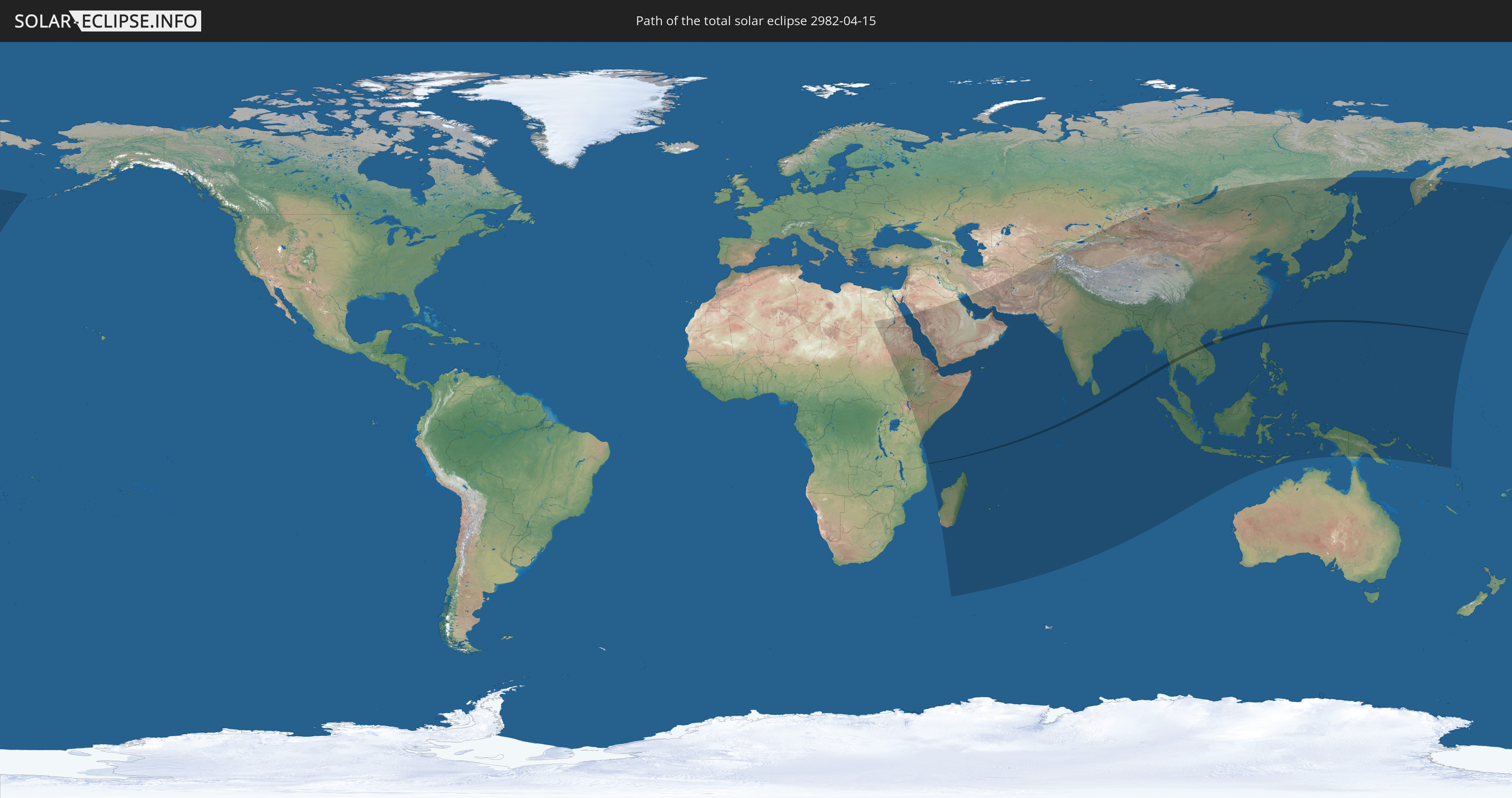
Die Sonnenfinsternis am 04/15/2982 kann man in 67 Ländern als partielle Sonnenfinsternis beobachten.
Der Finsternispfad verläuft durch 8 Länder. Nur in diesen Ländern ist sie als total Sonnenfinsternis zu sehen.
In den folgenden Ländern ist die Sonnenfinsternis total zu sehen
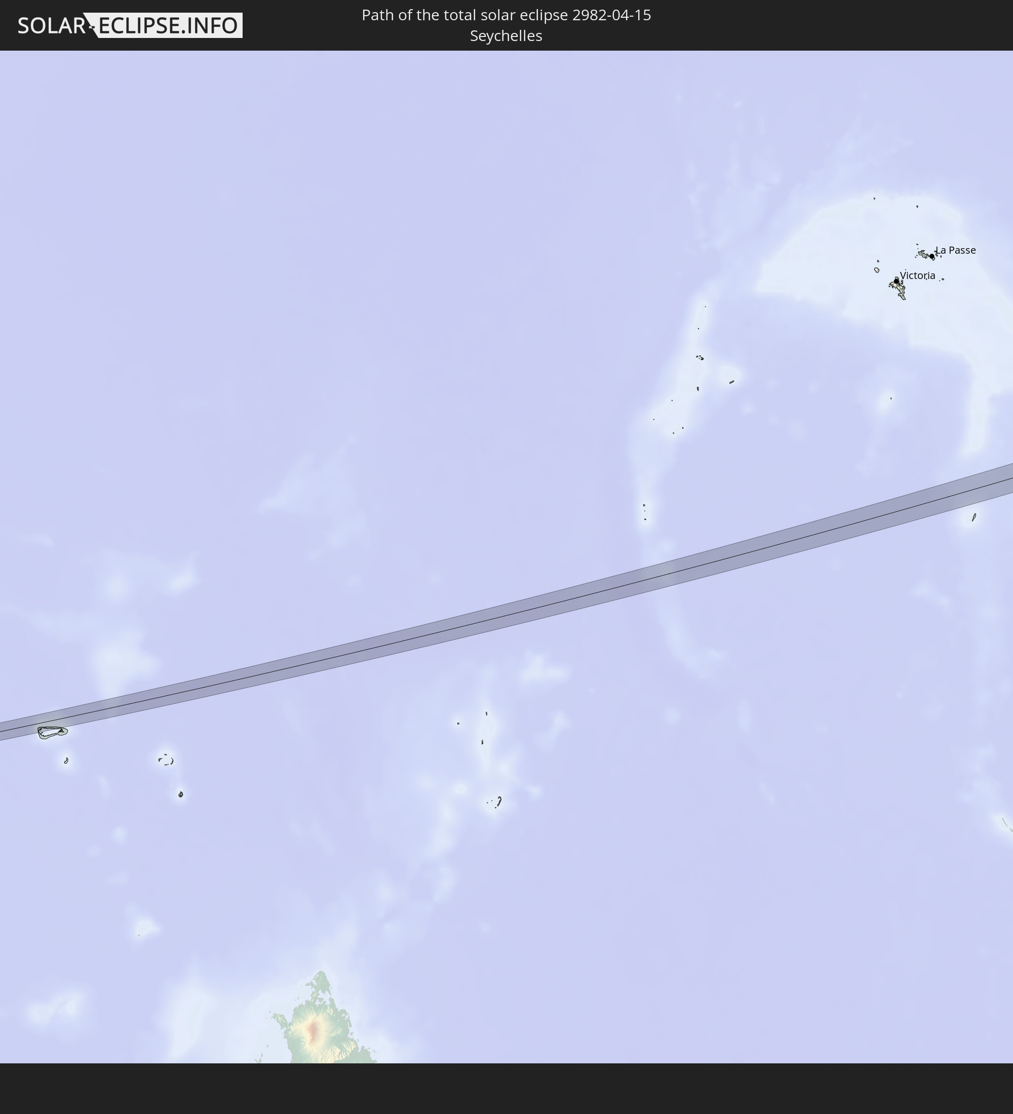 Seychelles
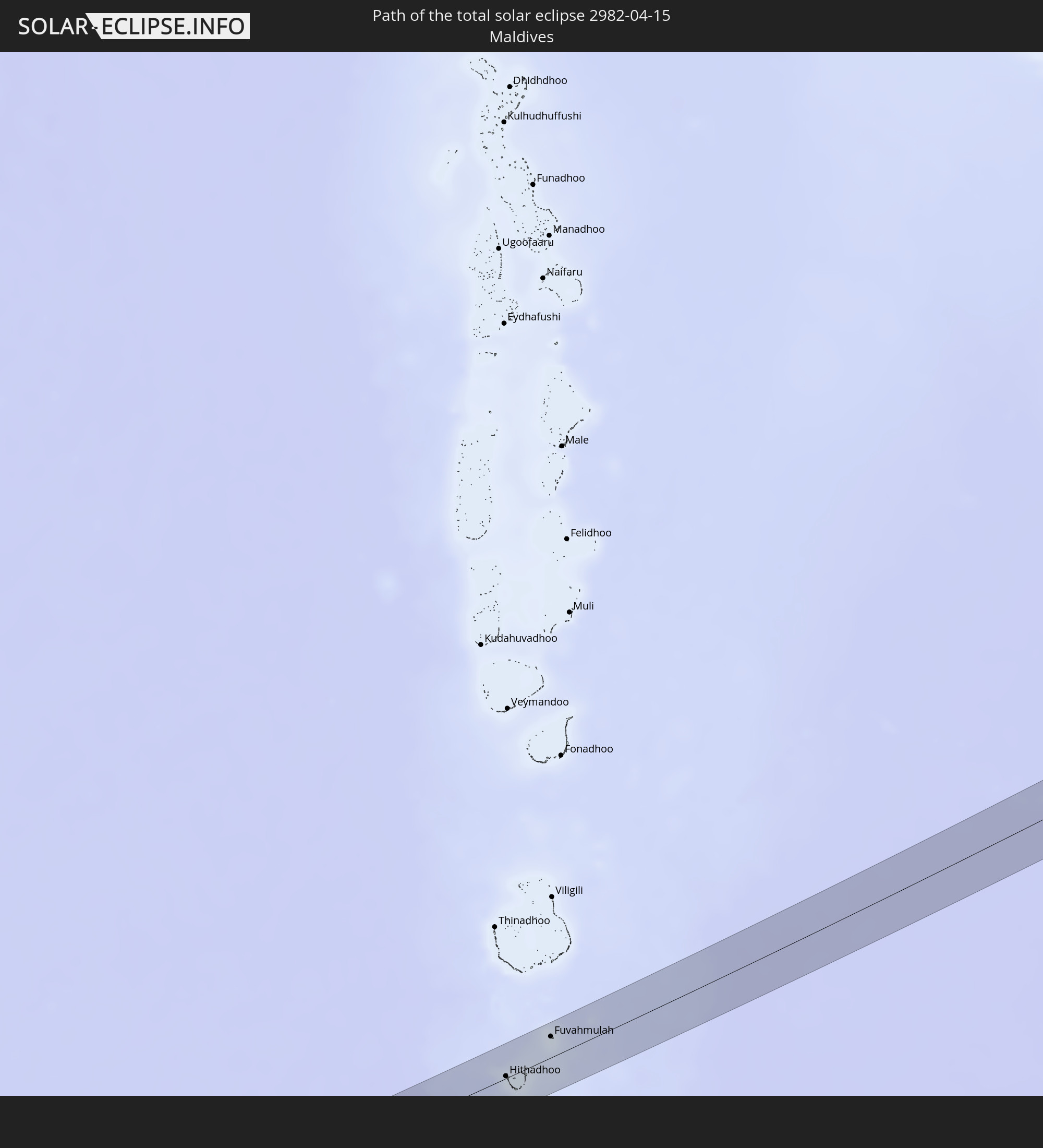 Maldives
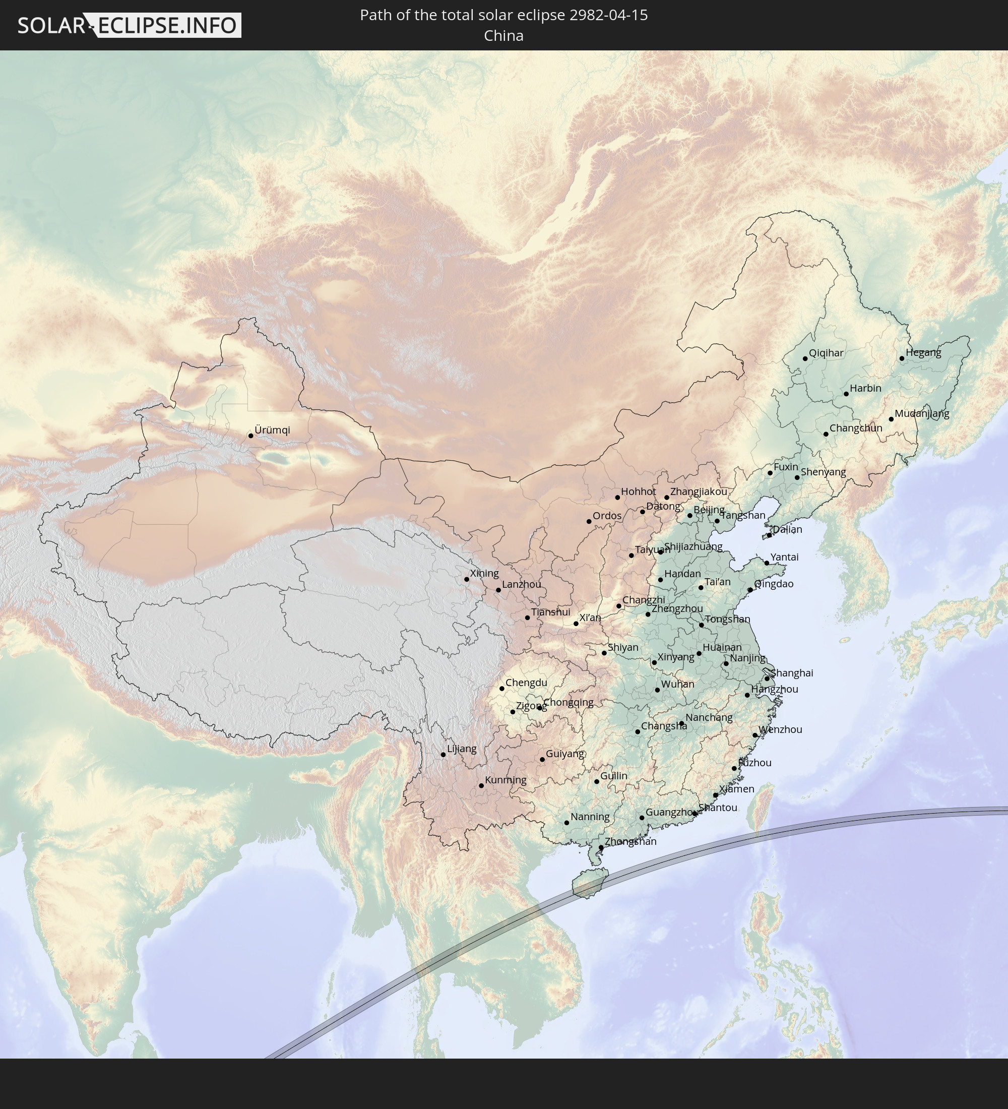 China
China
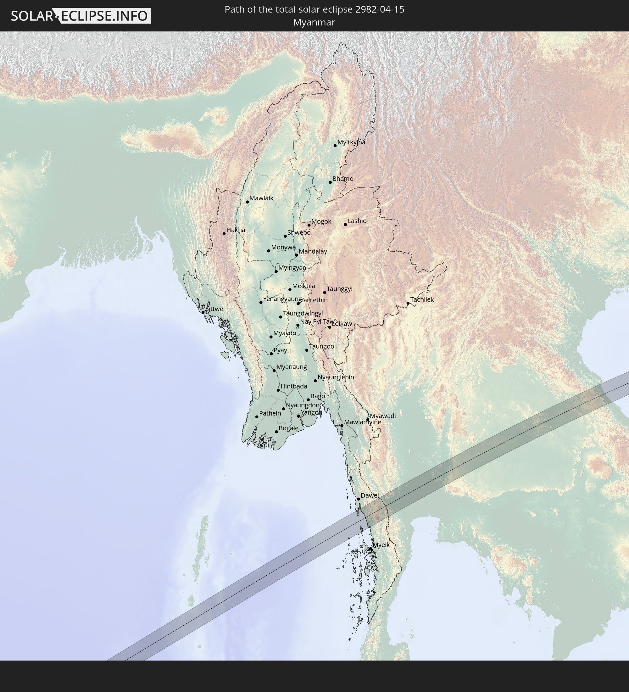 Myanmar
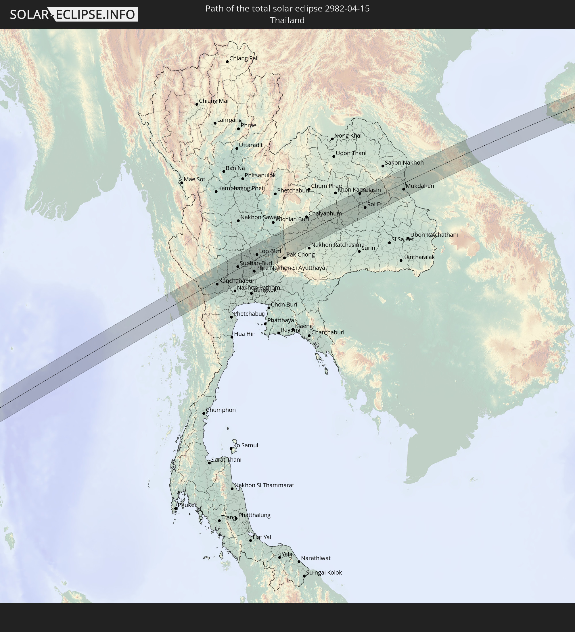 Thailand
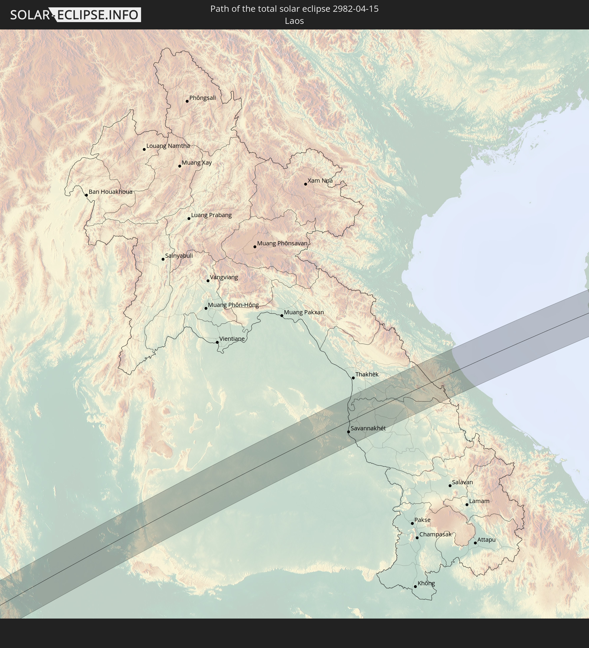 Laos
Laos
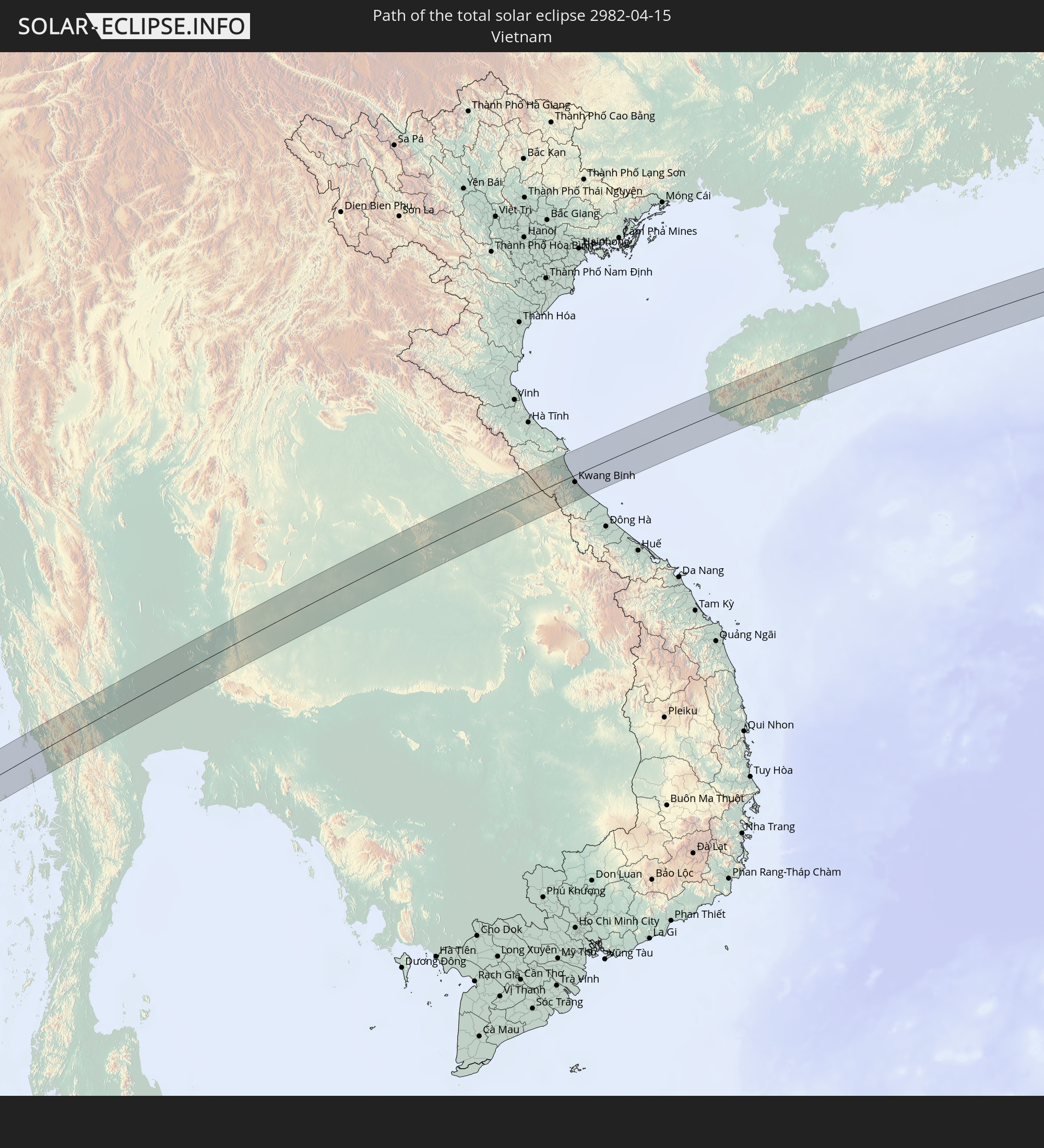 Vietnam
 Taiwan
In den folgenden Ländern ist die Sonnenfinsternis partiell zu sehen
 Russia
 United States
 United States Minor Outlying Islands
 Sudan
Sudan
 Egypt
Egypt
 Tanzania
 Ethiopia
 Kenya
Kenya
 Saudi Arabia
 Eritrea
 French Southern and Antarctic Lands
 Somalia
 Djibouti
 Yemen
Yemen
 Madagascar
 Comoros
 Iran
Iran
 Mayotte
 Seychelles
 Kazakhstan
 Kuwait
 Bahrain
 Qatar
Qatar
 United Arab Emirates
 Oman
Oman
 Réunion
 Uzbekistan
 Mauritius
 Afghanistan
 Pakistan
 Tajikistan
 India
India
 Kyrgyzstan
 British Indian Ocean Territory
 Maldives
 China
China
 Sri Lanka
 Nepal
Nepal
 Mongolia
 Bangladesh
 Bhutan
 Myanmar
 Indonesia
 Cocos Islands
 Thailand
 Malaysia
 Laos
Laos
 Vietnam
 Cambodia
 Singapore
 Christmas Island
 Macau
Macau
 Hong Kong
 Brunei
 Taiwan
 Philippines
 Japan
Japan
 East Timor
 North Korea
 South Korea
 Palau
Palau
 Federated States of Micronesia
 Papua New Guinea
 Guam
Guam
 Northern Mariana Islands
 Solomon Islands
 Marshall Islands
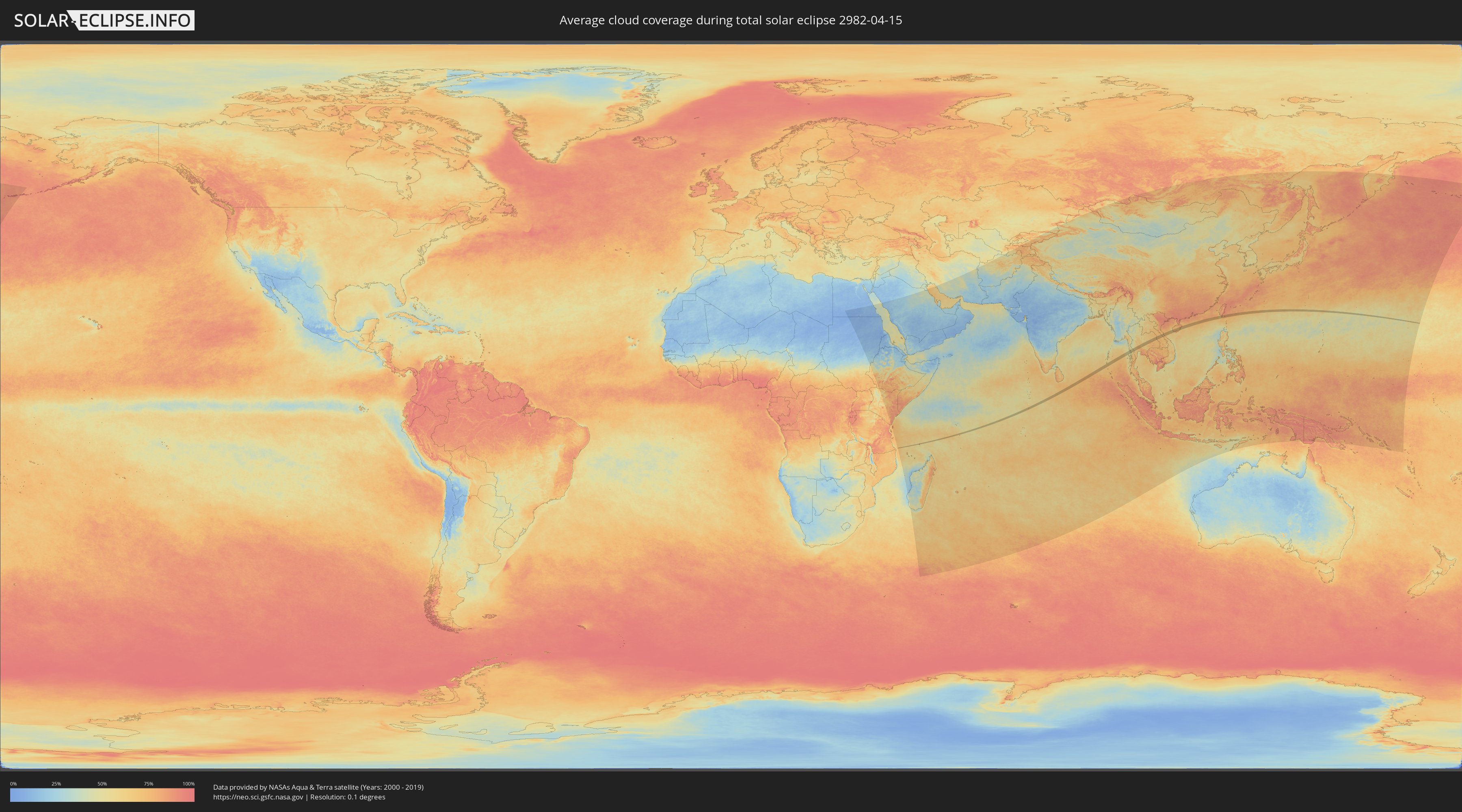
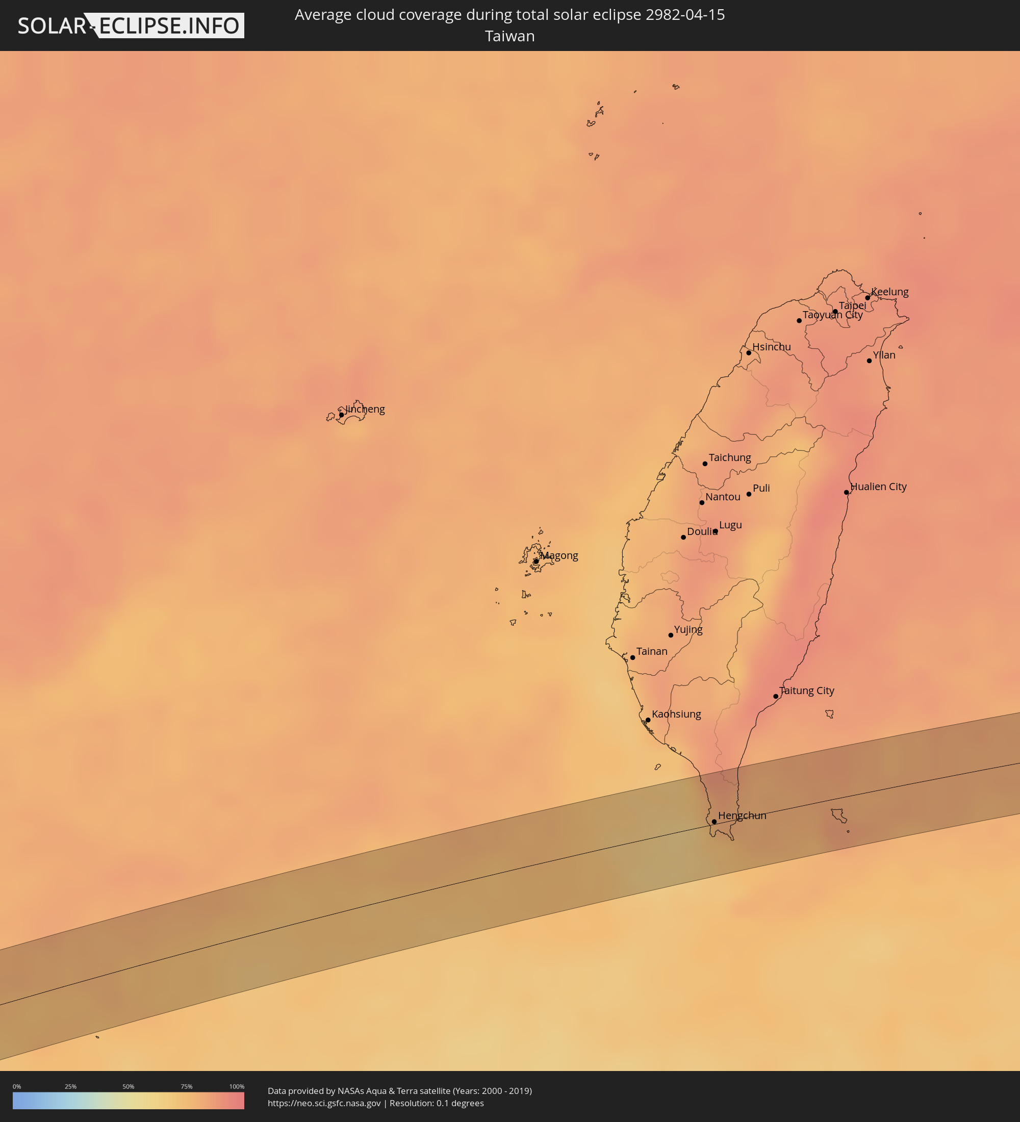
How will be the weather during the total solar eclipse on 04/15/2982?
Where is the best place to see the total solar eclipse of 04/15/2982?
The following maps show the average cloud coverage for the day of the total solar eclipse.
With the help of these maps, it is possible to find the place along the eclipse path, which has the best
chance of a cloudless sky.
Nevertheless, you should consider local circumstances and inform about the weather of your chosen
observation site.
The data is provided by NASAs satellites
AQUA and TERRA.
The cloud maps are averaged over a period of 19 years (2000 - 2019).

Detailed country maps
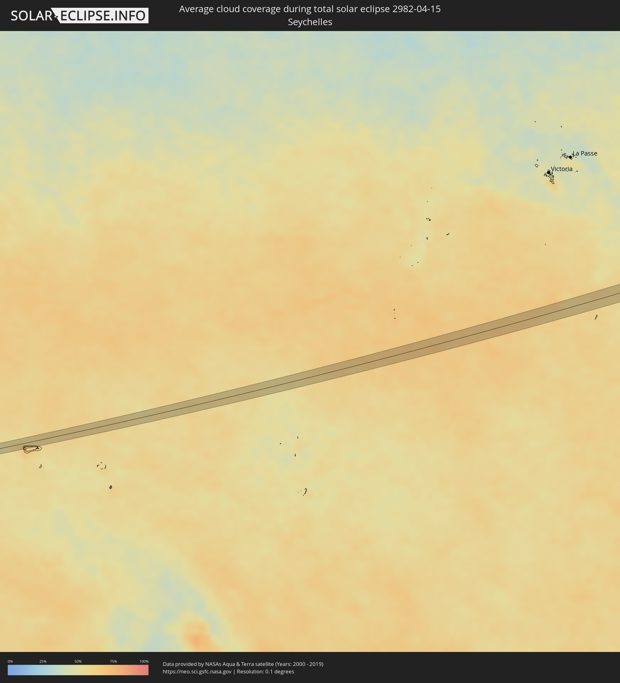 Seychelles
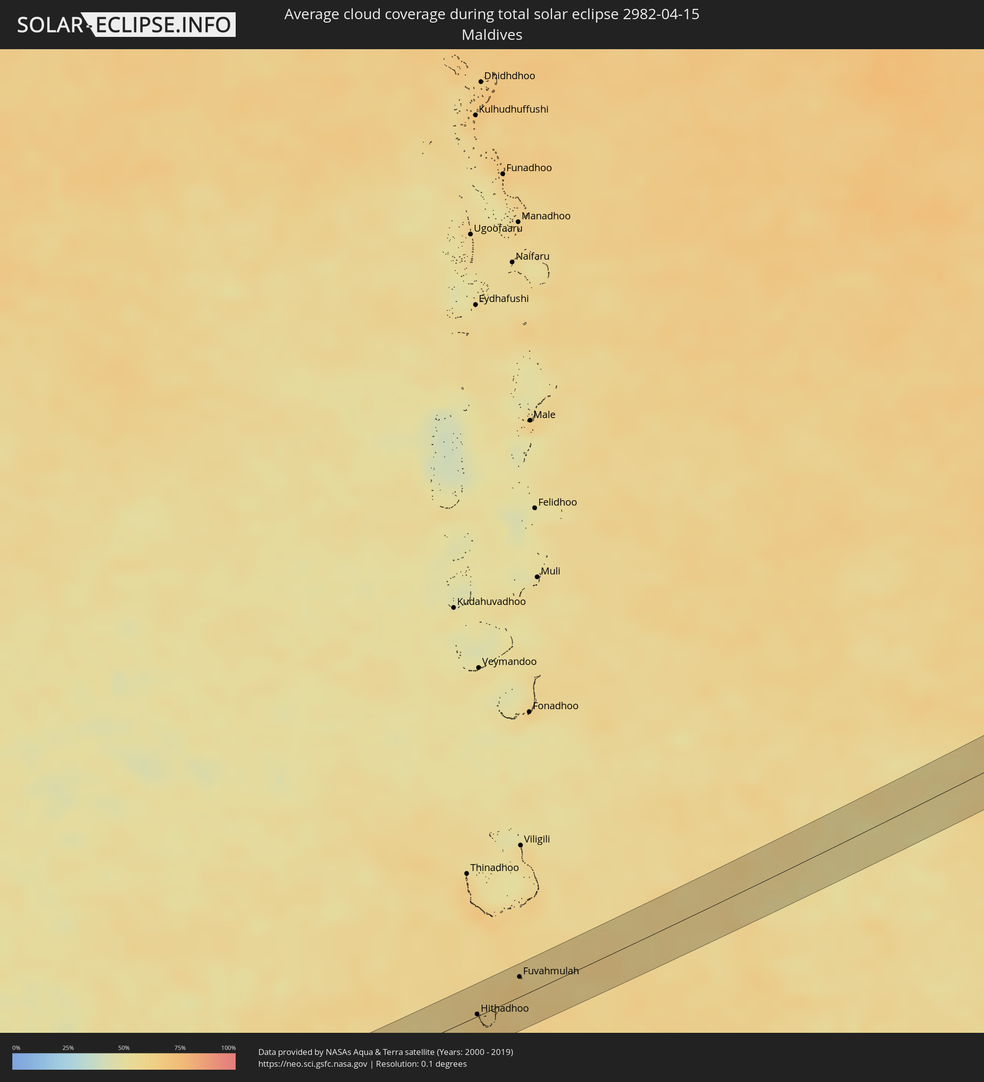 Maldives
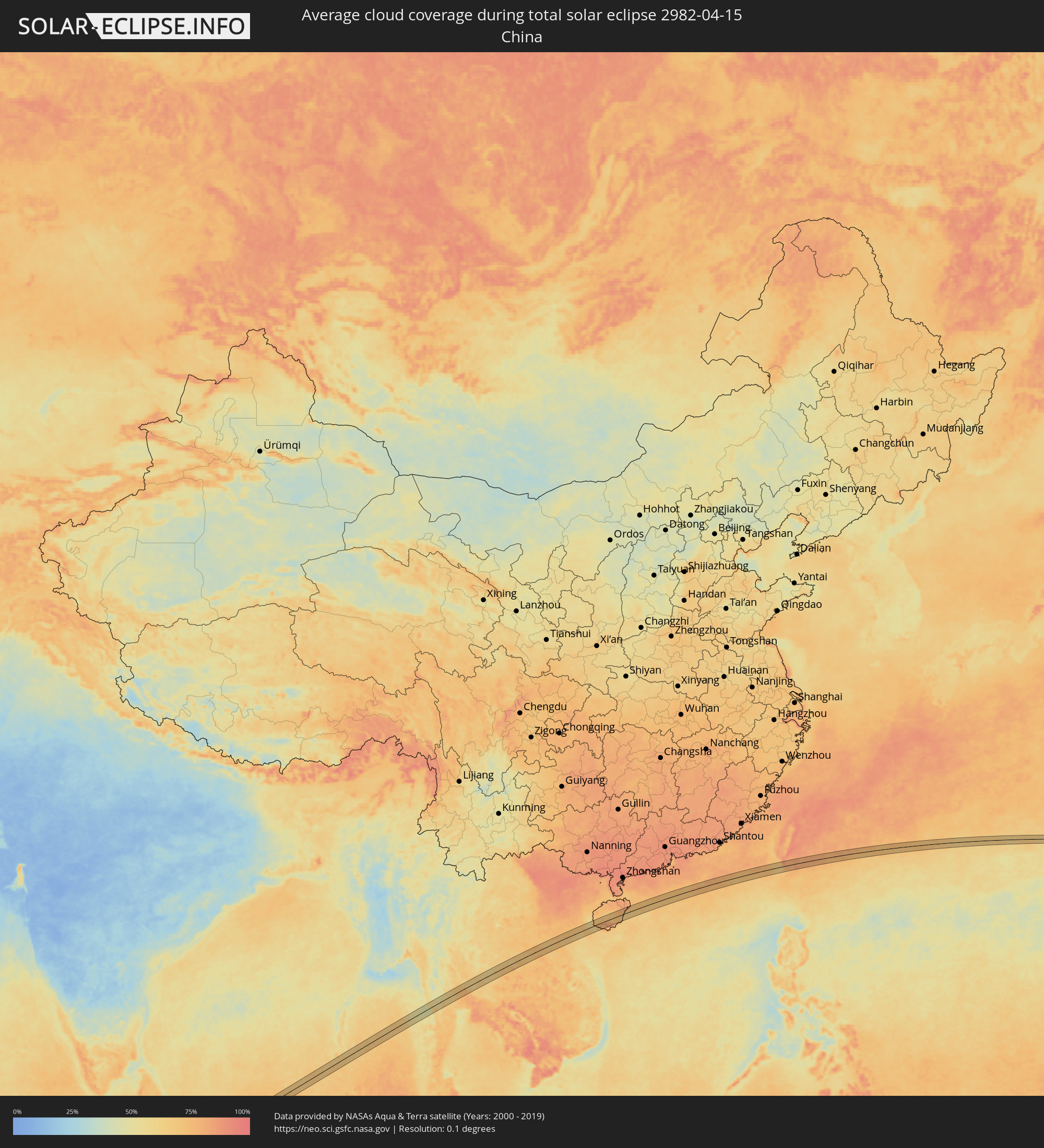 China
China
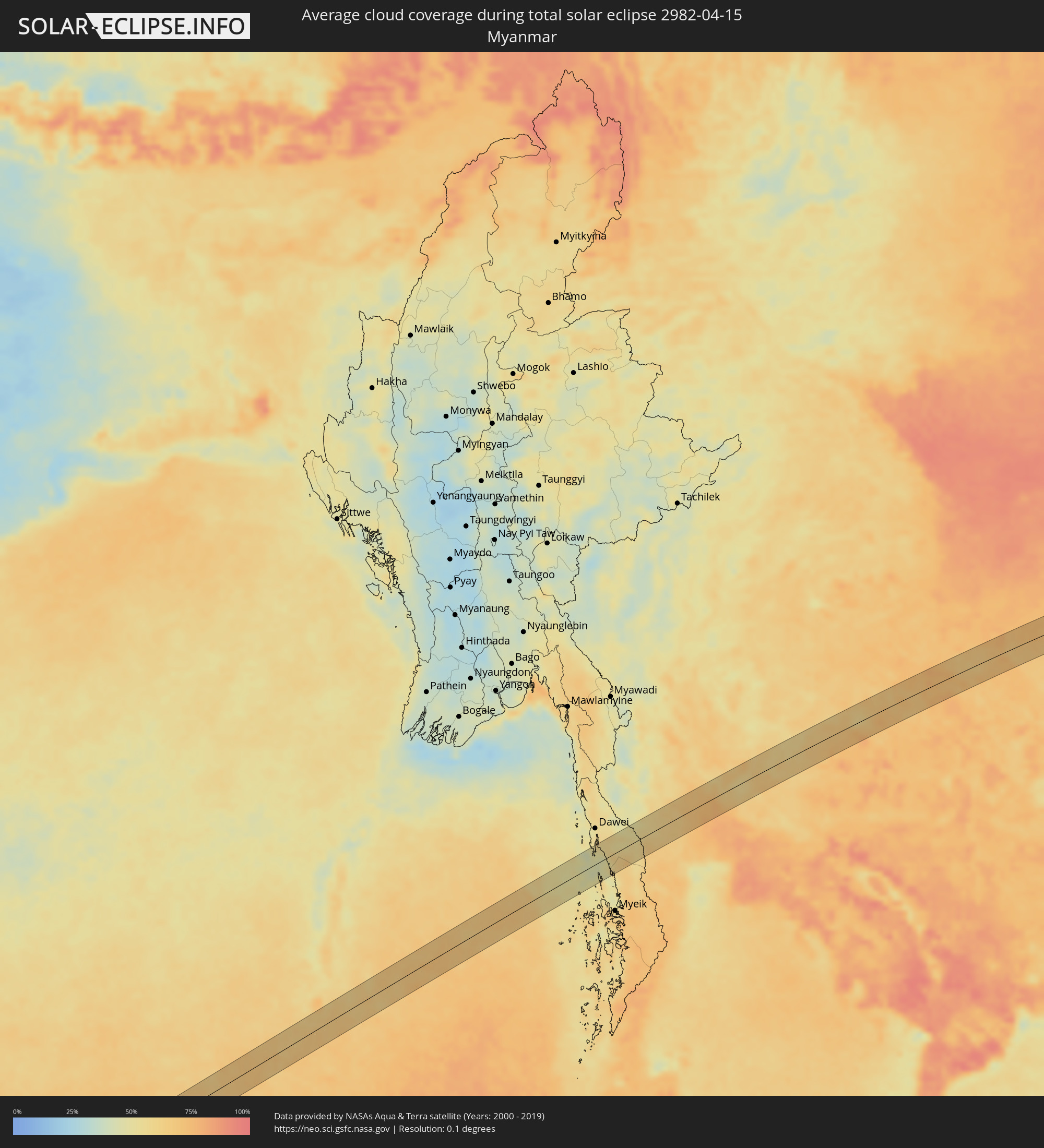 Myanmar
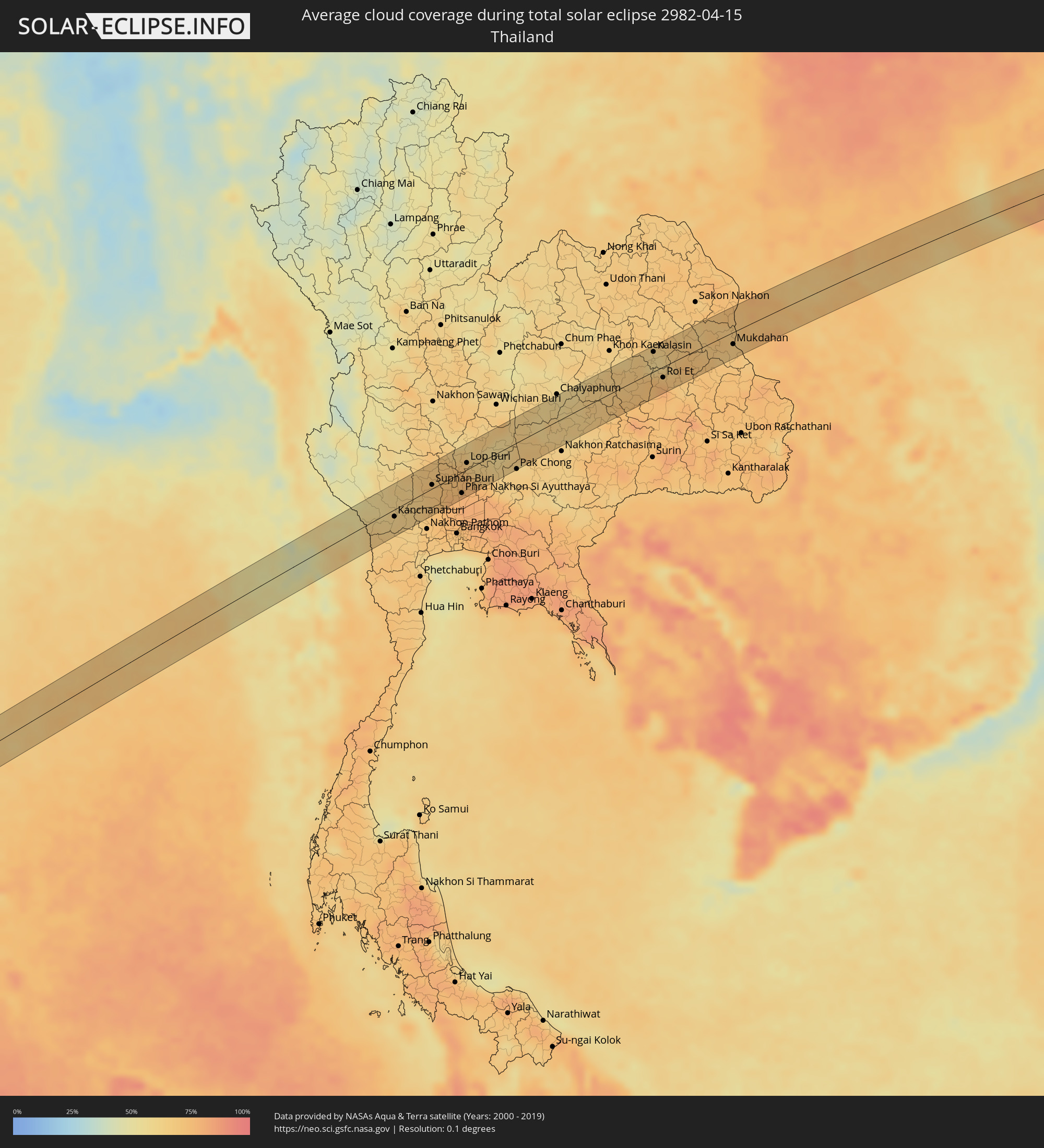 Thailand
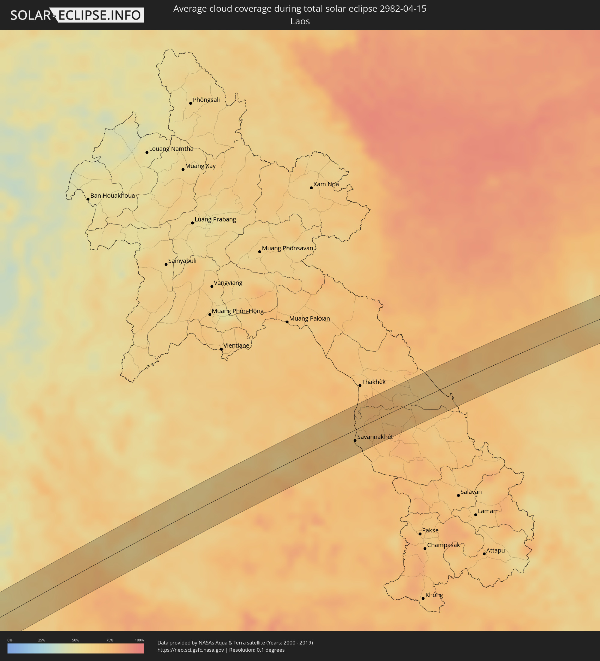 Laos
Laos
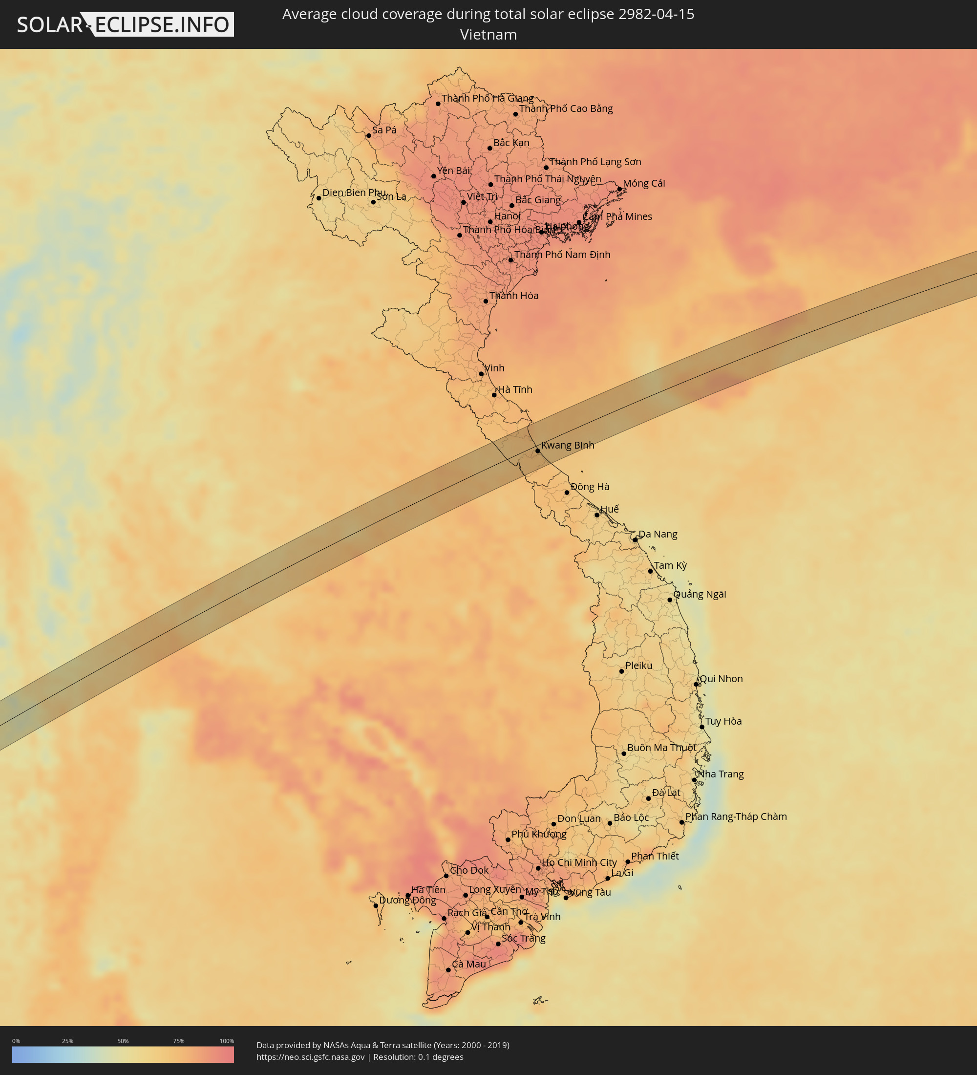 Vietnam
 Taiwan
Cities inside the path of the eclipse
The following table shows all locations with a population of more than 5,000 inside the eclipse path. Cities which have more than 100,000 inhabitants are marked bold. A click at the locations opens a detailed map.
| City | Type | Eclipse duration | Local time of max. eclipse | Distance to central line | Ø Cloud coverage |
|
Hithadhoo
|
total | - | 08:47:30 UTC+05:00 | 2 km | 69% |
|
Fuvahmulah, Gnyaviyani Atoll
|
total | - | 08:48:17 UTC+05:00 | 16 km | 62% |
|
Bo Phloi, Kanchanaburi
|
total | - | 12:04:56 UTC+07:00 | 23 km | 60% |
|
Kanchanaburi, Kanchanaburi
|
total | - | 12:04:31 UTC+07:00 | 10 km | 61% |
|
Tha Maka, Kanchanaburi
|
total | - | 12:04:58 UTC+07:00 | 32 km | 65% |
|
Suphan Buri, Suphan Buri
|
total | - | 12:06:50 UTC+07:00 | 6 km | 70% |
|
Bang Racham, Sing Buri
|
total | - | 12:08:00 UTC+07:00 | 36 km | 70% |
|
Wiset Chaichan, Ang Thong
|
total | - | 12:07:36 UTC+07:00 | 6 km | 72% |
|
Phak Hai, Phra Nakhon Si Ayutthaya
|
total | - | 12:07:29 UTC+07:00 | 9 km | 74% |
|
Sing Buri, Sing Buri
|
total | - | 12:08:14 UTC+07:00 | 31 km | 69% |
|
Bang Ban, Phra Nakhon Si Ayutthaya
|
total | - | 12:07:40 UTC+07:00 | 23 km | 75% |
|
Ban Thai Tan, Ang Thong
|
total | - | 12:08:03 UTC+07:00 | 1 km | 73% |
|
Phra Nakhon Si Ayutthaya, Phra Nakhon Si Ayutthaya
|
total | - | 12:07:53 UTC+07:00 | 30 km | 78% |
|
Nakhon Luang, Phra Nakhon Si Ayutthaya
|
total | - | 12:08:09 UTC+07:00 | 21 km | 76% |
|
Lop Buri, Lop Buri
|
total | - | 12:08:47 UTC+07:00 | 10 km | 67% |
|
Tha Ruea, Phra Nakhon Si Ayutthaya
|
total | - | 12:08:38 UTC+07:00 | 17 km | 74% |
|
Ban Mo, Sara Buri
|
total | - | 12:08:42 UTC+07:00 | 12 km | 74% |
|
Phra Phutthabat, Sara Buri
|
total | - | 12:09:04 UTC+07:00 | 5 km | 68% |
|
Saraburi, Sara Buri
|
total | - | 12:09:06 UTC+07:00 | 30 km | 75% |
|
Chai Badan, Lop Buri
|
total | - | 12:10:43 UTC+07:00 | 24 km | 57% |
|
Pak Chong, Nakhon Ratchasima
|
total | - | 12:10:45 UTC+07:00 | 38 km | 65% |
|
Bamnet Narong, Chaiyaphum
|
total | - | 12:12:42 UTC+07:00 | 26 km | 60% |
|
Amphoe Sikhiu, Nakhon Ratchasima
|
total | - | 12:11:51 UTC+07:00 | 34 km | 65% |
|
Dan Khun Thot, Nakhon Ratchasima
|
total | - | 12:12:29 UTC+07:00 | 7 km | 67% |
|
Non Sung, Nakhon Ratchasima
|
total | - | 12:13:47 UTC+07:00 | 34 km | 63% |
|
Bua Yai, Nakhon Ratchasima
|
total | - | 12:14:51 UTC+07:00 | 3 km | 63% |
|
Phon, Khon Kaen
|
total | - | 12:15:40 UTC+07:00 | 12 km | 65% |
|
Ban Phai, Khon Kaen
|
total | - | 12:16:23 UTC+07:00 | 29 km | 64% |
|
Maha Sarakham, Maha Sarakham
|
total | - | 12:18:08 UTC+07:00 | 14 km | 68% |
|
Kalasin, Kalasin
|
total | - | 12:19:04 UTC+07:00 | 29 km | 60% |
|
Kamalasai, Kalasin
|
total | - | 12:19:07 UTC+07:00 | 16 km | 60% |
|
Roi Et, Roi Et
|
total | - | 12:18:56 UTC+07:00 | 16 km | 70% |
|
Ban Selaphum, Roi Et
|
total | - | 12:19:42 UTC+07:00 | 34 km | 68% |
|
Kuchinarai, Kalasin
|
total | - | 12:20:43 UTC+07:00 | 14 km | 71% |
|
Khao Wong, Kalasin
|
total | - | 12:21:03 UTC+07:00 | 28 km | 69% |
|
Mukdahan, Mukdahan
|
total | - | 12:22:35 UTC+07:00 | 18 km | 66% |
|
Savannakhét, Savannahkhét
|
total | - | 12:22:42 UTC+07:00 | 17 km | 68% |
|
Kwang Binh, Quảng Bình
|
total | - | 12:29:04 UTC+07:00 | 11 km | 72% |
|
Wanning, Hainan
|
total | - | 13:40:52 UTC+08:00 | 29 km | 75% |
|
Hengchun, Taiwan
|
total | - | 14:08:56 UTC+08:00 | 1 km | 70% |