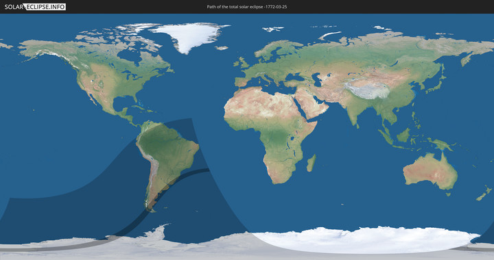
Totale Sonnenfinsternis vom 25.03.-1772
| Wochentag: | Sonntag |
| Maximale Dauer der Verfinsterung: | 03m53s |
| Maximale Breite des Finsternispfades: | 313 km |
| Saroszyklus: | 1 |
| Bedeckungsgrad: | 100% |
| Magnitude: | 1.0583 |
| Gamma: | -0.7985 |
Wo kann man die Sonnenfinsternis vom 25.03.-1772 sehen?
Die Sonnenfinsternis am 25.03.-1772 kann man in 16 Ländern als partielle Sonnenfinsternis beobachten.
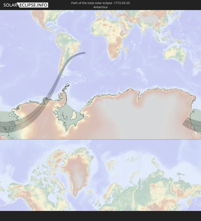
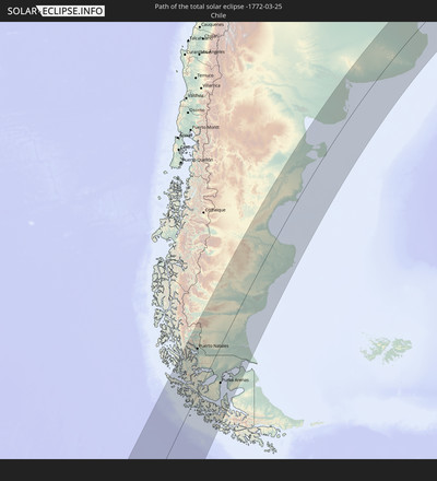
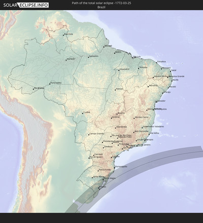
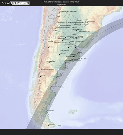
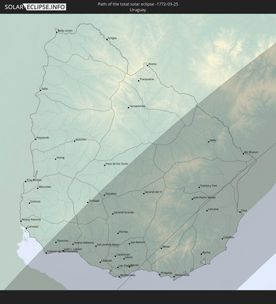
Der Finsternispfad verläuft durch 5 Länder. Nur in diesen Ländern ist sie als totale Sonnenfinsternis zu sehen.
In den folgenden Ländern ist die Sonnenfinsternis total zu sehen
In den folgenden Ländern ist die Sonnenfinsternis partiell zu sehen
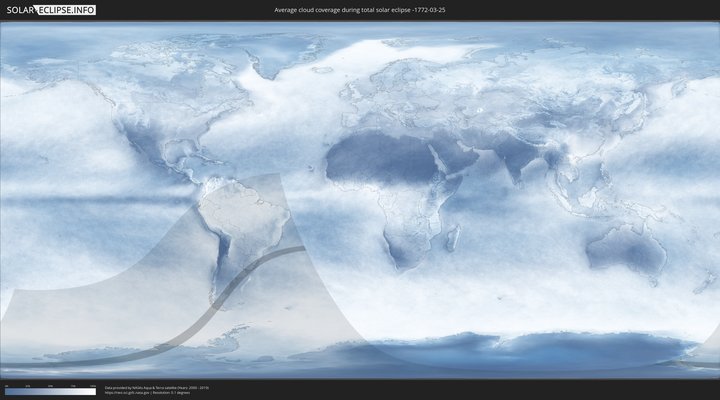
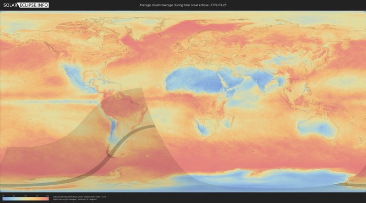
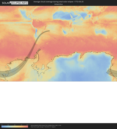
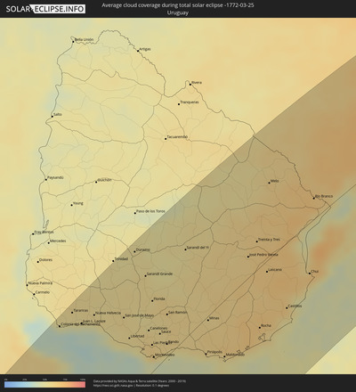
Wie wird das Wetter während der totalen Sonnenfinsternis am 25.03.-1772?
Wo ist der beste Ort, um die totale Sonnenfinsternis vom 25.03.-1772 zu beobachten?
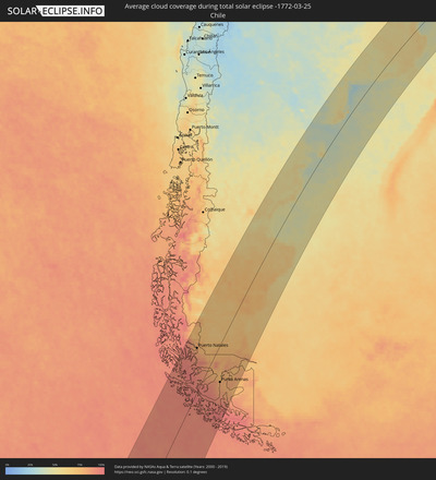
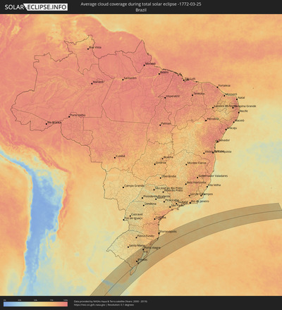
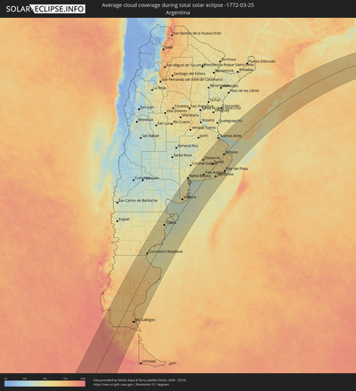
Die folgenden Karten zeigen die durchschnittliche Bewölkung für den Tag, an dem die totale Sonnenfinsternis
stattfindet. Mit Hilfe der Karten lässt sich der Ort entlang des Finsternispfades eingrenzen,
der die besten Aussichen auf einen klaren wolkenfreien Himmel bietet.
Trotzdem muss man immer lokale Gegenenheiten beachten und sollte sich genau über das Wetter an seinem
gewählten Beobachtungsort informieren.
Die Daten stammen von den beiden NASA-Satelliten
AQUA und TERRA
und wurden über einen Zeitraum von 19 Jahren (2000 - 2019) gemittelt.
Detaillierte Länderkarten
Orte im Finsternispfad
Die nachfolgene Tabelle zeigt Städte und Orte mit mehr als 5.000 Einwohnern, die sich im Finsternispfad befinden. Städte mit mehr als 100.000 Einwohnern sind dick gekennzeichnet. Mit einem Klick auf den Ort öffnet sich eine Detailkarte die die Lage des jeweiligen Ortes zusammen mit dem Verlauf der zentralen Finsternis präsentiert.
| Ort | Typ | Dauer der Verfinsterung | Ortszeit bei maximaler Verfinsterung | Entfernung zur Zentrallinie | Ø Bewölkung |
 Puerto Natales, Magallanes
|
total | - | 14:14:22 UTC-04:42 | 92 km | 80% |
 Yacimiento Río Turbio, Santa Cruz Province
|
total | - | 14:40:43 UTC-04:16 | 92 km | 79% |
 Río Turbio, Santa Cruz Province
|
total | - | 14:40:47 UTC-04:16 | 93 km | 76% |
 El Calafate, Santa Cruz Province
|
total | - | 14:42:48 UTC-04:16 | 151 km | 70% |
 Punta Arenas, Magallanes
|
total | - | 14:13:30 UTC-04:42 | 74 km | 80% |
 Río Gallegos, Santa Cruz Province
|
total | - | 14:43:29 UTC-04:16 | 105 km | 76% |
 Las Heras, Santa Cruz Province
|
total | - | 14:52:33 UTC-04:16 | 138 km | 59% |
 Pico Truncado, Santa Cruz Province
|
total | - | 14:53:00 UTC-04:16 | 59 km | 62% |
 San Julián, Santa Cruz Province
|
total | - | 14:48:46 UTC-04:16 | 87 km | 66% |
 Rada Tilly, Chubut Province
|
total | - | 19:11:45 UTC+00:00 | 77 km | 53% |
 Caleta Olivia, Santa Cruz Province
|
total | - | 14:54:02 UTC-04:16 | 49 km | 54% |
 Comodoro Rivadavia, Chubut Province
|
total | - | 14:55:07 UTC-04:16 | 79 km | 53% |
 Puerto Deseado, Santa Cruz Province
|
total | - | 14:53:09 UTC-04:16 | 129 km | 59% |
 Gaimán, Chubut Province
|
total | - | 15:01:43 UTC-04:16 | 89 km | 57% |
 Trelew, Chubut Province
|
total | - | 15:01:57 UTC-04:16 | 78 km | 57% |
 Rawson, Chubut Province
|
total | - | 15:02:03 UTC-04:16 | 61 km | 49% |
 Puerto Madryn, Chubut Province
|
total | - | 15:03:06 UTC-04:16 | 88 km | 50% |
 Viedma, Río Negro Province
|
total | - | 15:08:37 UTC-04:16 | 66 km | 53% |
 Bahía Blanca, Buenos Aires
|
total | - | 15:13:16 UTC-04:16 | 152 km | 52% |
 Punta Alta, Buenos Aires
|
total | - | 15:13:08 UTC-04:16 | 128 km | 42% |
 Coronel Dorrego, Buenos Aires
|
total | - | 15:14:06 UTC-04:16 | 84 km | 48% |
 Olavarría, Buenos Aires
|
total | - | 15:18:25 UTC-04:16 | 144 km | 54% |
 Tres Arroyos, Buenos Aires
|
total | - | 15:15:35 UTC-04:16 | 38 km | 49% |
 Azul, Buenos Aires
|
total | - | 15:19:00 UTC-04:16 | 121 km | 54% |
 Tandil, Buenos Aires
|
total | - | 15:18:32 UTC-04:16 | 32 km | 58% |
 Necochea, Buenos Aires
|
total | - | 15:16:28 UTC-04:16 | 81 km | 50% |
 Adrogué, Buenos Aires
|
total | - | 15:23:58 UTC-04:16 | 168 km | 59% |
 Quilmes, Buenos Aires
|
total | - | 15:24:11 UTC-04:16 | 165 km | 55% |
 La Plata, Buenos Aires
|
total | - | 15:24:03 UTC-04:16 | 130 km | 58% |
 Colonia del Sacramento, Colonia
|
total | - | 15:56:58 UTC-03:44 | 158 km | 36% |
 Dolores, Buenos Aires
|
total | - | 15:21:35 UTC-04:16 | 7 km | 59% |
 Tarariras, Colonia
|
total | - | 15:57:30 UTC-03:44 | 158 km | 52% |
 Mar del Plata, Buenos Aires
|
total | - | 15:18:26 UTC-04:16 | 123 km | 59% |
 Juan L. Lacaze, Colonia
|
total | - | 15:57:20 UTC-03:44 | 136 km | 44% |
 Rosario, Colonia
|
total | - | 15:57:36 UTC-03:44 | 137 km | 52% |
 Nueva Helvecia, Colonia
|
total | - | 15:57:43 UTC-03:44 | 131 km | 53% |
 Villa Gesell, Buenos Aires
|
total | - | 15:20:17 UTC-04:16 | 110 km | 53% |
 Trinidad, Flores
|
total | - | 15:59:25 UTC-03:44 | 168 km | 54% |
 San Clemente del Tuyú, Buenos Aires
|
total | - | 15:22:12 UTC-04:16 | 60 km | 55% |
 San José de Mayo, San José
|
total | - | 15:58:01 UTC-03:44 | 94 km | 58% |
 Libertad, San José
|
total | - | 15:57:32 UTC-03:44 | 64 km | 53% |
 Durazno, Durazno
|
total | - | 15:59:59 UTC-03:44 | 158 km | 53% |
 Santa Lucía, Canelones
|
total | - | 15:58:02 UTC-03:44 | 64 km | 57% |
 Delta del Tigre, San José
|
total | - | 15:57:27 UTC-03:44 | 37 km | 43% |
 Sarandí Grande, Florida
|
total | - | 15:59:27 UTC-03:44 | 117 km | 55% |
 Canelones, Canelones
|
total | - | 15:57:59 UTC-03:44 | 51 km | 58% |
 La Paz, Canelones
|
total | - | 15:57:34 UTC-03:44 | 29 km | 59% |
 Las Piedras, Canelones
|
total | - | 15:57:37 UTC-03:44 | 31 km | 61% |
 Progreso, Canelones
|
total | - | 15:57:45 UTC-03:44 | 36 km | 61% |
 Florida, Florida
|
total | - | 15:58:50 UTC-03:44 | 80 km | 57% |
 Montevideo, Montevideo
|
total | - | 15:57:19 UTC-03:44 | 15 km | 45% |
 Sauce, Canelones
|
total | - | 15:58:02 UTC-03:44 | 34 km | 59% |
 Paso de Carrasco, Canelones
|
total | - | 15:57:30 UTC-03:44 | 10 km | 42% |
 Joaquín Suárez, Canelones
|
total | - | 15:57:45 UTC-03:44 | 18 km | 57% |
 Colonia Nicolich, Canelones
|
total | - | 15:57:36 UTC-03:44 | 11 km | 51% |
 Pando, Canelones
|
total | - | 15:57:50 UTC-03:44 | 15 km | 57% |
 San Ramón, Canelones
|
total | - | 15:58:39 UTC-03:44 | 48 km | 56% |
 Sarandí del Yi, Durazno
|
total | - | 16:00:40 UTC-03:44 | 103 km | 54% |
 Piriápolis, Maldonado
|
total | - | 15:58:02 UTC-03:44 | 41 km | 44% |
 Minas, Lavalleja
|
total | - | 15:58:59 UTC-03:44 | 5 km | 59% |
 Pan de Azúcar, Maldonado
|
total | - | 15:58:13 UTC-03:44 | 37 km | 52% |
 Maldonado, Maldonado
|
total | - | 15:58:11 UTC-03:44 | 65 km | 52% |
 Punta del Este, Maldonado
|
total | - | 15:58:06 UTC-03:44 | 70 km | 50% |
 San Carlos, Maldonado
|
total | - | 15:58:24 UTC-03:44 | 58 km | 55% |
 José Pedro Varela, Lavalleja
|
total | - | 16:01:12 UTC-03:44 | 25 km | 60% |
 Treinta y Tres, Treinta y Tres
|
total | - | 16:01:43 UTC-03:44 | 34 km | 64% |
 Rocha, Rocha
|
total | - | 15:59:23 UTC-03:44 | 71 km | 60% |
 Lascano, Rocha
|
total | - | 16:01:00 UTC-03:44 | 13 km | 65% |
 Melo, Cerro Largo
|
total | - | 16:03:29 UTC-03:44 | 93 km | 59% |
 Castillos, Rocha
|
total | - | 16:00:14 UTC-03:44 | 78 km | 57% |
 Chui, Rocha
|
total | - | 16:01:26 UTC-03:44 | 62 km | 62% |
 Herval, Rio Grande do Sul
|
total | - | 16:43:00 UTC-03:06 | 76 km | 66% |
 Río Branco, Cerro Largo
|
total | - | 16:03:33 UTC-03:44 | 26 km | 68% |
 Jaguarão, Rio Grande do Sul
|
total | - | 16:42:00 UTC-03:06 | 28 km | 68% |
 Santa Vitória do Palmar, Rio Grande do Sul
|
total | - | 16:40:12 UTC-03:06 | 52 km | 65% |
 Arroio Grande, Rio Grande do Sul
|
total | - | 16:42:47 UTC-03:06 | 39 km | 68% |
 Canguçu, Rio Grande do Sul
|
total | - | 16:44:36 UTC-03:06 | 88 km | 71% |
 Encruzilhada do Sul, Rio Grande do Sul
|
total | - | 16:46:16 UTC-03:06 | 154 km | 65% |
 Pelotas, Rio Grande do Sul
|
total | - | 16:44:06 UTC-03:06 | 35 km | 59% |
 Rio Grande, Rio Grande do Sul
|
total | - | 16:43:45 UTC-03:06 | 2 km | 61% |
 São Lourenço do Sul, Rio Grande do Sul
|
total | - | 16:45:04 UTC-03:06 | 50 km | 52% |
 Butiá, Rio Grande do Sul
|
total | - | 16:47:22 UTC-03:06 | 160 km | 64% |
 Camaquã, Rio Grande do Sul
|
total | - | 16:46:07 UTC-03:06 | 86 km | 77% |
 Arroio dos Ratos, Rio Grande do Sul
|
total | - | 16:47:35 UTC-03:06 | 151 km | 63% |
 São Jerônimo, Rio Grande do Sul
|
total | - | 16:47:48 UTC-03:06 | 161 km | 63% |
 Triunfo, Rio Grande do Sul
|
total | - | 16:47:50 UTC-03:06 | 162 km | 58% |
 Charqueadas, Rio Grande do Sul
|
total | - | 16:47:52 UTC-03:06 | 156 km | 64% |
 Tapes, Rio Grande do Sul
|
total | - | 16:46:40 UTC-03:06 | 78 km | 59% |
 Guaíba, Rio Grande do Sul
|
total | - | 16:47:44 UTC-03:06 | 125 km | 59% |
 Portão, Rio Grande do Sul
|
total | - | 16:48:32 UTC-03:06 | 158 km | 68% |
 Porto Alegre, Rio Grande do Sul
|
total | - | 16:47:56 UTC-03:06 | 127 km | 69% |
 Esteio, Rio Grande do Sul
|
total | - | 16:48:16 UTC-03:06 | 140 km | 69% |
 Estância Velha, Rio Grande do Sul
|
total | - | 16:48:40 UTC-03:06 | 159 km | 67% |
 Ivoti, Rio Grande do Sul
|
total | - | 16:48:47 UTC-03:06 | 164 km | 67% |
 Sapucaia, Rio Grande do Sul
|
total | - | 16:48:20 UTC-03:06 | 141 km | 69% |
 Novo Hamburgo, Rio Grande do Sul
|
total | - | 16:48:38 UTC-03:06 | 154 km | 68% |
 Cachoeirinha, Rio Grande do Sul
|
total | - | 16:48:09 UTC-03:06 | 127 km | 71% |
 Viamão, Rio Grande do Sul
|
total | - | 16:47:57 UTC-03:06 | 111 km | 69% |
 Sapiranga, Rio Grande do Sul
|
total | - | 16:48:46 UTC-03:06 | 151 km | 67% |
 Gravataí, Rio Grande do Sul
|
total | - | 16:48:14 UTC-03:06 | 122 km | 69% |
 Parobé, Rio Grande do Sul
|
total | - | 16:48:53 UTC-03:06 | 142 km | 62% |
 Canela, Rio Grande do Sul
|
total | - | 16:49:23 UTC-03:06 | 167 km | 66% |
 Igrejinha, Rio Grande do Sul
|
total | - | 16:49:00 UTC-03:06 | 145 km | 62% |
 Taquara, Rio Grande do Sul
|
total | - | 16:48:52 UTC-03:06 | 137 km | 64% |
 Três Coroas, Rio Grande do Sul
|
total | - | 16:49:07 UTC-03:06 | 150 km | 65% |
 São Francisco de Paula, Rio Grande do Sul
|
total | - | 16:49:21 UTC-03:06 | 146 km | 72% |
 Rolante, Rio Grande do Sul
|
total | - | 16:48:59 UTC-03:06 | 126 km | 62% |
 Osório, Rio Grande do Sul
|
total | - | 16:48:43 UTC-03:06 | 88 km | 62% |
 Tramandaí, Rio Grande do Sul
|
total | - | 16:48:36 UTC-03:06 | 72 km | 57% |
 Capão da Canoa, Rio Grande do Sul
|
total | - | 16:49:06 UTC-03:06 | 87 km | 59% |
 Torres, Rio Grande do Sul
|
total | - | 16:49:59 UTC-03:06 | 111 km | 62% |
 Sombrio, Santa Catarina
|
total | - | 16:50:26 UTC-03:06 | 126 km | 62% |
 Araranguá, Santa Catarina
|
total | - | 16:50:49 UTC-03:06 | 136 km | 70% |
 Forquilhinha, Santa Catarina
|
total | - | 16:51:10 UTC-03:06 | 153 km | 75% |
 Criciúma, Santa Catarina
|
total | - | 16:51:20 UTC-03:06 | 154 km | 73% |
 Cocal, Santa Catarina
|
total | - | 16:51:29 UTC-03:06 | 159 km | 73% |
 Içara, Santa Catarina
|
total | - | 16:51:18 UTC-03:06 | 147 km | 69% |
 Morro da Fumaça, Santa Catarina
|
total | - | 16:51:28 UTC-03:06 | 149 km | 68% |
 Jaguaruna, Santa Catarina
|
total | - | 16:51:36 UTC-03:06 | 142 km | 71% |
 Tubarão, Santa Catarina
|
total | - | 16:51:53 UTC-03:06 | 156 km | 71% |
 Laguna, Santa Catarina
|
total | - | 16:51:58 UTC-03:06 | 143 km | 63% |
 Imbituba, Santa Catarina
|
total | - | 16:52:27 UTC-03:06 | 161 km | 64% |
