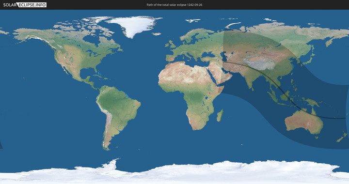
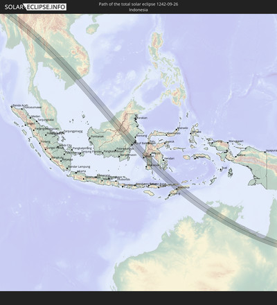
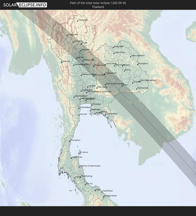
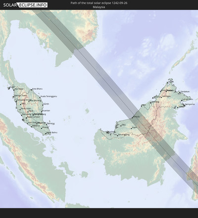
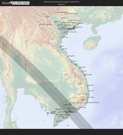
Totale Sonnenfinsternis vom 26.09.1242
| Wochentag: | Freitag |
| Maximale Dauer der Verfinsterung: | 03m48s |
| Maximale Breite des Finsternispfades: | 149 km |
| Saroszyklus: | 112 |
| Bedeckungsgrad: | 100% |
| Magnitude: | 1.0443 |
| Gamma: | 0.1219 |
Wo kann man die Sonnenfinsternis vom 26.09.1242 sehen?
Die Sonnenfinsternis am 26.09.1242 kann man in 60 Ländern als partielle Sonnenfinsternis beobachten.
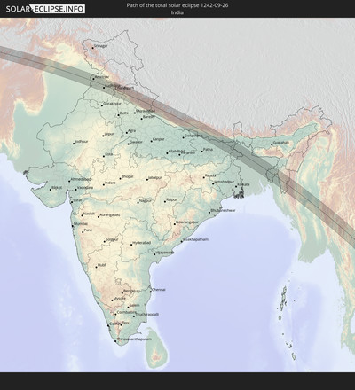
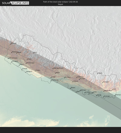
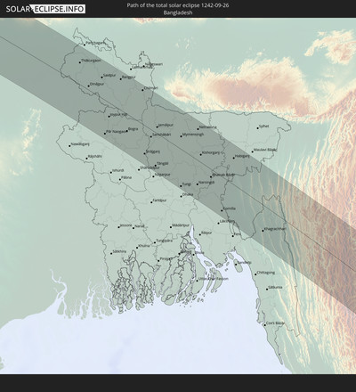
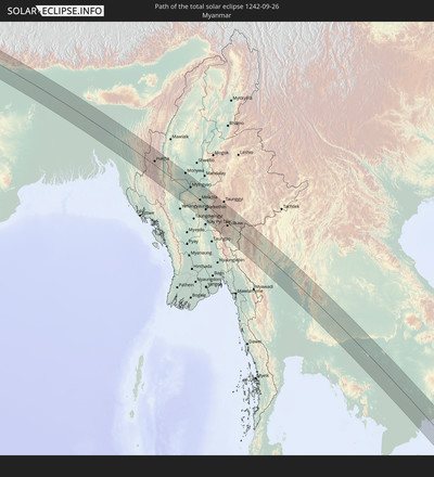
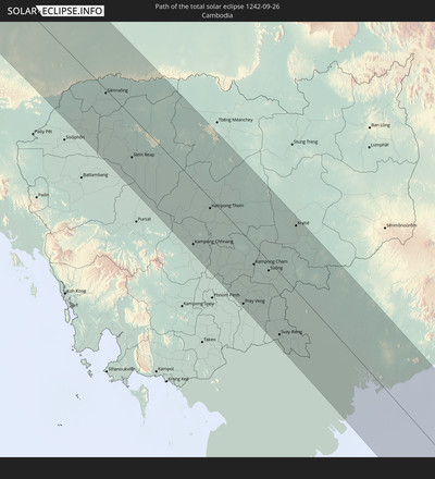
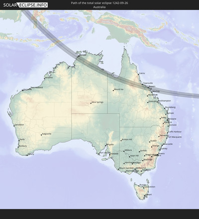
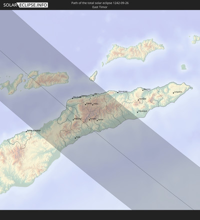
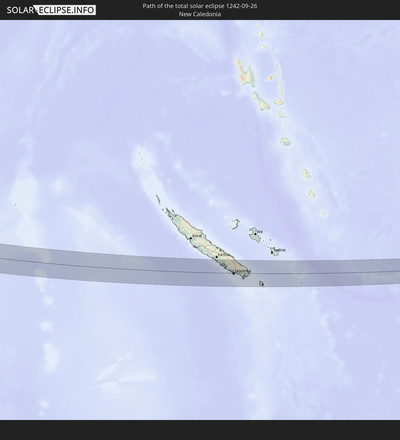
Der Finsternispfad verläuft durch 15 Länder. Nur in diesen Ländern ist sie als totale Sonnenfinsternis zu sehen.
In den folgenden Ländern ist die Sonnenfinsternis total zu sehen
In den folgenden Ländern ist die Sonnenfinsternis partiell zu sehen
 Russland
 Neuseeland
 Kiribati
 Äthiopien
 Saudi-Arabien
 Somalia
 Jemen
Jemen
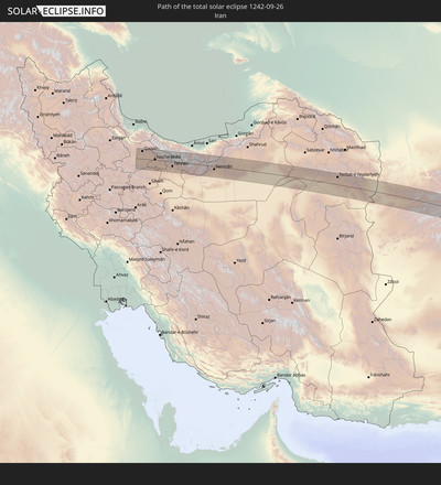
 Iran
Iran
 Aserbaidschan
 Kasachstan
 Bahrain
 Katar
Katar
 Vereinigte Arabische Emirate
 Oman
Oman
 Turkmenistan
 Usbekistan
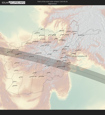
 Afghanistan
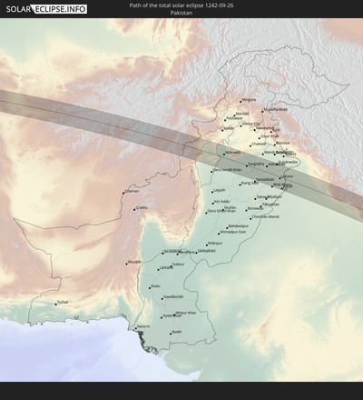
 Pakistan
 Tadschikistan
 Indien
 Kirgisistan
 Malediven
 Volksrepublik China
 Sri Lanka
 Nepal
Nepal
 Mongolei
 Bangladesch
 Bhutan
 Myanmar
 Indonesien
 Kokosinseln
 Thailand
 Malaysia
 Laos
Laos
 Vietnam
 Kambodscha
 Singapur
 Weihnachtsinsel
 Australien
 Macau
Macau
 Hongkong
 Brunei
 Taiwan
 Philippinen
 Japan
Japan
 Osttimor
 Nordkorea
 Südkorea
 Palau
Palau
 Föderierte Staaten von Mikronesien
 Papua-Neuguinea
 Guam
Guam
 Nördliche Marianen
 Salomonen
 Neukaledonien
 Marshallinseln
 Vanuatu
 Nauru
Nauru
 Norfolkinsel
 Tuvalu
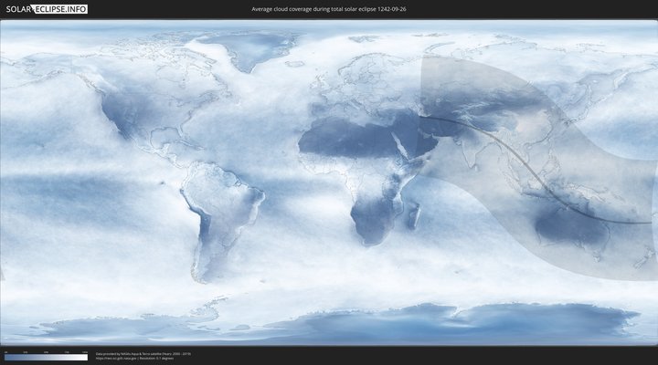
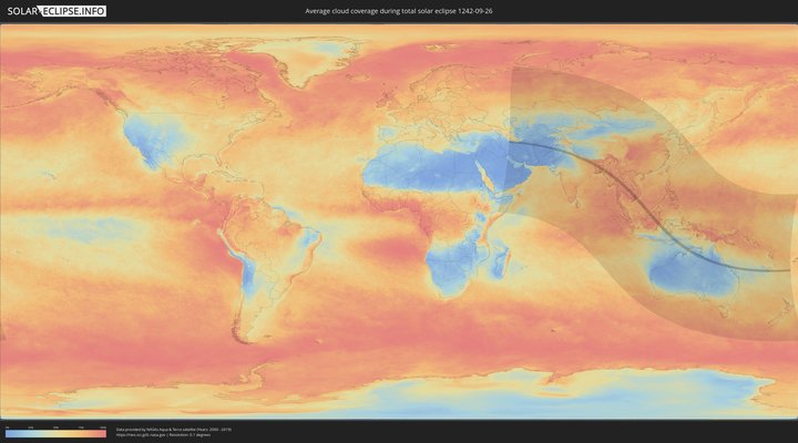
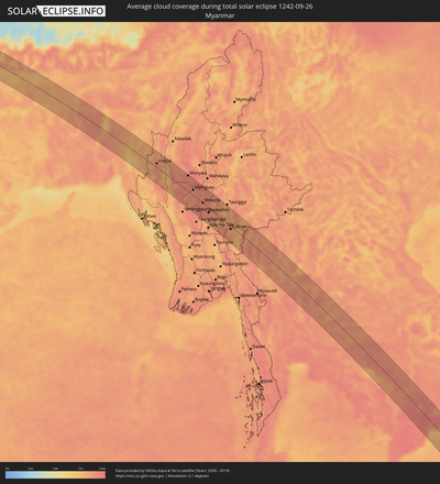
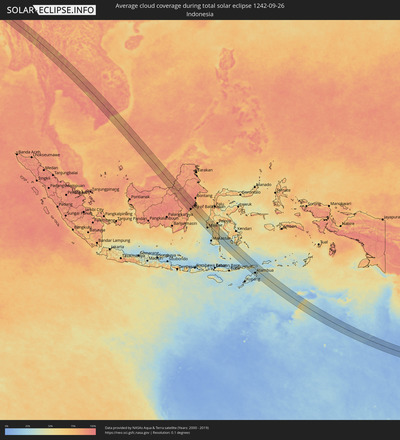
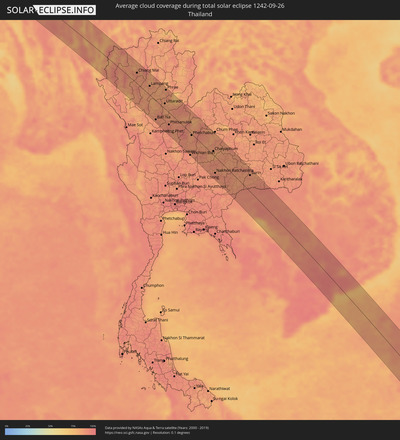
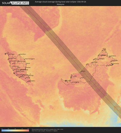
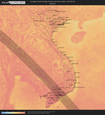
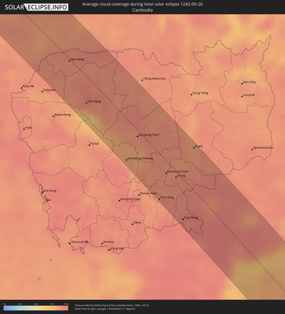
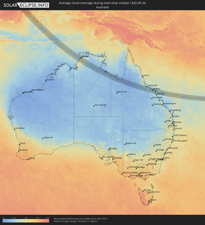
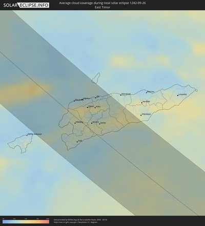
Wie wird das Wetter während der totalen Sonnenfinsternis am 26.09.1242?
Wo ist der beste Ort, um die totale Sonnenfinsternis vom 26.09.1242 zu beobachten?
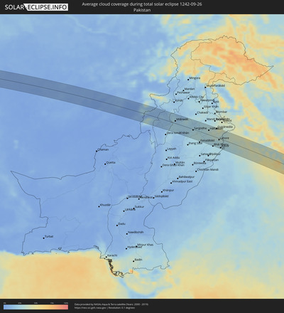
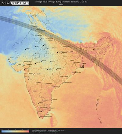
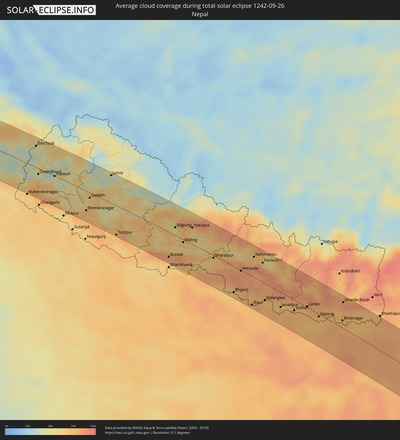
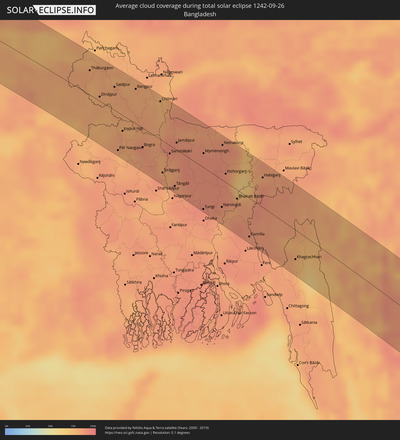
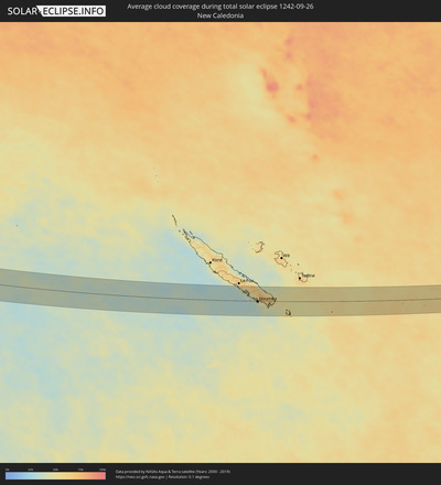
Die folgenden Karten zeigen die durchschnittliche Bewölkung für den Tag, an dem die totale Sonnenfinsternis
stattfindet. Mit Hilfe der Karten lässt sich der Ort entlang des Finsternispfades eingrenzen,
der die besten Aussichen auf einen klaren wolkenfreien Himmel bietet.
Trotzdem muss man immer lokale Gegenenheiten beachten und sollte sich genau über das Wetter an seinem
gewählten Beobachtungsort informieren.
Die Daten stammen von den beiden NASA-Satelliten
AQUA und TERRA
und wurden über einen Zeitraum von 19 Jahren (2000 - 2019) gemittelt.
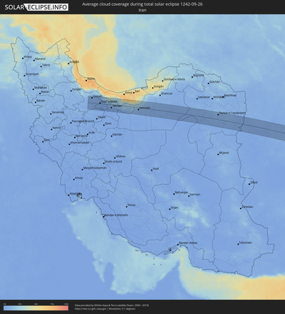
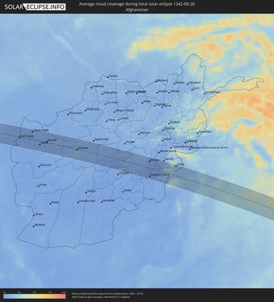
Detaillierte Länderkarten
Orte im Finsternispfad
Die nachfolgene Tabelle zeigt Städte und Orte mit mehr als 5.000 Einwohnern, die sich im Finsternispfad befinden. Städte mit mehr als 100.000 Einwohnern sind dick gekennzeichnet. Mit einem Klick auf den Ort öffnet sich eine Detailkarte die die Lage des jeweiligen Ortes zusammen mit dem Verlauf der zentralen Finsternis präsentiert.
| Ort | Typ | Dauer der Verfinsterung | Ortszeit bei maximaler Verfinsterung | Entfernung zur Zentrallinie | Ø Bewölkung |
 Qazvin, Qazvīn
|
total | - | 06:07:31 UTC+03:25 | 33 km | 6% |
 Ābyek, Markazi
|
total | - | 06:07:30 UTC+03:25 | 15 km | 4% |
 Naz̧arābād, Alborz
|
total | - | 06:07:29 UTC+03:25 | 3 km | 4% |
 Malārd, Tehrān
|
total | - | 06:07:27 UTC+03:25 | 26 km | 2% |
 Karaj, Alborz
|
total | - | 06:07:29 UTC+03:25 | 7 km | 2% |
 Shahre Jadide Andisheh, Tehrān
|
total | - | 06:07:27 UTC+03:25 | 24 km | 2% |
 Shahrīār, Tehrān
|
total | - | 06:07:27 UTC+03:25 | 26 km | 2% |
 Tehran, Tehrān
|
total | - | 06:07:29 UTC+03:25 | 19 km | 2% |
 Damāvand, Tehrān
|
total | - | 06:07:31 UTC+03:25 | 10 km | 7% |
 Mahdishahr, Semnān
|
total | - | 06:07:37 UTC+03:25 | 2 km | 7% |
 Semnān, Semnān
|
total | - | 06:07:36 UTC+03:25 | 12 km | 4% |
 Kāshmar, Razavi Khorasan
|
total | - | 06:08:21 UTC+03:25 | 16 km | 4% |
 Torbat-e Ḩeydarīyeh, Razavi Khorasan
|
total | - | 06:08:32 UTC+03:25 | 32 km | 5% |
 Tāybād, Razavi Khorasan
|
total | - | 06:08:53 UTC+03:25 | 1 km | 4% |
 Kafir Qala, Herat
|
total | - | 06:43:14 UTC+04:00 | 4 km | 4% |
 Kuhsān, Herat
|
total | - | 06:43:16 UTC+04:00 | 3 km | 4% |
 Tīr Pul, Herat
|
total | - | 06:43:17 UTC+04:00 | 8 km | 3% |
 Zindah Jān, Herat
|
total | - | 06:43:25 UTC+04:00 | 27 km | 2% |
 Qarah Bāgh, Herat
|
total | - | 06:43:27 UTC+04:00 | 39 km | 4% |
 Chahār Burj, Herat
|
total | - | 06:43:34 UTC+04:00 | 29 km | 2% |
 Herāt, Herat
|
total | - | 06:43:34 UTC+04:00 | 18 km | 2% |
 Karukh, Herat
|
total | - | 06:43:41 UTC+04:00 | 4 km | 2% |
 Shahrak, Ghowr
|
total | - | 06:44:17 UTC+04:00 | 2 km | 7% |
 Ghazni, Ghazni
|
total | - | 06:46:03 UTC+04:00 | 34 km | 2% |
 Zarghūn Shahr, Paktika
|
total | - | 06:46:09 UTC+04:00 | 41 km | 1% |
 Sharan, Paktika
|
total | - | 06:46:15 UTC+04:00 | 1 km | 2% |
 Zaṟah Sharan, Paktika
|
total | - | 06:46:17 UTC+04:00 | 1 km | 1% |
 Khōst, Khowst
|
total | - | 06:46:50 UTC+04:00 | 50 km | 13% |
 Miānwāli, Punjab
|
total | - | 07:16:01 UTC+04:28 | 13 km | 21% |
 Khushāb, Punjab
|
total | - | 07:16:33 UTC+04:28 | 8 km | 21% |
 Sargodha, Punjab
|
total | - | 07:16:48 UTC+04:28 | 4 km | 25% |
 Bhalwāl, Punjab
|
total | - | 07:16:54 UTC+04:28 | 23 km | 25% |
 Chiniot, Punjab
|
total | - | 07:17:04 UTC+04:28 | 33 km | 27% |
 Shahkot, Punjab
|
total | - | 07:17:26 UTC+04:28 | 33 km | 24% |
 Hāfizābād, Punjab
|
total | - | 07:17:26 UTC+04:28 | 25 km | 30% |
 Chūhar Kāna, Punjab
|
total | - | 07:17:35 UTC+04:28 | 4 km | 28% |
 Sheikhupura, Punjab
|
total | - | 07:17:42 UTC+04:28 | 3 km | 31% |
 Gujrānwāla, Punjab
|
total | - | 07:17:44 UTC+04:28 | 51 km | 35% |
 Kamoke, Punjab
|
total | - | 07:17:48 UTC+04:28 | 33 km | 34% |
 Murīdke, Punjab
|
total | - | 07:17:52 UTC+04:28 | 16 km | 32% |
 Lahore, Punjab
|
total | - | 07:17:59 UTC+04:28 | 8 km | 27% |
 Kasūr, Punjab
|
total | - | 07:18:11 UTC+04:28 | 50 km | 26% |
 Amritsar, Punjab
|
total | - | 08:11:17 UTC+05:21 | 17 km | 32% |
 Jalandhar, Punjab
|
total | - | 08:11:52 UTC+05:21 | 10 km | 34% |
 Ludhiāna, Punjab
|
total | - | 08:12:11 UTC+05:21 | 24 km | 34% |
 Chandigarh, Chandigarh
|
total | - | 08:12:55 UTC+05:21 | 9 km | 41% |
 Ambāla, Haryana
|
total | - | 08:13:04 UTC+05:21 | 48 km | 43% |
 Shimla, Himachal Pradesh
|
total | - | 08:13:04 UTC+05:21 | 42 km | 42% |
 Yamunānagar, Haryana
|
total | - | 08:13:32 UTC+05:21 | 54 km | 50% |
 Dehra Dūn, Uttarakhand
|
total | - | 08:14:02 UTC+05:21 | 6 km | 54% |
 Haridwar, Uttarakhand
|
total | - | 08:14:17 UTC+05:21 | 40 km | 48% |
 Birendranagar, Mid Western
|
total | - | 08:37:59 UTC+05:41 | 38 km | 69% |
 Tulsīpur, Mid Western
|
total | - | 08:38:51 UTC+05:41 | 56 km | 64% |
 Butwāl, Western Region
|
total | - | 08:40:13 UTC+05:41 | 48 km | 74% |
 Pokhara, Western Region
|
total | - | 08:40:22 UTC+05:41 | 32 km | 67% |
 Bharatpur, Central Region
|
total | - | 08:41:12 UTC+05:41 | 4 km | 66% |
 Bīrganj, Central Region
|
total | - | 08:42:06 UTC+05:41 | 49 km | 72% |
 Hetauda, Central Region
|
total | - | 08:41:58 UTC+05:41 | 1 km | 85% |
 Kathmandu, Central Region
|
total | - | 08:42:04 UTC+05:41 | 39 km | 70% |
 Janakpur, Central Region
|
total | - | 08:43:23 UTC+05:41 | 28 km | 74% |
 Lahān, Eastern Region
|
total | - | 08:44:00 UTC+05:41 | 2 km | 75% |
 Rājbirāj, Eastern Region
|
total | - | 08:44:25 UTC+05:41 | 5 km | 71% |
 Biratnagar, Eastern Region
|
total | - | 08:45:02 UTC+05:41 | 14 km | 76% |
 Ithari, Eastern Region
|
total | - | 08:44:53 UTC+05:41 | 35 km | 76% |
 Dharān Bāzār, Eastern Region
|
total | - | 08:44:46 UTC+05:41 | 49 km | 83% |
 Purnia, Bihar
|
total | - | 08:25:43 UTC+05:21 | 40 km | 86% |
 Katihar, Bihar
|
total | - | 08:26:01 UTC+05:21 | 58 km | 77% |
 Rāiganj, West Bengal
|
total | - | 08:26:35 UTC+05:21 | 22 km | 80% |
 Dinājpur, Rangpur Division
|
total | - | 08:59:19 UTC+05:53 | 6 km | 82% |
 Saidpur, Rājshāhi
|
total | - | 08:59:29 UTC+05:53 | 34 km | 83% |
 Pār Naogaon, Rājshāhi
|
total | - | 09:00:24 UTC+05:53 | 55 km | 82% |
 Rangpur, Rangpur Division
|
total | - | 08:59:55 UTC+05:53 | 50 km | 80% |
 Bogra, Rājshāhi
|
total | - | 09:00:52 UTC+05:53 | 28 km | 88% |
 Sirājganj, Rājshāhi
|
total | - | 09:01:38 UTC+05:53 | 46 km | 87% |
 Tāngāil, Dhaka
|
total | - | 09:02:04 UTC+05:53 | 54 km | 87% |
 Jamālpur, Dhaka
|
total | - | 09:01:29 UTC+05:53 | 10 km | 89% |
 Tungi, Dhaka
|
total | - | 09:03:01 UTC+05:53 | 60 km | 91% |
 Mymensingh, Dhaka
|
total | - | 09:02:11 UTC+05:53 | 20 km | 90% |
 Narsingdi, Dhaka
|
total | - | 09:03:22 UTC+05:53 | 39 km | 86% |
 Kishorganj, Dhaka
|
total | - | 09:02:56 UTC+05:53 | 12 km | 89% |
 Bhairab Bāzār, Dhaka
|
total | - | 09:03:33 UTC+05:53 | 13 km | 84% |
 Comilla, Chittagong
|
total | - | 09:04:25 UTC+05:53 | 55 km | 89% |
 Agartala, Tripura
|
total | - | 08:31:59 UTC+05:21 | 15 km | 88% |
 Aizawl, Mizoram
|
total | - | 08:33:54 UTC+05:21 | 59 km | 78% |
 Hakha, Chin
|
total | - | 09:39:52 UTC+06:24 | 16 km | 88% |
 Falam, Chin
|
total | - | 09:39:39 UTC+06:24 | 43 km | 80% |
 Chauk, Magway
|
total | - | 09:43:35 UTC+06:24 | 65 km | 85% |
 Pakokku, Magway
|
total | - | 09:43:24 UTC+06:24 | 9 km | 88% |
 Monywa, Sagain
|
total | - | 09:42:32 UTC+06:24 | 62 km | 90% |
 Myingyan, Mandalay
|
total | - | 09:43:40 UTC+06:24 | 21 km | 89% |
 Meiktila, Mandalay
|
total | - | 09:45:03 UTC+06:24 | 1 km | 87% |
 Yamethin, Mandalay
|
total | - | 09:46:02 UTC+06:24 | 20 km | 91% |
 Loikaw, Kayah
|
total | - | 09:48:35 UTC+06:24 | 13 km | 82% |
 Chiang Mai, Chiang Mai
|
total | - | 10:09:44 UTC+06:42 | 34 km | 90% |
 Lamphun, Lamphun
|
total | - | 10:10:05 UTC+06:42 | 18 km | 87% |
 San Kamphaeng, Chiang Mai
|
total | - | 10:10:00 UTC+06:42 | 39 km | 86% |
 Lampang, Lampang
|
total | - | 10:11:14 UTC+06:42 | 28 km | 87% |
 Ban Na, Sukhothai
|
total | - | 10:13:33 UTC+06:42 | 60 km | 87% |
 Uttaradit, Uttaradit
|
total | - | 10:13:10 UTC+06:42 | 16 km | 83% |
 Phrae, Phrae
|
total | - | 10:12:27 UTC+06:42 | 62 km | 84% |
 Phitsanulok, Phitsanulok
|
total | - | 10:14:40 UTC+06:42 | 38 km | 92% |
 Phichit, Phichit
|
total | - | 10:15:25 UTC+06:42 | 62 km | 90% |
 Wichian Buri, Phetchabun
|
total | - | 10:17:53 UTC+06:42 | 70 km | 87% |
 Phetchabun, Phetchabun
|
total | - | 10:16:44 UTC+06:42 | 4 km | 84% |
 Chaiyaphum, Chaiyaphum
|
total | - | 10:19:07 UTC+06:42 | 11 km | 82% |
 Nakhon Ratchasima, Nakhon Ratchasima
|
total | - | 10:20:38 UTC+06:42 | 50 km | 92% |
 Surin, Surin
|
total | - | 10:23:04 UTC+06:42 | 49 km | 88% |
 Sâmraông, Ŏtâr Méanchey
|
total | - | 10:24:19 UTC+06:42 | 4 km | 90% |
 Siem Reap, Siem Reap
|
total | - | 10:26:20 UTC+06:42 | 40 km | 92% |
 Kampong Chhnang, Kampong Chhnang
|
total | - | 10:29:43 UTC+06:42 | 63 km | 85% |
 Kampong Thom, Kampong Thom
|
total | - | 10:29:15 UTC+06:42 | 10 km | 90% |
 Prey Veng, Prey Veng
|
total | - | 10:32:16 UTC+06:42 | 68 km | 84% |
 Kampong Cham, Kampong Cham
|
total | - | 10:31:34 UTC+06:42 | 19 km | 89% |
 Suŏng, Tboung Khmum
|
total | - | 10:32:03 UTC+06:42 | 9 km | 89% |
 Svay Rieng, Svay Rieng
|
total | - | 10:33:51 UTC+06:42 | 60 km | 94% |
 Kratié, Kratie
|
total | - | 10:31:36 UTC+06:42 | 63 km | 85% |
 Tây Ninh, Tây Ninh
|
total | - | 10:58:32 UTC+07:06 | 19 km | 95% |
 Phú Khương, Tây Ninh
|
total | - | 10:58:39 UTC+07:06 | 19 km | 95% |
 Mỹ Tho, Tiền Giang
|
total | - | 11:00:49 UTC+07:06 | 69 km | 96% |
 Tân An, Long An
|
total | - | 11:00:34 UTC+07:06 | 52 km | 95% |
 Củ Chi, Ho Chi Minh City
|
total | - | 10:59:52 UTC+07:06 | 13 km | 97% |
 Bình Long, Bình Phước
|
total | - | 10:58:47 UTC+07:06 | 47 km | 93% |
 Ho Chi Minh City, Ho Chi Minh City
|
total | - | 11:00:24 UTC+07:06 | 13 km | 97% |
 Thủ Dầu Một, Bình Dương
|
total | - | 11:00:08 UTC+07:06 | 1 km | 96% |
 Cần Giuộc, Long An
|
total | - | 11:00:53 UTC+07:06 | 26 km | 94% |
 Biên Hòa, Đồng Nai
|
total | - | 11:00:30 UTC+07:06 | 12 km | 96% |
 Don Luan, Bình Phước
|
total | - | 10:59:29 UTC+07:06 | 61 km | 94% |
 Cần Giờ, Ho Chi Minh City
|
total | - | 11:01:46 UTC+07:06 | 17 km | 80% |
 Vũng Tàu, Bà Rịa-Vũng Tàu
|
total | - | 11:02:07 UTC+07:06 | 12 km | 73% |
 La Gi, Bình Thuận
|
total | - | 11:02:43 UTC+07:06 | 68 km | 82% |
 Bintulu, Sarawak
|
total | - | 11:42:21 UTC+07:21 | 38 km | 81% |
 Balikpapan, East Kalimantan
|
total | - | 12:35:11 UTC+07:57 | 45 km | 74% |
 City of Balikpapan, East Kalimantan
|
total | - | 12:35:15 UTC+07:57 | 38 km | 84% |
 Loa Janan, East Kalimantan
|
total | - | 12:34:14 UTC+07:57 | 28 km | 94% |
 Samarinda, East Kalimantan
|
total | - | 12:34:08 UTC+07:57 | 39 km | 95% |
 Mamuju, West Sulawesi
|
total | - | 12:42:01 UTC+07:57 | 16 km | 75% |
 Majene, West Sulawesi
|
total | - | 12:43:57 UTC+07:57 | 43 km | 48% |
 Polewali, West Sulawesi
|
total | - | 12:44:26 UTC+07:57 | 5 km | 56% |
 Parepare, South Sulawesi
|
total | - | 12:46:09 UTC+07:57 | 27 km | 53% |
 Sengkang, South Sulawesi
|
total | - | 12:47:09 UTC+07:57 | 4 km | 56% |
 Sinjai, South Sulawesi
|
total | - | 12:49:35 UTC+07:57 | 64 km | 40% |
 Watampone, South Sulawesi
|
total | - | 12:48:32 UTC+07:57 | 12 km | 59% |
 Atambua, East Nusa Tenggara
|
total | - | 13:05:43 UTC+07:57 | 42 km | 35% |
 Maubara, Liquiçá
|
total | - | 13:30:07 UTC+08:22 | 22 km | 43% |
 Maliana, Bobonaro
|
total | - | 13:30:49 UTC+08:22 | 10 km | 36% |
 Suai, Cova Lima
|
total | - | 13:31:28 UTC+08:22 | 34 km | 29% |
 Liquica, Liquiçá
|
total | - | 13:30:19 UTC+08:22 | 34 km | 50% |
 Gleno, Ermera District
|
total | - | 13:30:44 UTC+08:22 | 29 km | 43% |
 Ainaro, Ainaro
|
total | - | 13:31:20 UTC+08:22 | 11 km | 41% |
 Aileu, Aileu
|
total | - | 13:30:58 UTC+08:22 | 37 km | 30% |
 Dili, Díli
|
total | - | 13:30:41 UTC+08:22 | 52 km | 46% |
 Same, Manufahi
|
total | - | 13:31:37 UTC+08:22 | 19 km | 40% |
 Darwin, Northern Territory
|
total | - | 14:53:58 UTC+09:30 | 48 km | 41% |
 Palmerston, Northern Territory
|
total | - | 14:54:14 UTC+09:30 | 54 km | 50% |
 McMinns Lagoon, Northern Territory
|
total | - | 14:54:33 UTC+09:30 | 55 km | 47% |
 Katherine, Northern Territory
|
total | - | 14:59:09 UTC+09:30 | 59 km | 22% |
 Charters Towers, Queensland
|
total | - | 15:53:20 UTC+10:00 | 46 km | 13% |
 Townsville, Queensland
|
total | - | 15:53:18 UTC+10:00 | 56 km | 28% |
 Ayr, Queensland
|
total | - | 15:54:08 UTC+10:00 | 40 km | 28% |
 Bowen, Queensland
|
total | - | 15:55:15 UTC+10:00 | 14 km | 23% |
 Red Hill, Queensland
|
total | - | 15:55:42 UTC+10:00 | 12 km | 34% |
 Païta, South Province
|
total | - | 17:13:23 UTC+11:05 | 14 km | 50% |
 Dumbéa, South Province
|
total | - | 17:13:25 UTC+11:05 | 12 km | 52% |
 Nouméa, South Province
|
total | - | 17:13:27 UTC+11:05 | 2 km | 45% |
 Mont-Dore, South Province
|
total | - | 17:13:28 UTC+11:05 | 0 km | 48% |
