Totale Sonnenfinsternis vom 24.07.-1954
| Wochentag: | Sonntag |
| Maximale Dauer der Verfinsterung: | 04m51s |
| Maximale Breite des Finsternispfades: | 361 km |
| Saroszyklus: | 24 |
| Bedeckungsgrad: | 100% |
| Magnitude: | 1.058 |
| Gamma: | -0.8494 |
Wo kann man die Sonnenfinsternis vom 24.07.-1954 sehen?
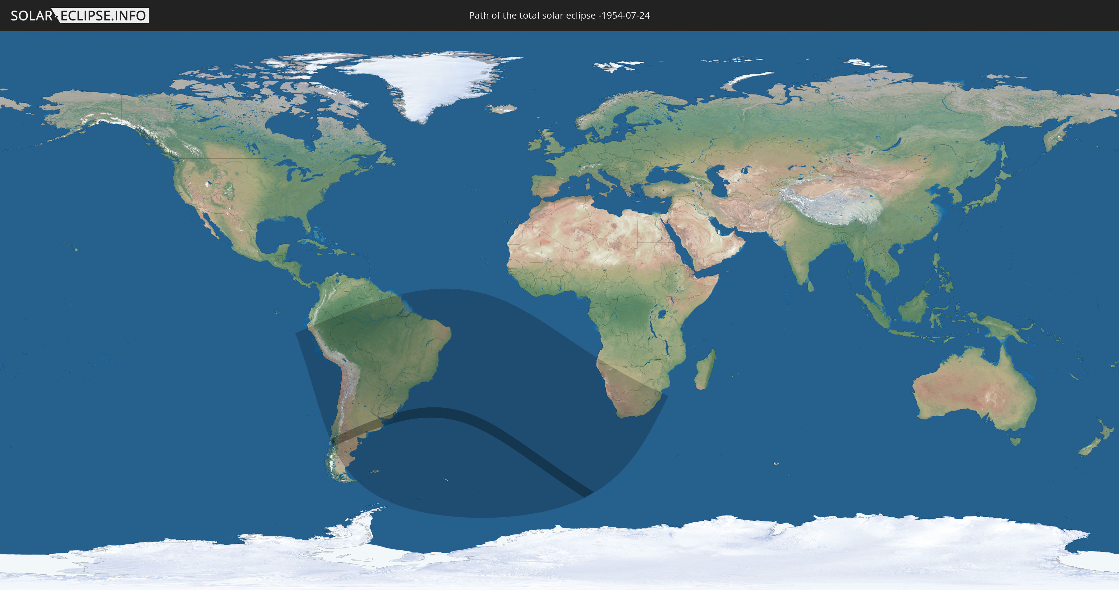
Die Sonnenfinsternis am 24.07.-1954 kann man in 25 Ländern als partielle Sonnenfinsternis beobachten.
Der Finsternispfad verläuft durch 5 Länder. Nur in diesen Ländern ist sie als totale Sonnenfinsternis zu sehen.
In den folgenden Ländern ist die Sonnenfinsternis total zu sehen
 Chile
Chile
 Brasilien
 Argentinien
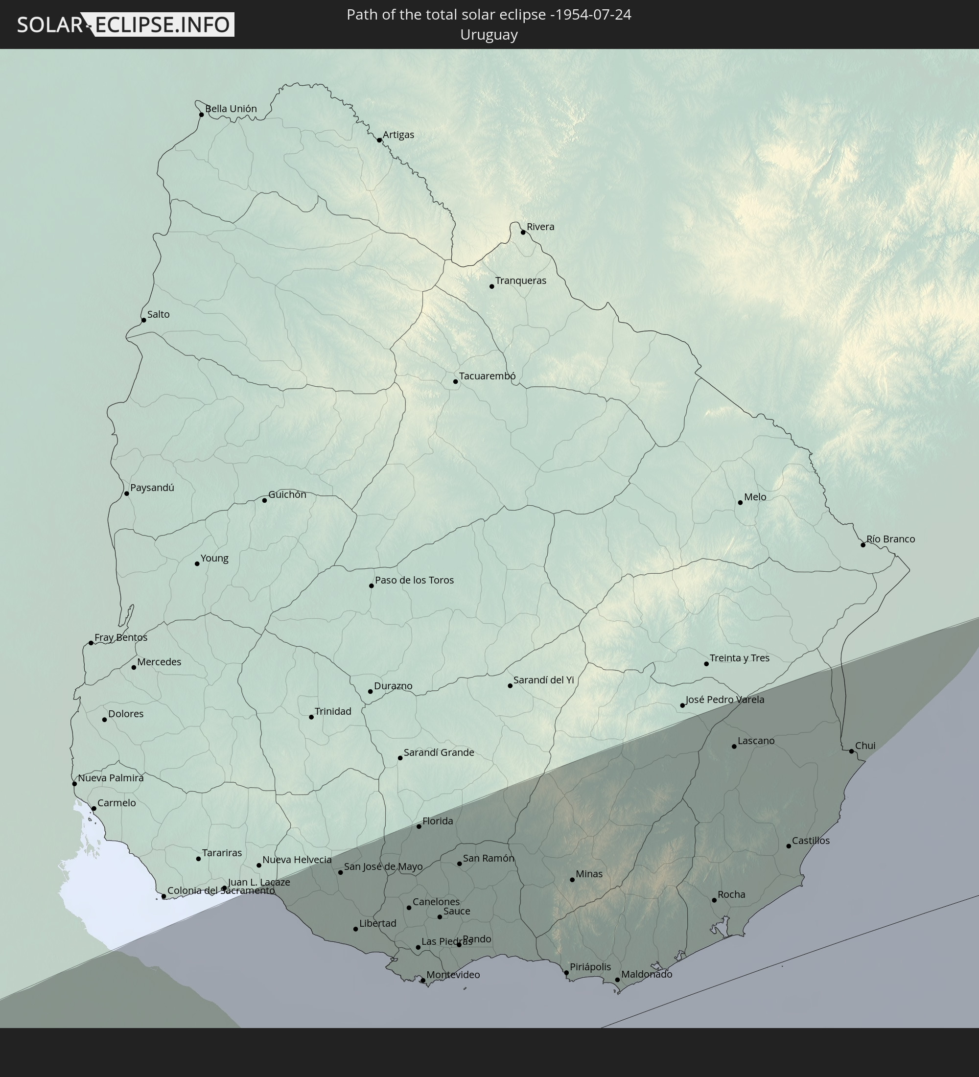 Uruguay
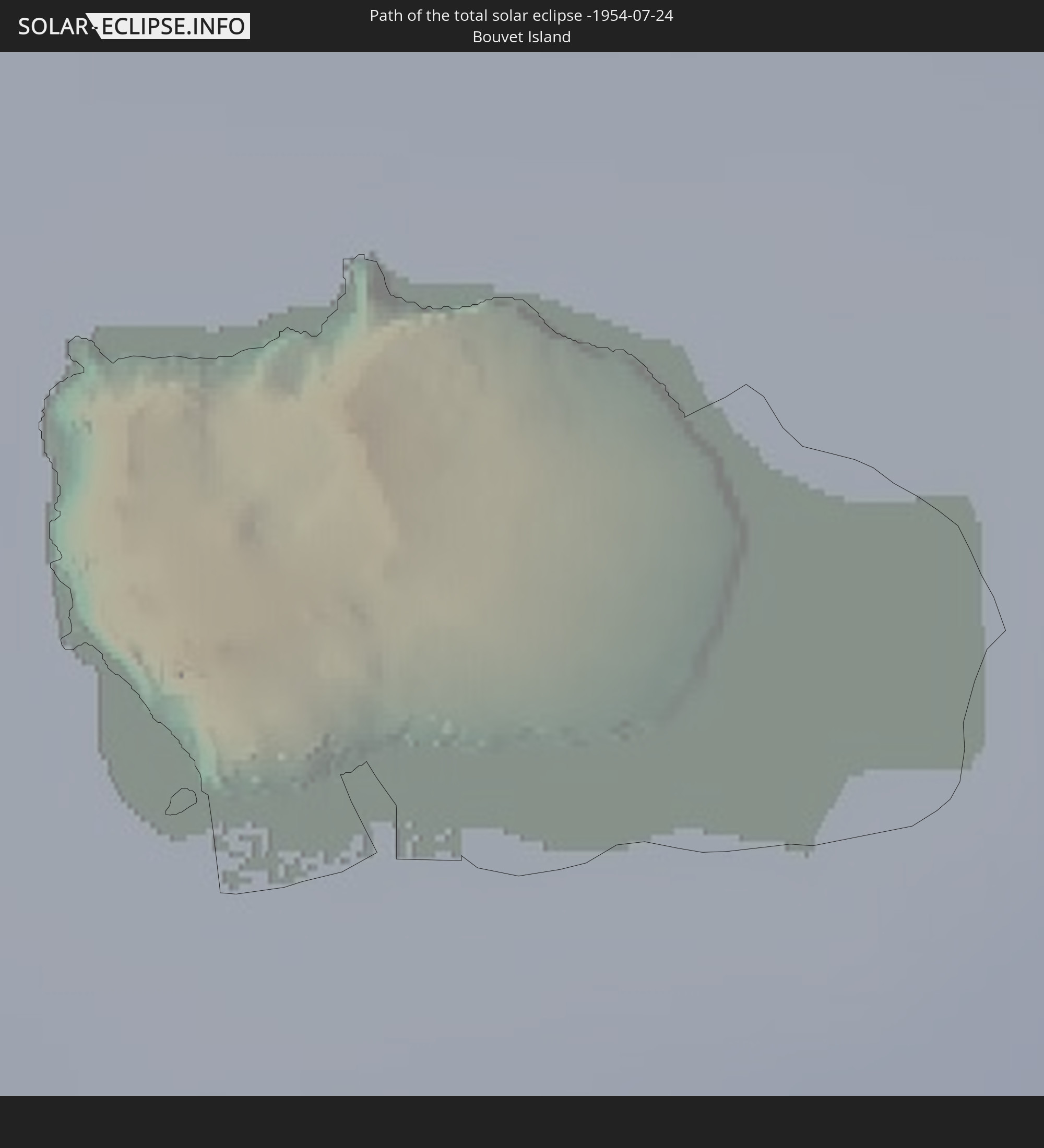 Bouvetinsel
In den folgenden Ländern ist die Sonnenfinsternis partiell zu sehen


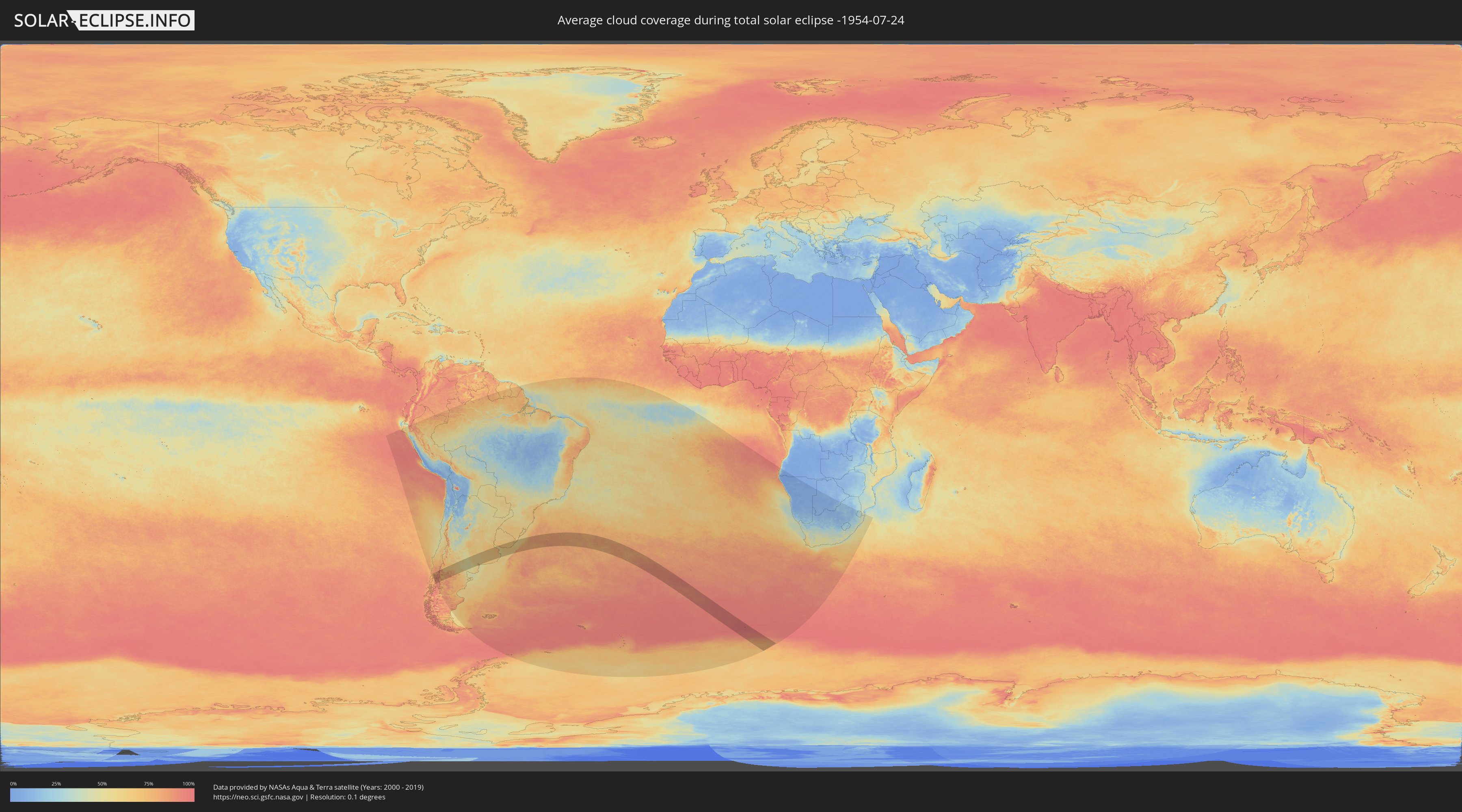
Wie wird das Wetter während der totalen Sonnenfinsternis am 24.07.-1954?
Wo ist der beste Ort, um die totale Sonnenfinsternis vom 24.07.-1954 zu beobachten?
Die folgenden Karten zeigen die durchschnittliche Bewölkung für den Tag, an dem die totale Sonnenfinsternis
stattfindet. Mit Hilfe der Karten lässt sich der Ort entlang des Finsternispfades eingrenzen,
der die besten Aussichen auf einen klaren wolkenfreien Himmel bietet.
Trotzdem muss man immer lokale Gegenenheiten beachten und sollte sich genau über das Wetter an seinem
gewählten Beobachtungsort informieren.
Die Daten stammen von den beiden NASA-Satelliten
AQUA und TERRA
und wurden über einen Zeitraum von 19 Jahren (2000 - 2019) gemittelt.

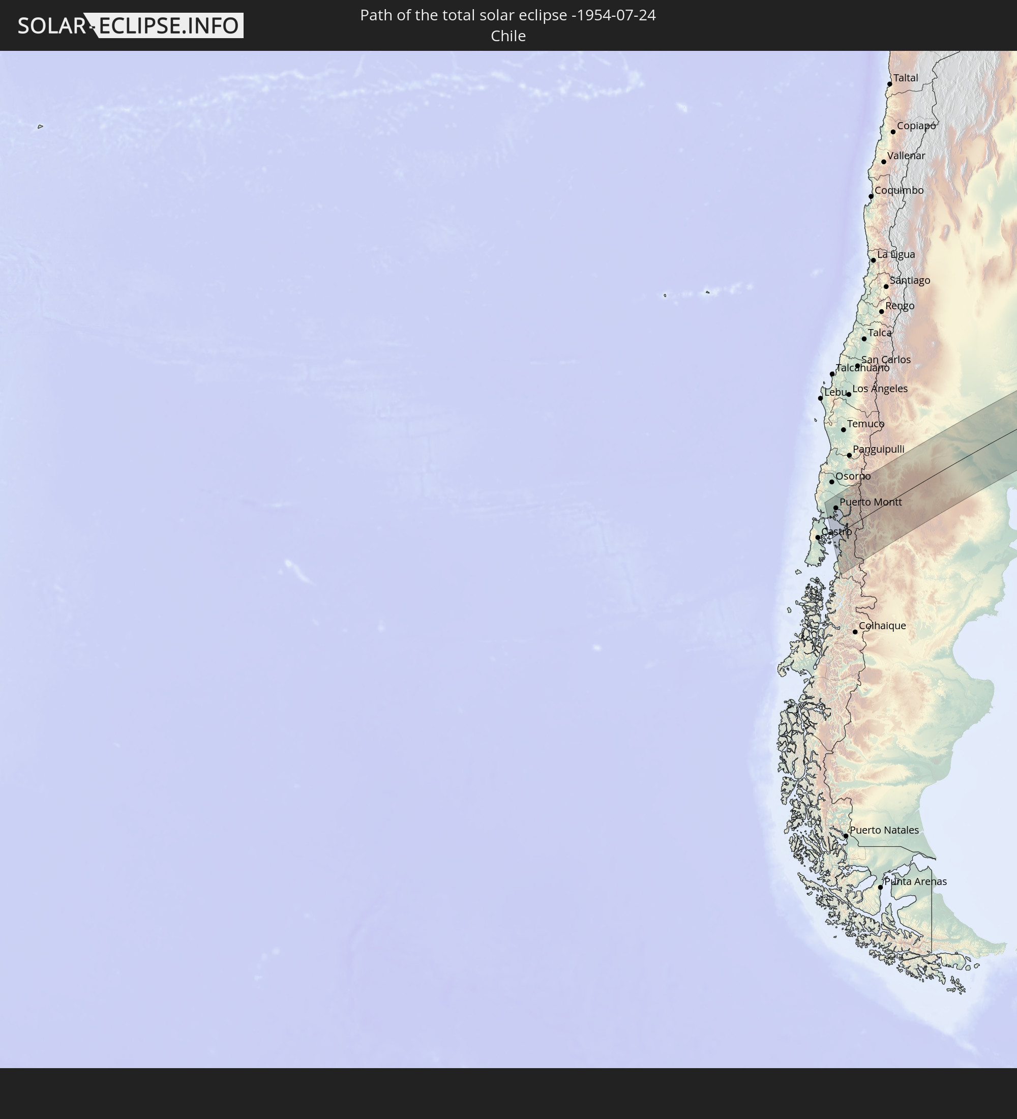
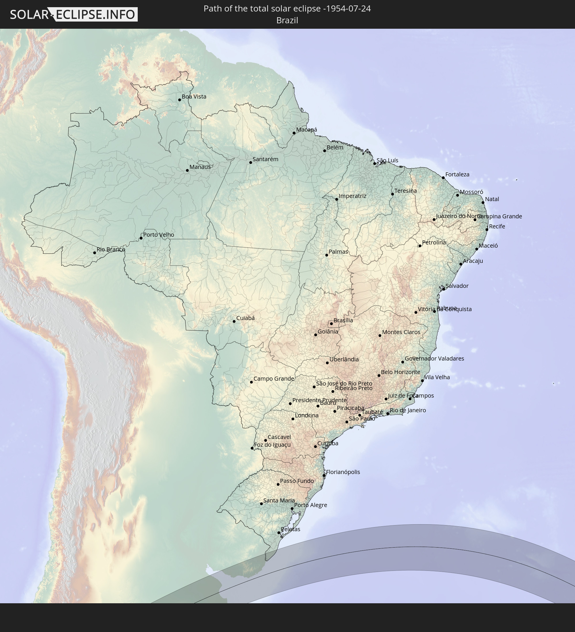
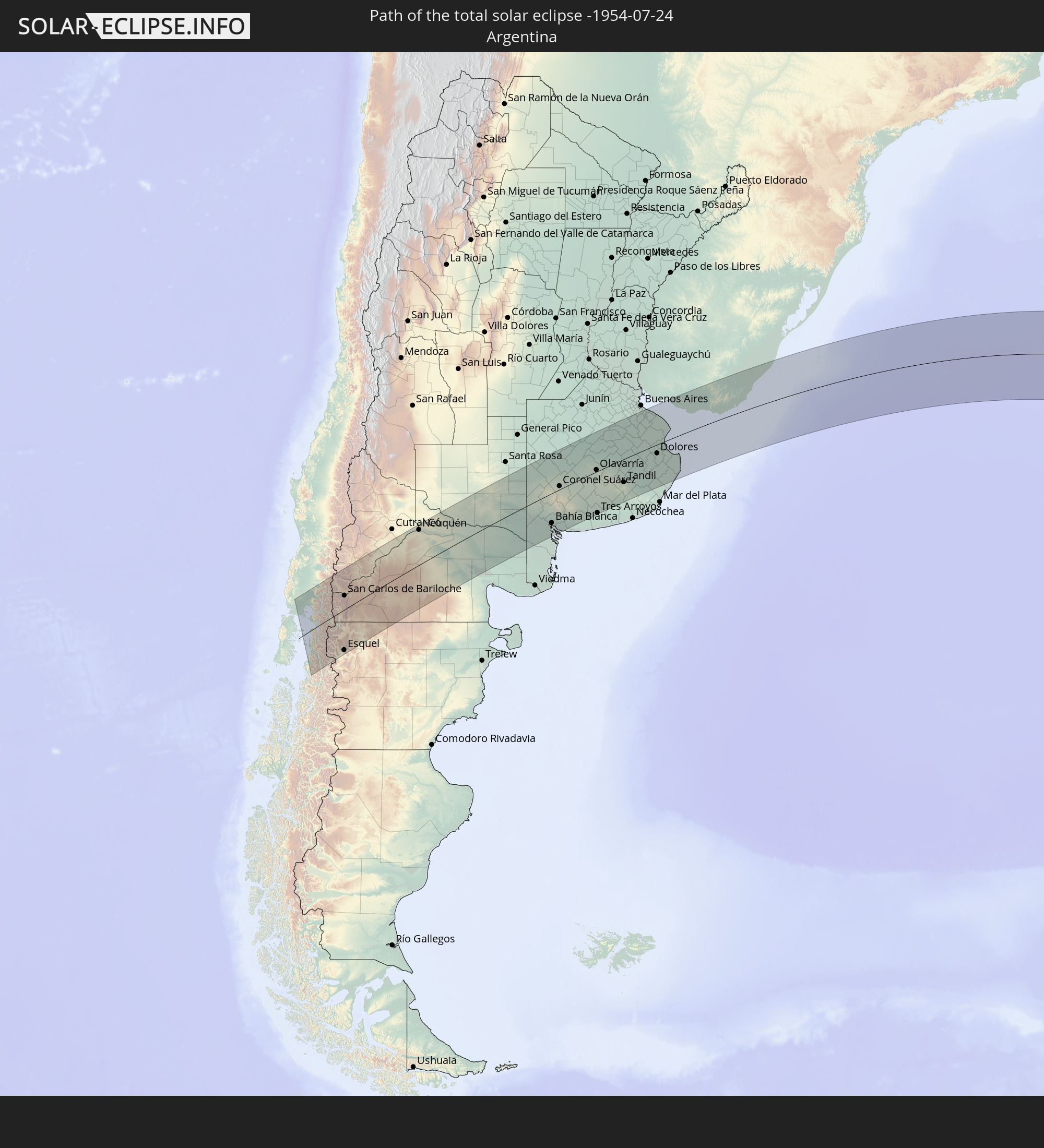
Detaillierte Länderkarten
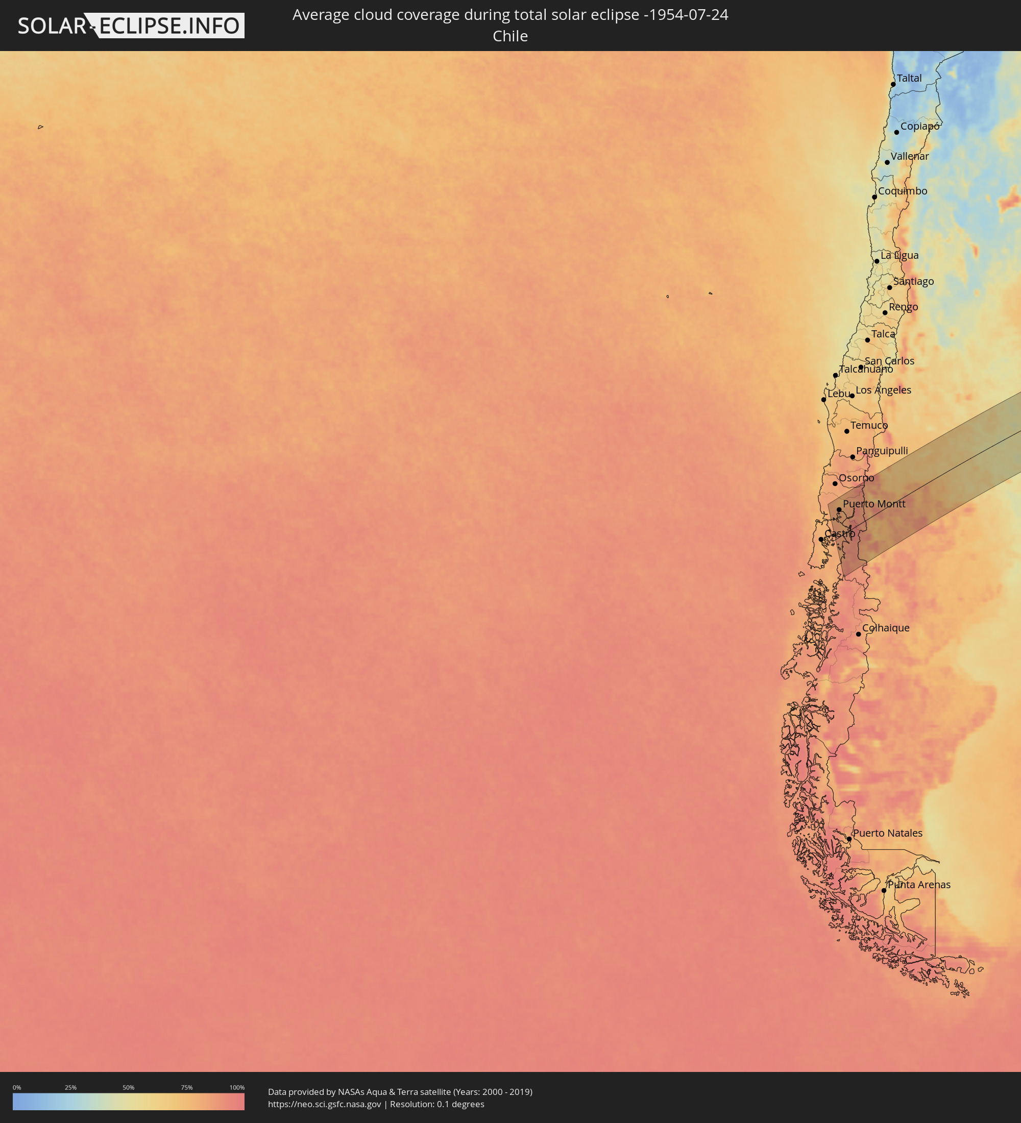 Chile
Chile
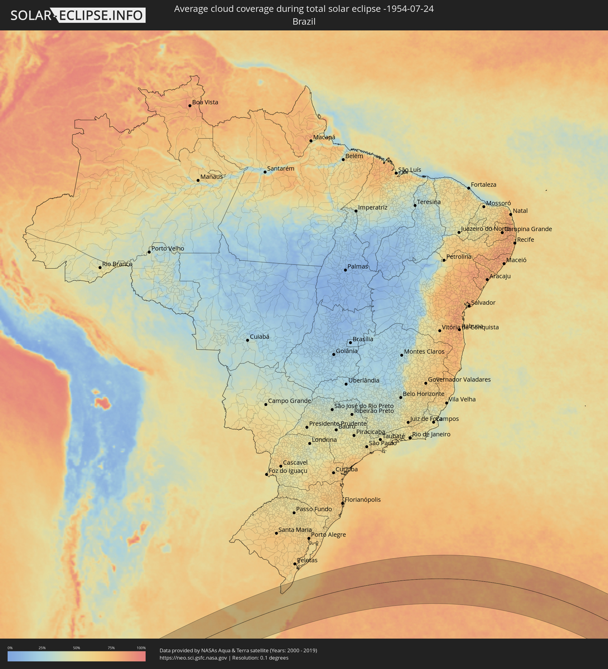 Brasilien
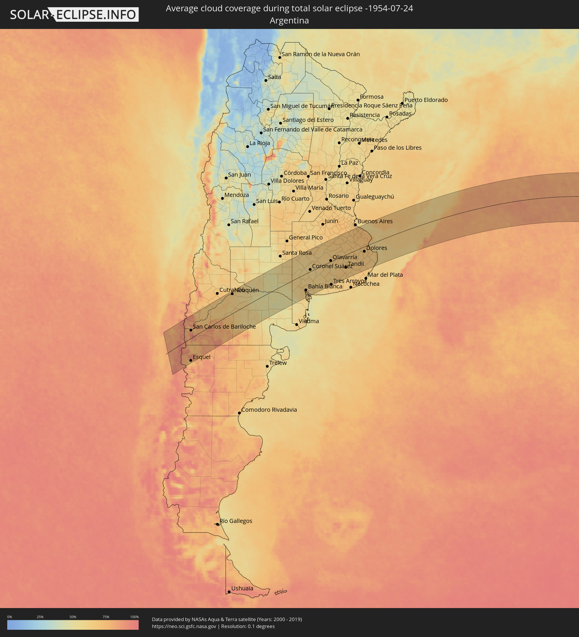 Argentinien
 Uruguay
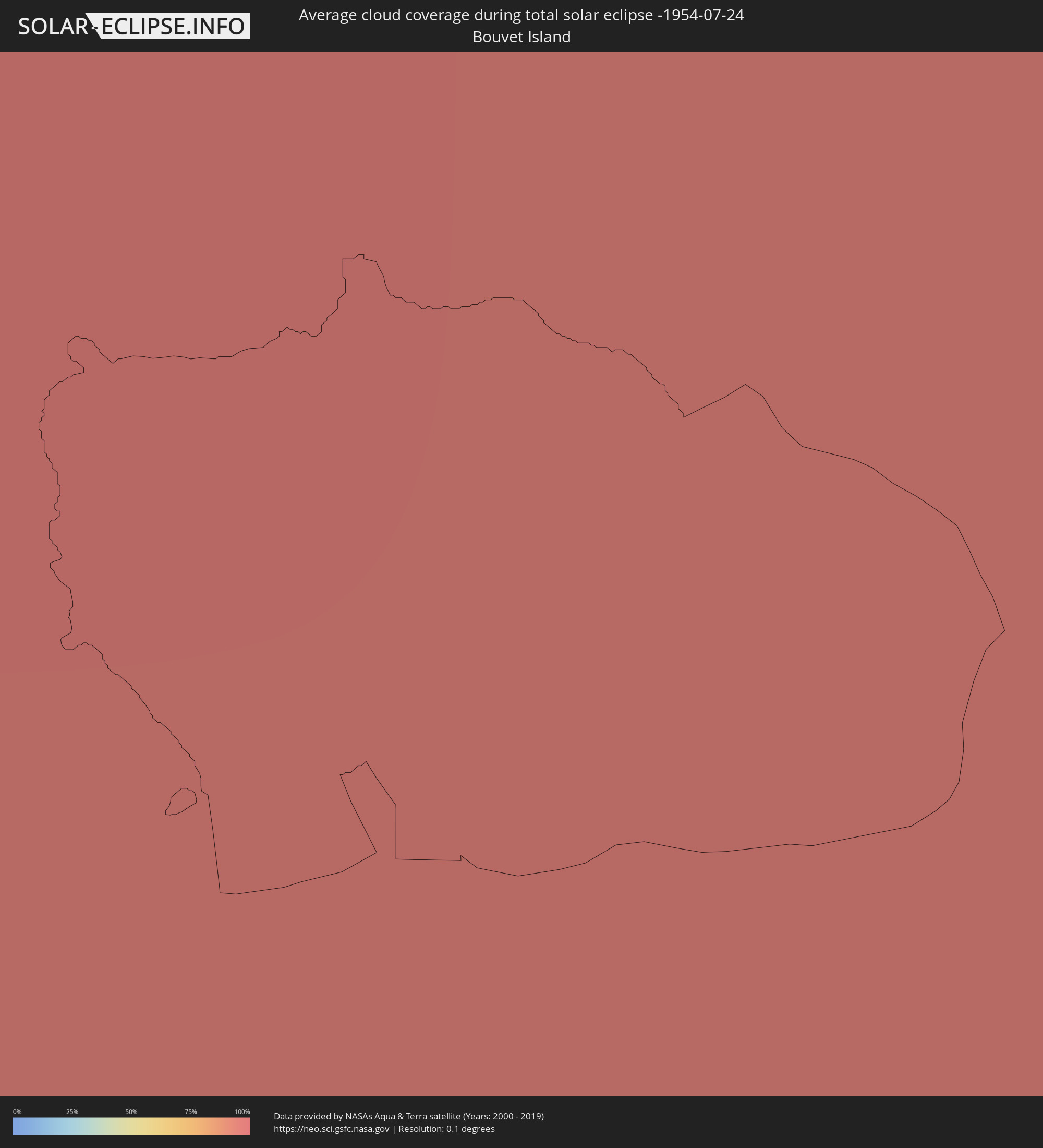 Bouvetinsel
Orte im Finsternispfad
Die nachfolgene Tabelle zeigt Städte und Orte mit mehr als 5.000 Einwohnern, die sich im Finsternispfad befinden. Städte mit mehr als 100.000 Einwohnern sind dick gekennzeichnet. Mit einem Klick auf den Ort öffnet sich eine Detailkarte die die Lage des jeweiligen Ortes zusammen mit dem Verlauf der zentralen Finsternis präsentiert.
| Ort | Typ | Dauer der Verfinsterung | Ortszeit bei maximaler Verfinsterung | Entfernung zur Zentrallinie | Ø Bewölkung |
 Calbuco, Los Lagos
|
total | - | 07:41:02 UTC-04:42 | 64 km | 83% |
|
Frutillar, Los Lagos
|
total | - | 07:40:12 UTC-04:42 | 121 km | 77% |
|
Puerto Varas, Los Lagos
|
total | - | 07:40:31 UTC-04:42 | 100 km | 81% |
|
Puerto Montt, Los Lagos
|
total | - | 07:40:44 UTC-04:42 | 85 km | 83% |
 Villa La Angostura, Neuquén Province
|
total | - | 08:06:39 UTC-04:16 | 95 km | 74% |
|
El Bolsón, Río Negro Province
|
total | - | 08:08:23 UTC-04:16 | 24 km | 74% |
|
Trevelin, Chubut Province
|
total | - | 08:10:00 UTC-04:16 | 133 km | 70% |
|
Esquel, Chubut Province
|
total | - | 08:09:52 UTC-04:16 | 123 km | 75% |
|
San Carlos de Bariloche, Río Negro Province
|
total | - | 08:07:25 UTC-04:16 | 43 km | 72% |
|
Ingeniero Jacobacci, Río Negro Province
|
total | - | 08:09:01 UTC-04:16 | 51 km | 81% |
|
Senillosa, Neuquén Province
|
total | - | 08:06:48 UTC-04:16 | 124 km | 66% |
|
Plottier, Neuquén Province
|
total | - | 08:06:55 UTC-04:16 | 120 km | 67% |
|
Centenario, Neuquén Province
|
total | - | 08:06:49 UTC-04:16 | 129 km | 65% |
|
Cinco Saltos, Río Negro Province
|
total | - | 08:06:52 UTC-04:16 | 127 km | 65% |
|
Neuquén, Neuquén Province
|
total | - | 08:07:03 UTC-04:16 | 114 km | 67% |
|
Cipolletti, Río Negro Province
|
total | - | 08:07:05 UTC-04:16 | 113 km | 65% |
|
General Fernández Oro, Río Negro Province
|
total | - | 08:07:10 UTC-04:16 | 109 km | 60% |
|
Allen, Río Negro Province
|
total | - | 08:07:17 UTC-04:16 | 102 km | 58% |
|
General Roca, Río Negro Province
|
total | - | 08:07:34 UTC-04:16 | 86 km | 61% |
|
Cervantes, Río Negro Province
|
total | - | 08:07:46 UTC-04:16 | 76 km | 55% |
|
Ingeniero Luis A. Huergo, Río Negro Province
|
total | - | 08:07:56 UTC-04:16 | 67 km | 56% |
|
Villa Regina, Río Negro Province
|
total | - | 08:08:07 UTC-04:16 | 58 km | 57% |
|
Fray Luis Beltrán, Río Negro Province
|
total | - | 08:09:36 UTC-04:16 | 17 km | 53% |
|
Lamarque, Río Negro Province
|
total | - | 08:09:48 UTC-04:16 | 30 km | 51% |
|
Choele Choel, Río Negro Province
|
total | - | 08:09:37 UTC-04:16 | 16 km | 54% |
|
General Acha, La Pampa Province
|
total | - | 08:08:13 UTC-04:16 | 125 km | 51% |
|
Guatraché, La Pampa Province
|
total | - | 08:09:41 UTC-04:16 | 53 km | 61% |
|
Bahía Blanca, Buenos Aires
|
total | - | 08:12:24 UTC-04:16 | 101 km | 67% |
|
Punta Alta, Buenos Aires
|
total | - | 08:12:49 UTC-04:16 | 124 km | 59% |
|
Coronel Suárez, Buenos Aires
|
total | - | 08:11:09 UTC-04:16 | 11 km | 59% |
|
Coronel Dorrego, Buenos Aires
|
total | - | 08:13:30 UTC-04:16 | 140 km | 61% |
|
Olavarría, Buenos Aires
|
total | - | 08:12:18 UTC-04:16 | 6 km | 66% |
|
Tres Arroyos, Buenos Aires
|
total | - | 08:14:14 UTC-04:16 | 144 km | 65% |
|
Azul, Buenos Aires
|
total | - | 08:12:43 UTC-04:16 | 0 km | 67% |
|
Tandil, Buenos Aires
|
total | - | 08:14:18 UTC-04:16 | 82 km | 65% |
|
La Plata, Buenos Aires
|
total | - | 08:12:52 UTC-04:16 | 121 km | 74% |
|
Dolores, Buenos Aires
|
total | - | 08:14:55 UTC-04:16 | 32 km | 69% |
|
San Clemente del Tuyú, Buenos Aires
|
total | - | 08:16:15 UTC-04:16 | 70 km | 67% |
 San José de Mayo, San José
|
total | - | 08:45:47 UTC-03:44 | 138 km | 72% |
|
Libertad, San José
|
total | - | 08:46:17 UTC-03:44 | 104 km | 71% |
|
Santa Lucía, Canelones
|
total | - | 08:46:23 UTC-03:44 | 116 km | 73% |
|
Delta del Tigre, San José
|
total | - | 08:46:47 UTC-03:44 | 82 km | 67% |
|
Canelones, Canelones
|
total | - | 08:46:37 UTC-03:44 | 105 km | 73% |
|
La Paz, Canelones
|
total | - | 08:46:58 UTC-03:44 | 78 km | 75% |
|
Las Piedras, Canelones
|
total | - | 08:46:57 UTC-03:44 | 81 km | 75% |
|
Progreso, Canelones
|
total | - | 08:46:52 UTC-03:44 | 88 km | 75% |
|
Florida, Florida
|
total | - | 08:46:12 UTC-03:44 | 147 km | 70% |
|
Montevideo, Montevideo
|
total | - | 08:47:12 UTC-03:44 | 62 km | 66% |
|
Sauce, Canelones
|
total | - | 08:46:57 UTC-03:44 | 93 km | 73% |
|
Paso de Carrasco, Canelones
|
total | - | 08:47:20 UTC-03:44 | 62 km | 64% |
|
Joaquín Suárez, Canelones
|
total | - | 08:47:13 UTC-03:44 | 75 km | 73% |
|
Colonia Nicolich, Canelones
|
total | - | 08:47:19 UTC-03:44 | 66 km | 71% |
|
Pando, Canelones
|
total | - | 08:47:18 UTC-03:44 | 74 km | 73% |
|
San Ramón, Canelones
|
total | - | 08:46:48 UTC-03:44 | 118 km | 72% |
|
Piriápolis, Maldonado
|
total | - | 08:48:27 UTC-03:44 | 37 km | 61% |
|
Minas, Lavalleja
|
total | - | 08:47:56 UTC-03:44 | 86 km | 68% |
|
Pan de Azúcar, Maldonado
|
total | - | 08:48:24 UTC-03:44 | 44 km | 66% |
|
Maldonado, Maldonado
|
total | - | 08:48:58 UTC-03:44 | 22 km | 67% |
|
Punta del Este, Maldonado
|
total | - | 08:49:03 UTC-03:44 | 17 km | 67% |
|
San Carlos, Maldonado
|
total | - | 08:48:53 UTC-03:44 | 33 km | 69% |
|
Rocha, Rocha
|
total | - | 08:49:23 UTC-03:44 | 47 km | 67% |
|
Lascano, Rocha
|
total | - | 08:48:38 UTC-03:44 | 128 km | 66% |
|
Castillos, Rocha
|
total | - | 08:49:46 UTC-03:44 | 62 km | 66% |
|
Chui, Rocha
|
total | - | 08:49:48 UTC-03:44 | 103 km | 68% |
 Chuí, Rio Grande do Sul
|
total | - | 08:49:48 UTC-03:44 | 104 km | 68% |
|
Santa Vitória do Palmar, Rio Grande do Sul
|
total | - | 09:28:08 UTC-03:06 | 119 km | 66% |